As we count down to the first year geomatics field course in March, second year BSc Surveying and Mapping Science student Matt recalls what he did during his week-and-a-half long stay in the Lake District.
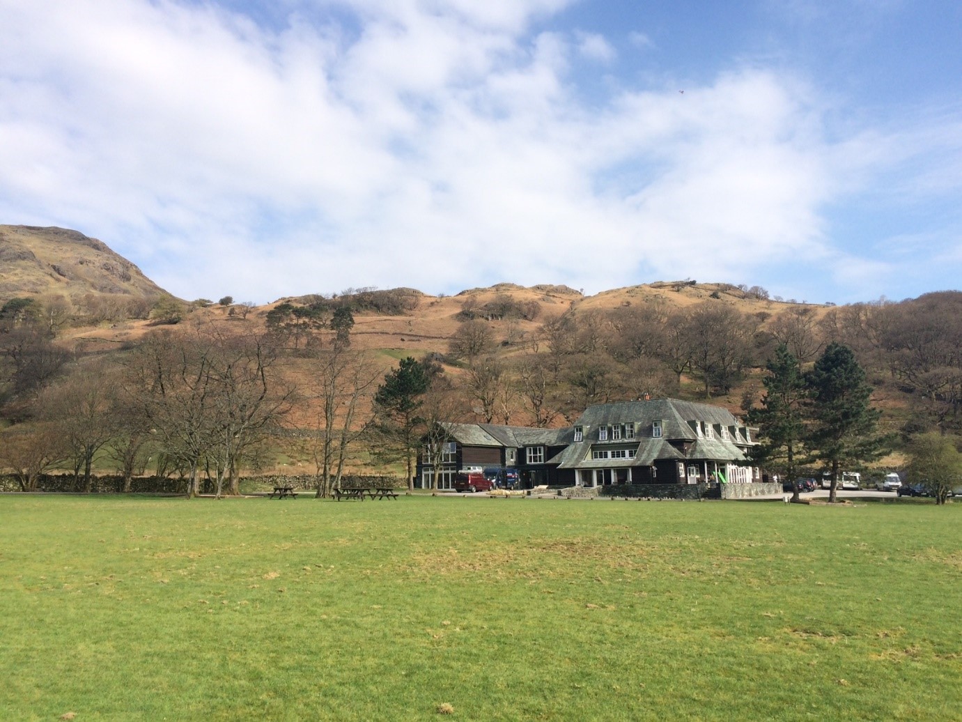
Matt’s photo of the Glaramara field centre where the field course is based.
One of my highlights of my first year at Newcastle University was the field course to the Lake District. During the week-and-a-half that we were there, we saw all forms of weather and worked long, hard days, but I wouldn’t hesitate to do it all over again.
The field course was based in Seathwaite Valley, just a few miles from Keswick. Constantly, and somewhat gleefully, our lecturers would remind us that this exact valley cops the most rainfall in the whole of England. We stayed at the Glaramara Field Centre, in the quaint village of Seatoller, which is just at the southern end of Honister Pass. Firstly, and most importantly, the food at the centre – although it was more of a hotel – was all really good, with huge cooked breakfasts every morning and three-course meals each night. On some of those long days that were spent out in the valley, the idea of returning to the centre for a hot meal and an even hotter shower was what kept me going. There’s a well-stocked bar, too…
The first couple of days of the course involved re-familiarising ourselves with the equipment we had used during practical sessions earlier in the year, and creating a control network for the whole valley. Hundreds of traverse observations were taken with the result being a set of coordinates that would be used to create some topographic maps. Luckily, the weather was good with a warm sun and little breeze: almost perfect conditions!
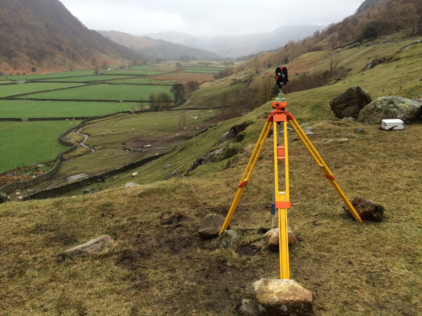
“Prism watch” – Matt took this photo whilst protecting a survey control station from being knocked over or moved by sheep!
After being split into our groups, the overall aim for the fieldcourse was to produce a detailed topographic map of a section of the floor of the valley. Over the next few days, a secondary control network was established. Part of this task requires someone to be on ‘prism watch’, which means sitting by a prism to make sure that the copious amounts of lambs and sheep surrounding the tripod wouldn’t knock it over. It was possible to end up sitting there for hours on end, but this was not a negative; there isn’t a nicer place to have an hour in the tranquility of the Lakes.
Each detail point we surveyed over the week had to be hand-plotted onto the plan. This was a bit repetitive but the finished product was something that we could really be proud of: an accurate, hand-drawn 1:1,000 map with a separate (again hand-drawn) contour overlay.
There are fewer than thirty people in my year group and so the fieldcourse really helped everyone to get to know each other. I can safely say that I’d spoken to everyone at least once after the time we spent in Seatoller. It was really nice to have a social area where we could get a pint after a long day, and it meant the lack of mobile signal didn’t really matter.
As I mentioned at the start of this post, I wouldn’t hesitate to do it all over again … and it’s only making me look forward to the Stage 3 field course in Kielder even more!
Useful links: