Surveying and Mapping Science at Newcastle – Stage 1 Field Course – Part 1 of 2

blog_header_ambassador_tim_hajda_sms

During the Easter holidays, the Stage 1 Surveying & Mapping Science and GIS students went on a field course to the Seathwaite Valley in the heart of the Lake District.  It was a challenging and rewarding eight days that brought together all of the theory acquired in lectures and practicals and applied it in a real world setting.  This series of blogs will share some of the highlights from the perspective of a surveying and mapping science student.

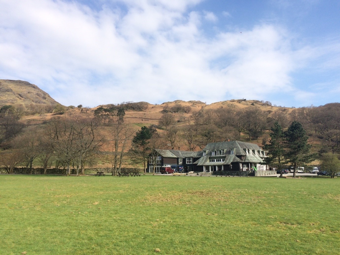
It’s the fourth day of the field course and it’s hard to believe we’re already at the halfway point!  I’m writing this blog from the Glaramara House, our hotel which is serving as our base for the duration of the fieldcourse.  We arrived at Glaramara on Thursday morning after a scenic two-and-a-half hour coach ride from Newcastle.  The setting is stunning: a pastoral valley of green fields; dry stone walls and streams; surrounded by craggy fells; waterfalls and oak forests.  Our mission for the field course is to create a detailed map of the valley, but first we need to lay the foundations by creating a control network.

1

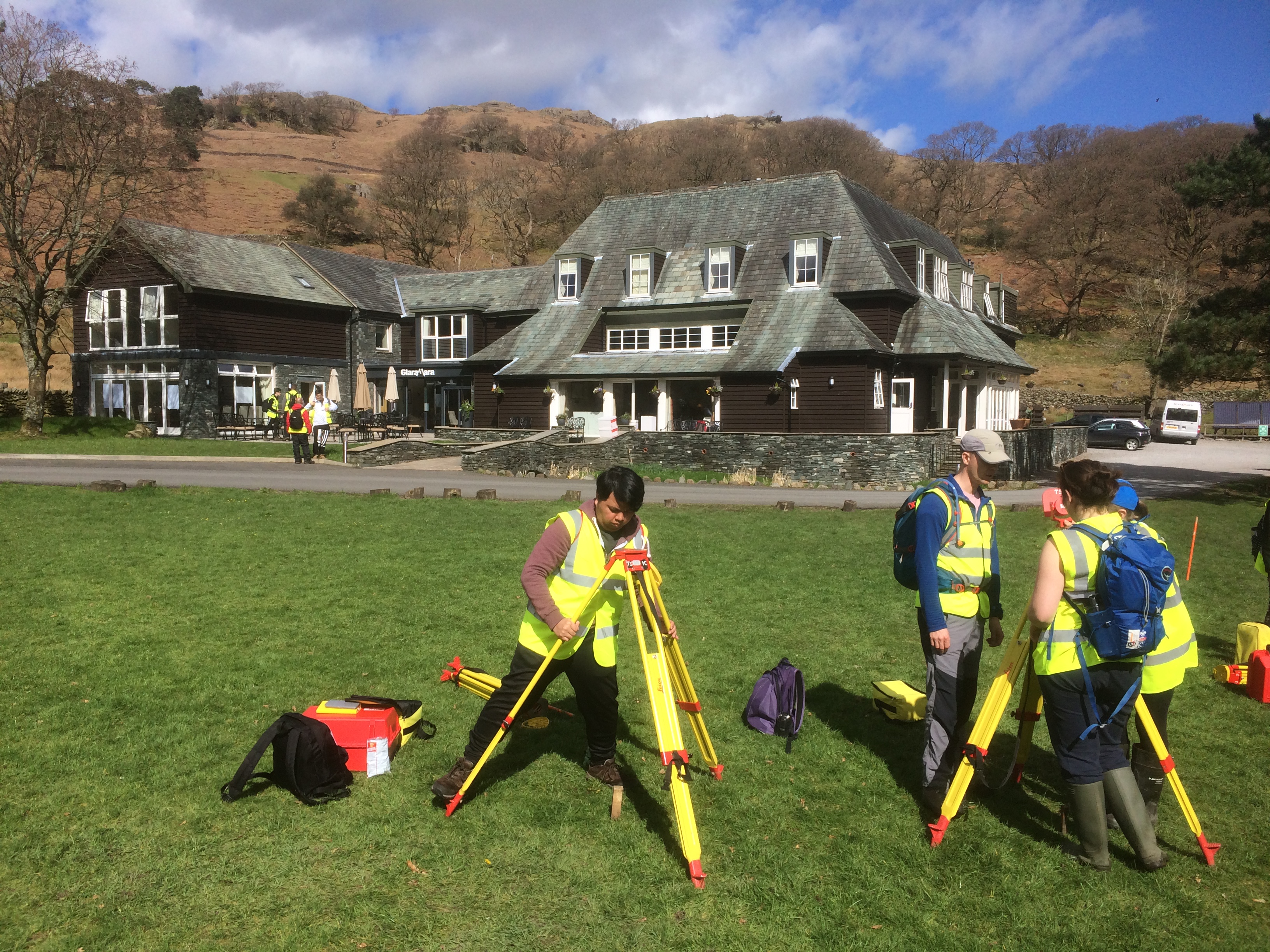
Practising setting up targets in front of the Glaramara House, our base for the field course.

Shortly after arriving at Glaramara, we donned our high-vis and waterproofs to undertake our first task: brushing up on the surveying skills we’d be using over the next eight days.  The valley is famous for being the wettest inhabited place in England, and it’s definitely living up to its reputation.  After a soggy afternoon of measuring angles and levelling, we dried off and enjoyed what would be the first of many delicious dinners.  A pint from the hotel’s bar was the perfect way to celebrate a successful first day.

2

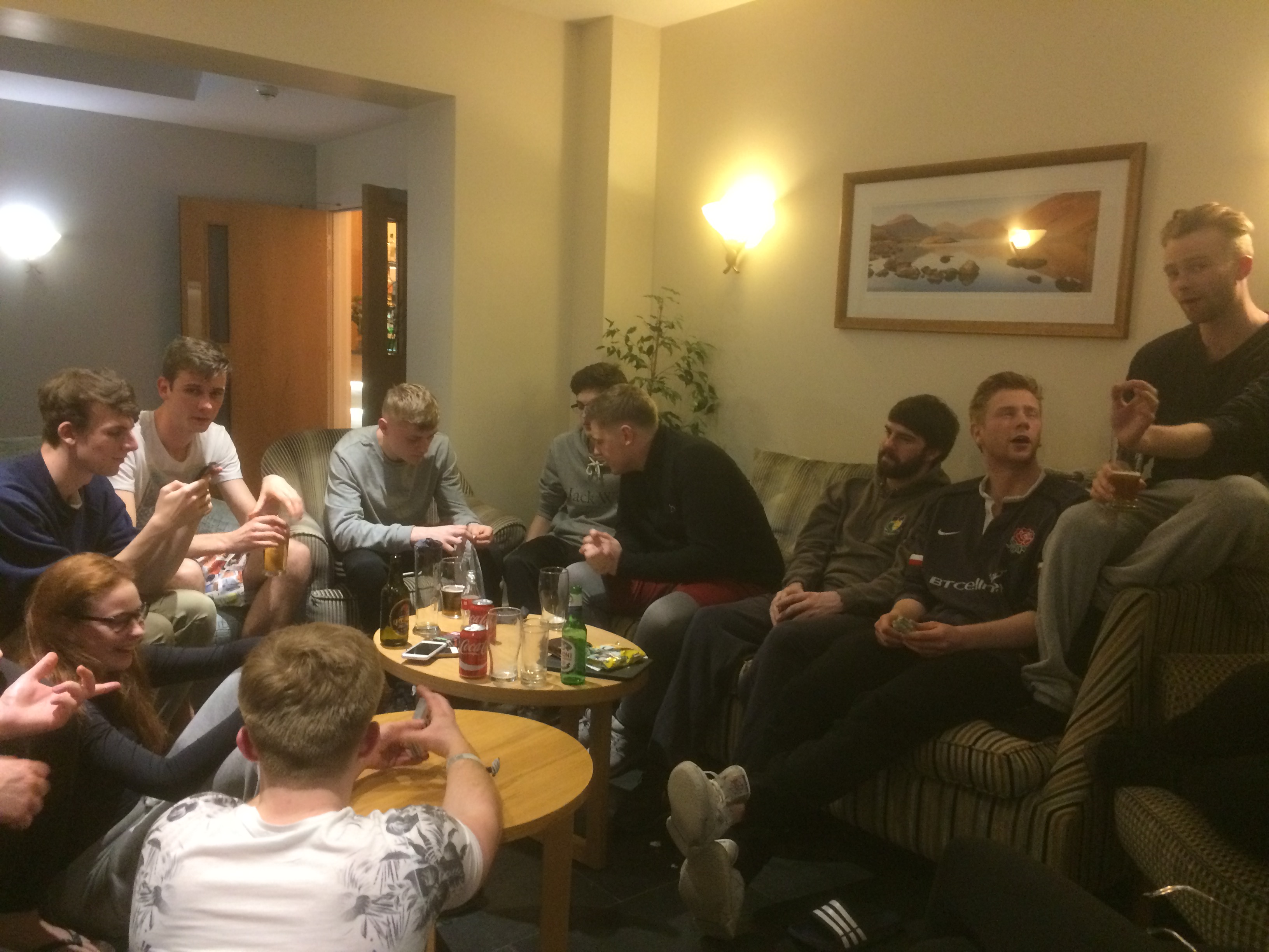
A pint was much appreciated after a long day in the field.

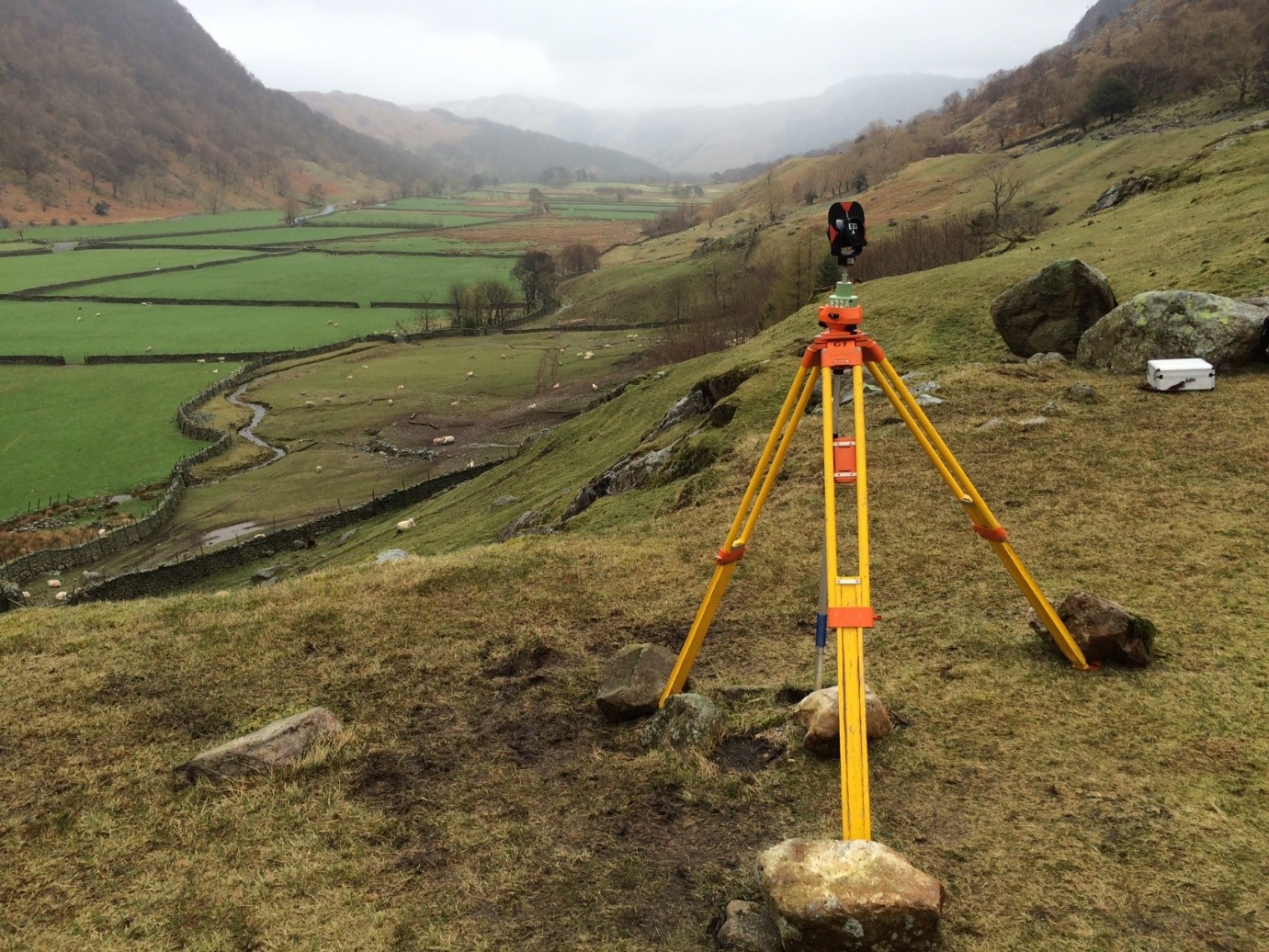
The next morning, we enjoyed a full English breakfast before beginning our next task: establishing the primary control stations throughout the valley.  We were divided into teams and taken by minibus to our assigned locations.  Using total stations, we spent the day measuring the angles and distances between points.  We would be using this data later to compute the coordinates of the stations.  The blustery weather was a challenge, especially looking back to the relatively easy practical’s we did at Town Moor back in Newcastle, but we persevered.

Yesterday’s assignment was to determine the height of points around the valley using spirit levelling.  Simple enough…or so we thought.  My team quickly realized that those lovely green fields were essentially giant mud pits and the stone walls an endless maze to navigate through, but it was a great feeling when we arrived at our last benchmark.  Another job finished and I’ve never been more grateful for a hot shower!

Today the GIS students have joined us and we’ll be going out in teams to create secondary control networks around the valley.  It looks like it’s going to be a beautiful day, better bring along the sun cream!

Memories of the first year Geomatics field course

As we count down to the first year geomatics field course in March, second year BSc Surveying and Mapping Science student Matt recalls what he did during his week-and-a-half long stay in the Lake District.

Matt_Edge_Glaramara_1

Matt’s photo of the Glaramara field centre where the field course is based.

One of my highlights of my first year at Newcastle University was the field course to the Lake District. During the week-and-a-half that we were there, we saw all forms of weather and worked long, hard days, but I wouldn’t hesitate to do it all over again.

The field course was based in Seathwaite Valley, just a few miles from Keswick. Constantly, and somewhat gleefully, our lecturers would remind us that this exact valley cops the most rainfall in the whole of England. We stayed at the Glaramara Field Centre, in the quaint village of Seatoller, which is just at the southern end of Honister Pass. Firstly, and most importantly, the food at the centre – although it was more of a hotel – was all really good, with huge cooked breakfasts every morning and three-course meals each night. On some of those long days that were spent out in the valley, the idea of returning to the centre for a hot meal and an even hotter shower was what kept me going. There’s a well-stocked bar, too…

The first couple of days of the course involved re-familiarising ourselves with the equipment we had used during practical sessions earlier in the year, and creating a control network for the whole valley. Hundreds of traverse observations were taken with the result being a set of coordinates that would be used to create some topographic maps. Luckily, the weather was good with a warm sun and little breeze: almost perfect conditions!

Matt_Edge_Glaramara_2

“Prism watch” – Matt took this photo whilst protecting a survey control station from being knocked over or moved by sheep!

After being split into our groups, the overall aim for the fieldcourse was to produce a detailed topographic map of a section of the floor of the valley. Over the next few days, a secondary control network was established. Part of this task requires someone to be on ‘prism watch’, which means sitting by a prism to make sure that the copious amounts of lambs and sheep surrounding the tripod wouldn’t knock it over. It was possible to end up sitting there for hours on end, but this was not a negative; there isn’t a nicer place to have an hour in the tranquility of the Lakes.

Each detail point we surveyed over the week had to be hand-plotted onto the plan. This was a bit repetitive but the finished product was something that we could really be proud of: an accurate, hand-drawn 1:1,000 map with a separate (again hand-drawn) contour overlay.

There are fewer than thirty people in my year group and so the fieldcourse really helped everyone to get to know each other. I can safely say that I’d spoken to everyone at least once after the time we spent in Seatoller. It was really nice to have a social area where we could get a pint after a long day, and it meant the lack of mobile signal didn’t really matter.

As I mentioned at the start of this post, I wouldn’t hesitate to do it all over again … and it’s only making me look forward to the Stage 3 field course in Kielder even more!


Useful links:

Geomatics visit to Wardell Armstrong

As a student, it’s always exciting when we get to leave the lecture theatre and even more exciting when we go on a visit. The rest of Stage 2 Geomatics (that’s the Surveying & Mapping and GIS students) and I visited the Newcastle offices of Wardell Armstrong. As we walked through the offices on the way to one of the meeting rooms, it was good to see some of the employees on software packages that we recognised and often use in our degree programmes, such as ArcGIS and QGIS. The company has a specialised mapping team of 10 staff. We heard from four different speakers, two of whom were alumni of our own degree courses.

The first speaker, Chris, was the Director of the mapping team and introduced us to the company, its history and a few of their major clients. They are a very international company, with operations all over the planet. Having many opportunities to travel after graduation is one of the reasons why I like the course I’m studying. He was very complimentary of his team and their work, which was good to hear.

Claire, an alumna of the GIS course, then spoke about a project regarding an Armenian gold mine where they are planning to literally take the top off a mountain.  She had to collaborate with teams in Denver, Colorado as well as Armenia and South Africa, which demonstrates the global nature of the industry and shows what an important role that we as graduates would be able to take up after only a few years of experience. The video below shows the project.

https://www.youtube.com/watch?v=jusjrlRLaoA

The third person to speak to us, Harriet, talked about challenging act of managing a huge amount of GI data that covers England, Wales and Scotland, and some other countries around the world. To maintain a complete and comprehensive database of information for the United Kingdom, as Harriet explained, was much more efficient and effective than only collecting the information that was necessary for a project.

The final speaker, Dave, was a graduate of the Surveying & Mapping course who graduated in 2003. He’d been with Wardell Armstrong since leaving university and had worked his way up the ranks from a graduate surveyor through to a being an Associate Director.

The final part of the session was a quick talk about careers and Q&A session with lots of staff. It was very useful of Chris to not focus the careers talk on WA, but instead the whole industry. He mentioned how, as employers, they considered ‘life’ experience to be as relevant as ‘work’ experience, and emphasised how important it was to display initiative.

All in all, the visit was really worthwhile and gave a useful and realistic insight into the workings of a surveying consultancy that utilises all the skills gained during the SMS and GIS degree programmes.