New work by CESER researchers has demonstrated how a long temporal baseline of daytime AVHRR data can be employed to capture the summer temperature regime of the city of London, UK, including the response to a known heatwave event.
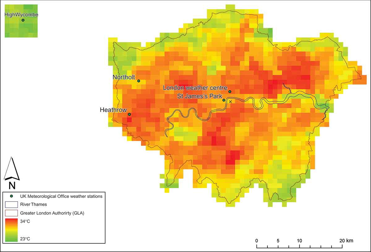
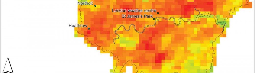
AVHRR scene of estimated surface temperature (EST) of Greater London, 8 August 2003, 14:04 (GMT), showing the location of London weather stations employed in the study and the rural reference site relative to London.
Analysis of Advanced Very High Resolution Radiometer (AVHRR) data for London shows the high degree of spatial variability of intensity of urban heat across London. Furthermore, it is highly sensitive to local meteorological effects and daily cycles.
Comparison of the Urban Heat Island Intensity (UHII) [the maximum difference between urban and rural temperatures during one day] in a statistically robust manner showed that the 2003 heatwave UHII data sets for both image surface and ground air temperatures did not exhibit significantly greater intensities than the other years under consideration. This is in contrast to other work on this topic (e.g. Cheval et al., 2009; Tomlinson et al., 2010) that indicates that not only is the UHII metric a relatively poor means by which to distinguish between a heatwave summer in London, but also the need for further scrutiny of the use of the UHII.
The full paper can be downloaded by following the link:
Holderness, T., Barr, S.L., Dawson, R.J. and Hall, J.W. (2013) An evaluation of thermal Earth observation for characterising urban heatwave event dynamics using the urban heat island intensity metric, Int. J. Remote Sensing, 34(3):864–884