Following the geophysical survey of the area around the villa we took a decision to survey the big field to the south. This piece of land is known as ‘Hungerford’, a fieldname that usually denotes poor land. In the nineteenth century this big field was a number of smaller fields some of which were named ‘Little’ and ‘Lower Danscombe’.
The geophysical survey was undertaken between 2009 and 2011 and revealed an astonishing archaeological landscape. It is of many phases but includes a large and almost circular enclosure and a settlement with trackways and enclosures. This ancient settlement was a new discovery. We had no idea it was there and it came as quite a surprise.
The settlement probably dates to the Iron Age and Roman periods. Some of the geophysical anomalies are likely to be contemporary with the villa – it may be where the agricultural workers and tenants lived.
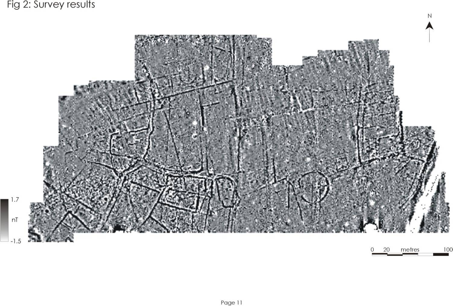
Geophysics of Hungerford © GeoFlo and the Lufton Project