We completed the survey of Hungerford and realised that the settlement continued further to the south. So we carried on surveying and in 2010 and 2011 covered two smaller fields known as Danscombe and Mr Unwin’s Field.
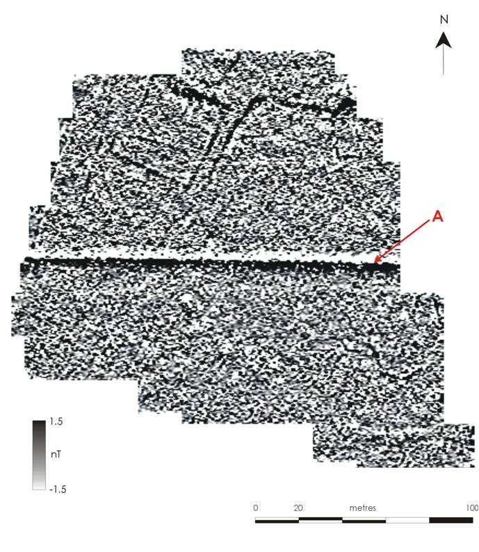
Geophysics of Danscombe © GeoFlo and The Lufton Project
Danscombe was particularly interesting because just before the magnetometer survey was carried out the landowner manured the field with ‘green waste‘. This is the composted hedge clippings and other stuff collected from householders by the council. Theoretically it shouldn’t have an impact on the survey but at Danscombe we discovered that the ‘green waste’ had a lot of many metal contaminants. These had a negative impact on the survey (compare image above with the one below) and this problem is currently being studied by Alissa, an MA student at Newcastle.
For all of the problems caused by the ‘green waste’ we could see that the ancient settlement continued into this field. The big line running across the image is a modern pipeline (A).
The Mr Unwin’s Field (to the east: below) was also surveyed and contained further anomalies associated with the settlement (A). We also identified a round anomaly (B) that we thought might be the remains of a roundhouse or barrow. This is where we decided to dig in 2012.
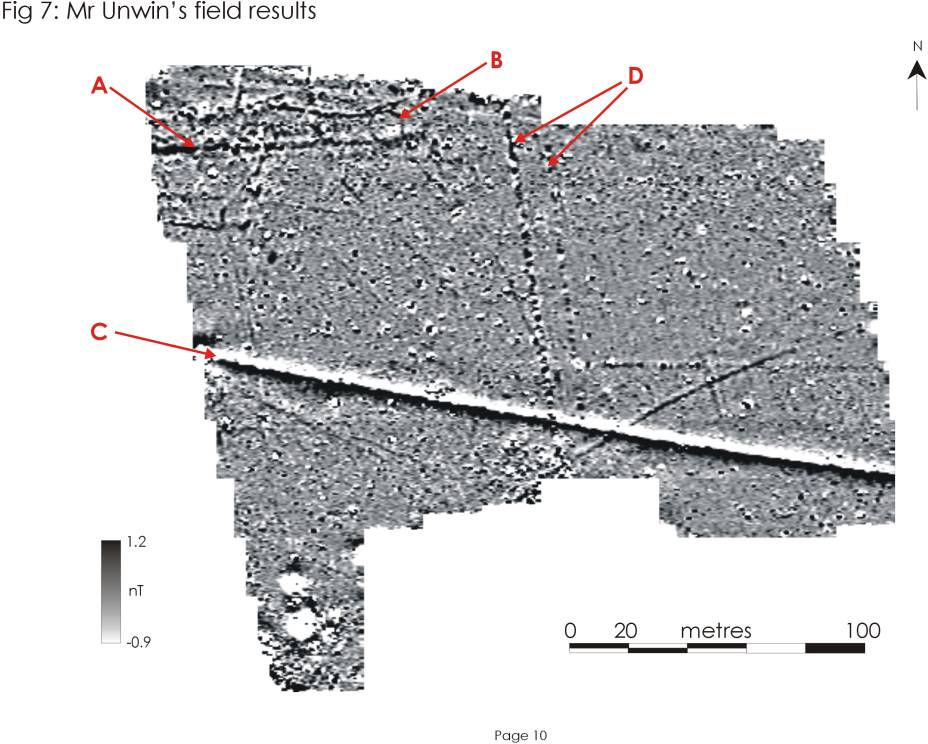
Geophysics of Mr Unwin's Field © GeoFlo and The Lufton Project