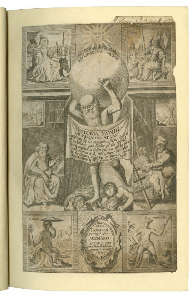
(London: Printed by T. Cotes for Michael Sparke and Samuel Cartwright, 1635)
(Post-Incunabula Collection: PI 912 MER Quarto)
Gerardus Mercator was born 500 years ago, on 5th March 1512. He was a Flemish cartographer who made it possible to navigate straight paths across the entire ocean.
Although he came to be known for cartography, Mercator’s main income source was initially in the crafting of mathematical instruments and he would later teach mathematics at the academic college in Duisburg.
While working in Leuven, he struck out as an independent mapmaker, producing maps of Palestine (1537), the world (1538) and Flanders (1540). In 1552 he relocated to Duisburg where he opened a cartography workshop and found employment as the city’s surveyor.
Mercator put his atlas together in the early 1570s when the son of his patron, the crown prince of Cleves, was planning a grand tour of Europe. It was based on his cylindrical projection (a major revolution) and compiled from a collection of wall maps that were available in his workshop, as well as some of his own hand-drawn maps. He copied the maps, then cut and pasted them into the bound format that would come to be known as an atlas.

(London: Printed by T. Cotes for Michael Sparke and Samuel Cartwright, 1635)
(Post-Incunabula Collection, PI 912 MER Quarto)
The Philip Robinson Library copy is an ‘Englished’ version of the edition published by Jodocus Hondius (1563-1612). Mercator’s work had become eclipsed by Ortelius’ Theatrum Orbis Terrarum but Hondius purchased the plates for Mercator’s Atlas in 1604 and, in reprinting it with additional maps, re-established Mercator’s reputation. The Mercator/Hondius series would go on to include a second and a pocket edition. This copy also has an illustrated title page from the second edition, printed in London for Micheall [sic] Sparke in 1637 pasted in at the front.
