Back in June 2020, I gave a presentation (for Salford University’s Healthy Active Citiies group) on how children, families and play might fit in to the active travel agenda, particularly in the context of the covid-19 crisis and our recovery from it.
Sponsored by Geographies of Children, Youth and Families Research Group and Urban Geography Research Group.
During the course of the coronavirus pandemic, play in urban space – rainbow trails, children scooting, pavement chalking, for example – emerged as both a hopeful and contentious practice. On the one hand suggesting fun, connection and freedom for children, their families and communities, often in contrast to the overriding atmospheres of repeated restrictions and lockdowns; on the other as something frivolous, risky, and even illegal. As hopes were pinned on an emergence from the pandemic, organisations in diverse national contexts called for play to be at the heart of the ‘recovery’ (Cortés-Morales et al, 2021). At the same time, debates in many different places around the use – and reallocation – of urban space, in the pandemic and beyond, became one of the focuses of discussions around “building back better”, proposing urban spaces that were more human, more accessible, and more playful.
The role of play as a space for recovery and repair is at the heart of much longstanding work on play – play can be a space where connections are made, emotions are revealed and worked through, and, simply, where fun is had. But, as exemplified during the pandemic, play is not unproblematic; attitudes towards play and unequal access to space for play, for example, pose challenges to the potential for play to contribute to environmentally and socially just futures (McKendrick et al, 2015; Horton and Kraftl, 2018). As such, it is potentially productive to think about the place of play in ‘recovery’ not only from the pandemic, but also from diverse urban crises of family, health, housing and community, the environment, violence, and much more, at scales from the personal to the global, and past and present.
This session seeks submissions of papers which explore how play figures in dialogues, policies, practices and experiences of ‘recovery’ in urban spaces. We welcome papers that report research at a variety of scales, from a diversity of locations, and that engage with both empirical and/or more conceptual approaches.
Cortés-Morales, S., Holt, L., Acevedo-Rincón, Aitken, S., Ekman Ladru, D., Joelsson, T., Kraftl, P., Murray, L. and Tebet, G., 2021, Children living in pandemic times: A geographical, transnational and situated view, Children’s Geographies, online first.
Horton, J. and Kraftl, P. 2018. Three playgrounds: Researching the multiple geographies of children’s outdoor play, Environment and Planning A: Economy and Space, 50/1, pp.214-235.
McKendrick, J., Kraftl, P., Mills, S., Gregorius, S. and Sykes, G. 2015. Complex geographies of play provision dis/investment across the UK, International Journal of Play, 4/3, pp.228-235.
The session format will be “live hybrid”, with presenters presenting in-person, to a live audience but, we hope, with capacity for attendees to also view online and be able to ask questions through an online platform.
We are committed to inclusivity and safety for all participants and presenters at our session.
Further details on the RGS Annual Conference are available here.
Presented by: Professor Alison Stenning, Newcastle University
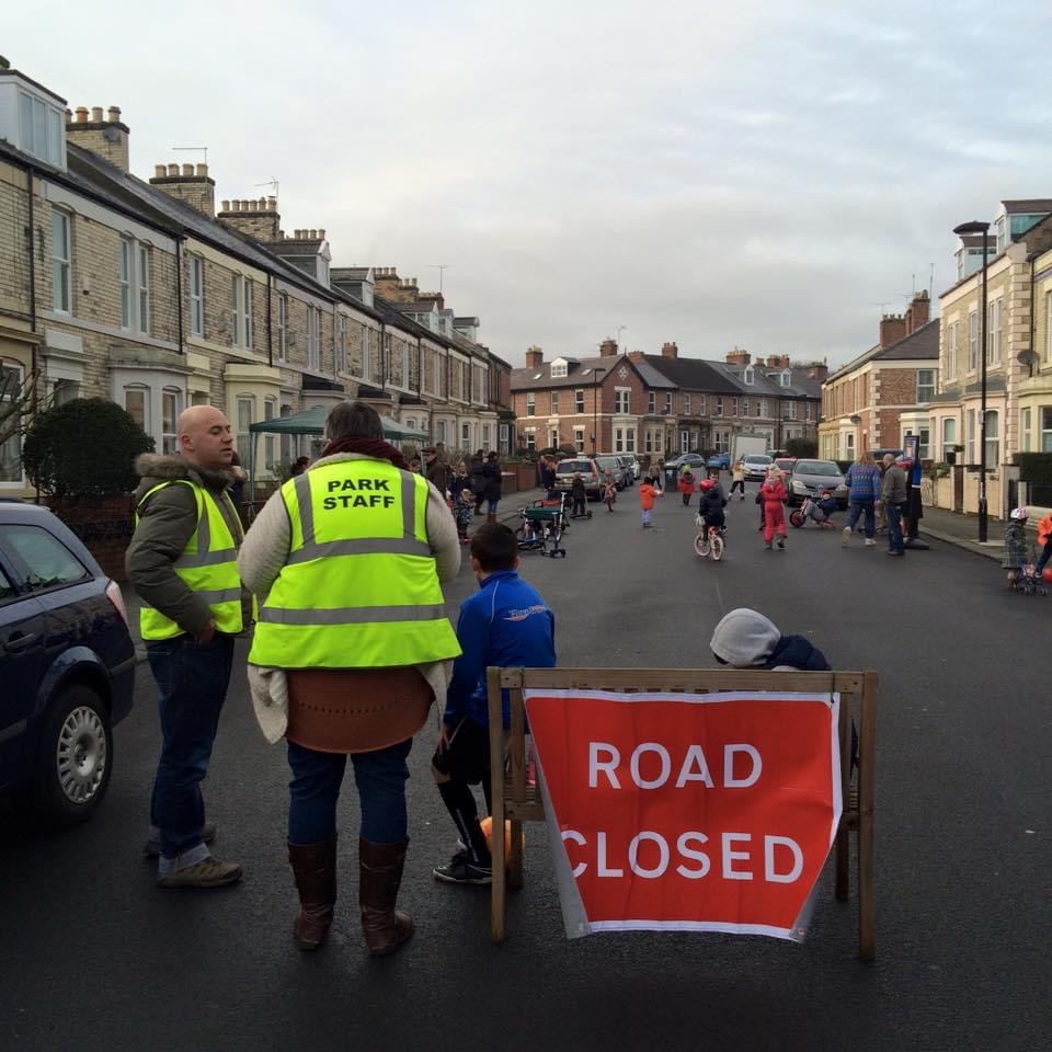
Reporting an ongoing research from local authorities across the country, and a focused case study in North Tyneside. This presentation explores the potential for the ‘playing out’ model, which facilitates temporary residential road closures for play, to support the development of community, a stronger sense of place, and associated health and well-being benefits, for both children and adults. This is in the context of cuts to other community spaces.
More than 80 UK local authorities (including Newcastle and North Tyneside) support playing out and more than 1000 streets have participated since 2009. In July 2019, the Department for Transport wrote to all local authorities and MPs to encourage them to support the practice, recognising the many benefits for children, families and wider communities.
While the presentation will focus on themes of community, belonging and place attachment, there will be links to ideas around active travel, air quality, wellbeing and green space.
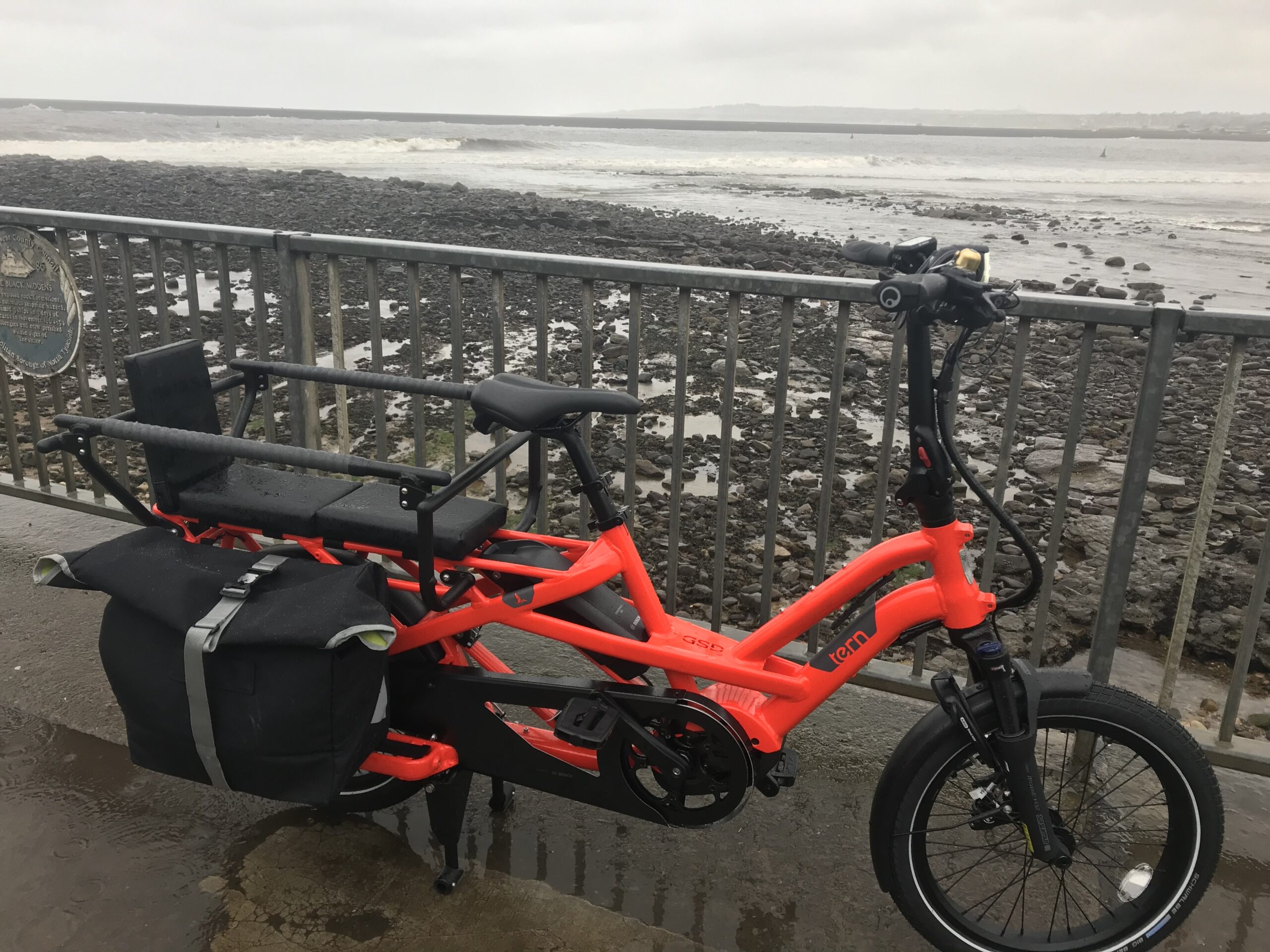
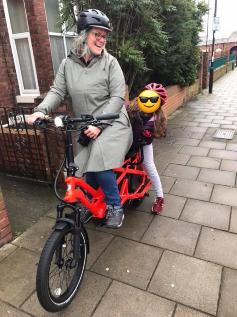
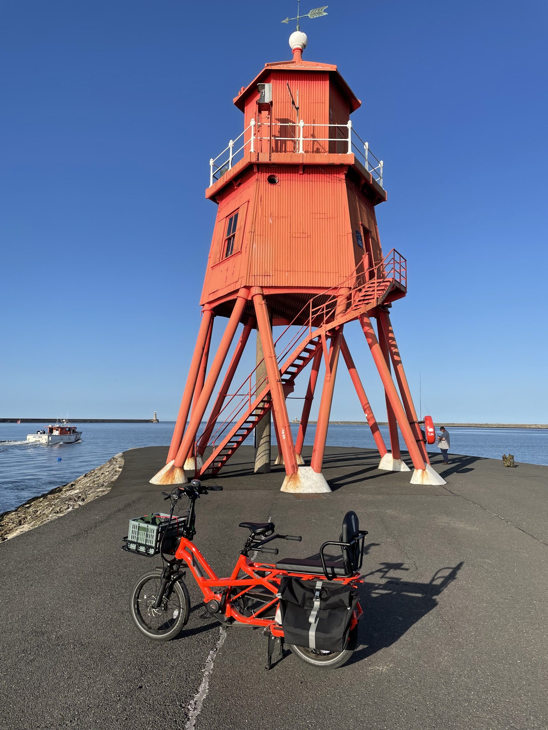
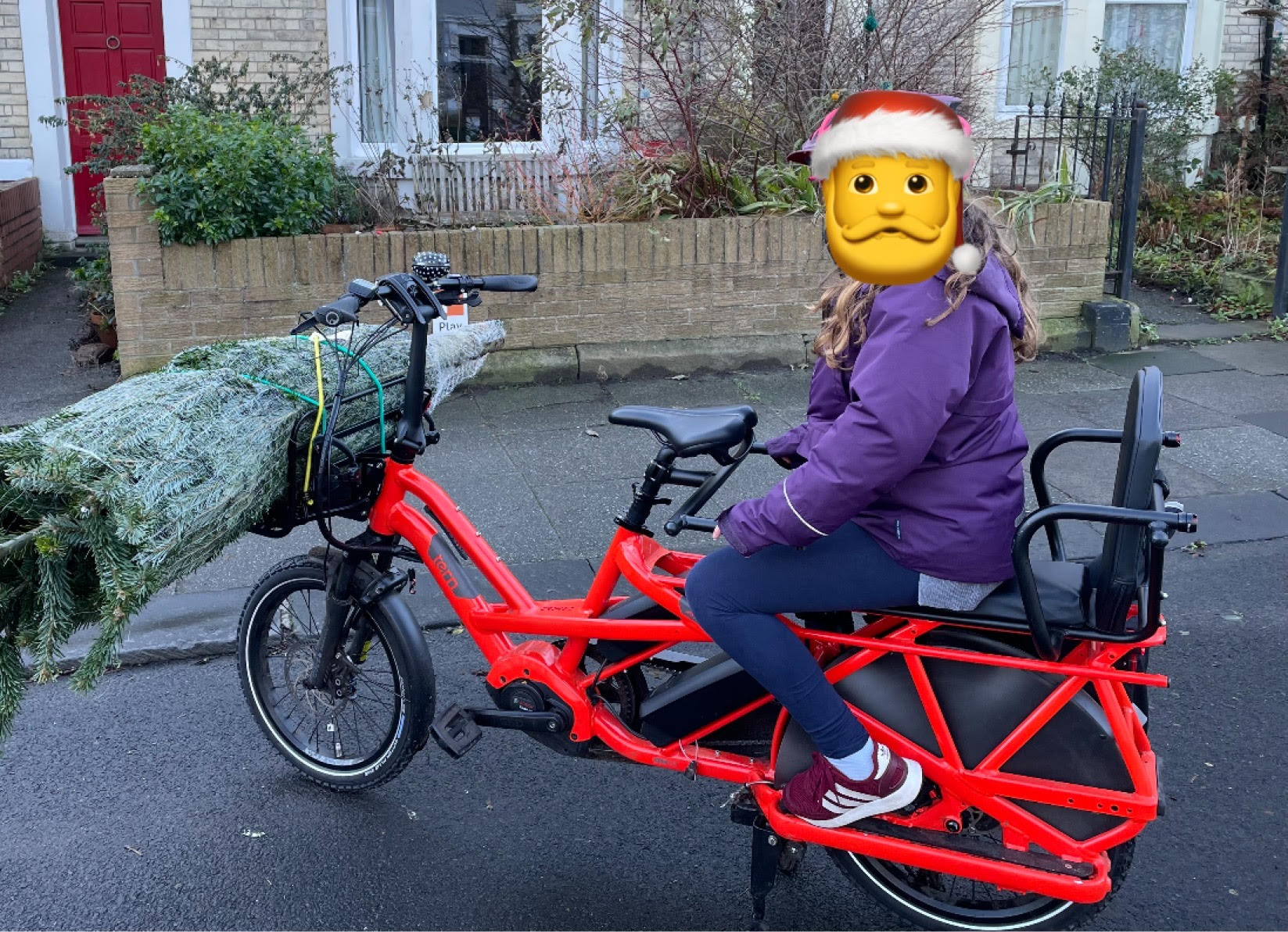
I’ve just passed the 1000-mile marker on my Tern GSD, my beautiful, bright orange, e-cargo bike. I know 1000 miles isn’t much for a seasoned cyclist, used to 100-mile rides every weekend, but it’s quite a milestone for me – I even managed to coordinate passing it with a Christmas social cycle with friends, festooned with lights, and with my daughter on the back.
I’ve almost always owned a bike, and I’ve cycled in most of the different stages of my life, but if you’d suggested to me, say, before covid struck, that I’d be riding this much, and that cycling would be my primary form of transport I’d have been surprised. It’s been a fairly rapid transformation, if one that already had foundations.
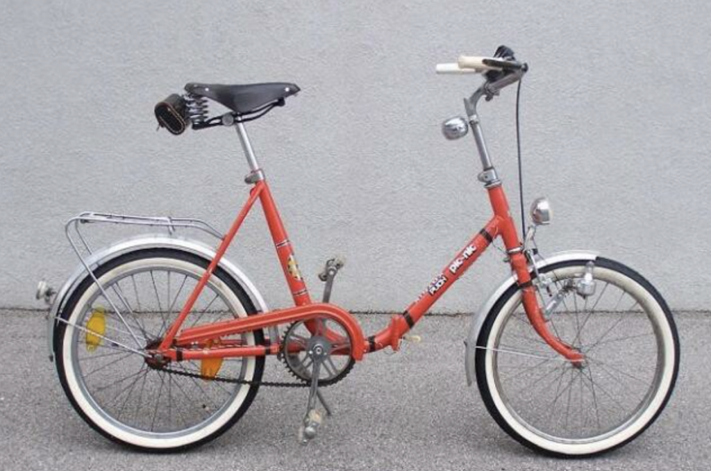
I cycled as a child (as I reflect in this blog) and at university; in sixth form and at university, in Birmingham and in Newcastle, bikes were my primary form of transport (though I have almost no recollection of what my bikes were then, what they looked like). I’d cycle daily to campus, and cycle home in the dark, with a strong sense that this was safer than walking. And in Birmingham, I cycled a lot with friends on long(ish) rides to the south of the city, to pubs mostly, as you do in your 20s. I bought my first car in about 1998 and that probably marked a significant shift in my cycling habits.
I don’t think I owned a bike when I moved back to Newcastle (in 2003) but bought one in around 2008 from Edinburgh Cycles and started cycling into work, from Heaton, for a couple of years. I cycled a bit on the waggonways then too, but I never cycled to the shops or to friends’ houses. Then I got pregnant and moved to North Shields and stopped cycling routinely. My then partner cycled to work quite regularly and did quite a lot of weekend bike rides too, some of which I joined him on, but it always seemed like I was juggling too much (childcare, work, shopping, etc.) to manage to cycle too – given what I know now about cargo bikes, perhaps I’d have made a different decision. I do remember one friend getting a box bike for the nursery run, but couldn’t quite imagine doing it myself. I still cycled quite a lot on holidays; we always took our bikes on family holidays to Ireland and I regularly cycled there, exploring quiet lanes on my own, with my partner, and often with my daughter on the back of my bike.
I’ve never particularly liked driving and I certainly don’t love cars. My current car is an 18-year-old Fiesta which somehow manages to pass its MOT each year without costly repairs. But, for years, especially those with a young child, we defaulted to driving for most journeys (though never the school run).
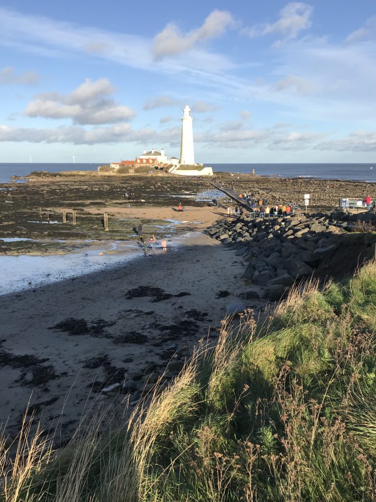
Fast forward to March 2020, to home working, remote schooling, and the quieter streets of lockdown. My daughter and I took to cycling around the residential streets of North Shields, mostly feeling safe with the low levels of traffic. We started regularly cycling to her dad’s and did a few longer journeys, to see the piles of stones near St Mary’s Lighthouse and to the marina at Royal Quays, for example.
In July 2020, North Tyneside Council created a pop-up cycleway all along our seafront, from Tynemouth to Whitley Bay, a cycleway that became popularly known as the Sunrise Cycleway. This 3-mile route opened up so much, as we managed the first summer of covid and the ongoing need for social distancing. My daughter and I used the route a lot, sometimes with friends, cycling to Whitley Bay for an ice cream, or just getting about, shopping, visiting friends. And I used it even more on my own, probably 3 or 4 times a week, to get to friends’ houses, to shop on the temporarily-closed-to-motor-vehicles Park View, and just to get some exercise and fresh air, a break from working at home.
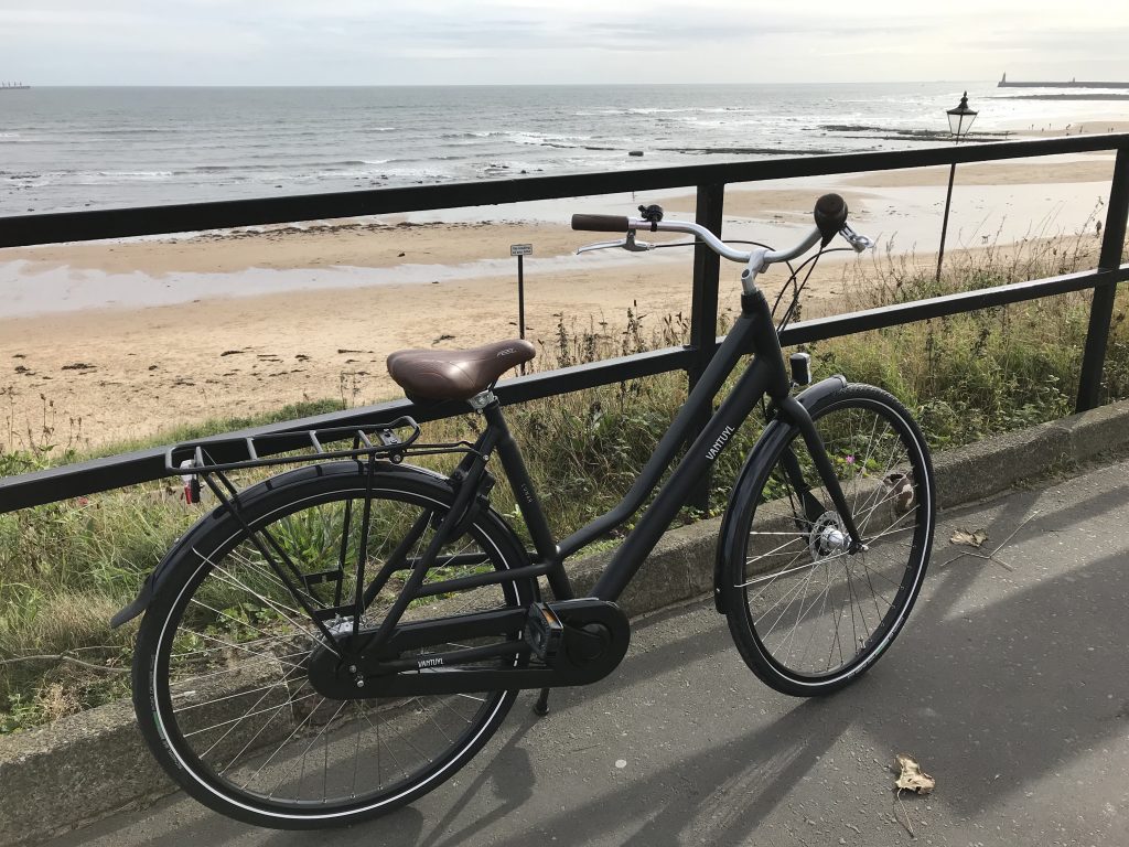
My old Edinburgh Cycles bike started to fall apart – the seat snapped off as I rode home one day on the Sunrise Cycleway, and then the gears went and it seemed to make more sense to buy a new bike than fork out for expensive new parts. So I bought a lovely and long-coveted Dutch-style bike and rode that around the coast, on errands, for fun, often when I’d otherwise have driven.
I was beginning to imagine that cycling could be a bigger part of my life, and that it could become my primary means of transport for the first time since my 20s.
I’d started idly investigating ebikes over the summer of 2020, partly because I was cycling so much more but also because, as I engaged in more and more campaigning around the Sunrise Cycleway and other temporary walking and cycling interventions, more people were talking about ebikes in my social (media) circles. The geography of my everyday life had shrunk during the pandemic, as it did for many; most of my journeys were very local, but some of them involved carrying a load of stuff (mostly signs and kit for the play streets I support through PlayMeetStreet North Tyneside; it had always felt wrong to deliver kit to play streets by car, when at their heart play streets promote car-free spaces), but also, of course, shopping and my 10 year old daughter. If I was going to cycle more and drive less, I had to think about longer distances and heavier loads. I knew that I’d be unlikely to commute the 16-mile round trip to work, when we returned to the office, on an acoustic bike as I hadn’t for over 10 years. I knew, especially, that I would rarely be able to face the homeward trip in bad weather and in the dark, at the end of a long working day. I also knew from experience that I often ‘trip chained’ on my journeys to work, either by car or by metro, to fit in other errands and other destinations. I figured an e-cargo bike might be the solution for my needs.
So I hired an bike (just a Raleigh Motus at this stage) from Tynemouth’s Ride Electric for a month and I used it a lot – to travel to work occasionally, to shop, to take things to the dry cleaners, to go on little adventures, exploring Tyneside, travelling further by bike than I had for years. I loved the roaming distance it gave me, that I could just keep going (as long as my battery did).
These experiences convinced me that I’d use an ebike, that I’d enjoy it, and that an ebike would open up spaces and activities for me. I’d been eyeing up Tern GSD and other long-tail e-cargo bikes, wondering if, as well as moving me, I might use a bike like this to move my daughter and other ‘cargo’.
Tern GSD have some impressive promo films, imagining a seamless life of childcare, shopping and fun (not much work!) and I was tentatively persuaded – but any ebike is a big purchase and the Tern GSD all the more so (though much less than a car, as I always tell curious passers-by).
In late January, Craig from Ride Electric rang me to tell me he could get me a GSD the following week. I was slightly freaked out; I’d imagined taking months to make the decision carefully and cautiously. But I looked at the finances, talked to a lot of people, and said yes.
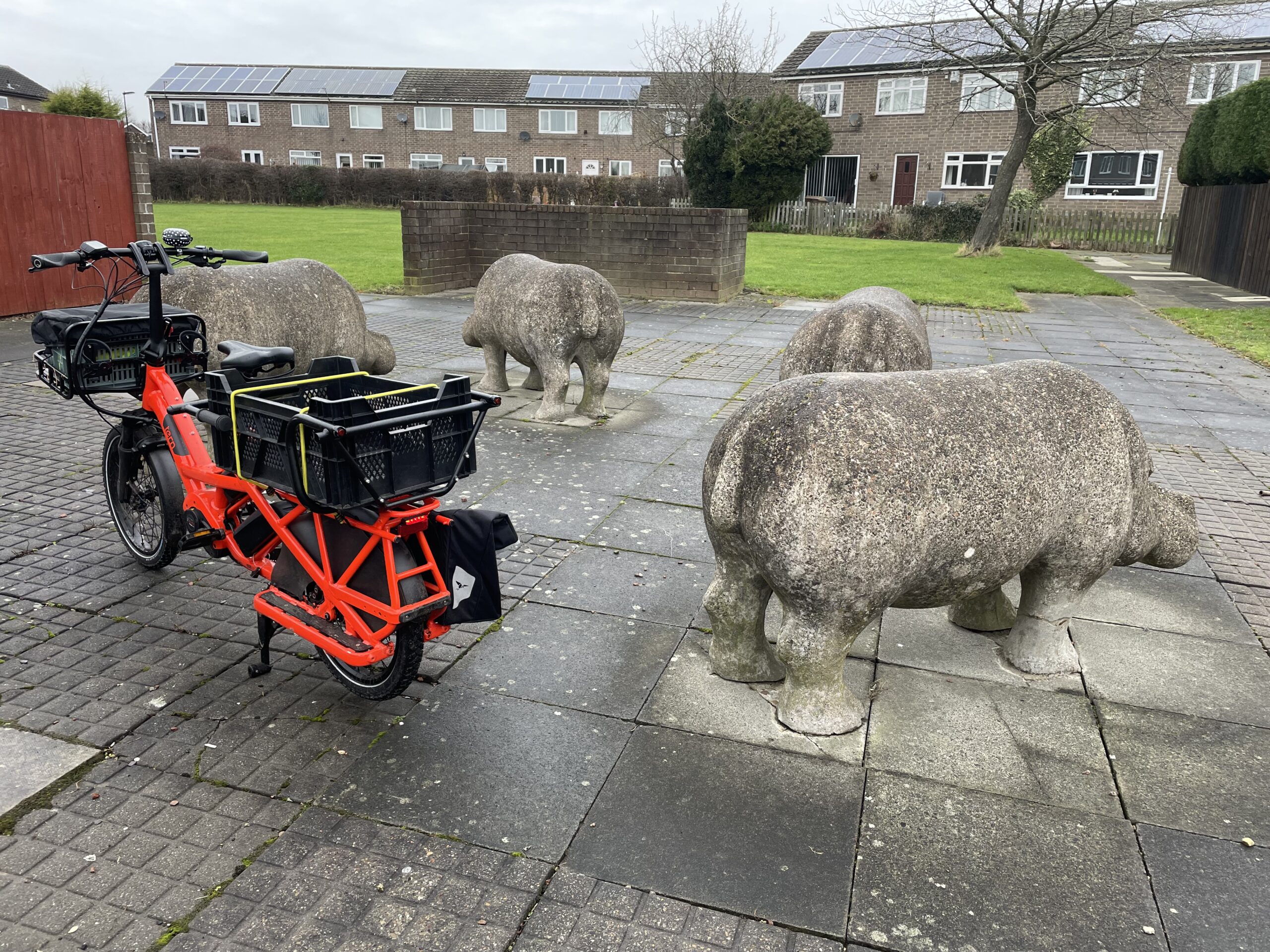
On 3rd February, I became the proud owner of a ‘tabasco’ (orange) Tern GSD.
I loved it immediately. Even on a cold, wet February day, cycling felt like a breeze and I was confident that I’d manage – and enjoy – longer and longer distances. I had the Captain’s Chair installed for my daughter (which can be swapped out for a crate for cargo) and my Tern GSD adventures began.
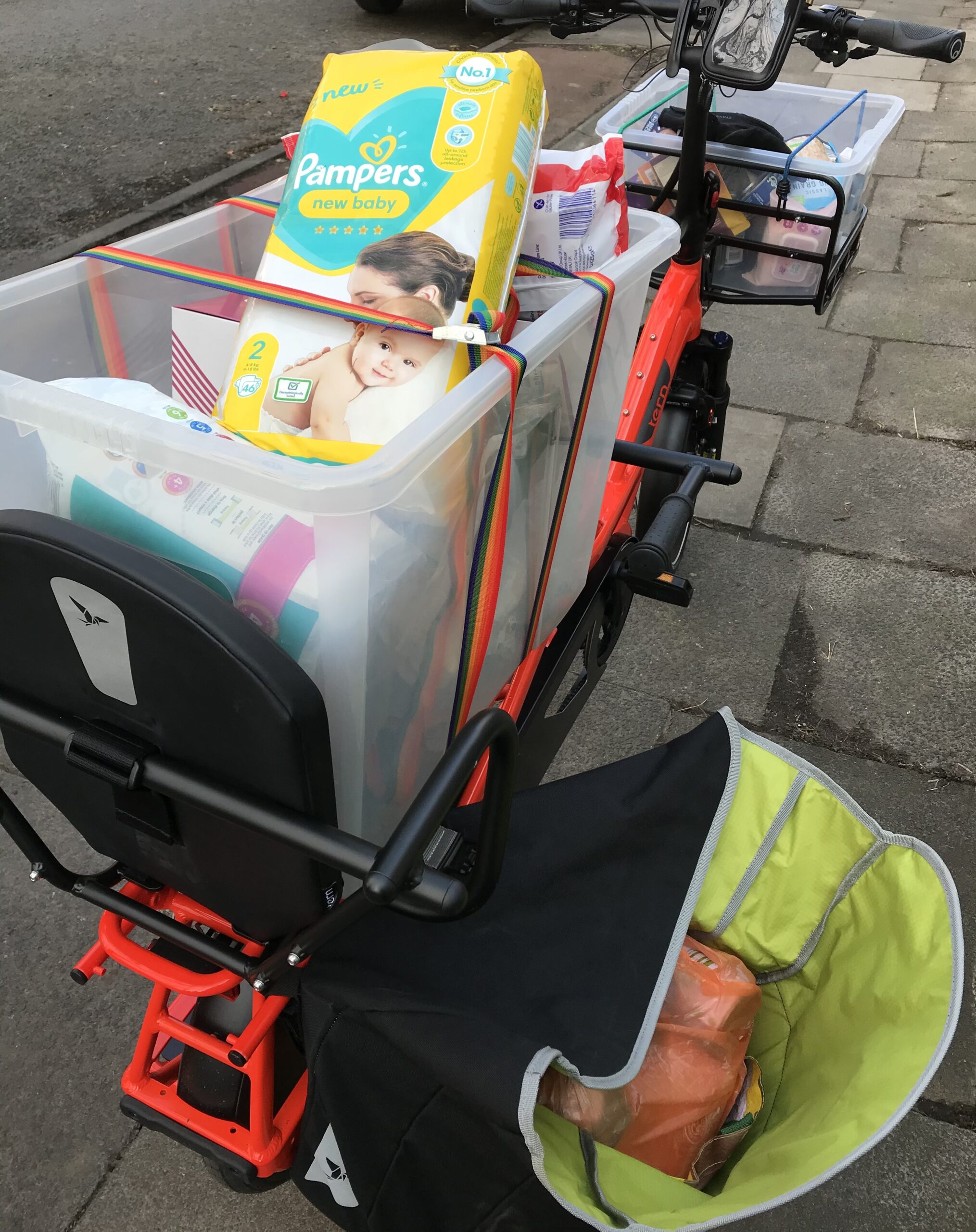
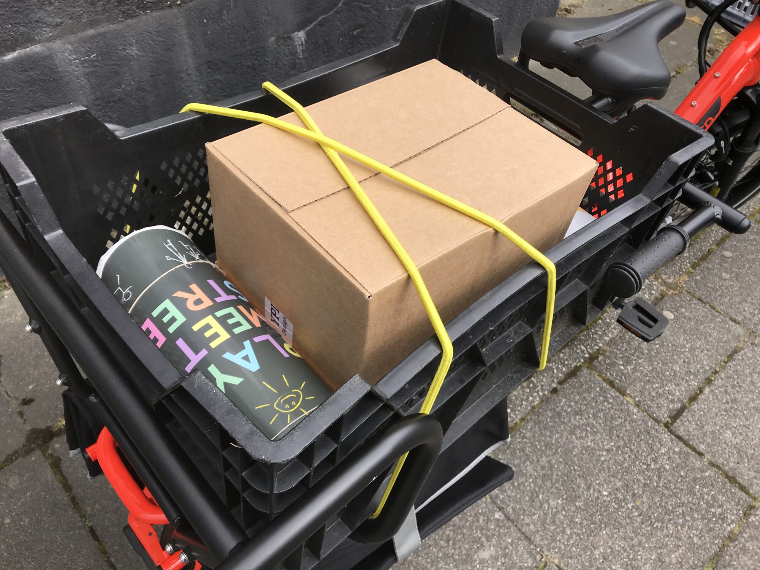
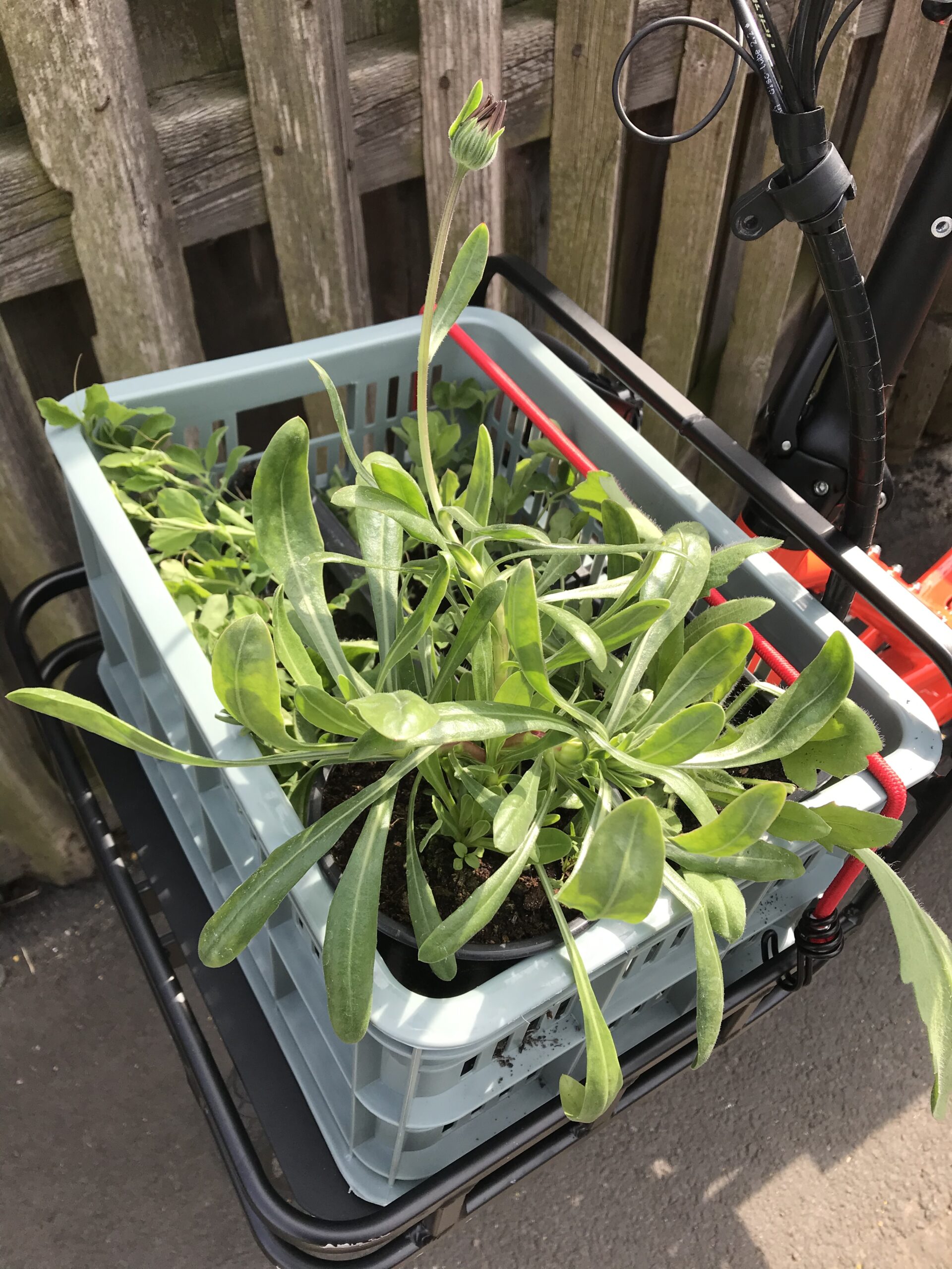
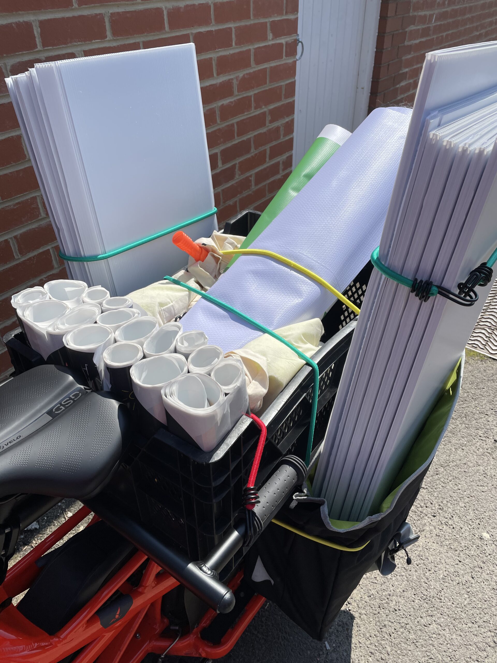
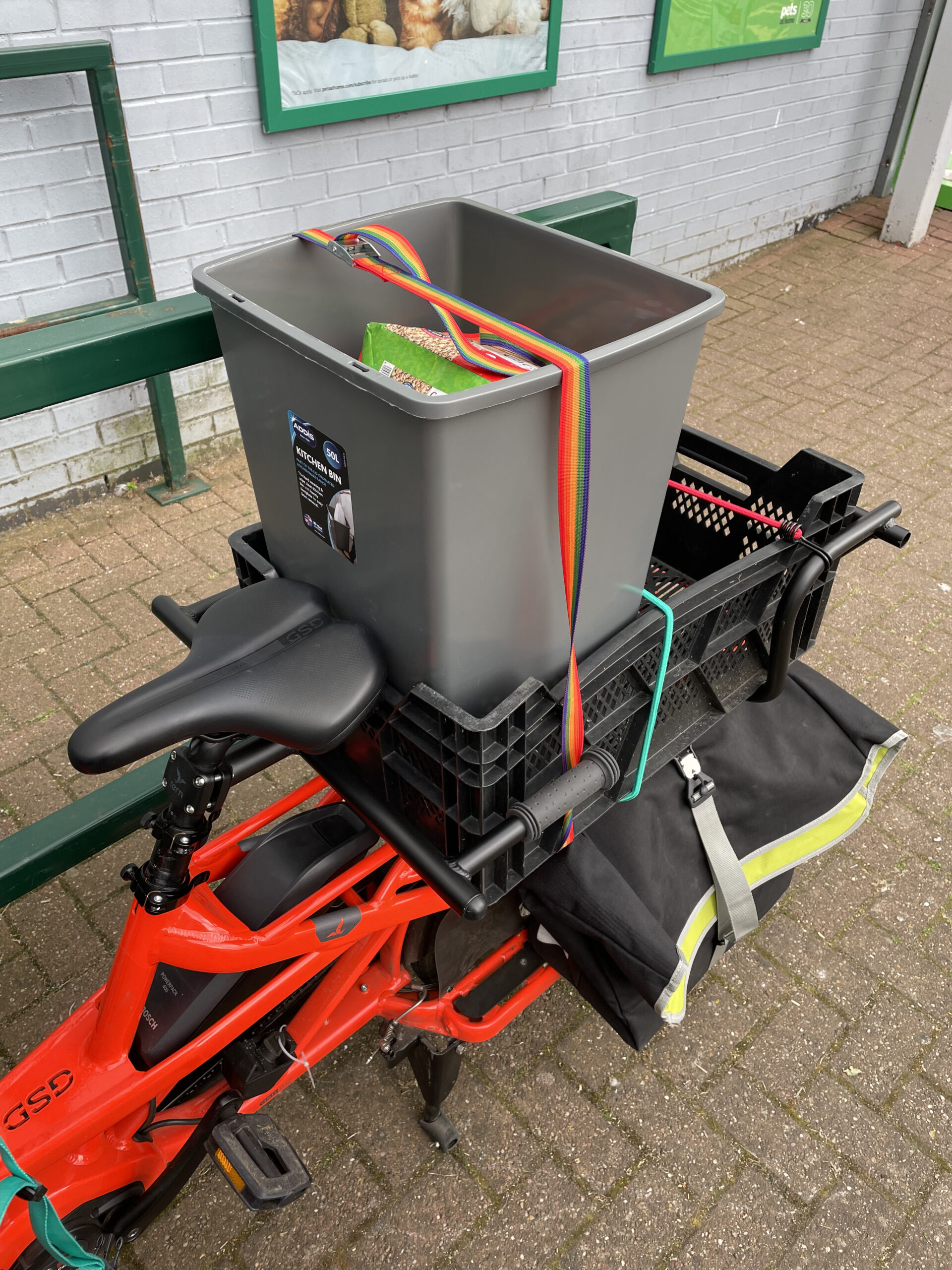
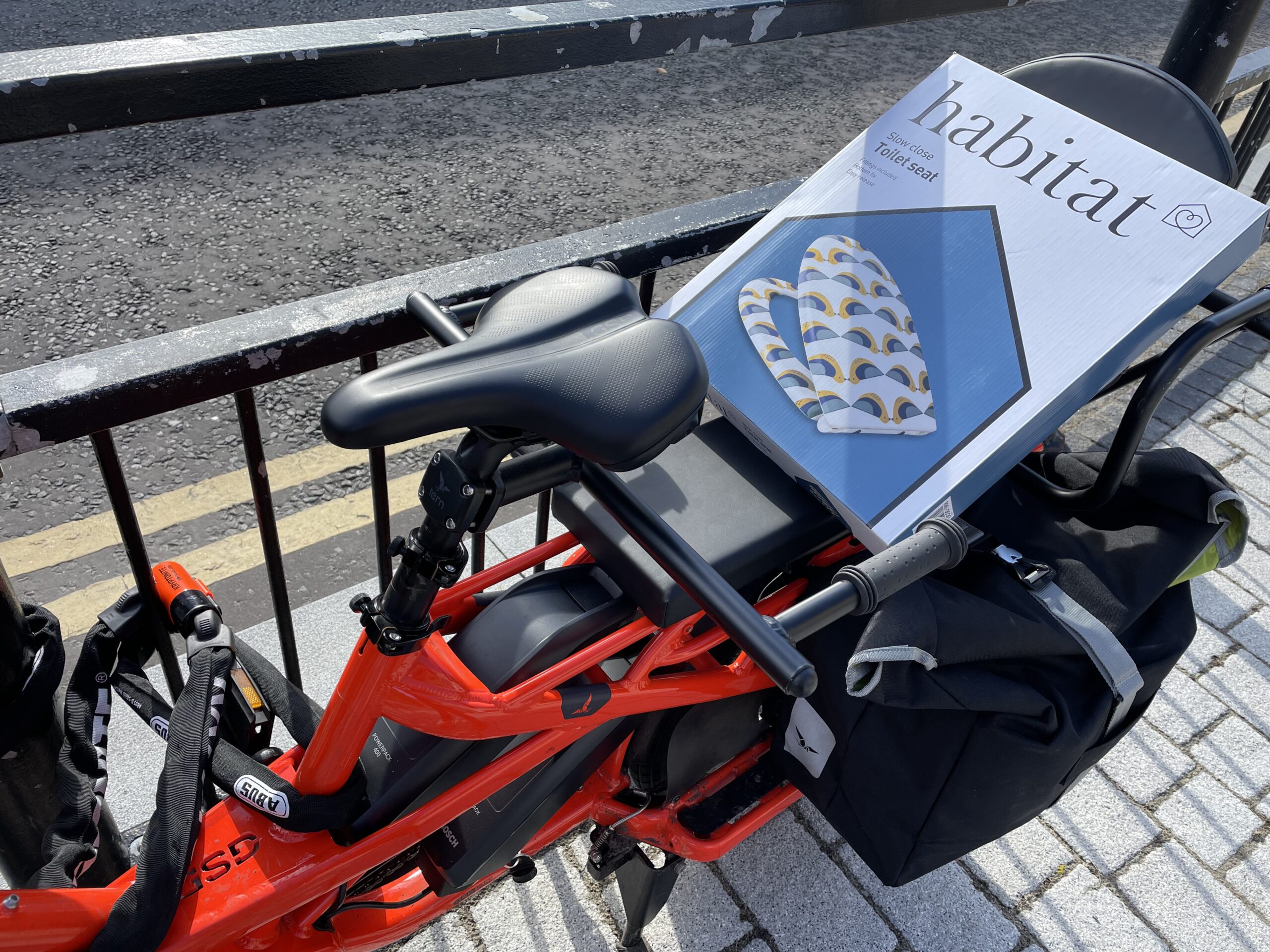
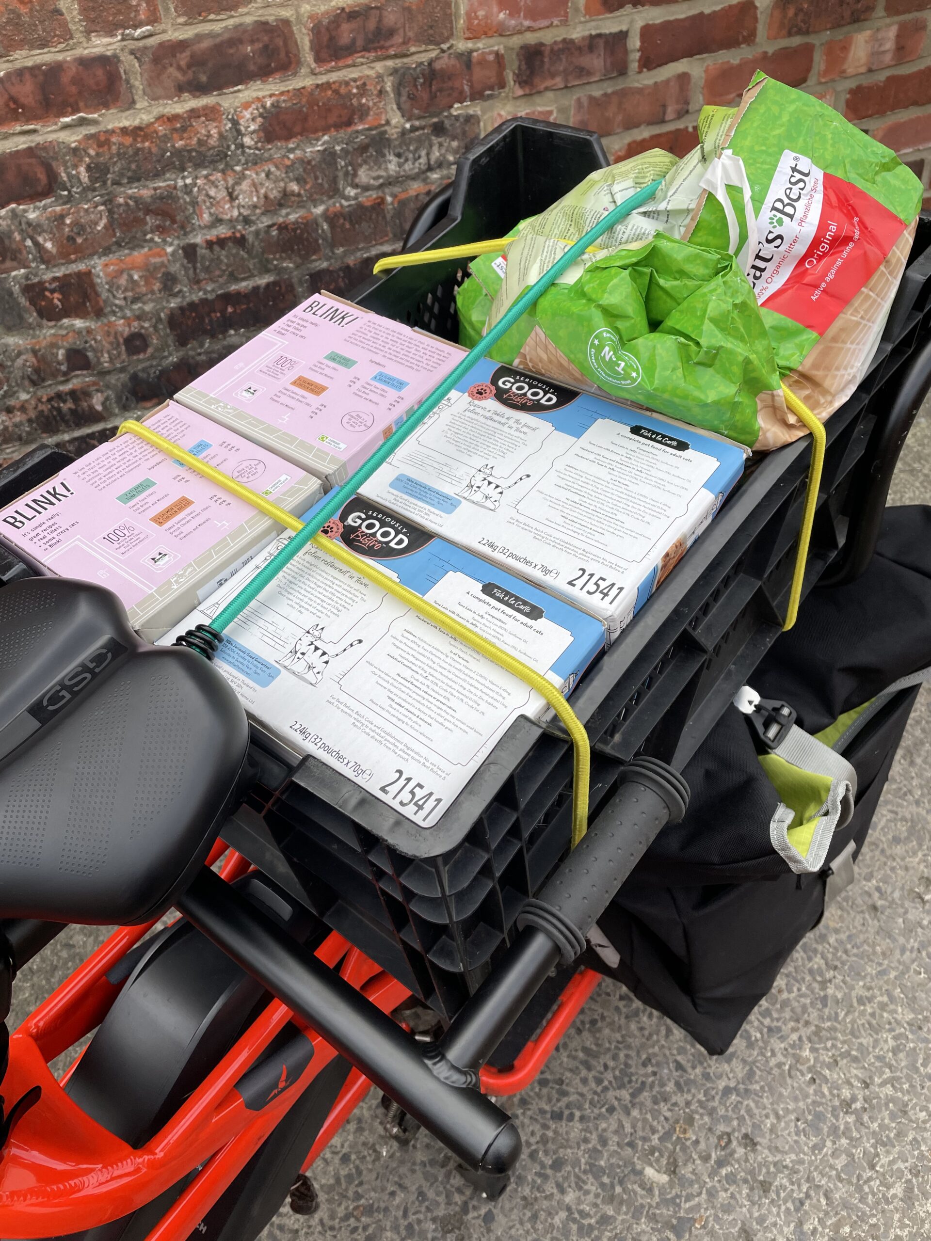
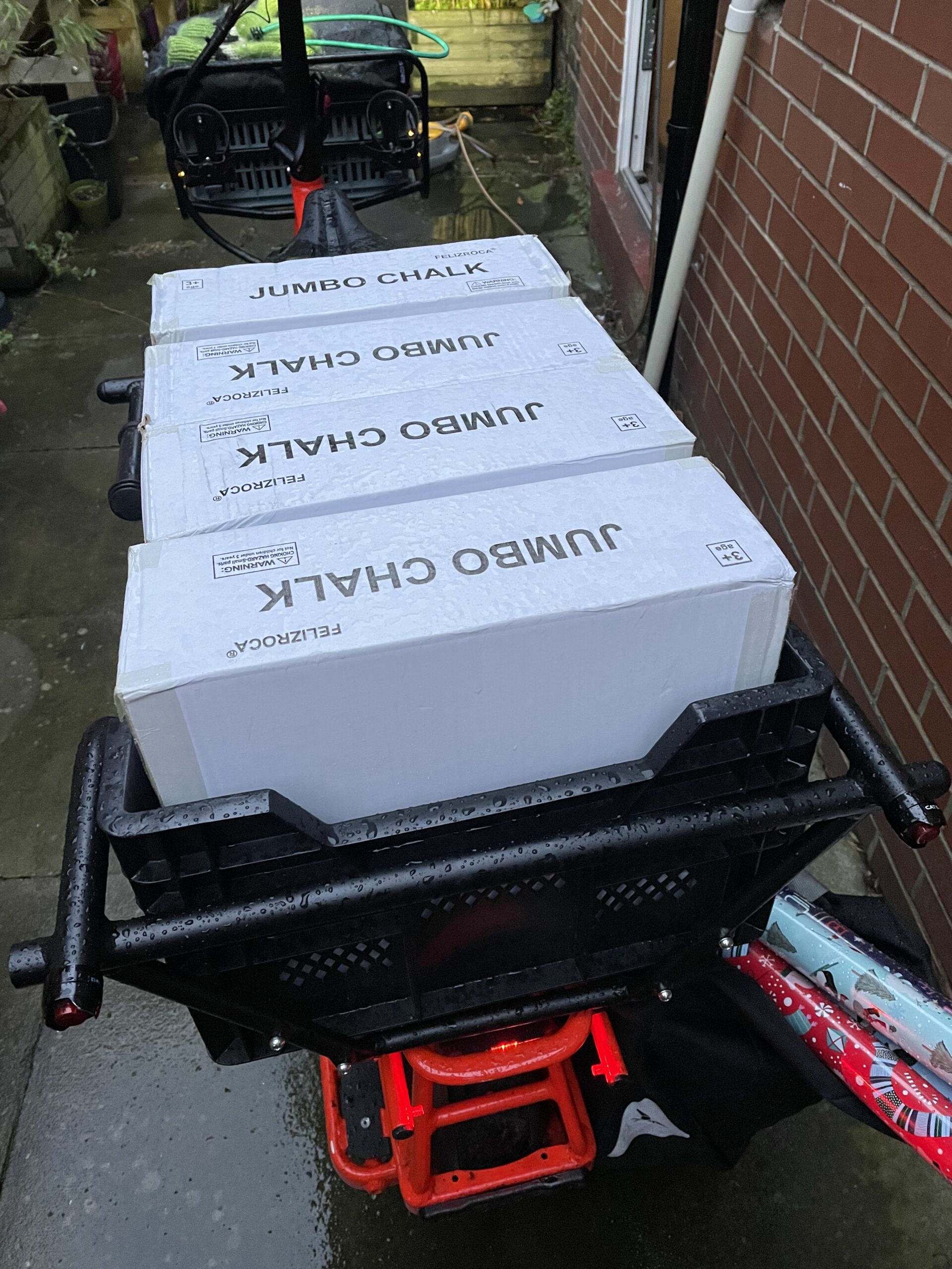
I’ve used it for everything I expected and much more. My 1000 miles have been racked up by cargo trips – carrying weekly shops, pet food, charity collections, plants, bulk purchases of pavement chalk, a toilet seat and a bin, and many, many sets of Road Closed signs and kit for play streets.
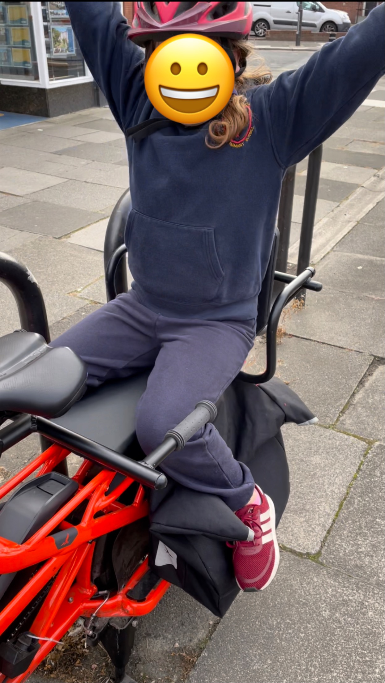
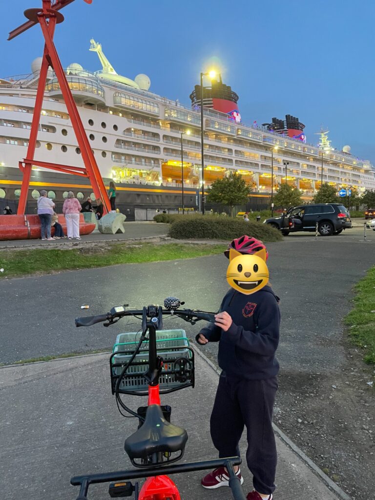
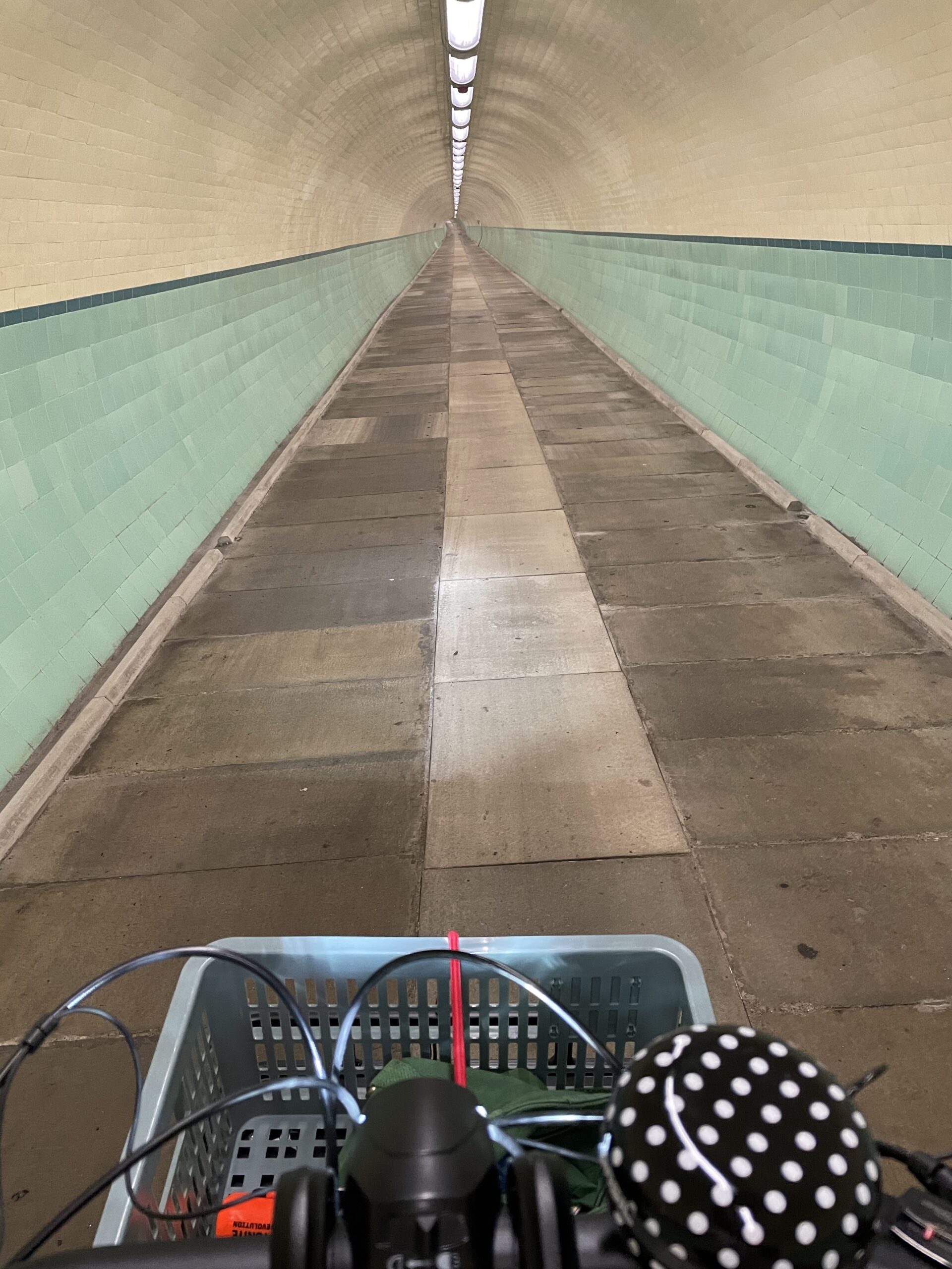
By trips with my daughter, sometimes getting her places which were too far (or too dangerous) for her to ride her own bike, trips we’d otherwise have driven – to friends, to her dad’s, to and from after-school activities – and sometimes just for fun, to explore the streets around us, to see the sea, to experience the joy of the Tyne Pedestrian and Cycle Tunnel.
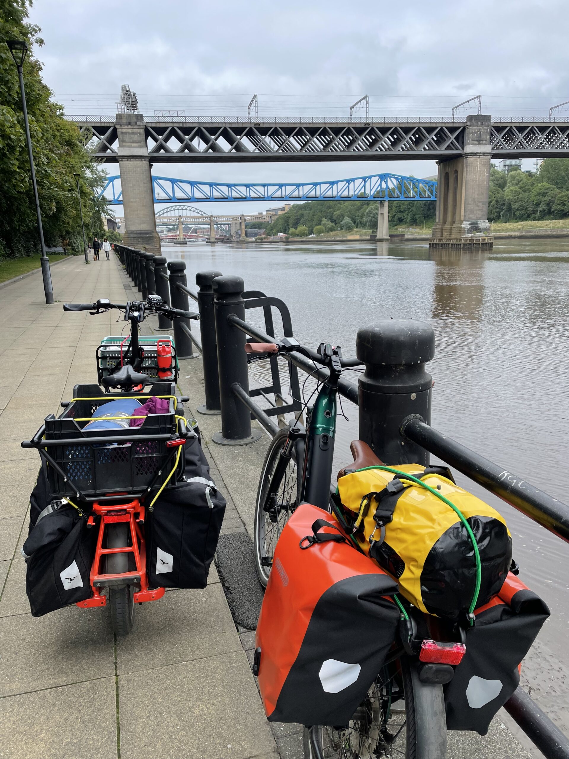
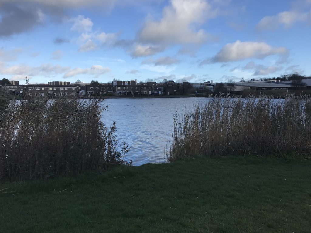
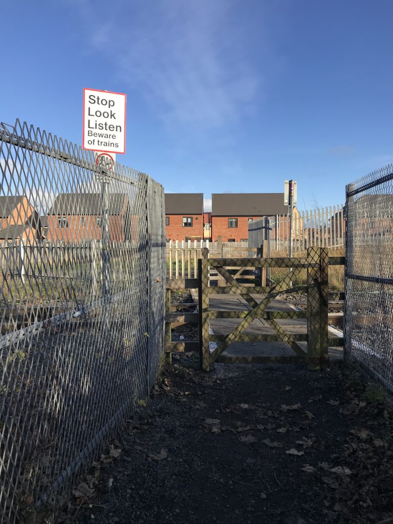
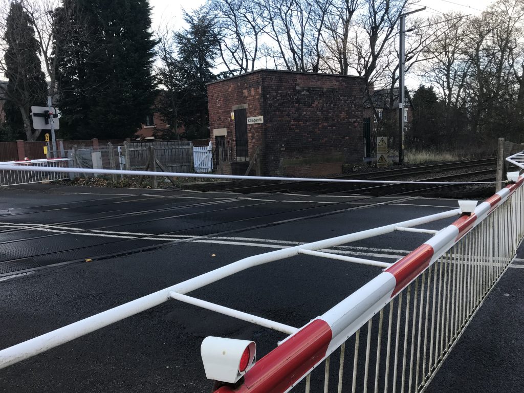
By longer rides, on my own and with friends, to explore more and more of Tyneside (and Northumberland and Wearside), to get some exercise, to enjoy the pleasure and thrill of cycling (sometimes despite our ropey cycling infrastructure). I’ve been to Sunderland, Washington, Killingworth, up and down the North Tyneside coast hundreds of times, into Newcastle and around, racking up the local miles.
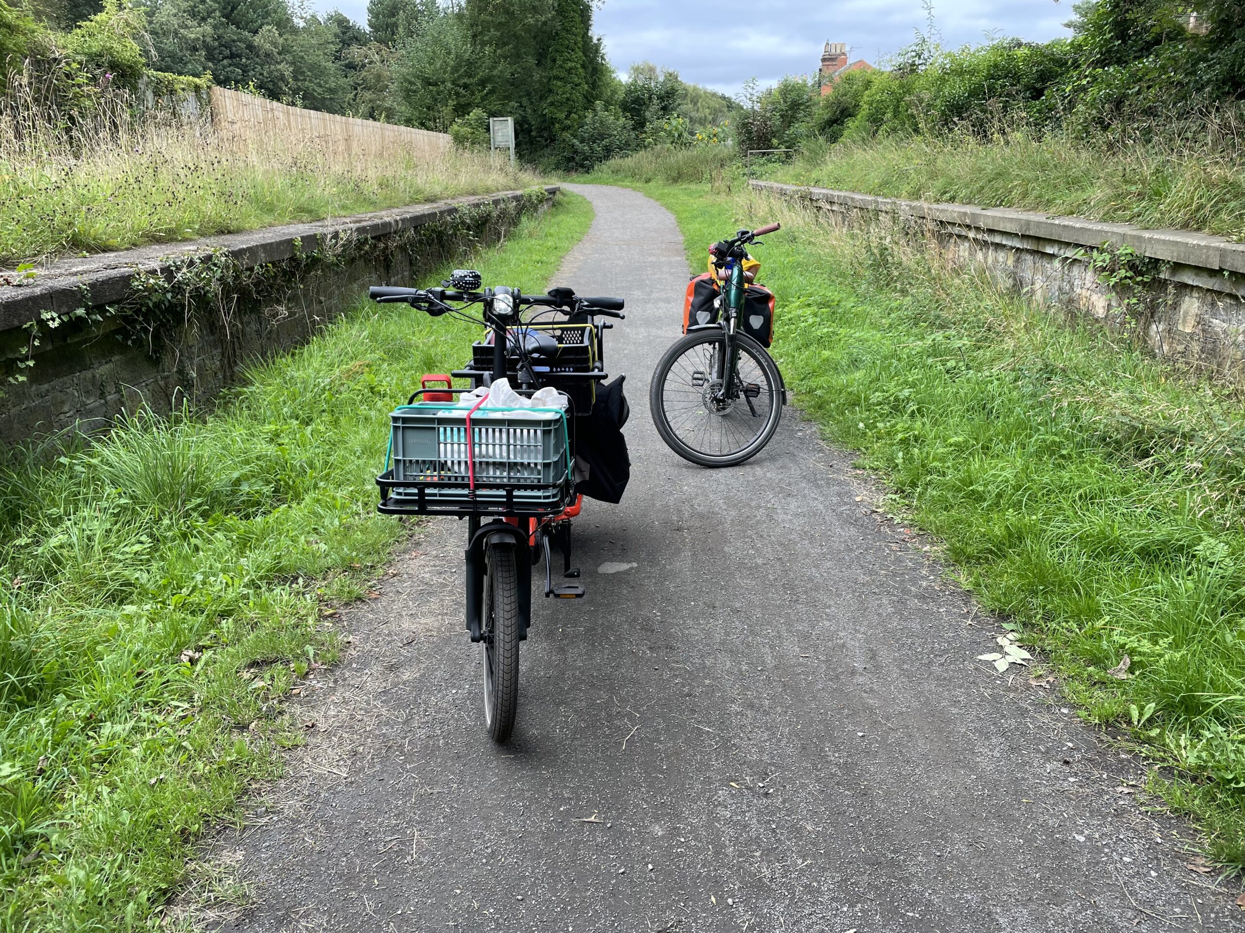
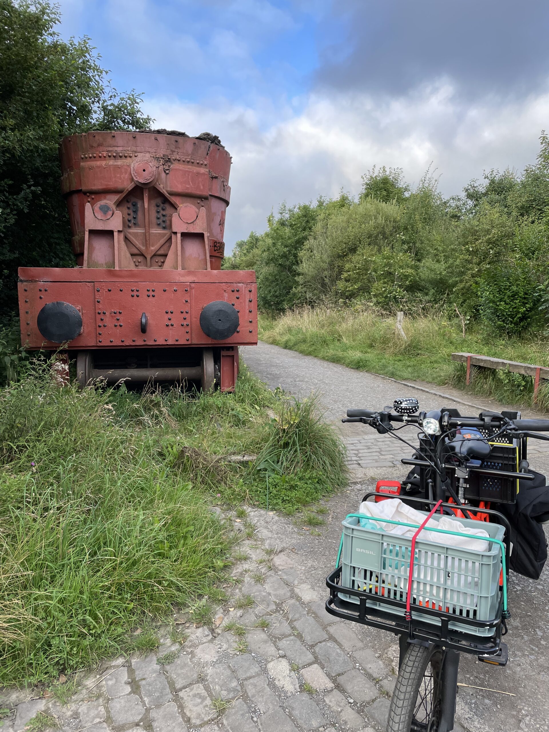
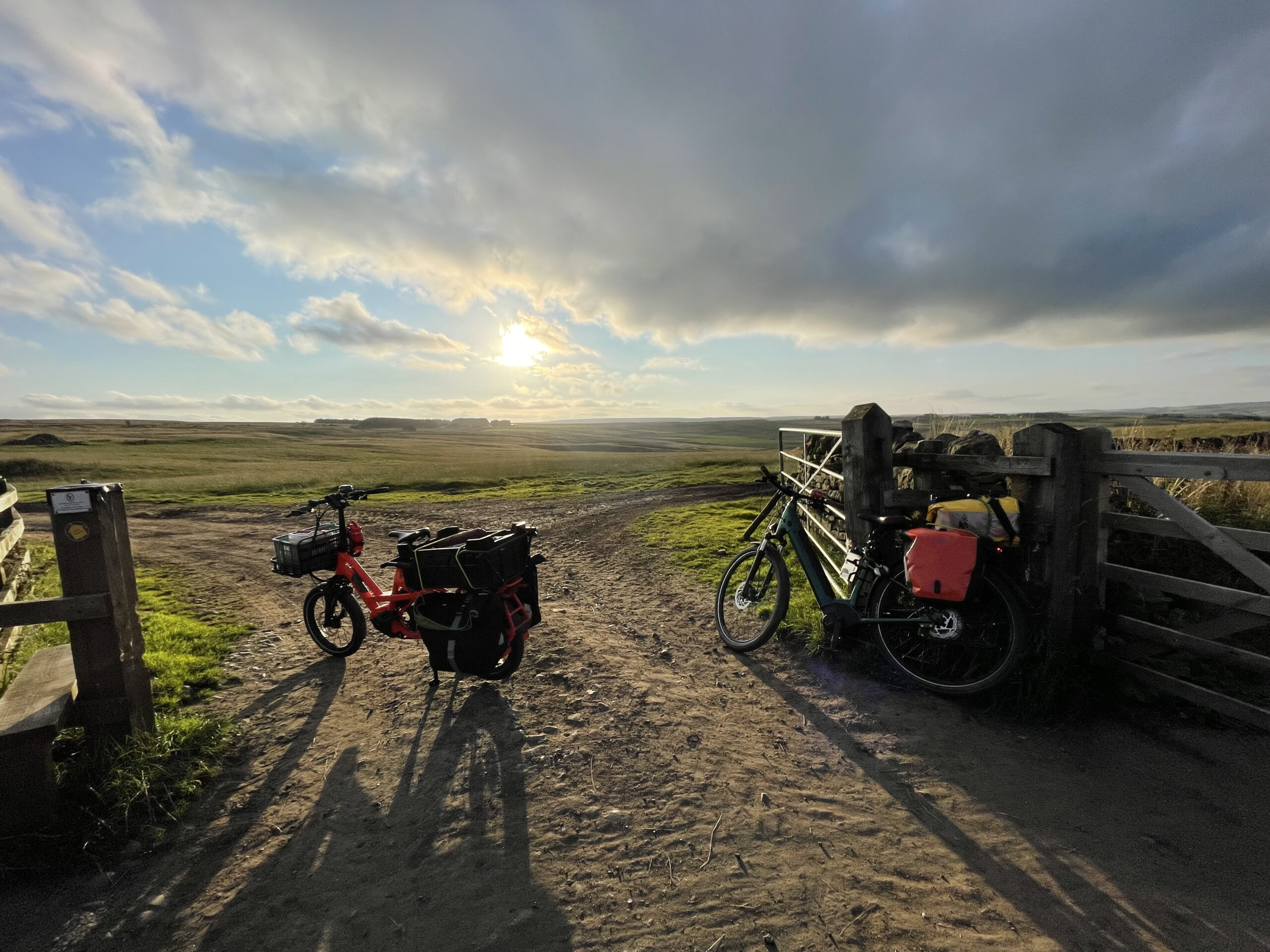
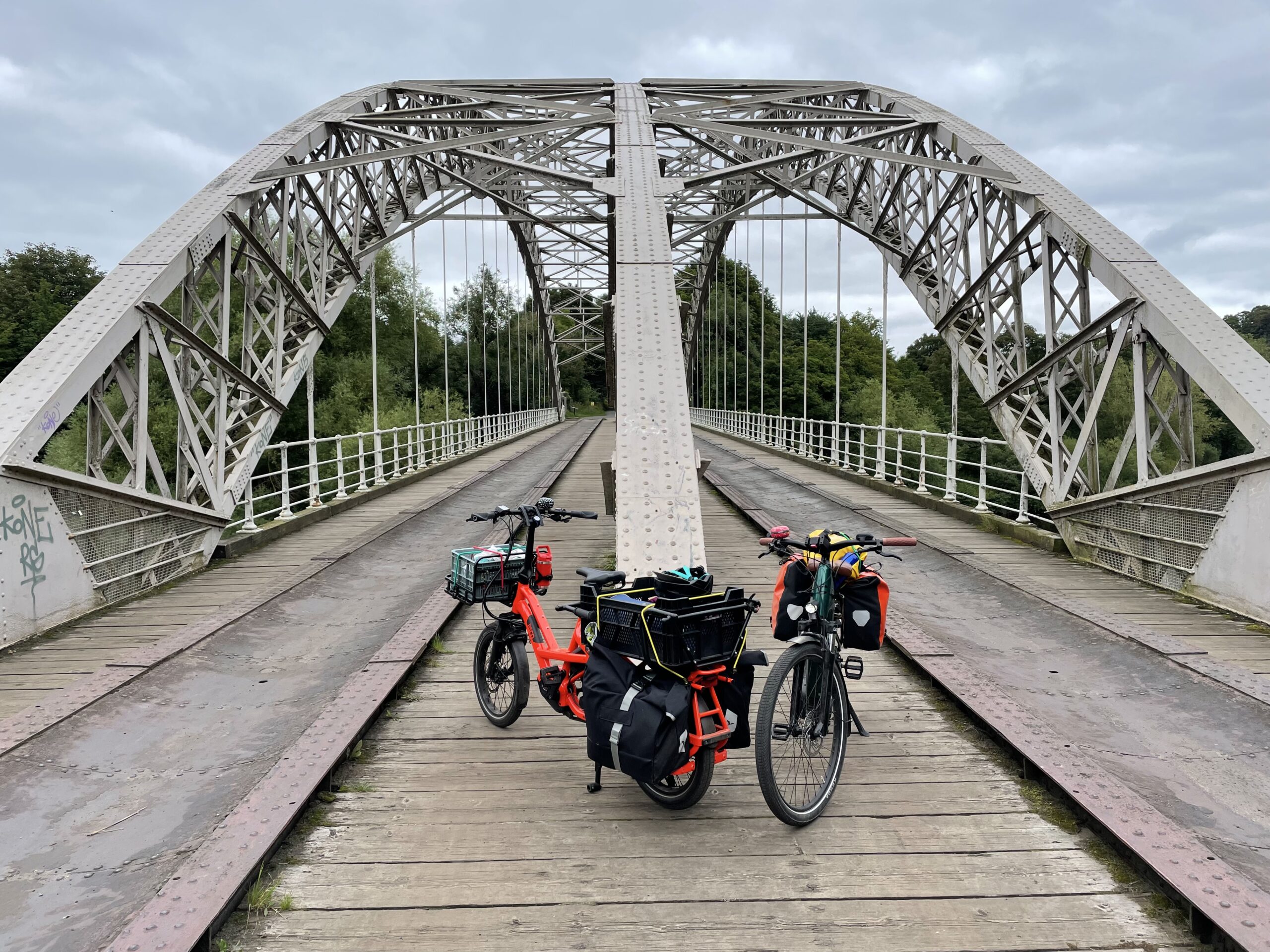
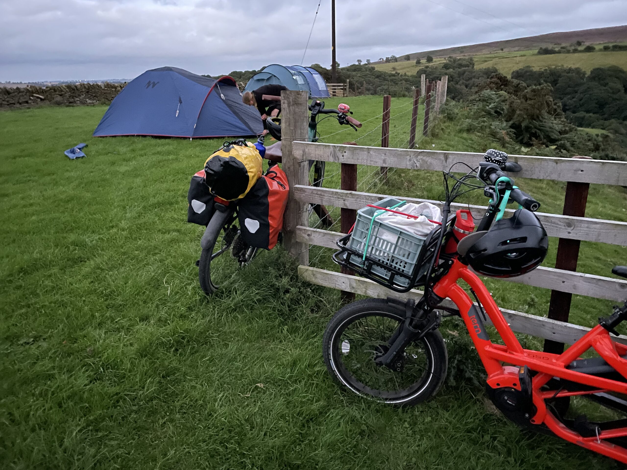
And, with a friend, I did my longest ever cycling trip and my first ever cycle-camping trip, taking in over 80 miles on a round trip up the Derwent valley to the north Pennines, back to the Tyne, and home to North Shields, loading all we needed onto my GSD (and stopping occasionally to recharge my battery – I’ve since invested in a second battery – nothing stops me now).
And, since September, I’ve been commuting, to the centre of Newcastle, at least twice a week, a 16-mile round trip that’s quicker and more reliable than the metro, and probably the car. It takes me 38 minutes, door-to-door, give or take a minute or two. I’ve done it all weathers, and have just got winter tyres fitted so that I can carry on. On the one occasion I had to take the metro to work (as Storm Barra approached), I got colder standing on the metro platform and wetter walking between work and the metro than I ever have on the GSD – waterproofs do their job. I love the commute – I love that it’s predictable, but also that I’m in the world. I witness the seasons change, I see sunsets, I meet other cyclists, I enjoy the movement. I don’t love the Coast Road cycle path, the primary route from North Tyneside to Newcastle, but that’s another story.
Oh, and I brought my Christmas tree home by bike, because I could and because it was fun.
So that’s 1000 miles. Interestingly, it took me seven months to do the first 500 and just 3 to do the second 500, mostly as I’ve been racking up the miles on my commute. I wonder how many miles I’ll have done by the first anniversary of my bike purchase in February. I’m tempted to say I’ll aim for 1500 miles by then, but it’s winter and it’s Christmas, so I make no promises.
I’ve done everything I expected to by bike, and more. I didn’t know how I’d find cycling in miserable weather, but it’s genuinely OK. And I never feel too tired to cycle home at the end of a working day; I just boost the power up to turbo. Even on turbo, I’m getting more exercise and more fresh air, and more contact with the world around me, than I have for years. I’m much more profoundly connected to my neighbourhood, town and region than I was before (and being a geographer, this has always been something I have striven for).
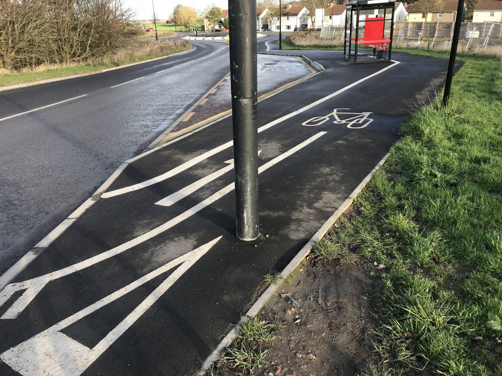
There are real frustrations around infrastructure – some of it is not only dreadful but dangerous – and my experiences have reinforced my commitment to campaigning, and I’m holding on to a slightly forlorn hope that things will get better. But I’ve loved planning routes, using maps and street view, and get a surprising amount of joy in finding the cut-throughs, alleyways and short-cuts that I’ve spotted on a map – and through which cars can never travel.
The plan is to give up my car altogether at the end of January, perhaps to mark my GSD anniversary. I use it maybe one or twice a fortnight at the moment; the rest of the time it’s parked up, taking up space on my overcrowded road. I’ve joined a car club and I’ll still use a car occasionally, but mostly I’ll make do, either with my bike, or with public transport, or the occasional taxi.
Like I said at the beginning, it’s been a fairly rapid ‘modal shift’ for me, albeit one with long foundations. What have been the key ingredients? Certainly, being encouraged to cycle as a child and keeping that up through early adulthood. After that, hmm, believing that streets are for people and getting involved in movements that campaigned around this, and consequently getting to know more people who made these choices. But beyond these quite abstract ideas, perhaps the most important factors were the quiet streets of lockdown and North Tyneside’s Sunset Cycleway, which reminded me how much I enjoyed cycling and how enabling it is, and the rise of ebikes, which are still more enabling, for longer distances and heavier loads. (This is what I said in answer to this question on Twitter; the other answers in the thread are fascinating.)
So, that’s it. That’s the story of my 1000 miles. And the moral – ride a bike, ride it more, fork out for the fancy one if it’ll help you do what you need (it’s always going to be considerably cheaper than a car) – you’ll save money, be healthier, and get to know your world more. What’s not to like?
We began playing out on my street, in North Shields, North Tyneside, six years ago, in December 2015.
I’d been living on this street for about four years and had a four year old daughter. I’d got to know a few of my nearest neighbours, to chat to briefly as we passed on the street, to share stories of our children, to maybe borrow a missing ingredient. I had the sense that more and more families with young children were moving on to the street, including, coincidentally, two I’d met through baby and toddler groups.
Somehow in October 2015 I googled “playing out” – I don’t know why, and even how I knew this was a thing, but I must have seen something about the idea, probably on social media, possibly in a news article somewhere. I’ve always been interested, personally and academically, in the idea of our most proximate everyday environments and what the relationships in these places mean, so it wasn’t completely out of blue that I’d connected somehow to the idea of neighbours meeting and playing on their streets. What was a surprise to discover, as I searched, was that North Tyneside was piloting a play streets project in 2015, supported by Playing Out, the social enterprise emerging out of the activism of a handful of mothers in Bristol, and Play England.
So I emailed Diane at the House of Objects, the organisation leading the pilot here in North Tyneside, on 6th October 2015, and arranged a meeting for my neighbours. With a bunch of us keen to go ahead, Diane applied to the council on our behalf and we planned for our first “playing out” session on 13th December 2015. I think we were the fifth North Tyneside street to get started; only one other of these pilot streets is still going and celebrated its sixth anniversary in October.
Our first play street, 13.12.15
That first session was a huge success. It was December, so cold, but it was dry, and we made hot chocolate for the kids and mulled wine for the adults, and we played for three hours, until it was dark. Diane said she thought our session “one of the best to date” – and she asked us for some feedback and quotes to promote the scheme. This is what I sent her:
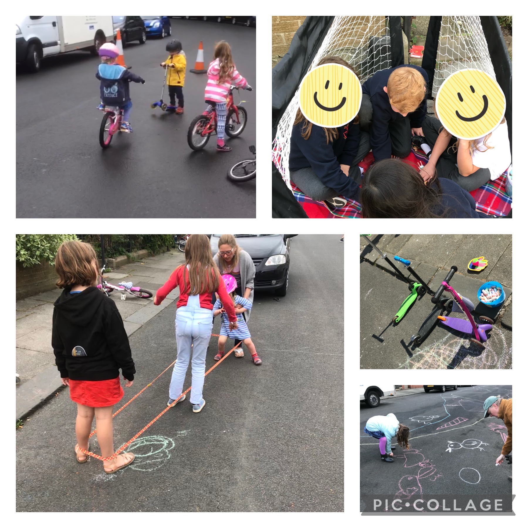
“there must have been between 15 and 20 families out, with about 30-40 children. The atmosphere was fantastic – one dad said “The sound of laughing and shouting kids echoing up the road will stay with me for a long time.” The kids played happily with each other for the full three hours, no squabbles, no accidents, just lots of scootering, cycling, football, trampolining, drawing with chalk, blowing bubbles and facepainting. My 4 year old daughter said “I liked scootering on the road the best”. Everyone said what a fantastic idea it was – and everyone’s up for planning the next.”
So we planned more – every four weeks, and sometimes every other week, from January 2016. Our regular pattern has been one Sunday afternoon a month, but for the last three years or so, during the summer months, we’ve also played out after school on Mondays or Fridays once a month, and we’ve had additional sessions for occasional street parties and special dates like Halloween. I reckon since December 2015 we’ve played out more than 70 times, over 200 hours of neighbours playing, hanging out and chatting. Before the pandemic, we’d cancelled just a handful of sessions, either because it was raining just too hard or because too many neighbours were away (usually in the middle of the summer holidays).
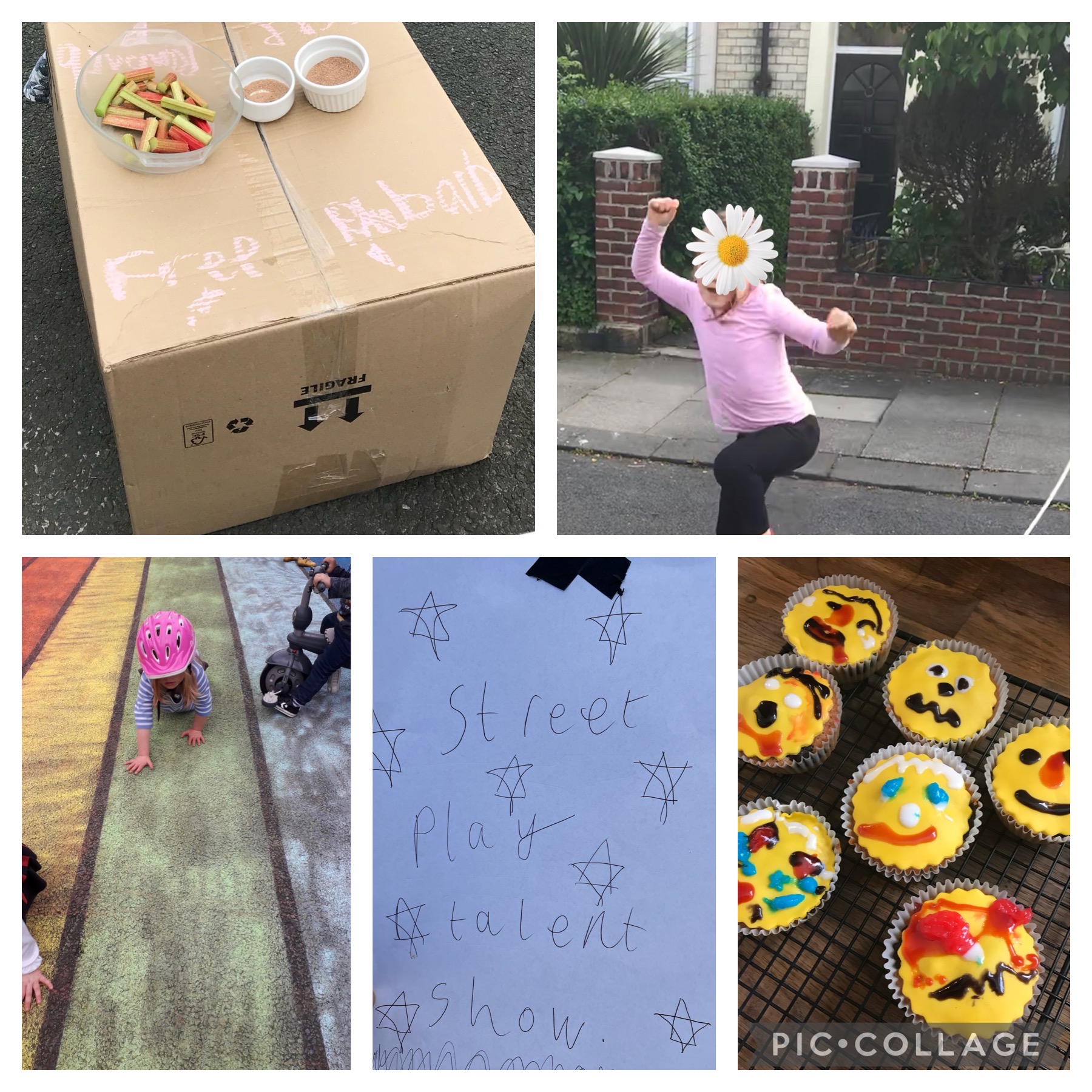
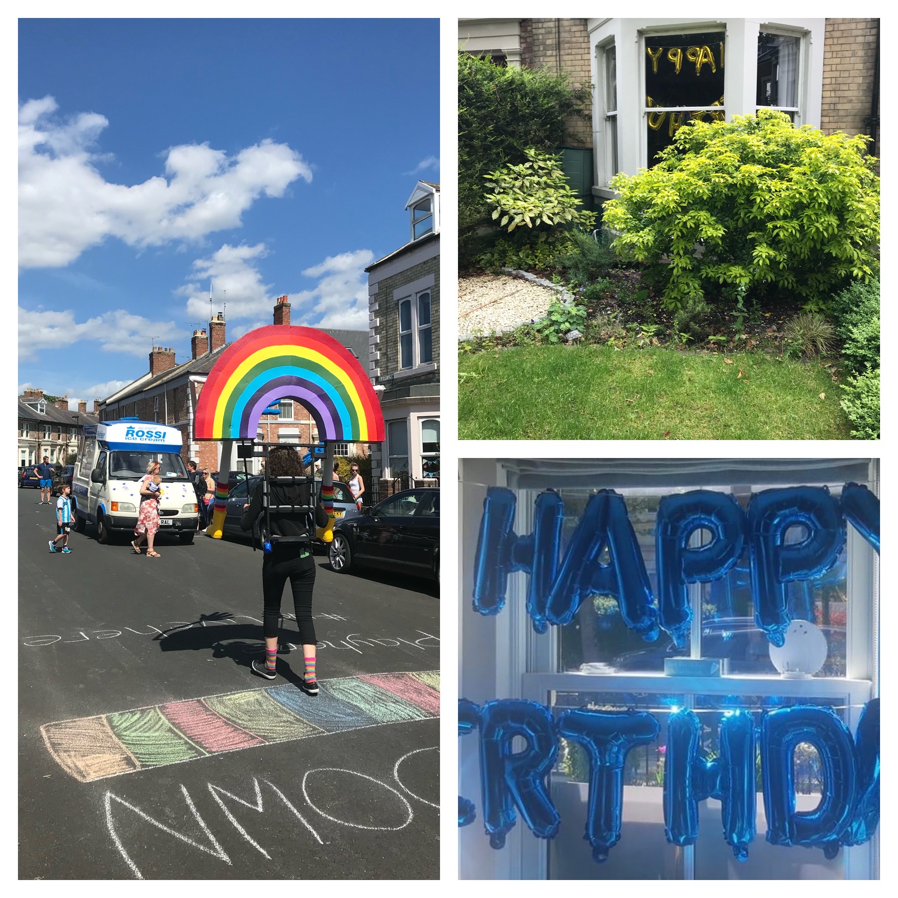
There’s been scooting, chalking, skipping, cycling, football, bug hunts, races, hopscotch, tennis, apple bobbing, sprinklers, “elastics”, fancy dress, pancakes (cooked on the street!), crawling, falling (not too much!), noughts and crosses, tents, impromptu stalls, talent shows, biscuits, crisps, sweets, the ice cream van, charity bakes, hand-me-downs of all kinds (bikes, clothes, books, toys), lots of sitting (on the road, on walls, on the kerb), laughter, some crying, chatter, squeals, a bit of shouting, some music, bubbles, sparklers, and much much more.
Dozens of neighbours – of all ages – have got to know each other, have played together and hung out, watching the children play. New neighbours have moved in, children have been born. We’ve made friends, lent and borrowed, shared childcare, recommended plumbers, roofers and electricians, moaned together about parking and the weather, and just to got know each other a little better, a little more.
It’s all generally been pretty conflict-free. We’ve had, I think, three or four minor complaints in the six years we’ve been running, and none of these have been insurmountable. We’ve had a couple of drivers try to barge through the barriers, but none of those incidents escalated.
This has been a part of my daughter’s life for more than half of her 10 years. As I suggested, there are children who’ve been born since we started, who just know this as a taken-for-granted part of their life, who crawled on the street from the moment they could move. These children know this street is theirs, but I’m not sure they know how special it is. They play together, children of different ages, showing each other how to play, what to play, taking care of each other, and sometimes bossing each other around.
That my daughter has grown up is sign of change on the street; we’ve already seen a cohort of children ‘graduate’ from playing out, to hanging out, to moving relatively freely beyond the street, and my daughter is now close to that. Most of the group of parents who got this started now have children in, or on the brink of, secondary school. Some of those older children have been playing out – playing football or skateboarding, or just hanging out in front gardens – outwith our play streets sessions for a few years now. It seems to me, at least, that our play street sessions have made a real difference to our children’s sense of their street and their place on it.
Of course, the pandemic has been important too. We missed out on over a year of playing out. We managed one last session in mid-March 2020, unsure whether we should be going ahead, but reluctant to give up. And we managed a couple of sessions in late summer 2020 (August and September) before the “rule of six” was introduced and all play streets sessions were paused again. As we moved into 2021 with another lockdown, I recognised just how much I was missing our regular play streets. We finally restarted in May 2021, on the first Sunday we had permission to do so – I’ve written about restarting here.
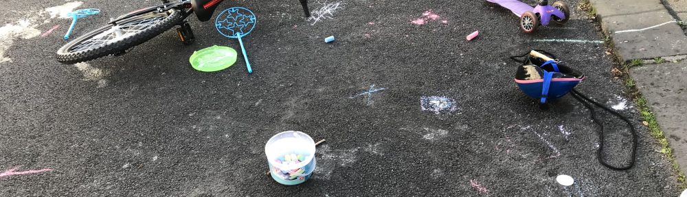
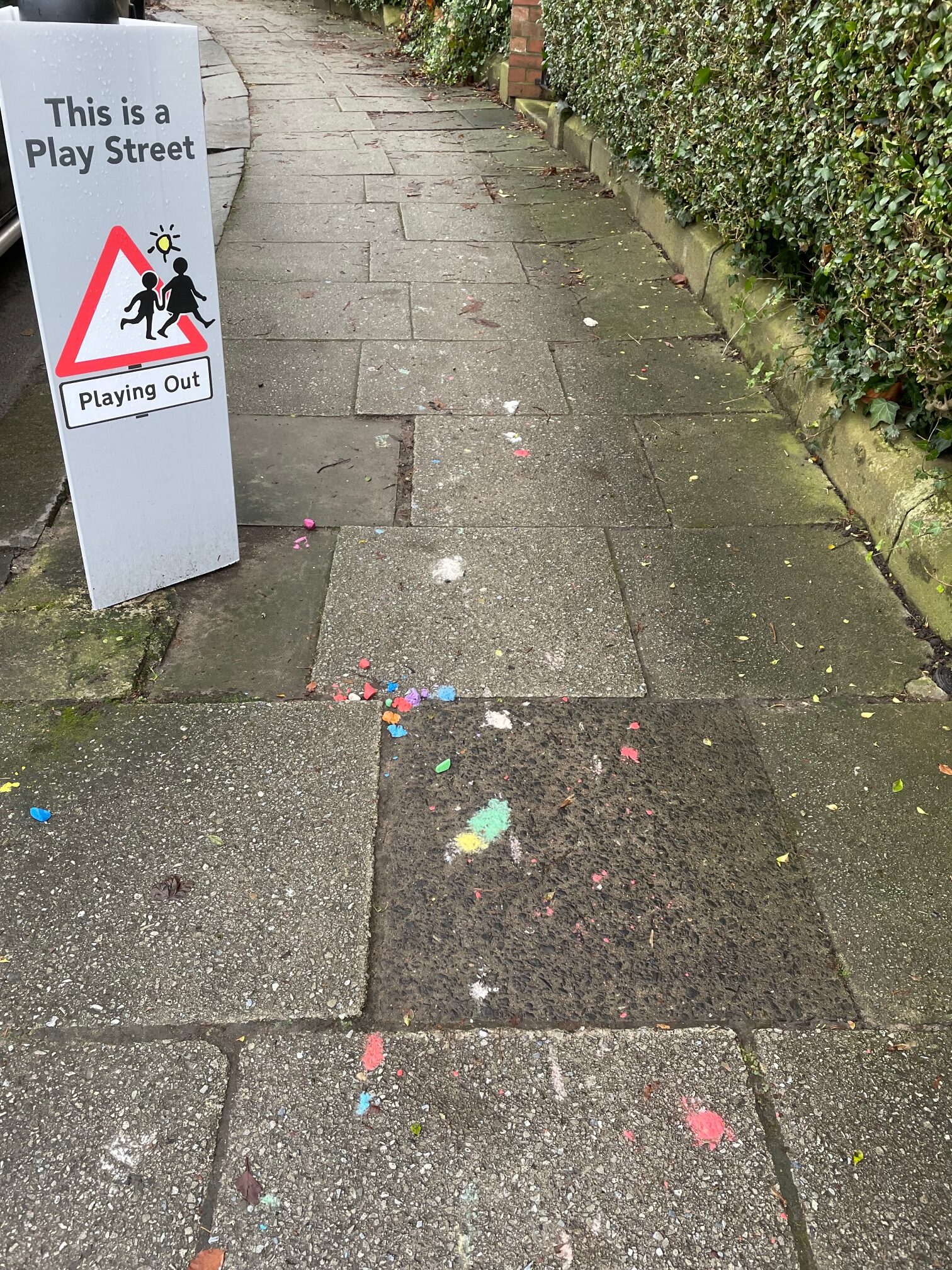
But, we didn’t stop being a play street. All the relationships we’d created – including a Facebook group – helped us weather the pandemic. Within days of the first lockdown being announced, we’d set up a network of neighbours to check in on and support the more vulnerable amongst us; we shared toys, films, jigsaws, and seeds; and lockdown clearouts led to bricks, old furniture, sandpits, timber, and much more being passed on along the street. One neighbour took doorstep photos, arranged for a puppet rainbow to visit the street, and persuaded one of their friends to deliver regular takeaways to the street. And two sets of balloons moved between half a dozen lockdown birthdays. Oh, and I started chalking regularly on the pavement and the street – hopscotches, trails, rainbows, random messages, plant names, and much more – and leaving chalk out for passers-by to play with or to take elsewhere.
Some of this might have happened anyway – surprising things happened on streets around the world during the lockdown – but I’m pretty sure lots of it happened because we were already a play street.
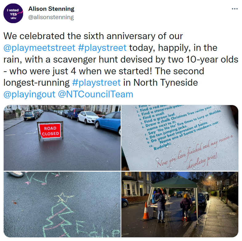
We celebrated our sixth anniversary, in the rain, with a scavenger hunt, organised by my daughter and her friend who were both just 4 when we started, and with mince pies and chocolates.
Starting to play out on my street has certainly been transformative for me – I now spend a big part of my life organising, developing, supporting play streets with PlayMeetStreet North Tyneside and researching them as a geographer at Newcastle University, as various posts in this blog explain. But it’s also transformed my relationship, and my daughter’s, with our street. We know our street – the people and the places on it – so much better. We feel at home on it.
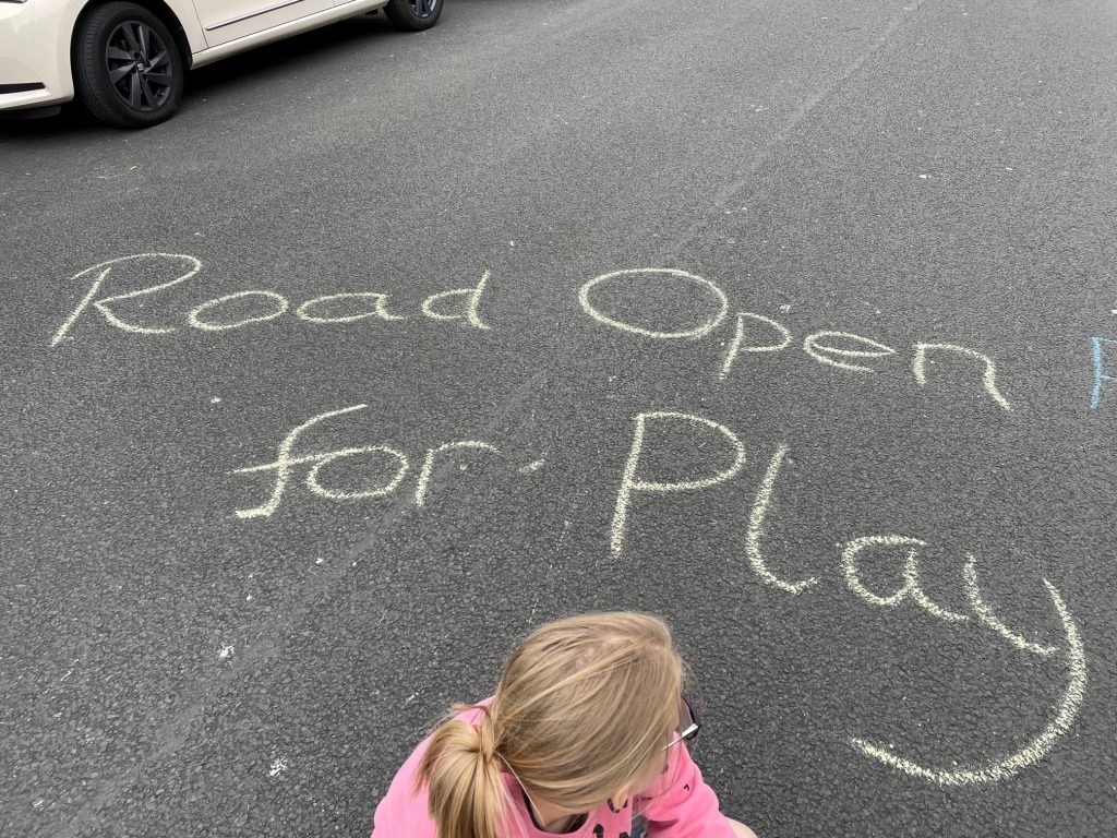
Closing a street for play seems like a simple and inoffensive act, but it also still feels quite radical. For a few hours every month or fortnight, my neighbours and I shift the focus of our street away from cars to people, of all ages, and we do frivolous things on it. It feels good, even magical (I talked about the magic of play streets in this recent podcast.)
What this will all mean in another six years’ time is an open question. What will it mean for my daughter as she grows up that she had these experiences in her formative years? When she’s 16, how will my interest in and motivation for play streets have transformed and developed?
For now, I’m chuffed we did this, that we kept going, that we gave this to our children, and to ourselves.
In the last few weeks, with my PlayMeetStreet hat on, I’ve had to deal with more than the usual number of questions, raised by residents on streets that we’re planning to set up a play street on, asking why children can’t play in adjacent parks, green spaces or beaches, or even private gardens.
This might be because we happen to be working at the moment with a number of streets near local green and blue spaces, or I might just be noticing it more. Either way it’s an interesting phenomenon to think through.
Of course, this has been a recurring concern or objection when we’ve been setting up play streets, and in our FAQs circulated as residents consult their neighbours, we clearly state this:
Why can’t children play in local parks or their gardens? Even though there are sometimes other local spaces to play, the idea of street play is for children to be able to play on their own streets, outside their homes, and to meet other local children, like many adults used to do when they were young. Street play is also about community building and neighbours getting to know each other. Children playing together on their street helps to build a sense of community and belonging, which in turn makes your street a safer and friendlier place.
The objections vary – some suggest that the desire for play streets results from parents’ laziness and their reluctance to bother taking them to the park or the beach. Others suggest, as we might imagine, that streets are for cars not for children, and that children’s place is in designated, segregated spaces, a position Tim Gill and others have critiqued. Indeed, doyen of children’s play, Colin Ward argued in his The Child in the City (1978): “One should be able to play everywhere, easily, loosely, and not forced into a ‘playground’ or ‘park’.”
What has been particularly interesting for me in these questions, however, has been the sense from those writing that they see themselves as champions of children’s play and sincerely believe that their suggestion is better for children, particularly the children on their street.
Play on streets is seen very much as a sub-optimal choice.
There are two parts to this.
The first is the idea that parks and beaches are the spaces where children would choose to play, that our abundant local natural spaces, green and blue, offer children a richer environment for play. These natural spaces are contrasted with the apparently hostile landscapes of roads and pavements and the presence of cars. Streets are described as dirty, hard, and risky. Whilst there is no doubt that play in natural spaces can be rich and rewarding, offering opportunities that indeed don’t exist on residential streets, the idea that these are better places to play is much more contested.
The second is that play streets are OK, but not for these pleasant, green neighbourhoods where the children and their families are ‘lucky’ to have access to private gardens and well-tended and attractive public open spaces. Play streets are fine for more urban neighbourhoods, where flats or homes without gardens dominate, and where playable, outdoor space is limited, but not for those ‘lucky’ neighbourhoods. There are clearly class inferences in all of this.
This is an interesting provocation. In one sense, play streets are especially valuable in those places that have limited access to safe, communal spaces for play. The birth of play streets in early twentieth century New York and in mid-twentieth century Britain was very much driven by the idea that poorer children in more disadvantaged neighbourhoods needed space to play, in the absence of private gardens, public parks, or playgrounds.
All of this underlines however the idea that play streets are only for those children who have no other options. Even for the apparently progressive proponents of play streets during the twentieth century, play on streets was very much seen as a poor substitute for “gardens and open spaces”.
From this perspective – echoed in the messages we received – play on streets is fine as a last resort for poor children, but streets are not where children should be playing, unless there is no alternative, and they are not where children would choose to play.
By contrast, decades of play research and playwork – and hundreds of years of experience – suggest that the street is in fact often children’s chosen space for play. As Mike Barclay and Ben Tawil note “the places children value most outside of the home are not formally recognised as spaces for play, but instead are the streets where they live”.
For children, the streets where they live offer other playmates, kerbs, walls, patches of green space, smooth or bumpy pavements to play on, proximity to home, the easy possibility of adult-free play, and much more. Indeed, streets have been the primary space for play for generations, not least for those generations who tend to be the primary complainants.
Of course, other research underlines some of the other particular benefits of play on streets. Children’s streets are at the heart of their explorations of and relationships with the world and the ability to play in them is critical to their sense of belonging to and learning within them. Stuart Lester and Wendy Russell state clearly that “play is the principal way in which children participate within their own communities” and Tim Gill, in a quote cited regularly in support of street play, insists that “the street is the starting point for all journeys.”
Making these arguments to those who complain seems to have little impact. They often just reiterate that other places to play are more pleasant.
All of this leads me to think that what we are confronting here is a longstanding view, one which is undoubtedly overlaid with inferences of class as I have suggested, that children only belong in certain, designated spaces, that, for my correspondents, children simply don’t belong in the public spaces on their streets, and certainly not in nice neighbourhoods. This is still more interesting because play streets, in their current incarnation, are sometimes seen as very middle class interventions, in places where residents have enough social and cultural capital to navigate the necessary bureaucracy and make a claim to their street as a space for play.
All this resonates for me as I’m increasingly drawn to centring class in my ongoing research and practice around play streets, something that I hope to be able to think and write about more.
It is, of course, worth recognising that these objections are still rare – in the vast majority of resident consultations on new play streets, no objections are raised. Many people, in North Tyneside and beyond, do recognise the value of play on streets and of play streets. But it is nevertheless interesting to dwell for a moment on these particular imaginations of places for play and places for children.
As a researcher and activist with an interest in play streets, and in the midst of a pandemic that prevented planned fieldwork, I have spent some time in recent months piecing together some of the histories of play streets in North Tyneside, with a view to developing some academic and activist work around this theme.
As a starting point, this blog post sets out some of the developments, in time and space, of this history, from 1938 to more or less the present day. It’s very much a factual account, rather than an academic analysis, or even really an attempt to make any kind of argument.
There are lots of gaps and questions: if you have any answers, from your own experiences and memories, please do let me know in the comments below.
In 1938, parliament passed the Street Playgrounds Act, responding to concerns that many children, in poorer neighbourhoods in large urban areas in particular, were at risk playing on the streets, in the absence of any other safe and accessible spaces to play. The Hansard record of the House of Lords debate noted that “In the ten years from 1924 to 1933 inclusive, over 12,000 boys and girls under fifteen years of age were killed in the streets in England and Wales alone, and over 300,000 mutilated or injured.” In addition, this period also saw more than 2000 children prosecuted for playing on the street. In short, children’s lives were at risk as they played and they were also deemed to be ‘out of place’ whilst they played.
The 1938 act built on the experience of New York, where the Police Commissioner introduced street closures for play in 1914, and pilots in two London boroughs and in Salford and Manchester, where local schemes were introduced before the national legislation. In Salford, the local experiment reduced child road deaths to almost zero.
Local authorities around the country responded with varying enthusiasm to the new act, though by 1963, there were146 play street orders designating 750 play streets nationally.
Locally, in January 1939, Tynemouth Borough Council swiftly made their refusal to engage in this new movement clear: “No action is to be taken to close any streets to enable them to be used as playgrounds for children” whilst noting that “The council has power to do this under the Street Playgrounds Act 1938” (Evening News, 23.1.39, p.7).
When the matter was discussed at a council meeting on 25th January 1939, a Councillor Hails, referring to this recommendation, “said he was not happy about the arrangements in the borough on this question”. He argued that, in the face of the council’s refusal to designate play streets, “in certain areas of the town the school playgrounds be opened”. The mayor (Mr Harry Gee) retorted “We have nothing to do with that.” (Evening News, 25.1.39, p.1).
The first organisation in the north east to positively engage with the idea of play streets was the North East Women’s Parliament which, in February 1944, “urg[ed] upon all local authorities in the region the necessity of establishing play streets for children” (Evening News, 21.1.44, p.5), in the context of their wider work to secure space for play for children.
When this call was under review by Tynemouth Borough’s Parks and Sands Committee, the leader writer of the Evening News, “Collingwood”, expressed considerable disdain: “Surely it is not now seriously proposed that certain streets in a town should be marked off as ‘play streets’?”, he wrote, “Residents of any street specially marked off for such a purpose would, I fancy, have something to say about it.” (1.3.44, p.2). And Tynemouth Borough Council seemed to be of a similar view, stating, in April 1944, that “no action is be taken with regard to a resolution of the North East Women’s Parliament that consideration should be given to the necessity of establishing play streets for children” (Evening News, 24.4.44, p.3).
Yet, by October 1946, the Tynemouth Road Safety Committee was recommending the creation of play streets on 16 of the borough’s streets, fifteen in North Shields and one in Cullercoats (Evening News, 15.10.46, p.8):
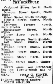
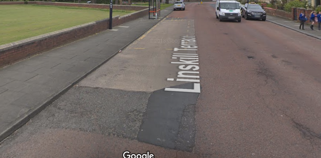
Owing to the lack of playing fields, it is proposed that the following streets be closed to vehicular traffic until such time as proper playing facilities are available for children in the near vicinity: Wilson Street, Shakespeare Street and Yeoman Street, and part of Cardonnel Street, Seymour Street, Victoria Street, Tennyson Terrace, Trinity Street, Laet Street, Thrift Street, Penman Street, Gardner Street, Coburg Street, North King Street, Linskill Street and Eleanor Street.
For reasons that were not reported, the road safety committee removed Coburg Street and North King Street from their list at their meeting on 16th October 1946. Although creating play streets on the remaining 14 streets was apparently approved, nothing seemed to happen in any hurry, prompting a concerned resident to write to the local paper asking what had happened to this “sensible proposal” (Evening News, 19.9.47, p.2). The first Tynemouth (Street Playground) Order was finally published on 29th May 1948, designating 13 streets as play streets. At some point, Gardner Street and Linskill Street were removed from this final list and never actually became play streets; this may have been because bomb damage in their immediate vicinities had radically changed the prospects for these streets. In any case, 11 streets were finally designated by this first order, 10 in North Shields and one in Cullercoats.
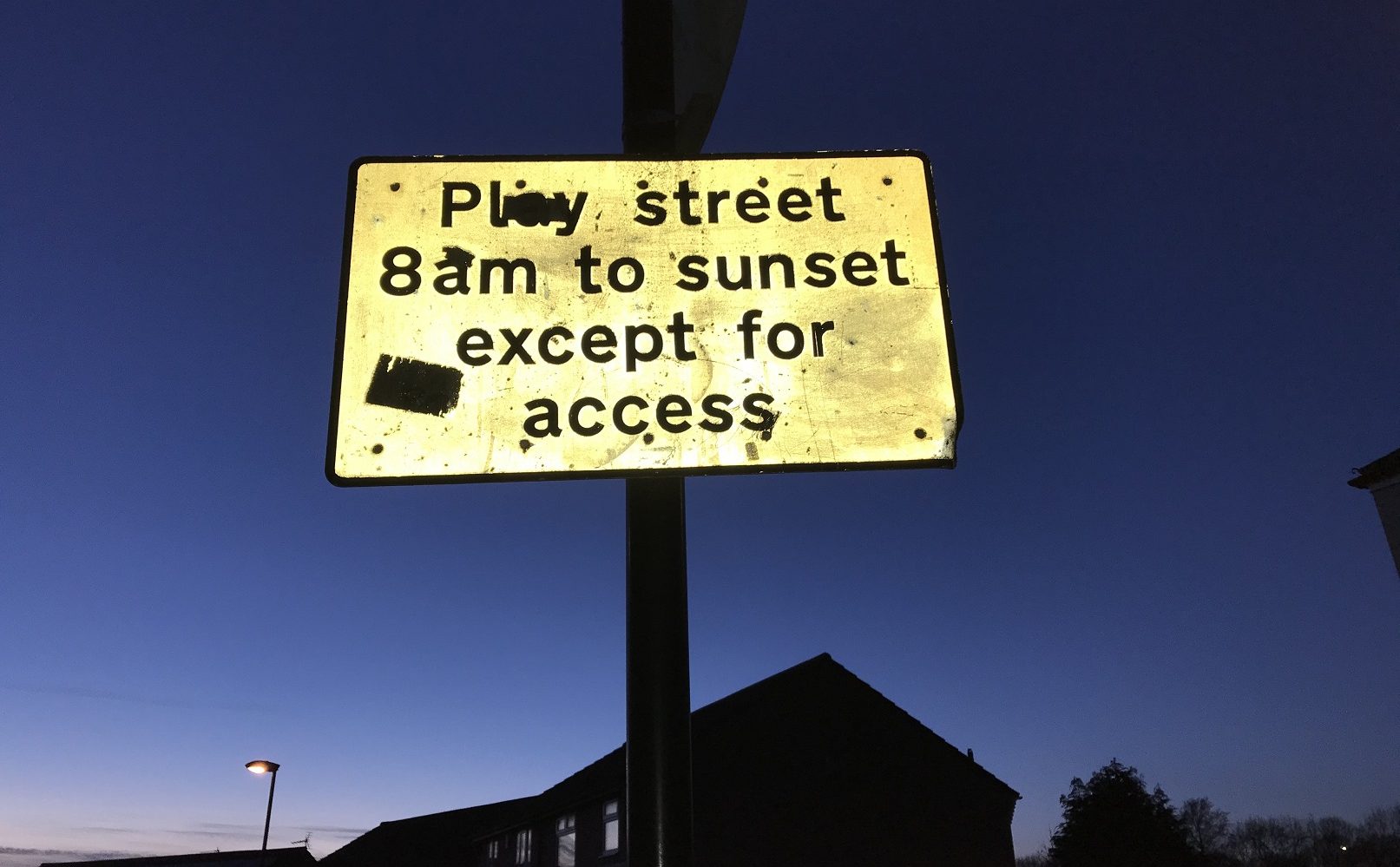
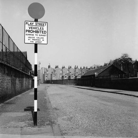
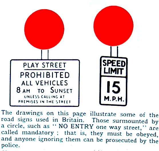
This first order was very specific about the days and times that the streets were to function as play streets – Mondays to Fridays from 5pm to 9pm, Saturdays from 1pm to 9pm, and Sundays all day, from 9am to 9pm. This is quite different to the orders seen on later play street signs (see below) – at some point these times were clearly revised. And it is also interesting to note that on school days, children would not have been able to safely play out immediately after school, nor in daylight in the winter months.
Exceptions included the “conveyancing of persons, goods and merchandise”, road maintenance, and military training. The first exception in particular was significant since, in the 1950s, many of the vehicles on urban roads, especially in poorer neighbourhoods, would have been goods vehicles (milk vans, coal lorries, post vans etc.) and, as we will see, this became an issue on the designated streets. This may also explain why the streets didn’t function as play streets until after business hours on weekdays and after the likely busy period for deliveries on Saturday mornings. Even with this significant move to create safe space for children on their streets, we can still see motor vehicles and deliveries taking precedence over children, in an echo of what was to return some 60 or 70 years later when online deliveries are seen in part to account for an increasing proportion of traffic on residential streets.
Without access (in the context of the pandemic) to the borough development plan, the minutes of the Tynemouth Watch Committee, and other documents explaining the decision-making process, we can’t know for sure why these streets were chosen, but the primary aim of the 1938 Street Playgrounds Act was to create space for children to play on streets where there were high numbers of resident children and few other very local spaces for play, such that creating safer streets for play was seen as a way of bringing “relief to many mothers whose youngsters have no playground” (Evening News, 5.6.50, p.2). This seems to explain the designation of the 10 streets in North Shields, all of which were located in one of four neighbourhoods in the west of the town. The Town Clerk, Fred Egner, explained some of the rationale for the creation of play streets: “You have children playing in the streets in cases where there were no accessible playgrounds. It is the policy these days to have one or two streets where traffic is restricted, so that children can play in safety” (Evening News, 2.6.50, p.5). In this explanation, two things seem worth highlighting: the plan was indeed to have clusters of streets to create safe space in neighbourhoods, and “street playgrounds” were very much seen as a poorer alternative to playgrounds. In a theme which recurs today in debates around children’s play, it seemed the preference was that children should play in dedicated and separate spaces, rather than in the places they choose on their doorsteps. This echoes the position in Salford, where play streets had been trialled but seen as a poor substitute for “gardens and open spaces” (Manchester Evening News, 7.10.2017).
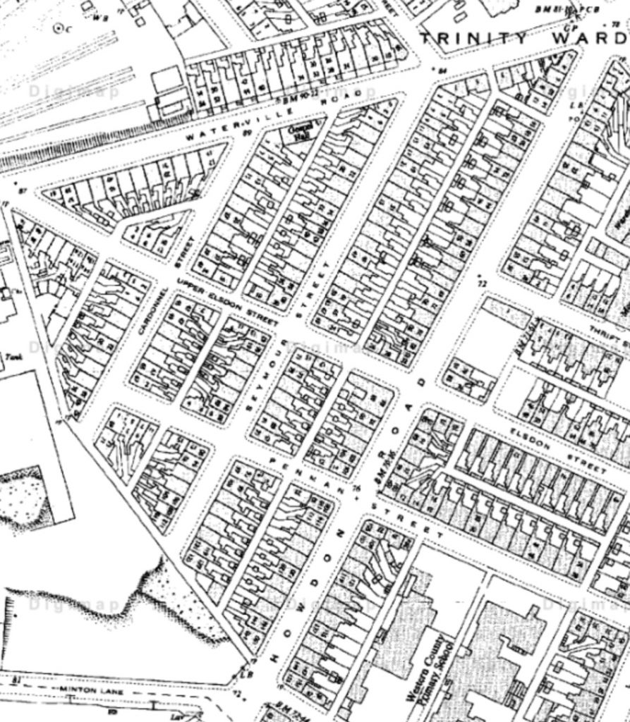
The Triangle
Cardonnel Street, Seymour Street, Upper Penman Street; Upper Elsdon Street was also designated at a later date
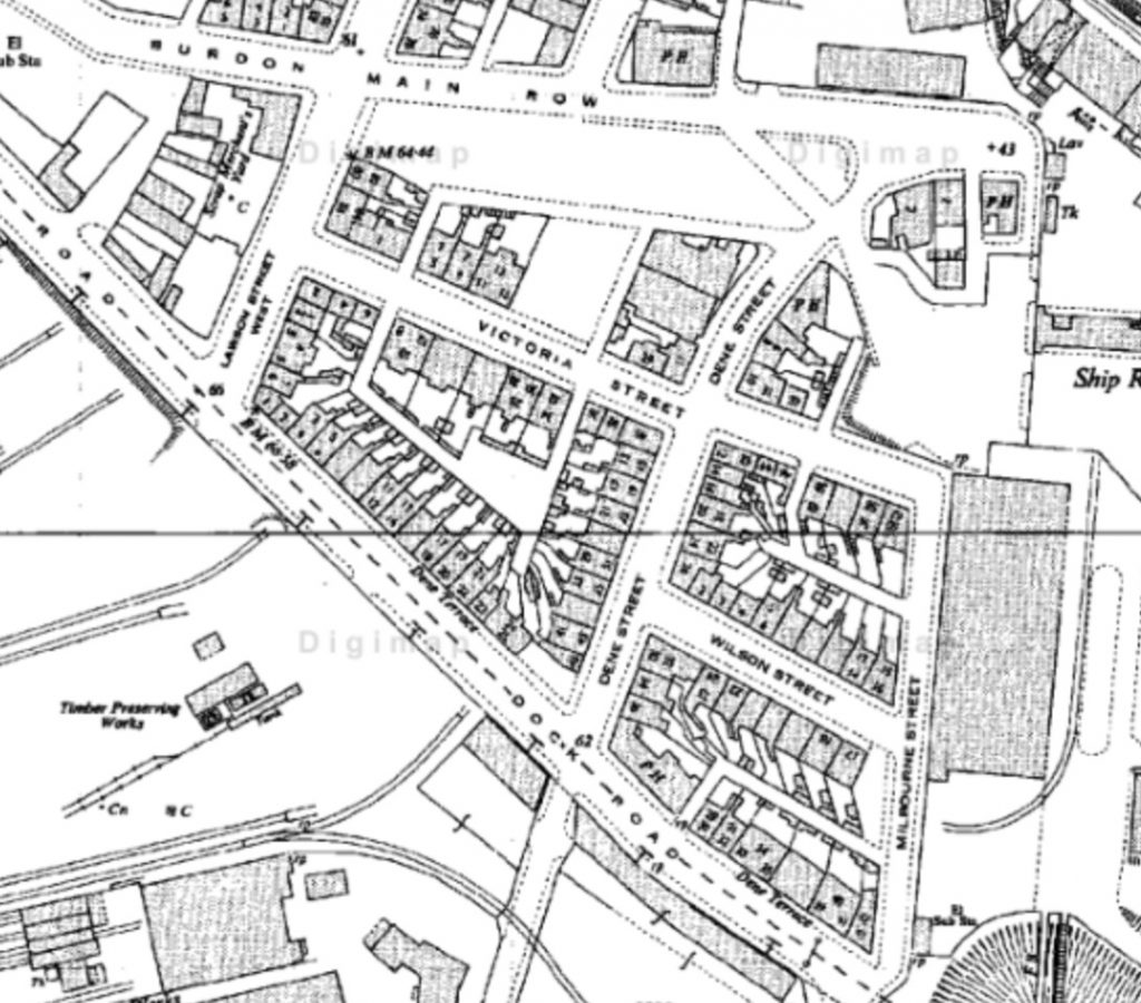
Milbourne Place
Victoria Street and Wilson Street
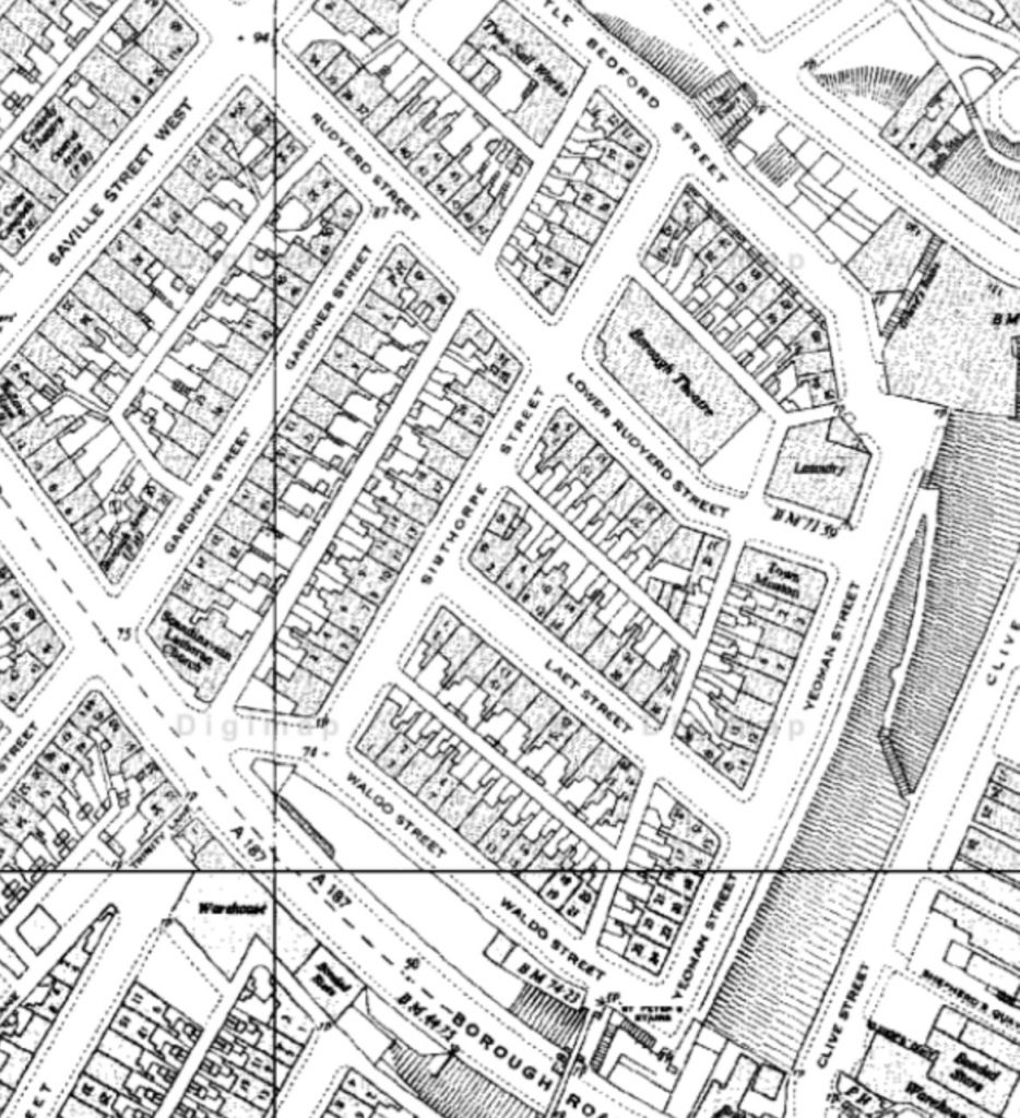
West Ropery Banks
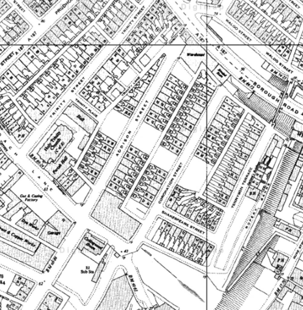
Shakespeare Street, Tennyson Terrace, and initially Trinity Street, swiftly replaced by Addison Street
East Ropery Banks
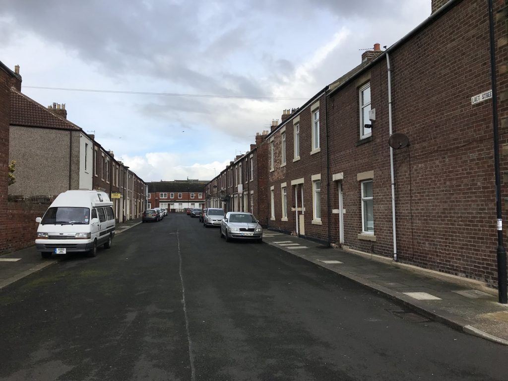
Laet Street and Yeoman Street
The Triangle
Milbourne Place
East Ropery Banks
West Ropery Banks
North Shields’ play street neighbourhoods
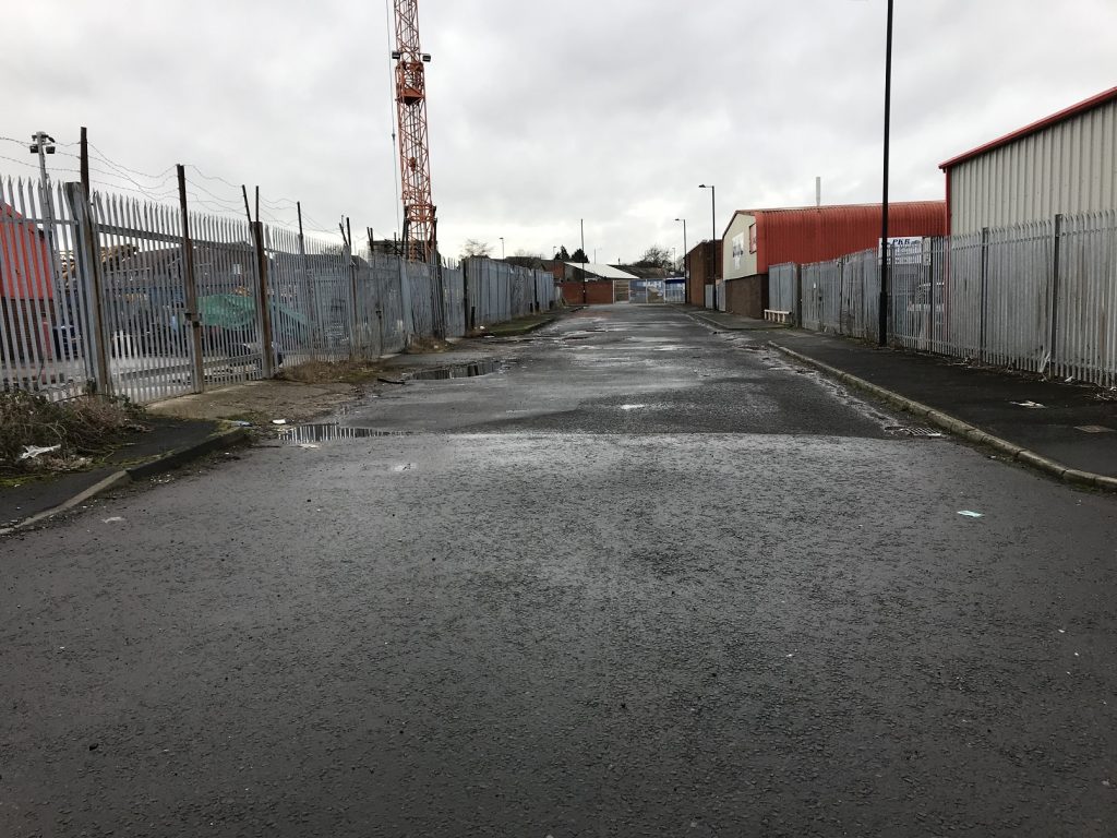
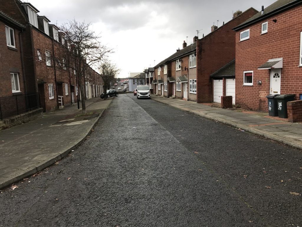
These sets of streets were all terraces of early twentieth century housing, with many Tyneside flats, doors opening directly on to the streets. In the Triangle and East Ropery Banks, these streets remain today much as they were when they were built and in the early 1950s when they were designated as play streets. In Milbourne Place, all the homes have been demolished and whilst Victoria Street still exists, there is no trace of Wilson Street; it is visible only on historic maps. In West Ropery Banks, all but a few houses have been demolished and rebuilt, and the layout of the roads changed, though all are still traceable.
Victoria Street today; Wilson Street ran parallel, to the left (west) of this photo
There had been considerable bomb damage in these neighbourhoods during the Second World War, with exploded bombs recorded on Addison Street and Victoria Street, and on many other adjacent streets. It’s likely that this will have been as a result of their proximity to the docks on the banks of the River Tyne and the coal mines and other industrial works to the south and west of North Shields. This would have left bombsites and vacant lots around these neighbourhoods, and it is likely, as happened elsewhere, that these sites became playgrounds for local children.
Addison Street today; a bomb fell on this street on 30th September 1941
Indeed “Collingwood” in the Evening News, who had earlier been so disdainful of play streets, suggested that, in these very neighbourhoods (Evening News, 5.6.50, p.2):
some of the open spaces created by bomb and slum clearance might also be turned into miniature playgrounds for toddlers. A little fence, sandpit and a little imagination – and Tynemouth Council could, at very little expense, convert eyesores into havens of happiness for youngsters.
The demolitions and redevelopments that took place through the 1960s and 70s signal that these were all areas of significant disadvantage. This is supported by the inclusion of all these areas in the North Tyneside Community Development Project (CDP) established by the government in 1972 (till 1977) to work with local communities to organise for change in labour and housing markets, and alleviate poverty. Uniquely within the 12 CDPs across the country, play was an important part of the work in North Shields, with action groups in all these neighbourhoods identifying safe space for children to play as a key aim of their collective work, though there is no specific mention of what was happening on the designated play streets in the reports of the CDP.
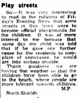
The designation of play streets in North Tyneside also seemed to respond to concerns that children should not be playing out, whether it was safe or not. In June 1950, “MP” of North Shields wrote to The Evening News (7.6.50, p.2), as follows:
The first play street order was the most significant. The Evening News reported (15.10.46, p.8) that “If the closing of the streets proves successful, the provision of further play streets will be considered”. In the following years, we see both new streets designated and calls from residents, usually mothers, on other streets for play streets to be established. It seems that the designation of some play streets in the borough allowed residents elsewhere to imagine the possibility that they too might have safe streets for their children.
In almost all instances, these calls appeared in the context of deaths and serious injuries of children playing out, or of a more general concern that there was nowhere safe for children to play, and that deaths or accidents would occur if nothing was done. In some instances, these calls fell on deaf ears and highlighted the continuing battle to prioritise children’s play – and their lives – over the needs of drivers.
in 1958, the death of a six year old killed on Waterville Road on The Ridges, just around the corner from Briarwood Avenue (see below), led residents to request a zebra crossing or a play street on adjoining Rowan Avenue (Evening News, 3.10.58, p.4); mothers testifed to their fears for their children:
Every time there is a screech of brakes you are frightened to look out of the window.
It is a terrible road. Every time my children go out into the garden I am terrified in case they get on to the road.
Yet, no play street was created here.
At a similar time, on Nater Street in Whitley Bay, a local mother “pointed out there were no playing fields in the vicinity and only older children were allowed on the beach by their parents”. This would have been Whitley Bay’s first play street, but this request was eventually rejected (Evening News, 4.11.58, p.8). Similarly, a few years later, an anonymous letter from a “young mother” from Woodbine Avenue, Wallsend begged Wallsend Accident Prevention Committee to create play street, as an oasis in a neighbourhood surrounded by streets with heavy traffic. The request was passed to the appropriate council department but no play street order was ever approved (The Journal, 8.4.64, p.7). In 1979, a petition from Waterloo Place, North Shields, was rejected, after an earlier claim in 1977, on the grounds that “a Government circular suggests that play streets should not be created where the streets adjoin a busy road” (Evening Chronicle, 3.7.79, p.9).
On Lilburn Street, North Shields, in March 1968, the council’s decision not to create play street “resulted in a protest by parents” (The Journal, 29.3.68, p.9). The parents argued that:
The street is an island surrounded by main roads, and there is nowhere for our children to play unless they cross a main road. The council will probably wait until there is an accident before they do anything.
Another resident, however, objected to the proposal on the grounds that “It would reduce the value of the property with kids playing around.” This echoes concerns raised in Newcastle, in Jesmond in particular. The opposition was upheld by Alderman Thomas Crawshaw:
This is a nice wide street, and there are a lot of cars in the street which would not be able to park. We don’t think there is any need to make it into a play street.
This prioritisation of parking reveals both a concerning set of values, but also a misconception – nothing in a street playground order prevented residents from parking on their streets.
Other objections on existing play streets echoed this Lilburn Street resident’s concerns about the nuisance of children playing out. A report from Charlotte Street, Wallsend in the the Evening Chronicle (24.1.64, p.5) expressed concerns that the “big boys” from neighbouring streets had taken over the play street, marking football goals on the street, breaking windows and climbing on drainpipes to retrieve balls. At the same time, residents noted that “drivers take no notice of the warning signs and even use their horns to clear the street when they drive through it.”
Despite these concerns, objections, rejections and misconceptions, there is some evidence that the creation of play streets in the borough was shifting the prevailing view on children’s right to play on their streets. Not only were residents emboldened to demand safe space for their own children, but local organisations, such as the Tynemouth Watch Commitee, were also making more general calls for more careful driving on ‘quiet streets’. Indeed, in a remarkable shift from his position in 1944, the Evening News’ leader writer “Collingwood” was making a bold argument in support of children’s safety on their streets by 1957 (Evening News, 24.7.57, p.2).
People may argue that children should not play on streets. But they are the sort of people who have never had children of their own – who don’t realise that it is nigh on impossible to keep children safely tucked away behind a garden gate. While children may stray to danger there is no need for motorists to add to that danger. Main roads are meant to carry the traffic – not the quiet streets leading from them. Leave the quiet streets to the butcher and the baker and their vans, calling on residents. It will lead to greater safety.
It’s important to note that “Collingwood” is only asking here for a recognition that children may “stray to danger” but he was, by doing so, recognising the real danger that the growing number of motor vehicles on ‘quiet streets’ posed.
This was not the only view, however. In 1954, a “warning to parents to keep their children from playing on roads on summer nights was issued by Wallsend Accident Prevention Committee”, apparently inspired by an electricity board maintenance engineer who complained that “it was a nightmare” driving his van “because of children on the road”. The committee acknowledged the shortage of local playing fields but also noted that children were not using the local play spaces provided, and seemed reluctant to blame a spate of recent child injuries on drivers (Evening News, 8.5.54, p.4). This perspective, prioritising drivers, relieving them of any responsibility for collisions, and recommending that children play elsewhere, is echoed in a letter to the Evening News from a North Shields resident who raised concerns for those with “business clientele” in and around the play streets (specifically, Redburn View on The Ridges) arguing that the necessary diversion increased inconvenience and running costs “when the children of that area have access to a splendid play field nearby” (Evening News, 30.6.54, p.2).
Redburn View was designated a play street in December 1953 (Evening News, 24.12.53, p.10), on account, according to the Tynemouth Watch Committee, of its narrowness (Evening News, 28.10.53, p.11). Redburn View was a long street which skirted the western edge of The Ridges, passing underneath the Newcastle-Tynemouth railway line (now the metro line) and offering one of only a few crossing points on the estate. As the letter quoted above suggested, some saw it as an essential route – and this seemed to be reflected in the fact that a number of drivers were prosecuted for driving down this street (see below).
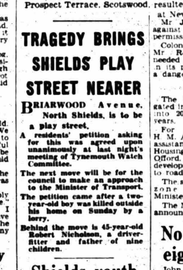
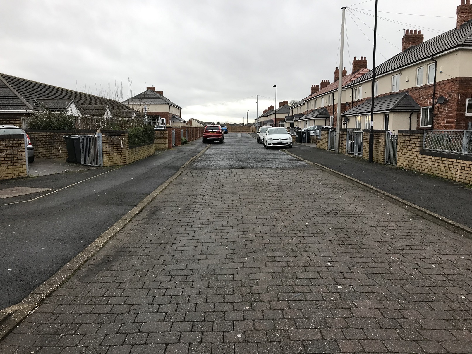
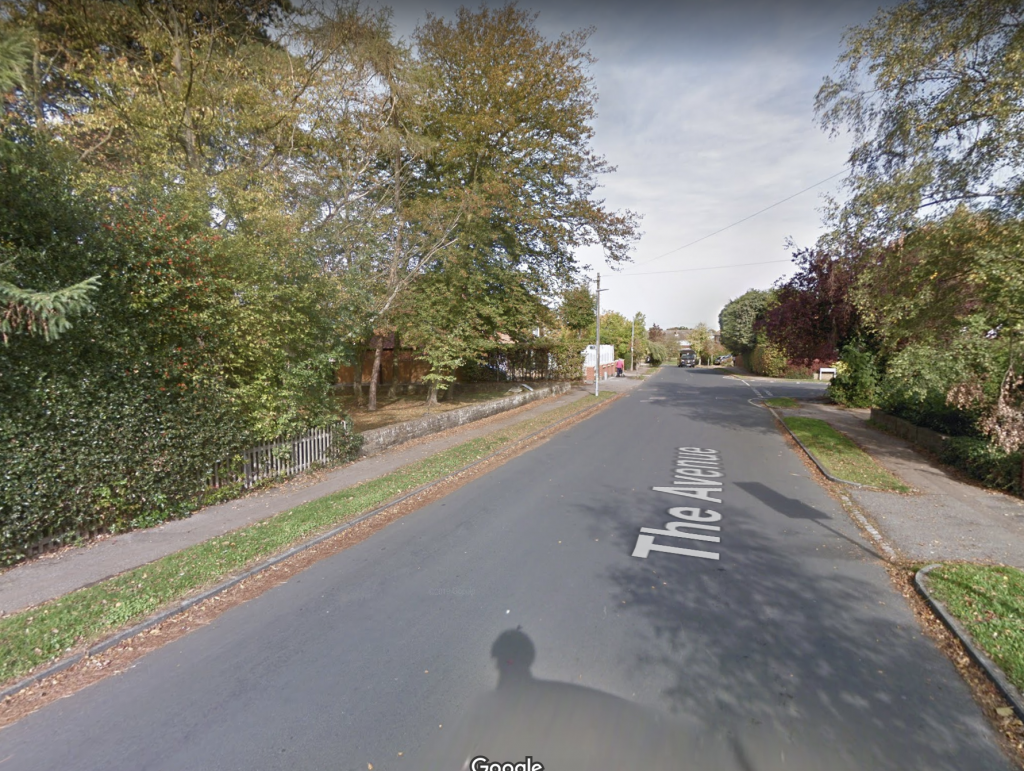
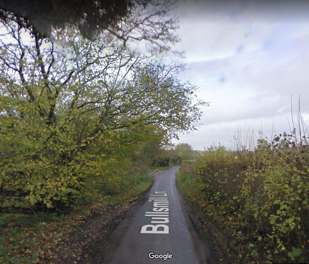
As far as I can tell, the only successful resident petition for a play street designation came from an actual, rather than feared, incident. On Briarwood Avenue on The Ridges, the death of a two year old boy, killed by a lorry driver outside his home, led to a unanimous residents’ petition, led by a father of nine, to Tynemouth Watch Committee (The Journal, 5.10.60, p.3). Briarwood Avenue was designated a play street around late 1960.
Briarwood Avenue today (now Kingsbridge Close and Amble Close)
In 1959, a successful request came not from residents but from an organisation, the Poor Children’s Home Association, a forerunner of Children North East. The PCHA opened a children’s home, Eustace Percy House, at 36 Beverley Terrace, Cullercoats, and campaigned for a zebra crossing from the moment they opened, so that their resident children might safely access the beach across the road for play. The request for a zebra crossing was rejected and “the children [were] told to use the back lane” for play (The Evening News, 7.1.59, p.6). In February 1959, a play street order was approved for Back Beverley Terrace, from sunrise to sunset.
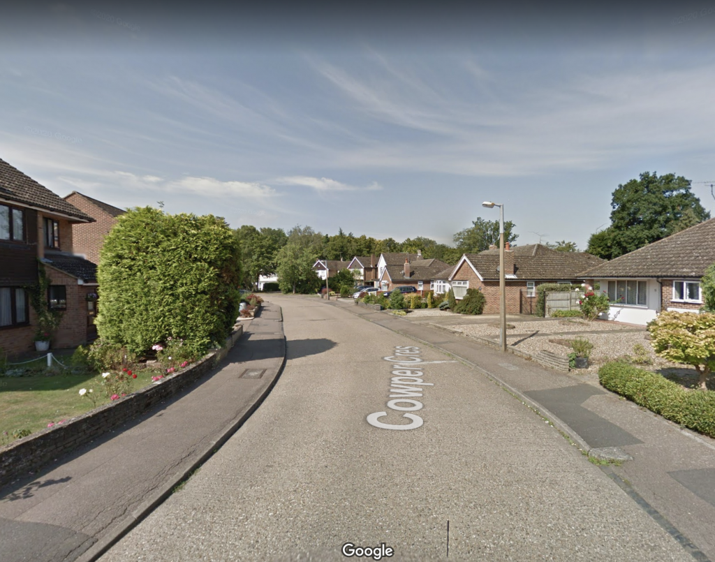
The only other clearly documented designations came in May 1963, from Wallsend Council. At the time, the town council seemed to be investing in new play spaces, creating both new playgrounds and new playing fields, often around new housing developments. In this context, residents of Myrtle Grove, Wallsend – a street of early twentieth century terraces and Tyneside flats – requested a play street. The response was surprising: “the council is going one better. It is to seek approval to make not only Myrtle Grove, but its neighbours Ash Grove and Willow Grove, into play streets.” (Evening Chronicle, 9.5.63, p.13). This was the only other occasion when a set of neighbouring streets was designated, as they had been in the first order in North Shields.
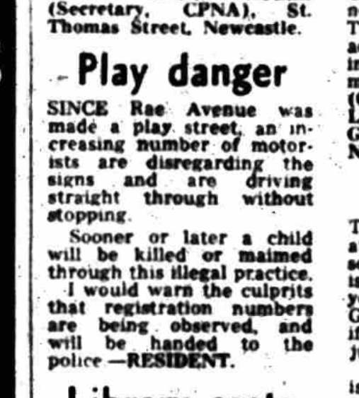
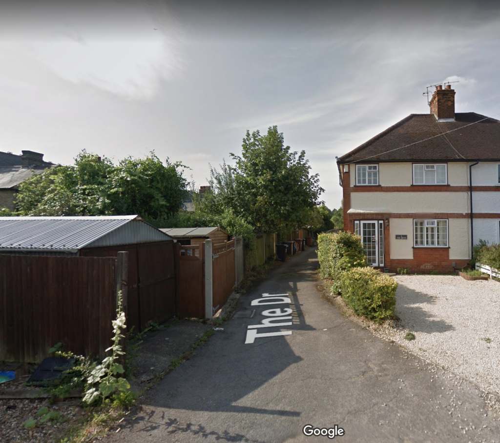
The southern half of Collingwood View, North Shields, was designated in early 1960 at the request of the Tynemouth Watch Committee, reported in an article entitled “This street is for children” (Evening Chronicle, 4.2.60, p.18). Charlotte Street was designated in October 1962. Others streets designated included Rae Avenue, Douglas Street in Wallsend and The Nook in North Shields. I don’t yet know much about these streets’ designation – any information would be most welcome.
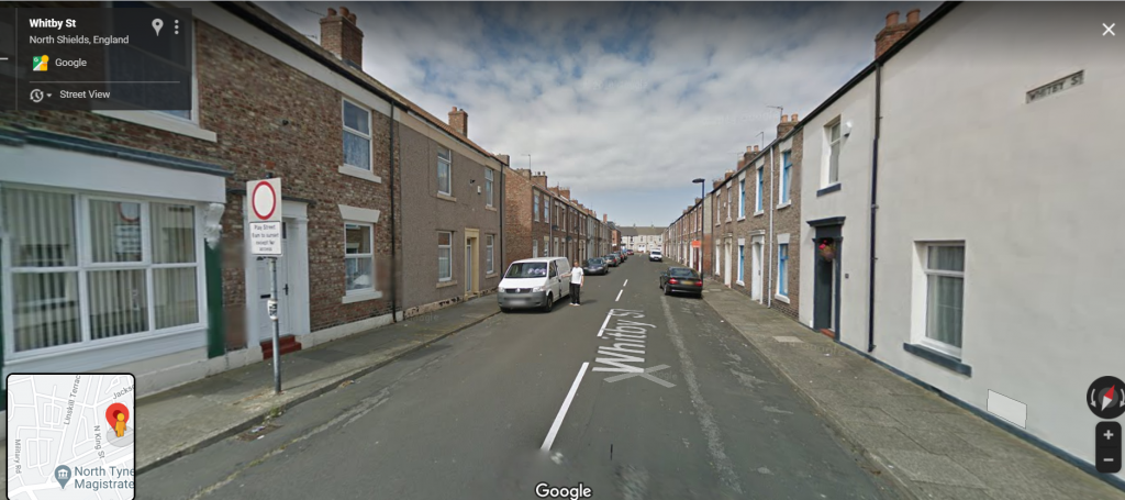
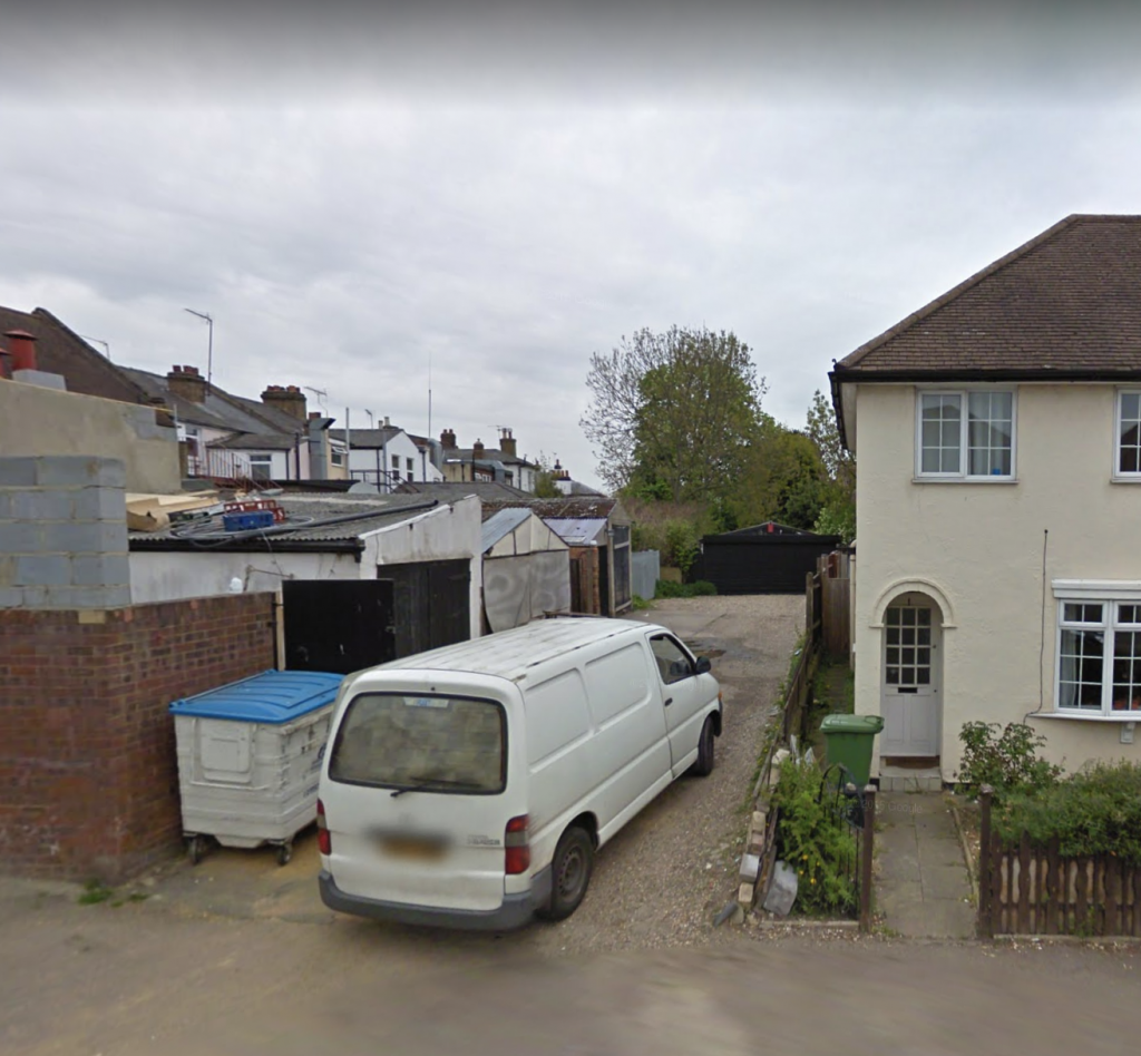
It seems Whitby Street in North Shields was also at some point designated as a play street. Its neighbouring streets, Coburg Street and North King Street, were both listed in the first set of streets identified by Tynemouth council, but not in fact designated. I can find no trace of Whitby Street becoming a play street and it is not currently covered by a play street order, as far as I can tell, yet past residents recall it being a play street, and indeed in 2014 (and earlier) the sign is clearly visible on Google Street View. There is, however, no sign today.
Some of the confusion around the timing and purpose of designation comes from the restructuring of the local authorities in the area in the 1970s. North Tyneside Council was formed in 1974, out of an amalgamation of Tynemouth Borough Council and Wallsend Council, together with parts of Whitley Bay, Longbenton and Seaton Valley, all previously in Northumberland. While some play street orders were formally published on the pages on the Shields Evening News, others were reported Newcastle’s Journal or Evening Chronicle.
As far as I can tell from reports in local papers, the reception of all these play streets was mixed. In September 1951, just a few months after the first order, “Collingwood”, now a vocal supporter of play streets, raised concerns about motorists ignoring the signs, such that some of these streets were “carrying as much traffic as ever” (Evening News, 28.9.51, p.2). “Collingwood” quoted a driver saying “it was about time some of them showed a bit more responsibility and recognised the children’s right to play in the streets”.
Some motorists’ reluctance to abide by the new orders resulted in prosecutions, documented in the pages of the Evening News. In July 1955, George Wells of Newcastle was fined £2 for driving down Redburn View (Evening News, 27.7.55, p.2). In June 1956, Stanley Rees Evans of Monkseaton was fined 10 shillings for driving down Addison Street “without stopping” which he described as “a genuine mistake on his part” (Evening News, 11.6.56, page unclear). In April 1958, Elsie Rollo was fined £1 for “driving in a street playground” [Penman Street], while on business for her employer; her defence was that “I did not notice the sign as that district was new to me” (Evening News, 16.4.58, p.5). In September 1958, a driver, Raymond Oliver, from one play street (Eleanor Street) was fined £1 for driving his van down another, Redburn View (Evening News, 15.9.58, p.7) and another driver, Robert Clark, was fined £2 for driving down the same street. For an offence in the same month and on the same street, a 16 year old was also prosecuted and fined 2 shillings for riding a motorcycle (Evening News, 18.9.58, p.8).
Cyclists too, perhaps surprisingly, were also prosecuted for contravening the play streets orders. In June 1953, four men and two juveniles (both boys aged 16) were discharged by Tynemouth Magistrates’ Court, with costs of 4 shillings each for riding bicycles down Addison Street on May 27th of that year. It seems the Chief Constable wanted to make an example of these cyclists as it was reported that “the prosecutions had been brought to publicise the fact that no vehicular traffic is allowed to pass through a play street during the day” (Evening News, 18.6.53, p.7; see also Evening News, 17.6.53, p.6; Evening News, 19.6.53, p.2).
There are certainly questions to be asked here about why it was cyclists, two of them aged just 16, who were held up as an example to drivers, but this seems to reflect real issues with motor vehicles continuing to use Addison Street regardless of the play street order. In March 1953, there were regular reports of heavy lorries cutting through Addison Street from the docks to the town centre – precisely the kind of traffic the play street orders were intended to prevent – and this left mothers fearful for their children, who often played on and around the street’s bombsite (Evening Chronicle, 13.3.53, p.22).
Many of these reports also seem to suggest that the times of the orders had been revised by this point, to reflect something like the current orders which are generally 8am, or sunrise, to sunset.
These contraventions – by drivers, perhaps, rather than cyclists – resulted not surprisingly in injuries and deaths on the designated play streets. It is clear that a play street order did not guarantee the safety of the children at play.
In September 1953, a 20-month old boy, David Marsh, who lived on Wilson Street, was found by a 6 year old neighbour with a crushed shoe and a broken leg: “it was thought that a heavy vehicle might have passed without the driver’s knowledge” (Evening News, 4.9.53, p.8).
Even after the earlier recorded child death led to the creation of a play street on Briarwood Avenue, three year old Ellen Teague was knocked down by the driver of a coal lorry in November 1961, less than a year later (The Journal, 3.11.61, 3).
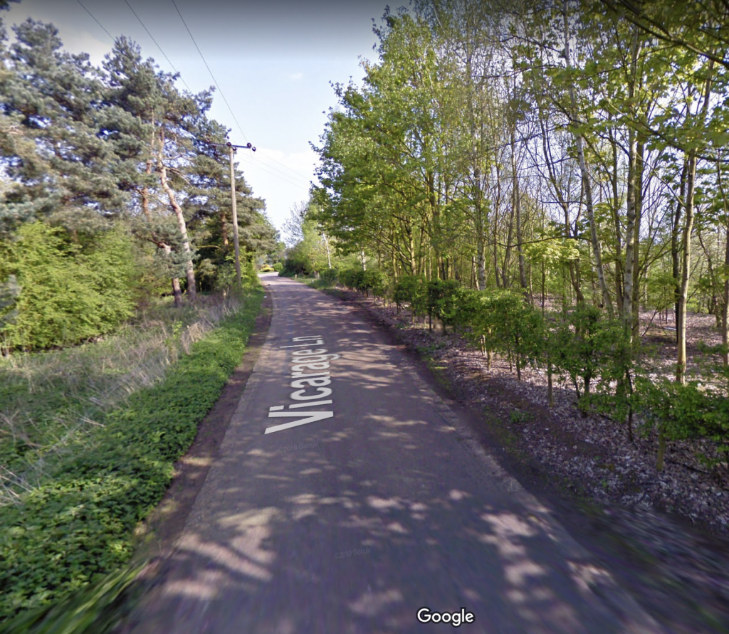
Real concerns were raised on Rae Avenue in Wallsend, as this letter published in May 1970 (6.5.70) shows:
Rae Avenue today
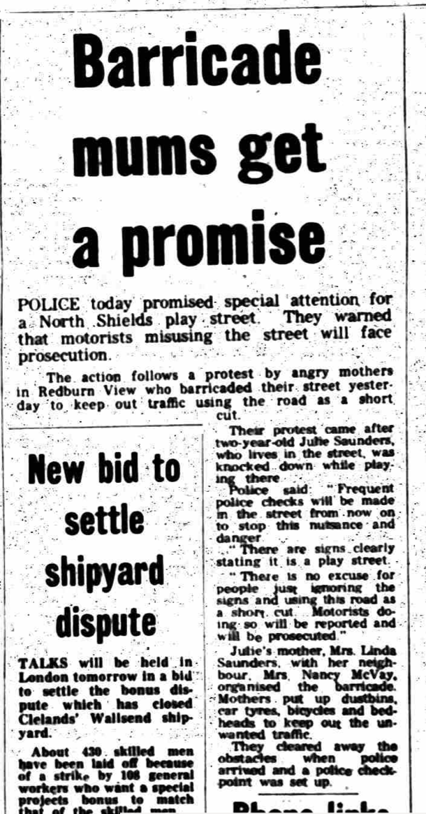
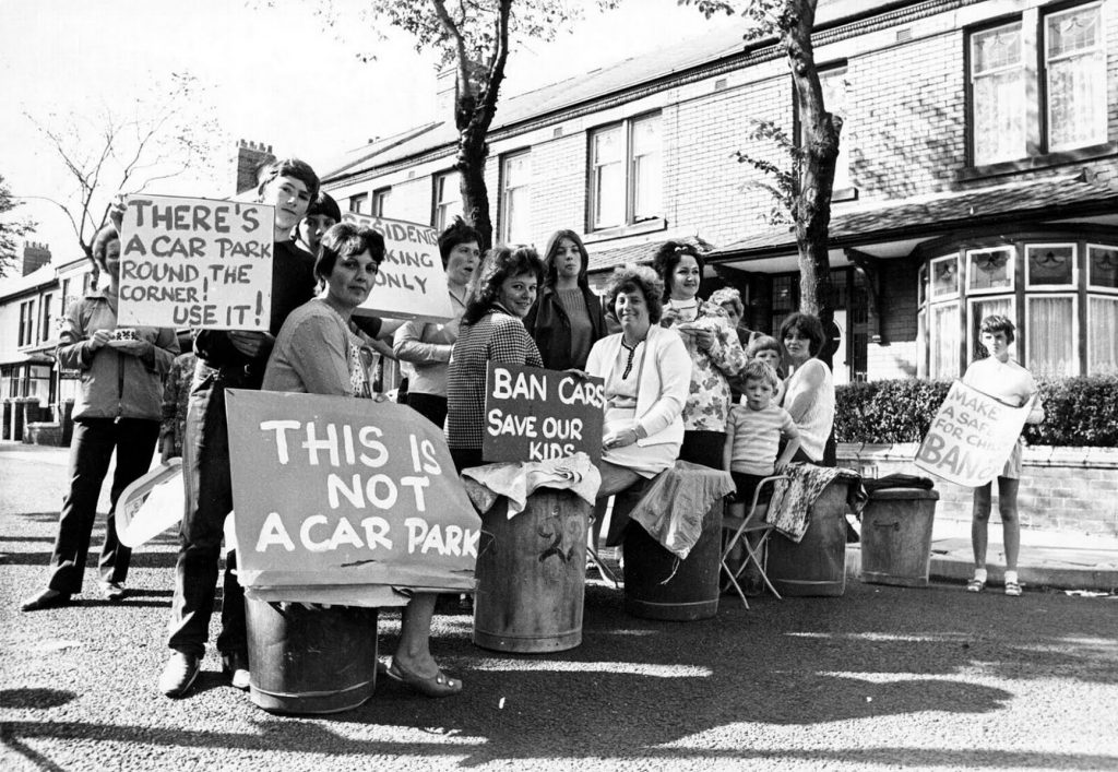
On Redburn View, five children were knocked over by drivers in eleven months in 1972; one incident resulted in a four year old being hospitalised with a broken leg and a fractured skull. These continuing dangers were the result, residents argued, of drivers driving straight through their street and a failure of the local police to enforce the play street order. The mothers on the street embarked on a campaign in August 1972 to demand better policing of the play street order. They established barricades of “dustbins, car tyres, bicycles and bedheads” (Evening Chronicle, 16.8.72, p.5) to stop drivers cutting through and successfully forced the police to set up a checkpoint on the street:
Police have promised special attention and checks … and prosecution for motorists who misuse the street … But the mothers warned that the barricades would be back if police checks were shortlived.
This attentive policing was indeed shortlived – by 1973, the mothers were protesting again and wanted a permanent solution. The play street wasn’t working:
In a play street, you should be able to let your children play out safely and not have to worry. But you can’t leave them alone for a minute, it’s just like a main road.
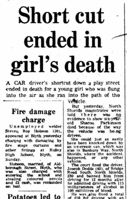
The mothers wanted bollards in the middle of the street to prevent through traffic (The Journal, 16.7.73, p.9). They didn’t get them and, in 1976, a six year old girl, Sharon Parkinson, was “flung into the air” and killed by a driver on the street, by this point renamed Banbury Way. The driver admitted driving under the influence of alcohol and was fined £30 and banned for driving for 12 months (The Journal, 7.10.76, p.3).
At some point after this, Banbury Way was turned into a no-through road, as part, I think, of the redevelopment of The Ridges (or Meadowell, as it was by then known), but it seems that by this point the play street was almost entirely non-functioning, despite its continuing designation. (If you know any more about this change, please do let me know).
I have not found any prosecutions for play street contraventions after 1958 and I think the last of the designations were in the 1960s. It is also clear that there were growing struggles to enforce the existing orders by the 1970s, as the Redburn View protests suggest.
The experience of Tyne Street in North Shields in the 1970s perhaps points to a change of policy with regard to play streets in the borough. In September 1972, a 3 year old child was knocked down and killed on the street. Residents were concerned that drivers were distracted by the river view – the street runs parallel to and overlooks the Tyne – and pulled together a 221-name petition for the street to be designated as a play street (The Journal, 9.9.72, 7). Their petition was unsuccessful: “The mothers … heard that the play street had been rejected because the signposting was too expensive”; “We will do our own sign boards … Give us the go-ahead and we will have them up in 24 hours”, a Mrs Darroll responded. In November 1972, the council, now North Tyneside Metropolitan Borough Council, suggested “closing the street as a link road and making it into a series of cul de sacs, with amenity areas in between” (Evening Chronicle, 3.11.72, p.11). The plan was to introduce temporary bollards for an experimental period, closing the street to all but access, with a view to investigating the long-term feasibility of the proposal.
A similar story from Whitley Bay in 1971 reinforces the idea that there was a move away from designating play streets towards closing roads to through traffic more generally. In August of that year, a group of mothers in Ventnor Gardens, Whitley Bay, barricaded their street, with dustbins and placards, to create a safe space for their children to play. The mothers complained that day trippers parking on and driving up and down their street were making it dangerous for their children; a six year old boy had been knocked down recently. Unlike demands, for example, on Lilburn Street just three years earlier, there is no mention of a desire to establish a play street; instead the mothers wanted their road closed to through traffic altogether. Councillor Freda Rosner, who supported the mothers, was reported as saying “This is ridiculous. We have become slaves to cars.” (The Journal, 9.8.71, p.7).
The Chronicle, originally published 9.8.71 but reproduced on Chronicle Live.
It is not clear what happened to the plans on Tyne Street nor the demands on Ventnor Gardens. As far as I can tell no changes were made on either street, at least not permanently. But it also seems like these accounts reflected a popular and policy switch from play streets to the introduction of other kinds of road closures, including modal filters – bollards or other barriers that restrict motor vehicle access but allow those walking and cycling to pass – on residential streets. A number of the other designated play streets, such as Briarwood Avenue (now Kingsbridge Close and Amble Close), The Nook and Collingwood View, now have modal filters, of unclear origin and timing.
In North Shields, it seems that creating and managing safe space for play was increasingly tied up in its redevelopment, within and beyond the Community Development Project. The redesign and redevelopment of streets on The Ridges and in the town centre neighbourhoods seemed to open new questions about the place of play in residential areas. In 1974, adventure playgrounds were created in Meadowell (as The Ridges were renamed in 1968) and in East Howdon (the former intended to be a permanent site and the latter temporary) and, as I’ve suggested, campaigns for better play facilities, including playgrounds and play schemes, were a key part of the CDP work. In The Triangle, a later attempt at redevelopment through the creation of a so-called Home Zone in the early 2000s also forefronted the creation of safe street space, for play and for community life more generally; indeed, home zones were seen by some to “offer[..] a renewed commitment to the concept” of the play street.
In this preliminary review of North Tyneside’s play streets we can highlight a number of themes and questions.
Tynemouth Borough Council embraced the idea of play streets when many other local authorities didn’t, including others in the north-east; there was clearly a policy decision in the late 1940s that enabled this.
Play streets were seen as an alternative in the absence of accessible playgrounds, and playgrounds were seen as by far the better option.
The designation of play streets did seem to open up a more public debate about the place of play on residential streets and dangers posed by rising vehicle ownership.
Almost all the streets designated were in North Shields and seemed to be connected to alleviating housing and environmental disadvantage.
Wallsend Town Council embraced the idea of play streets later, but seemed to see their value as part of their play provision.
Enforcement and prosecution dropped off extremely fast such that by the 1960s, or perhaps 1970s, these streets barely functioned as play streets.
Mothers played an important and visible role in demanding and sustaining play streets and ensuring that the real dangers posed to children by drivers on residential streets remained on the agenda.
Play streets did not protect children from injury and death on North Tyneside’s streets.
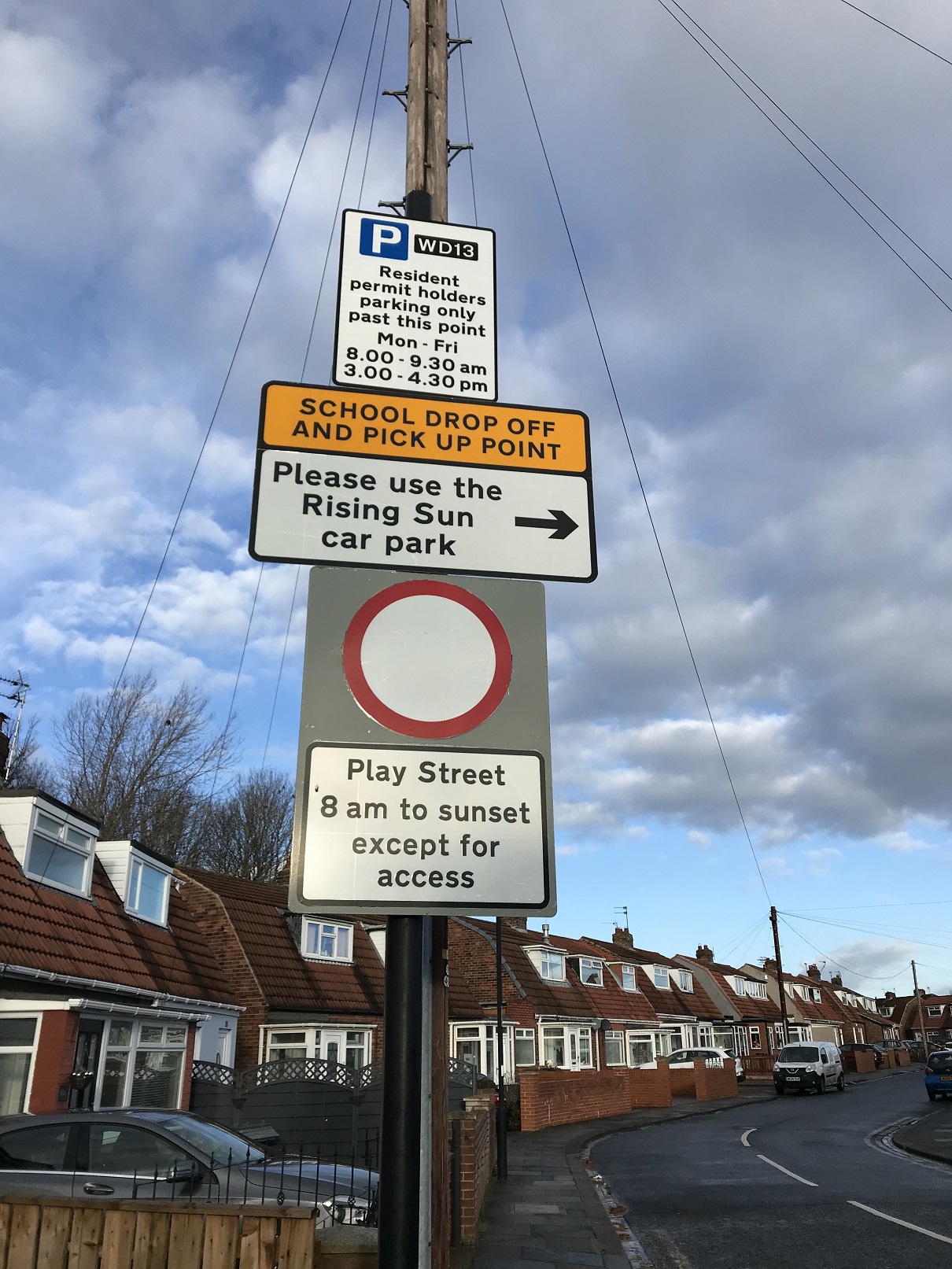
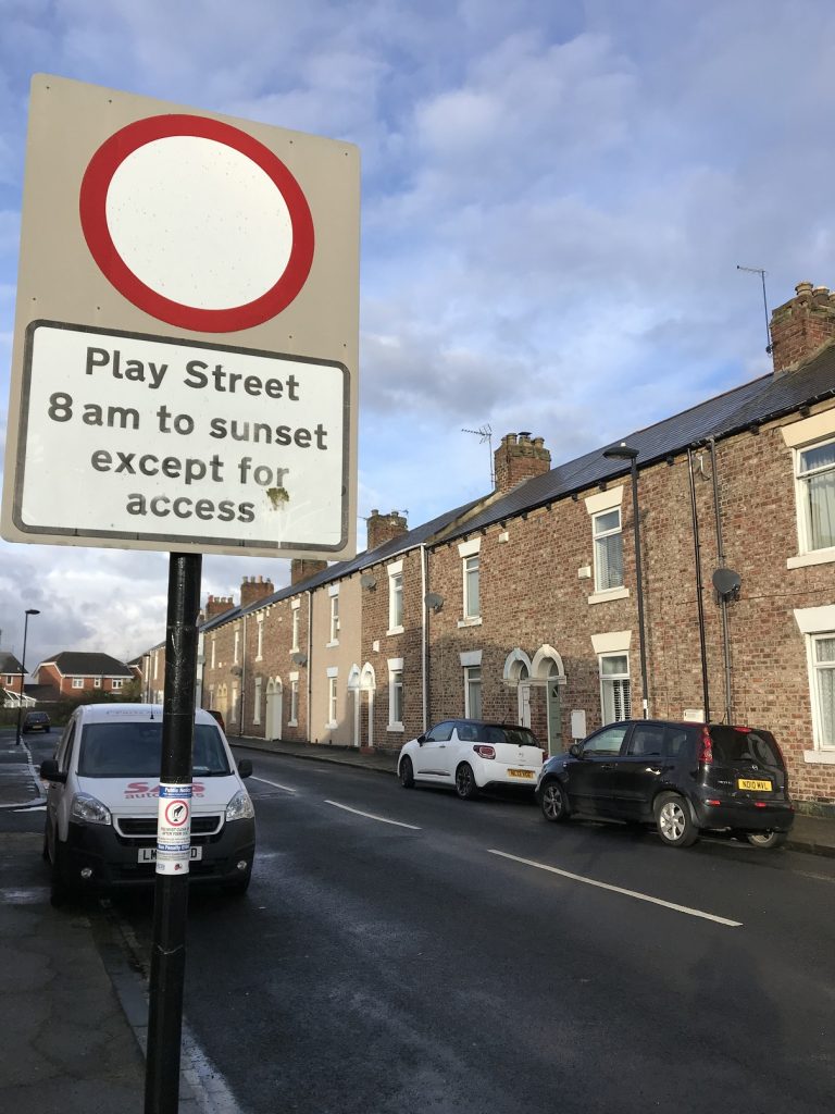
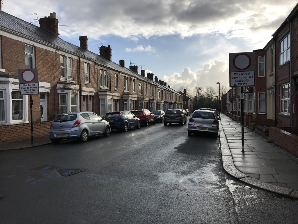
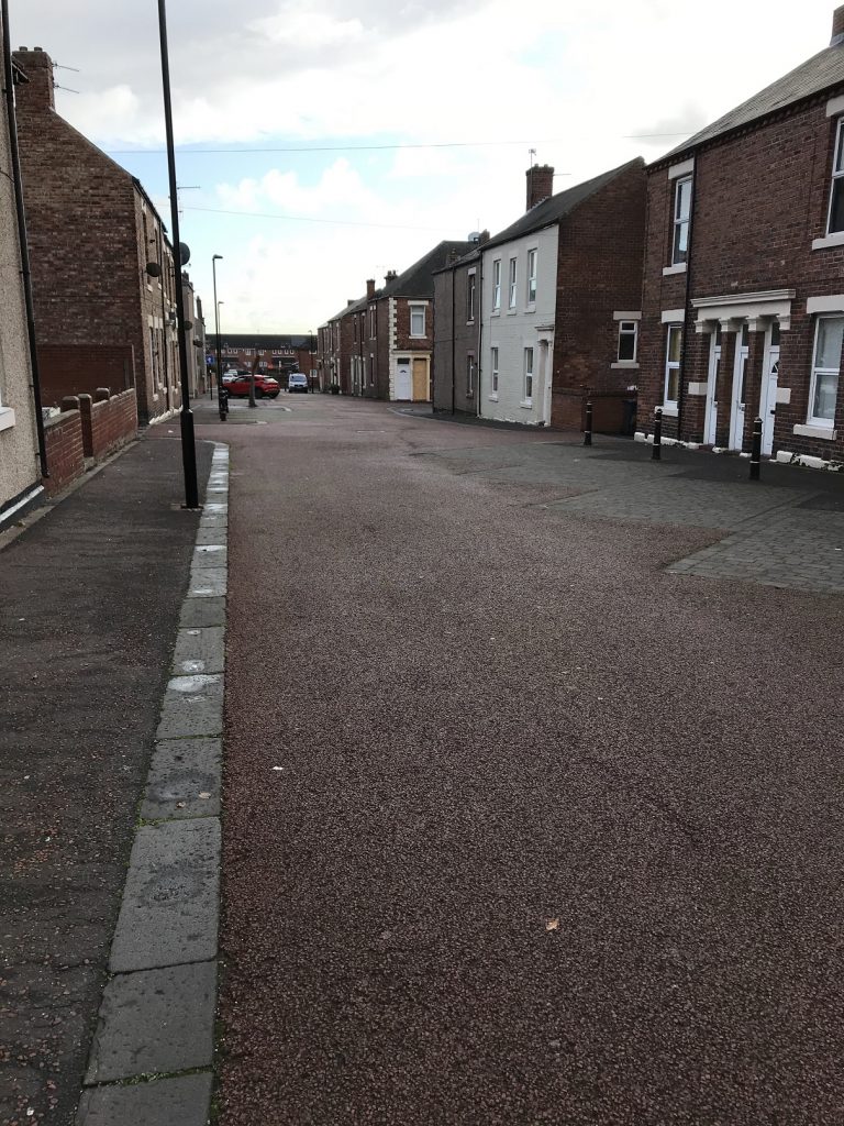
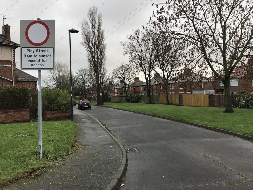
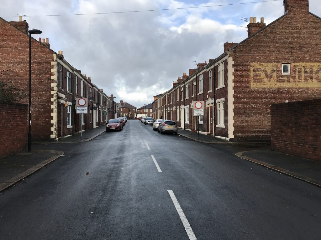
Twenty-one North Tyneside streets, most identified here, remain designated as play streets to this day, with orders covering either 8am or sunrise to sunset; this includes streets which no longer exist and ones which have been renamed in successive redevelopments. On many of the streets, the signs are still up but there are few indications on any of these streets of children playing out today. (For more images from a tour I did of these play streets, check out this Twitter thread.)
Douglas Street
Laet Street
Myrtle Grove
Penman Street
The Nook
Willow Grove
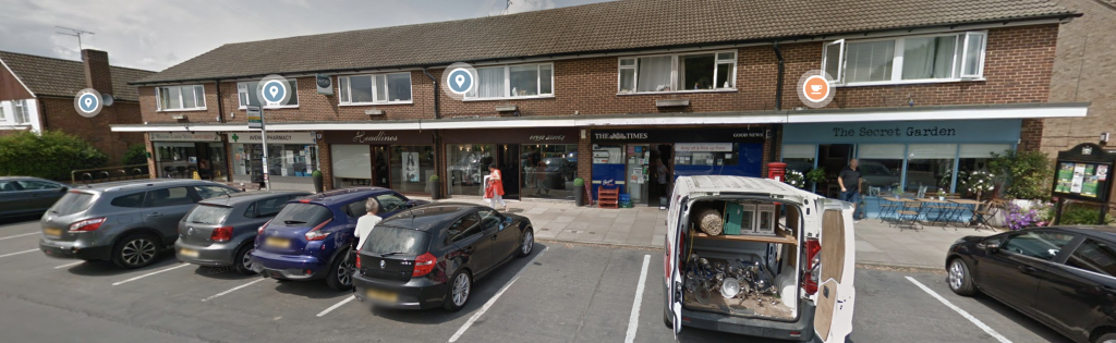
Residents on Cullercoats’ Beverley Terrace have recently launched a campaign to revitalise and enforce their dormant back lane play street, raising the question of the potential for others to be reviewed. On Charlotte Street, Wallsend, the council has just begun work on the renovation of eleven neglected properties, with a view to “deliver an improved physical environment, clear community benefits and increased stability”; this perhaps offers an opportunity for the street’s play street order to be revived and for play once again to be part of the borough’s framework for community redevelopment.
There is much more to be gained from reflecting in depth and detail on the history of North Tyneside’s play streets, a bold and important experiment in the life of some of the borough’s streets. There are many resonances with contemporary debates about car dependence and the regulation of traffic, the everyday life of our streets and neighbourhoods, and the place of children and their play in public space.
For now, if you have stories, memories or reflections to add, please do let me know in the comments.
My thanks to Sally Watson for sharing some of these stories – and a fascination with play streets – with me.
At the end of December, I decided that I would make a commitment to going out, into my neighbourhood, everyday, on foot or bike (and, as it turned out, scooter). This was before the third lockdown was announced and schools were closed, but I still knew that I was in for an intense and indoor January. The combination of a heavy workload and wintry weather meant that I could easily imagine days when I wouldn’t leave the house.
There’s a lot I like about the hyperlocal life that’s been enforced upon us. I have long valued the proximate spaces and relationships of my everyday life, but I know that my privileges mean that a hyperlocal life is both possible and comfortable, despite the pandemic. I spent much of 2020 exploring the places around me in depth and detail, documenting those experiences on social media and in blog posts (here and here, for example).
So this commitment to move around and document my everyday journeys built on all this, encouraged me to get out and to notice and connect to the places I moved through. Many of these trips were taken with my nine year old daughter, and gave us time together away from our desks, and some with a friend. Others I took alone.
I noticed signs, surfaces, skies, seas, nature, colours, routes, patterns, art, people, ships, stairs, paths, shadows, sounds, histories, and much more.
These are my tweets, from 31 days.
I am going to walk, run or cycle in and around my neighbourhood every day in January, in all weathers and moods, with purpose and without. If I enjoy it, I’ll carry on. I’ll record each trip with at least one photo. I started early so here are pics from the last two days of Dec.
Of course, this builds on one of the good things from 2020, lots of time spent out and about locally, getting to know more of the places around me, which has been a reminder of how important this kind of place making and marking is to me.
1st January: I forgot to include scooting, and that was today’s mode with my daughter, a meandering route to and through the local cemetery where we spotted some early blossom 1/31
2nd January: Day 2/31, scooting again, around and through the Tyne Tunnels, passed this old modal filter and a piece of port-related public art in East Howdon. Any additional info about the art gratefully received.
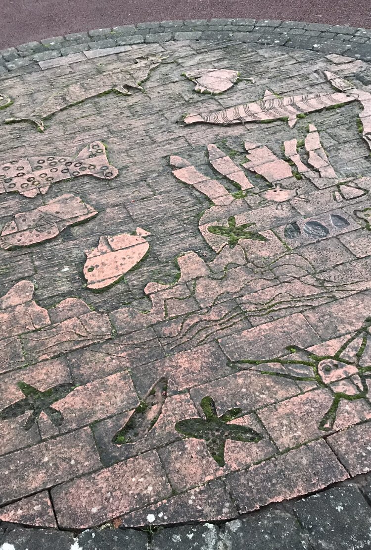
3rd January: Day 3/31, we stayed very local under the threat of hail and had a brief wander around North Shields town centre, where we found this sea scene complete with cat-fish
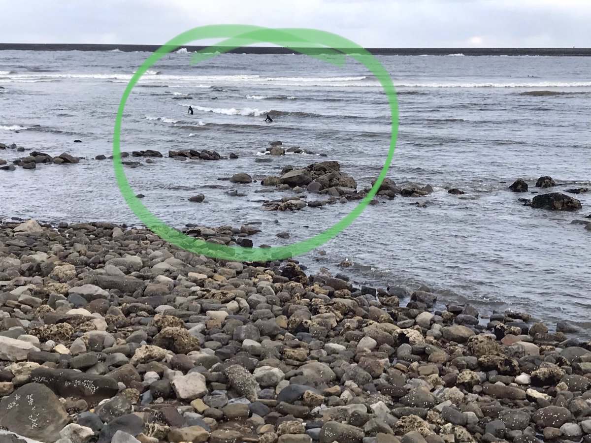
4th January: Days like today (too much work, very cold, threatening sleet) are why I made my “resolution”, so that I fight the urge to stay in. A biting bike ride along the mouth of the Tyne, past the Black Middens, where there were people surfing 🏄♂️ (and I thought I was cold and wet!) 4/31
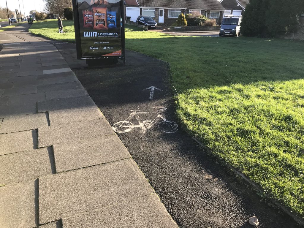
And a quick PS – I _really_ miss @SunriseCycleway. I was buffeted about along the seafront and barely felt safe on the road, yet the “shared path” was packed with people walking even in today’s miserable weather.
5th January: Despite (or because?) being home all day “homeschooling” we didn’t get out till it was dark, but these neighbourhood outings will be all the more important in #Lockdown3, as they were in #Lockdown1 5/31
6th January: For day 6/31 my first run of 2021, and indeed for a long time. I didn’t run far or for long but I ran, and experienced my streets as a runner, more observant of uneven pavements, varied surfaces and inclines, and recognising the different kinds of space my running body takes up.
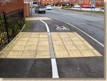
Talking of surfaces, on my recent scoot (2/31) with my daughter we experienced lots of different tactile paving, which I was trying to explain to my daughter and that reminded me of this thread by @BlondeHistorian which explains how these tactile cues work
We noticed the vertical and horizontal corduroy paving to demarcate the cycle and pedestrian sides of a shared path (a bit like this) – both sides are fun on a scooter!
And there’s a @RantyHighwaymanblog post about tactile paving here with loads more info/context (from 2015)
7th January: On day 7/31, a brief late afternoon walk through North Shields to explore this archway which leads to Field House, an impressive Georgian building dating to 1800, a reminder of what Shields once was (now flats)
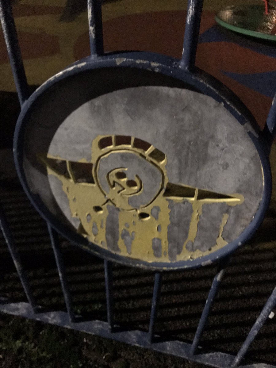
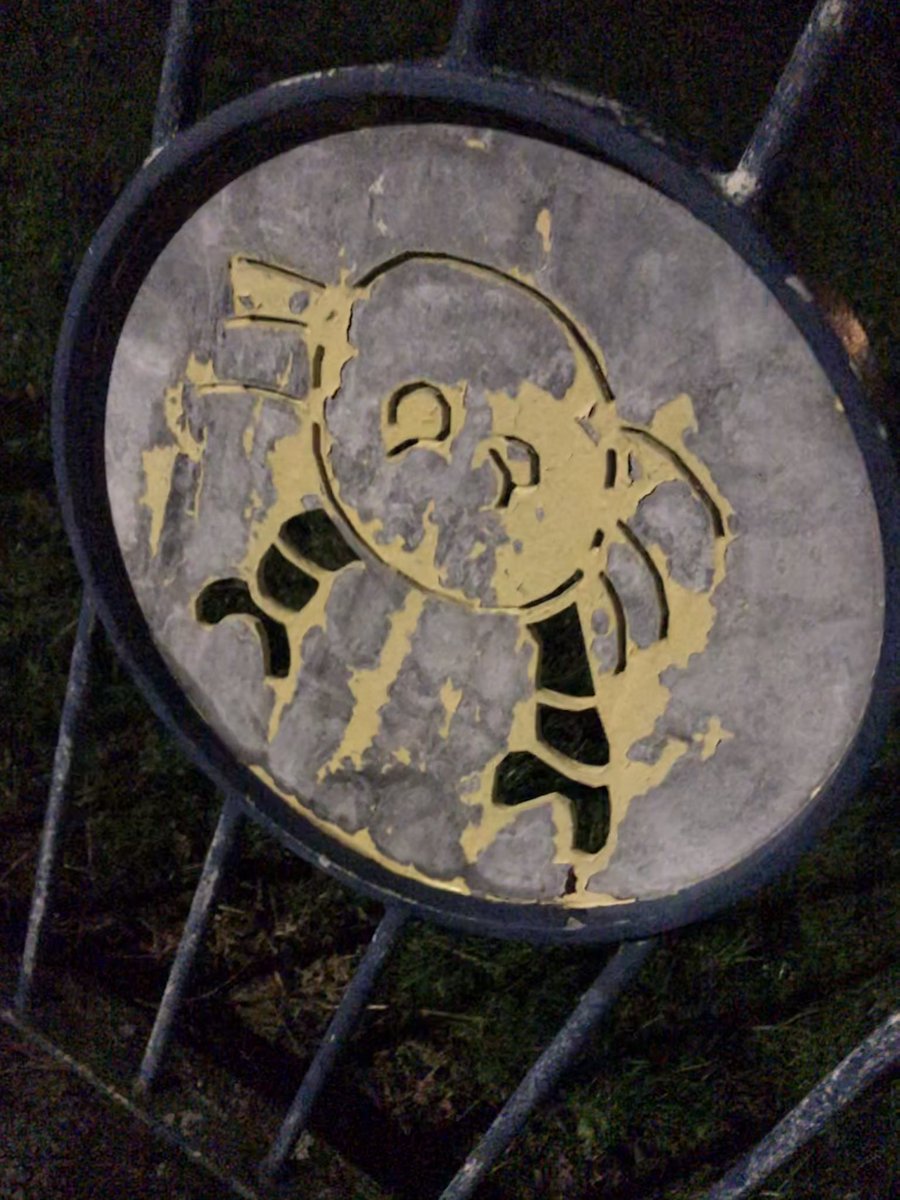
8th January: Another late, dark, brief, icy, local walk (determined to get out in daylight tomorrow) – back to Pearson Park to see the slightly peculiar characters on the playground railings. Not all fishy, but all looking shocked and/or disgruntled – maybe just their pandemic look? 8/31
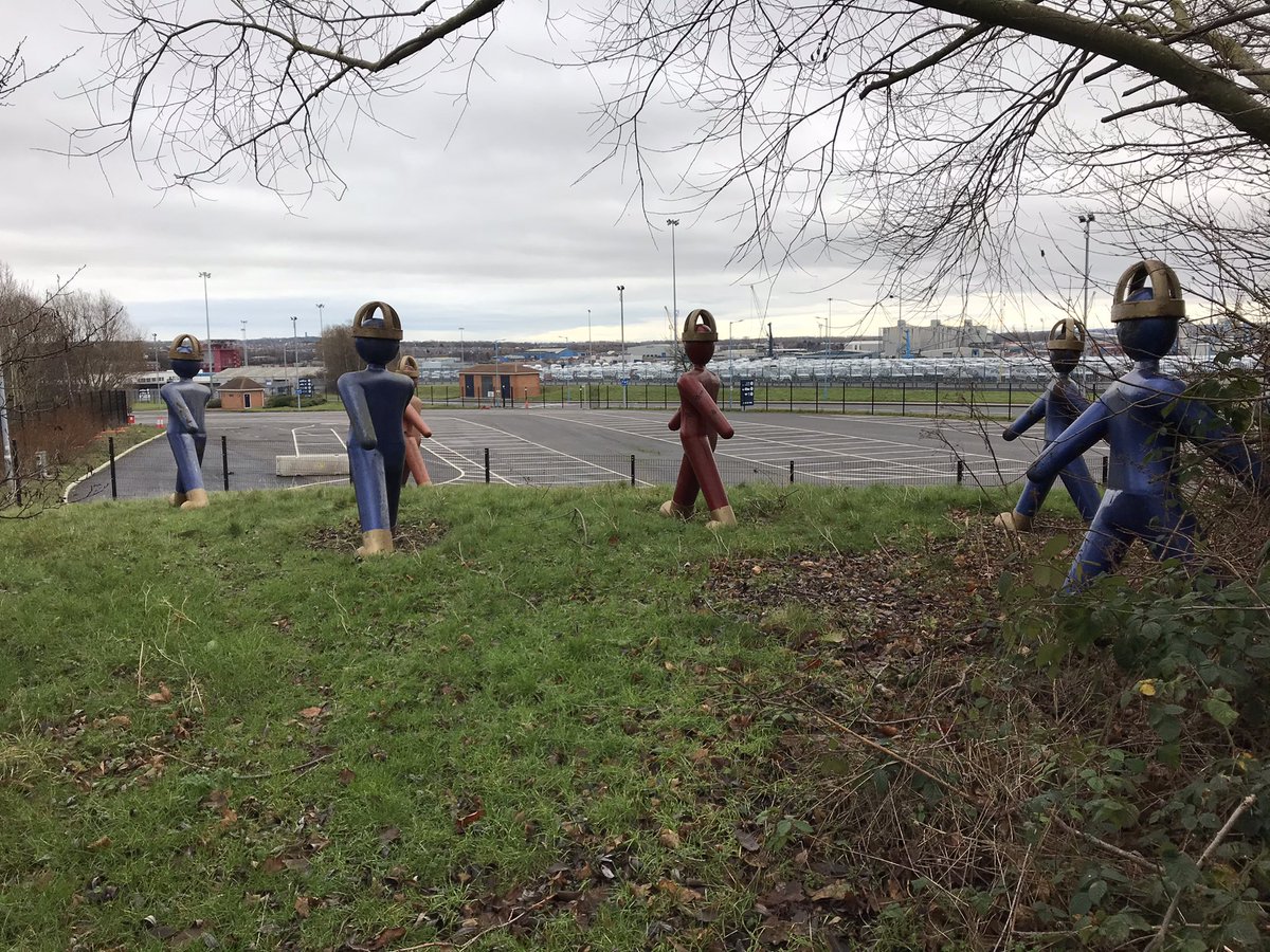
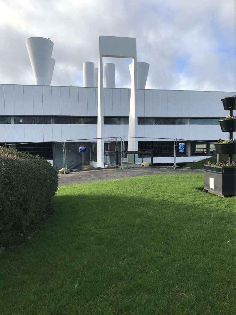
10th January: Finally a bike ride (no ice, no low sun), sort of on a mission to find a piece of public art, sort of just getting some exercise. I was looking for Dudes by Permindar Kaur (2002) at the entrance to the DFDS ferry terminal – first glimpse through railings, then I found them 10/31
11th January: A very short walk today to my allotment to see signs of spring 🌱amongst the uncleared winter debris 11/31
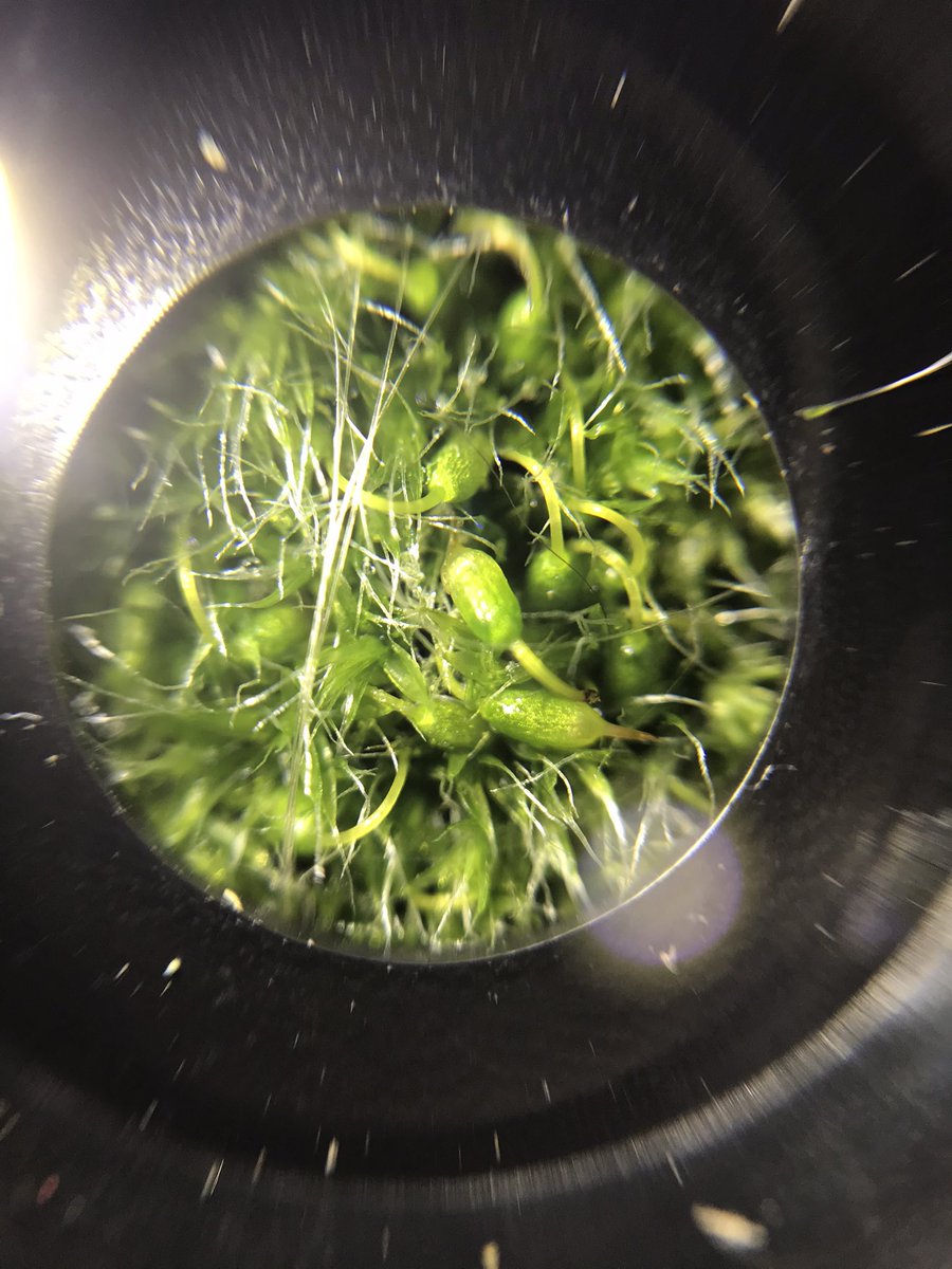
12th January: Very small-scale walk today with a smartphone microscope (a Christmas present) – I give you local walls, pavement-crack weeds, and moss – extraordinary! 12/31
And a mini beast (with a commentary!)
13th January: A fairly functional walk today back from Tynemouth after finally dropping off my @rideelectricgo hire bike 😢 but a stop for takeaway coffee (and the chance to extol the virtue of ebikes to the cafe person!) and some truly beautiful blossom 13/31
14th January: A wet and blustery walk along the mouth of the Tyne, and got to see the Nordic Ace, a Bahamas-registered vehicle carrier, arriving in the Port of Tyne (I saw no need to use the cannons) 14/21
15th January: Timed today’s walk to watch the arrival of the cruise ship Azura, berthing at Northumbrian Quay for a couple of months. It was both amazing and slightly ridiculous 15/31
16th January: A meandering walk round the streets of North Shields for day 16/31, too late for all but the last remnants of snow, but spotted some snowdrops and this dude, whoever he might be…
17th January: A short walk around the corner to my allotment (where exercise is digging and running around [we have no real garden at home]) and spotted an aconite 17/31
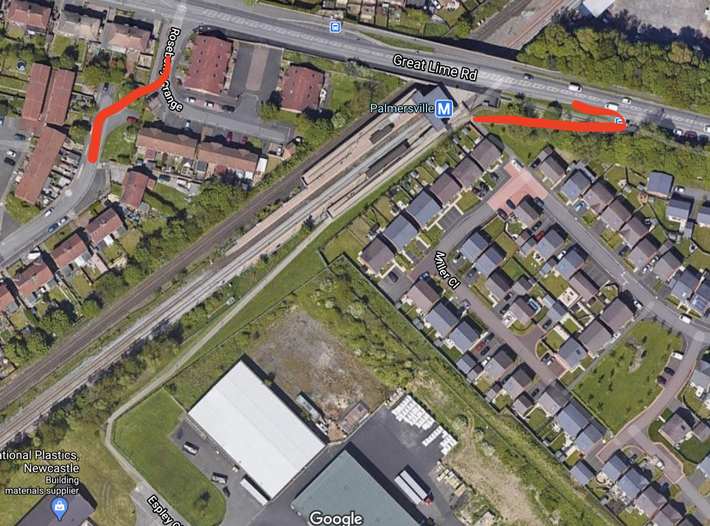
18th January: A dusk scoot today, with my 9yo leading me back to a smooth downhill path she remembered from the first lockdown – apparently I even said exactly same thing as last time (to not go so fast she’d go flying!) – for local folk it was Beach Rd cycle path, a great scoot! 18/31
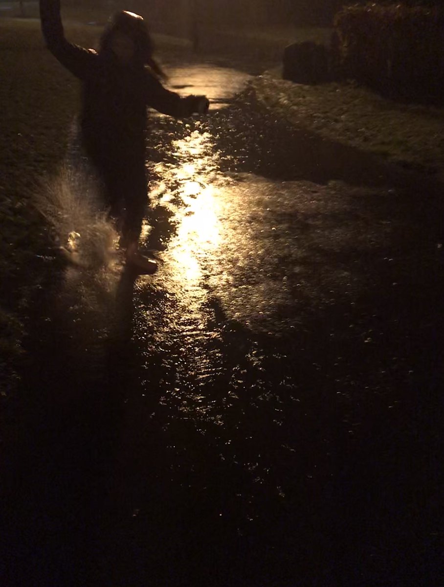
19th January: Making the most of Storm Christoph to jump in muddy puddles for a quick, dark and very wet bit of local fresh air tonight 19/31
20th January: Today I walked as I participated in a departmental meeting with my colleagues in my ears. I got very wet but it was a different way to Zoom with the landscapes of Shields, including the Ropery Stairs, around me. No squirrels though, @thelrm! 20/31
21st January: A bike ride to the sea and back on my old (new) analog bike which has been much neglected whilst I’ve been experimenting with ebikes. I missed the e-assist in the seafront winds but it was good to be back 21/31
22nd January: A cold and sunny walk around Cullercoats with a Cullercoats Coffee to the beautiful sea and back past the old fishermen’s cottages; happy to see so many children playing on the beach and in the seafront playground 22/31
23rd January: Beautifully sunny walk through North Shields to explore the places a friend’s mum lived in mid C20th, redeveloped many times, travelling up and down many of Shields’ stairs to make our way around 23/31
24th January: Wintry walk through Preston Cemetery, meandering round paths I’ve not walked before. No snow here but ice and snowdrops 24/31
25th January: A short scoot, despite the sign, to a tiny playground we used to go to often when my daughter was a toddler, to slide on some ice and see if we could fit into any of the play equipment. Yay for playgrounds! 25/31
26th January: A soundscape today; came to the allotment to do an art lesson for my daughter (go outside and make a picture from loose parts – yay!) and blown away by the birds. The allotments are a tiny wild oasis in a very urban area 26/31
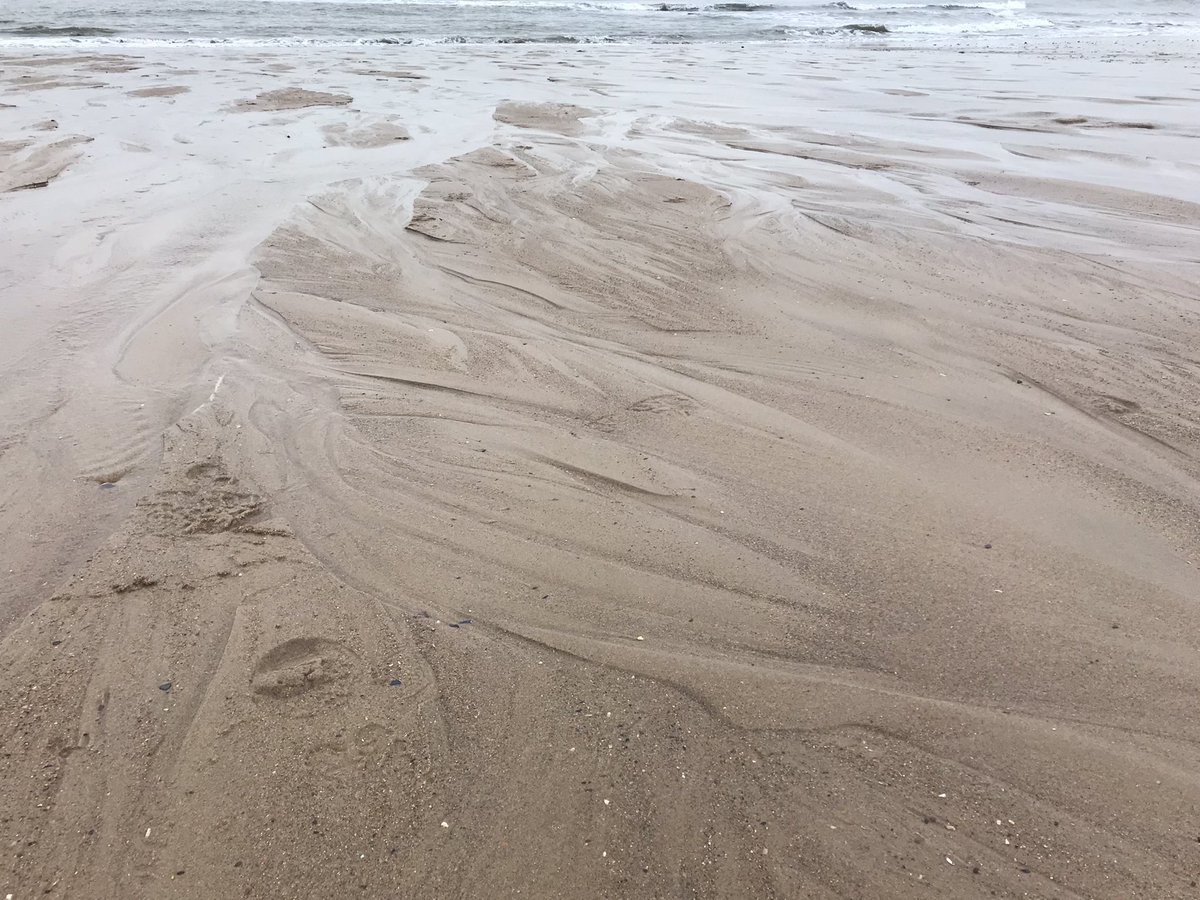
27th January: A brief beach walk before what threatens to be a horrendous work day; the sea view was extraordinary as usual, light changing every few minutes but I focused paying attention to detail on and around the beach 27/31
But, just in case you need it
28th January: A short walk in drizzle in the middle of a Zoom day, so not much to spot but I did pass my daughter’s school where the children were playing happily in the playground – a useful reminder that children at home need to be able to play out safely and confidently too #oktoplay 28/31
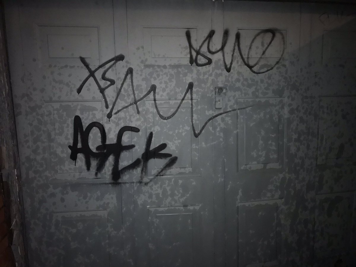
29th January: I almost didn’t go out today – too much work and horrible weather – but I did. With my 9yo, we used the dérive app to lead us round the streets. We had trouble finding the sun and a crowd, avoided public transport, but found a one-way street, some graffiti & lots of puddles 29/31
30th January: Another day, another dérive – we found something out of place, headed north, took a photo of something old, and documented our shadows. Lots of improvisation with tricky cues, but lots of noticing, of sounds, directions, the changing light… 30/31
31st January: Day 31/31 – the end of my January challenge – and we took inspiration from @Attention2place’s #GeographyDrift prompt from yesterday to notice red in our neighbourhood.
I think I know quite a lot of North Tyneside, where I live, very well, especially the parts east of Wallsend. The geographer in me (which, to be fair, is most of me) insists on learning, getting to know and mapping the places I visit, let alone the places I live. Mostly I know these streets and roads for driving and, closer to my North Shields home, for walking. I got to know many of local streets and roads pretty quickly when I first moved here (in 2011) as I had a newborn daughter who I walked and drove endlessly, to get her to sleep and to give me some time out of the house.
I drove west and north and round in circles, through Seaton Delaval, Seaton Sluice, Blyth, north to Northumberland (Cramlington, Morpeth) and south again through Killingworth and Forest Hall. Tha A19 and A1058 were my axes (the green lines on the map above) but I found other signed routes and used my instincts to always return a different way to my outward journey, making connections between places I was getting to know.
More often, I walked – up streets, through back alleys, finding snickets, new landmarks, with friends, on my way somewhere, or just to fill time. On these walks, I found the street we later moved to and the ‘secret garden’ where I now have an allotment. These walks created so many the ties I now have with my neighbourhood, brought me closer – step by step – to feeling at home here, marking my territory by beating the bounds.
From 2015, when we started to play out on my street, I started to make connections with other streets doing the same, with whom we had to share signs, passing them on from doorstep to doorstep on the morning of our street play sessions. And in 2017, I started to develop and coordinate playing out across the borough and got to know another layer of North Tyneside’s geography – working out whether streets could be closed, looking on Google Maps at terraces and semis, cross-streets, back alleys, and cul de sacs to see how easy and safe it would be to stop through traffic for a few hours a week, then delivering letters, notices and Road Closed signs to the growing number of streets that got involved, and finally beginning to see the patchwork of play streets connect across the borough.
So, I like to think I’m pretty well connected to North Tyneside, that I know its geography at a number of scales, that I think about where I’m going and make connections to the places I pass and travel to.
Yet, during successive lockdowns and the pandemic months, my connection to North Tyneside has grown, extending to new places and new perspectives, and deepened, as I’ve seen more in the places I know. I wrote here about how walking and scooting with my daughter in our closest streets fed an increasingly granular feeling of recognition and attachment, but as lockdown lifted, we filled the summer months with cycling and, for the first time, kayaking in and around the North Tyneside coast.
With and without my daughter, I’ve been cycling more and more – for fun and to visit friends along the Sunrise Cycleway, a 3-mile pop-up cycle lane created by North Tyneside Council in July (and ripped up in November), but also all around the coast, on all sorts of roads and paths, to shop and just to get around. My old bike died, I bought a new one, and now I’ve hired an ebike, to try it for a month. I’ve filled my ageing car up with petrol just 3 times in 9 months.
I was inspired to write this blog after my recent 23-mile bike ride, a carefully-planned round trip from North Shields to Battle Hill, Forest Hall, Killingworth, Backworth, Shiremoor, Wellfield, Monkseaton, Whitley Bay, Tynemouth and home to Shields. I spent a lot of time working out the route, asking advice, poring over Google Maps and Street View, weighing up the benefits of traffic-free routes against a fear of feeling scared. I was already developing a granular geography – seeing where there were alleyways to cut off a corner (or a few more metres on a busy road), spotting landmarks that would reassure me I was on track (primary schools, street names, the metro line, a pub or pizza takeway), and identifying places – roads, bridges, parks, paths – that I wasn’t sure I’d feel safe in. And, of course, I was connecting it to the places I already knew, from car and foot.
Short cuts
Heading out on Saturday morning marked the translation of this cartography of the mind and screen to a geography of body and bike, moving through these places I’d marked and memorised. At times, this meant realising that the short-cuts I’d planned on a screen took me up steep hills with sharp bends, or on narrow paths filled with families walking, or along rutted tracks and coarse gravel, or through an underpass in the earshot of the revving engines of micro bikes, that the physical, tangible geography of the real route was felt through my body – in exertion, in vibration, in anticipation and in fear. But it also meant that those bright, two-dimensional routes on screen translated into a short wooded path with a glorious soundtrack of birds and rustling leaves, a lakeside stretch fringed with reeds and new town houses, and a surprise level crossing with a warning to Stop Look Listen.
I was alert to the route, the traffic, and those with whom I shared my journey, for moments more or less brief. I observed and felt the surfaces, the potholes, the loose paving, the kerbs of different heights, the mud and the debris. I was grateful for smooth tarmac, alert to unavoidable ruts, looking ahead to see how I could navigate a turn or a crossing with the gentlest path for me and my bike. I noticed the speeds of cars, and roundels to warn me; I kept a constant eye on car doors and bends in the road, to expect the unexpected; and I looked for ways to avoid traffic if it came too fast and too close. I looked down and over my shoulder to be sure I could pull out, around a parked car or a pothole, if I needed to. I scanned ahead – and to the sides – for pedestrians, for children playing, and for dogs, tuning in for moments to witness their play, overhear their conversations, predict their next moves, at times ringing my bell, shouting a “thanks” or sharing an acknowledgement. And, at times, I listened to the voice on Google Maps telling me turn left, go straight ahead, make a u-turn.
I kept an eye out for those landmarks I’d recorded, to mark my progress and feel confident in my navigation, breathing a sigh of relief when the right path appeared or as I passed the school or shop I’d expected, and I tagged all these places on the maps in my head, to populate and animate my personal geography, and for the next time I travelled these routes. I also responded to the sites and sights that caught my attention, taking detours onto a path closer to the lake, or a road adjacent to the East Coast mainline and a speeding Pendolino, to check a noticeable street name, or take in a new housing development, to follow a path I suspected would lead me in the right direction. And I added all of these to those maps in my head.
And, of course, there were the wrong turns too, the bad choices, the moments of fear, a retracing of my steps, wasted time, a quick decision to get off and walk, or to move onto the pavement, to cross the road for more space or a better path. And each of these was accompanied by a calculation, a moment of self-criticism, of doubt and anxiety, of hesitation, felt in my body on a bike. And each was added to the maps in my head.
Some of this was bad infrastructure, a common theme in cycling narratives. There’s of course a sense of disappointment and frustration when a cycle lane appears and disappears within metres, or a painted bike directs you along a useless or impossible path, but bad infrastructure is also felt in the stops and starts, the dismounts, the endless decisions, and the continuous attention to the kerbs, the surfaces, the camber, the bends, the micro-topography of the streets and roads.
And, of course, there were the places I wanted to see – the Ryder and Yates 1967 British Gas Engineering Research Station, now North Tyneside Council’s Killingworth Site, the new town estates of Killingworth – its East and West Bailey and ‘garths’, the new-build estates of Backworth and Northumberland Park, the 1930s cycleway on Whitley Bay’s Links, and St Mary’s Lighthouse – a fairly eclectic mix of sights but ones which help me map and get to know North Tyneside’s many faces.
This is how you learn a route and a landscape. On a bike, you can’t progress without paying real attention to the details of the route, from the road names, to the landmarks, to the potholes and kerbs; this attention is essential, but it is also valuable. You have to see, listen, feel, and because you have to, you connect more. In contrast to travel by car, or even on foot, the route becomes richer, denser – more granular – every sense is invoked by the nature of your contact with the road and the route, a body on two wheels, propelling itself, in an in-between place between car and foot, between road and pavement, moving from one to the other.
These were mostly new places and new routes, but through their inscription in my head they’re mapped for the next time, not just these actual places – where to go, where to find something, how to get from A to B – but also a more general sense of what feels right when I’m riding my bike, and what I need to pay attention to.
These uneven surfaces, on one of my most common routes, demand my attention
The attention to place, at every scale, which I reflected on and recorded in this one trip plays out in more mundane ways in my everyday geographies. On those routes I travel regularly – to the shops, to friends, to the beach – I have mapped the breadth of the roads, the choice of paths, the pinch points, the steepness and camber, the changing surfaces, the worst potholes, the joyous stretches, the viewpoints, and I have felt them, in mind and body. As a ride, I map and re-map the spaces of my everyday life, making connections, feeling the places I move through, adding layers to my mental maps. I see what is possible and what is restricted. These inscribed geographies embed me in my everyday worlds and they ready me for my next trip, allowing me to see where to go and how to move as each day I find my way in North Tyneside.
“Some of my happiest childhood memories are on my BMX Burner, the bike I inherited as a seven-year-old from my big sister. It wasn’t new or flashy like other kids’ bikes at school, nor was it the bike that I secretly desired, but that didn’t matter. That red and yellow beauty sparked friendships – and an obsession with life on two wheels.
After school and on weekends, I’d meet up with my friends, a mix of kids from my class and new friends I’d made cycling around my housing estate. Our favourite time for bike adventures was the summer holidays: six glorious weeks of long, bright days, with no school to interrupt our time. Parks, other housing estates and even building sites (definitely a place where you need reliable tyres) became our adventure playgrounds to explore.”
Which brings us back to George Ezra and Bengeo. I didn’t know George (he’s a tiny bit younger than me), but I like to think he was inspired by his Bengeo childhood and that we shared some of the same adventures and pleasures around Bengeo’s streets.
I moved to Bengeo when I was 7 and a half. My parents had just divorced, so I was living with my mum and my brother, then 9 and a half. I was already at school in Bengeo, but we’d been driving to school by car 9 miles along the A10 from Wormley. We had a big house and a big garden in Wormley but the only, vague, memories I have of cycling there are of my brother and I trundling up and down this back lane (the van was probably there then too). The road we lived on had been the A10, and even though a new dual carriageway had been built, traffic was still heavy.
That all seemed to change when we moved to Bengeo. We were now living on a quiet residential street in what was basically a suburb of Hertford. We were about a mile from Hertford town centre, surrounded only by other residential streets, in an interwining and connected pattern. Beyond this built up area, there were vast expanses of country lanes and green fields, many of which turned yellow in the rapeseed season. This all became my roaming zone. Our bikes weren’t cool – we each had a folding bike, mine red, my brother’s light blue; they were new and I guess we got them as it was easy to move them between my mum’s house and my dad’s. It had three Sturmey Archer gears, I think my first bike with gears.
My bike looked a bit like this
We kind of had two modes of riding, and I mean, mostly, my brother and I. We rode from our back gate around the neighbouring streets, through alleyways, to local shops, making the most of the endless loops you could ride through crescents, closes, and pedestrian cut-throughs.
Our back lane, from where all bike rides started…
We loved riding to these shops, on The Avenue, where we’d buy sweets, fizzy drinks, or comics, post letters for our mum, and make prank phone calls form the phone boxes that used to sit behind these parked cars (on the right). We could cut through a little path that you can just make out beyond the cars, where, now I think about it, I remember a cherry tree and a small patch of grass, where we’d often stop, maybe to eat those sweets.
It was about half a mile from our house to the shops, but we could cycle miles on these streets, just going round in circles. We were on the top of a hill (Upper Bengeo, apparently) which meant that much of this riding was level, but we could easily find some good hills for thrills if we wanted.
Bengeo is divided by one main-ish road, the B158, so much of our riding was on “our” side, to the west of this road. The other side didn’t feel as familiar, but we did still seek out corner shops there – I had the vaguest memory of this one, and took a trip down Google Streeview memory lane to find it. And it was this side that led down to Hartham Common, a big green space on the edge of Hertford town centre, that gave us space to play and a safe route into the town centre, via the Norman church of St Leonards.
We’d also head further west, down a steep unpaved track or along unassuming alleyways, to Mole Wood (Great and Little) where we could paddle, catch tadpoles, and head through the woods to loop back into Bengeo.
These trips to Mole Wood led us into our second mode, which was to take the lanes out of Bengeo to the countryside and small villages to the north. I don’t know if we stayed mainly on the local streets for a bit after we moved to Bengeo and then progressed to these longer journeys. My mum’s recollection is that we cycled pretty freely from the moment we moved there. My mum remembers that she used to give us instructions:
“First left, second right, third right and so on until it brought you back home.”
I don’t remember this, but I do remember her packing us picnics and my brother and me riding off down Sacombe Road to Waterford or Bulls Mill. These roads were single-track lanes, with passing places. They were steep in places, which meant you could get a good speed up and surf round gentle bends. We would meet cars but I don’t have any recollection of feeling at risk.
I had a friend at Bulls Mill, so sometimes we’d cycle there. Sometimes we’d ride to Waterford Marsh, a place I’d all but forgotten but memories of picnics, wading, cow-pat dodging, and sitting in the sun came flooding back when I saw these photos. We’d stop and play pooh sticks as Vicarage Road crossed the River Beane in Waterford. The River Beane, after which Bengeo was named, featured quite heavily in our journeys. Our roaming-riding distances increased and we’d get as far as Stapleford (3 miles) and Watton-at-Stone (5 miles). These longer distances would mean we’d be back on bigger roads, including the A119 from Hertford to Stevenage. I’m guessing we didn’t cycle these till we were a bit older and maybe stuck to the pavements. We’d be out cycling for a good few hours, often the best part of the day.
These were increasingly holiday bike rides, because within a year both my brother and I were at boarding schools, so the ordinary, everyday cycling wasn’t possible. But these adventures, longer and shorter, were a major feature of our school holidays through our early teens.
I moved back to a school in Hertford for sixth form, and suddenly all those streets I’d been riding round became animated by local friends. I cycled to school most days, down a big hill and up another, with two new friends whose houses I would have passed hundreds of times on my earlier bike rides. We cycled to each other’s houses at evenings and weekends, as teenagers do, and then started cycling to pubs, before we could drive. I skived school one day (I don’t recall why!) and skidded on wet leaves under a horse chestnut tree as I rounded the corner onto my street. I fell off my bike and smashed my front tooth – a crown in my mouth, 30 years later, tells this tale. I always imagined somehow the accident was punishment for skiving school. I don’t even remember the bike I had then. We all learnt to drive, but our bikes were still important to us. One of my friends had an old postman’s bike that he was inordinately proud of, superseded only by his red VW Beetle a few years later.
Where I skidded off; there are still wet leaves
I kept cycling. I’ve always had a bike, through university and beyond. It’s always been one of my modes of transport and sources of pleasure. When I was 19, I inherited a car from a family friend. Determined not to become dependent on the car, I set out to cycle to Hertford Library during the holidays to do some university work. God knows why, but I took my work in a plastic bag on my handlebars. You remember I mentioned the steep hill?
I cycled down this with a plastic bag on my handlebars. I crashed into one of these houses (the cars clearly weren’t there!). Almost 30 years later, I remember losing control, I remember being about to crash, and I remember lying on the pavement waiting for someone to help me. They did, I went in an ambulance for the first and only time in my life, and I was fine. No major injuries, but I ripped my favourite shirt (a white collarless one from Carnaby Street).
But none of this put me off. I kept cycling. A few years later, living in Birmingham, I had friends who cycled more seriously and I rode with them. For the first time since childhood, I’d spend whole days cycling, getting to know the places around me, building relationships, having fun.
Why am I telling you all this? Partly, because those memories of freely cycling for hours on end, through my neighbourhood and beyond, have come back to me in recent weeks and months, as my nine year old daughter has been able to cycle round her neighbourhood and as I’ve been cycling more and more too, most recently on my brand new bike. I wanted to remember and record the details, material, sensual and emotional, of those times.
But mostly because all these experiences of childhood cycling gave me something, or a few things.
They enabled me to explore, learn about, map, imagine, inhabit and connect to my home, street and neighbourhood, to feel attached to it. When we started, we’d just moved to Bengeo and my parents had just divorced so maybe this was especially important to me, and doing it all with my brother all the more so. That I went away to school probably sharpened this need for connection, both that when I came home it felt important to reconnect, to re-map and to feel like I belonged again, but also that I could hold on to these stories, images and attachments when I wasn’t at home. I loved knowing my neighbourhood, where all the streets and alleys led, what the lanes felt like (and have loved recalling all these places here). That I then got a chance to ride these streets and lanes with friends, on the way to school, as I grew older, reinforced and extended my connections to this place. Only a couple of months ago, driving through some Hertfordshire lanes (not the same ones I cycled, but not far away), I felt that thrill of recognition, memories of freedom and of joy. And I still take pleasure in knowing the ins-and-outs of my neighbourhood, now in North Shields, of mapping the streets and animating them with friendships, landmarks, senses.
These bike rides also gave me a growing sense of ‘independent’ mobility. My mum trusted us – and the environment – and we carried that trust with us. We had no doubt that we could ride these streets and be safe. There were certainly fewer cars, and we were often on quiet streets, but we went further and onto busier roads as our confidence, skills, and knowledge grew, such that by our teenage years we happily cycled all around Hertford and well beyond, for fun, for school, for errands, to meet friends.
But our mobility wasn’t really independent – for years, my brother and I were together on these trips, and later we were with friends; as I got older I cycled more by myself, but a lot of my childhood cycling was accompanied, just not by an adult.
All of these experiences gave me a sense that I have a right to the road, on my bike, but also the skills and the confidence to ride on the roads that I carry with me now. I hate close passes, busy junctions and impatient drivers as much as any cyclist, but I can cope with them. Growing up as a cyclist has also made me, I think, a better driver.
And, of course, all these bike rides gave me a delight in the immense joys of cycling, despite the smashed tooth and the ripped shirt. I loved those bike rides with my brother, to the shops and to lanes beyond; I loved the speed, the lightness, the curves, the wind in my hair. I loved the friendships formed on bike rides to school and more slowly home, stopping at shops and friends’ houses. I loved cycling home from campus as a student – I remember cycling back one night, after seeing Keanu Reeves’ Point Break, and feeling like I was surfing on my bike. I felt like that again yesterday on my new bike, riding along our seafront. And just as cycling supported my teenage friendships, I still love bumping into friends and stopping to chat whilst cycling, in a way that just doesn’t happen in a car. Everyone should be able to enjoy the many exquisite pleasures of cycling.
I’ve had a good few years when I’ve barely cycled and even now, I don’t go out for long bike rides. I increasingly cycle to the shops, to friends, and will cycle to work, when I’m not working at home, and I cycle for fun, with my daughter and with friends, when I can. So I do cycle, quite a lot.
I’m now a geographer and an activist with a profound commitment to creating spaces for children, their families and communities to explore, play in, and connect with. I have no doubt that what I do now comes from these childhood experiences (and others). I loved all these bike rides because I’m a geographer (I think I always have been) and I’m a geographer because of all these bike rides (and much more).
Not everyone needs to be a geographer, but everyone should have the chance to enjoy cycling, from a young age, so that they too might explore and connect to their neighbourhoods, develop the confidence to move where they want to with others and by themselves, and experience the joy of spinning along, of getting tired, of being outside, and taking notice.
That all these personal pleasures also translate into social goods makes enabling children to cycle from an early age all the more powerful. Enjoying cycling and being given the chance, and the confidence, to explore and connect to the people and places in our communities through cycling will help us to build a healthier, safer, livelier, and happier world.