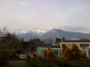
Monday 3rd till Tuesday 4th March saw the introductory lectures held for the 12th EuroSDR EduServ e-learning course at the University of Trento, Italy. Located just south of the Alps, the city sits in the Adige Valley so is surrounded by snow-caped mountains to give a picturesque view. The lectures were attended by a small delegation, mainly from national mapping agencies and universities from across mainland Europe. The four courses of the EduServ programme were introduced and presented by the various course leaders over the two days.
View from Bruno Kessler Foundation, Trento University
On the first day Professor Norbert Haala, of Stuttgart University, started proceedings and presented material for his course on high density imaging matching. He presented some of the results of DSM creation from different software packages as part of his EuroSDR benchmark on image matching, whilst giving an overview of the Semi-Global Matching (SGM) algorithm, which I am using as part of my PhD, It was shown how a dense point cloud can be created from UAV and aerial photography by using the SGM approach. Hopefully this workshop will give greater insight and help overcome issues that have been experienced with ‘noisy’ photogrammetric point cloud.
Afterwards Dr Petri Ronnholm, of Aalto University in Finland, presented his course on the integrated use of airborne laser scanning and aerial photogrammetry. This was again based around a EuroSDR benchmark which tested different methods for the integration of the two dataset, some of which will be used in the course. The lecture was concluded with an interactive session to discuss the advantages and disadvantages of integrating the two dataset and what future applications this could be used for. One point that arose and was discussed was whether there was a need to integrate the two datasets due to high density point clouds being created from imagery, by the principles outline previously by Professor Haala. It was concluded that although lidar is still essential for forestry application, research may prove that photogrammetric point clouds are just as suitable as lidar for other applications.
A meal was held after the first day’s lectures at a local restaurant in Trento, with exquisite pasta and other traditional Italian food enjoyed over four courses and wash down with a glass (or two) of local wine. This offered a great ice breaker and a way to get to know other delegates as well as the course leaders.
Dr Clement Mallet, of IGN France, started the second day by presenting material for his course on change detection in high-resolution land-use/land-cover geodatabases and presented work from his EuroSDR benchmark regarding change detection methods. The need for land cover and land use was introduced followed by many different approaches presented, which mainly used satellite imagery.
Dr Daniella Poli, of Terra Messflug GmbH, closed proceedings with the last of the four courses on mapping using high-resolution satellite imagery. An insightful overview was given of low resolution film-based satellites to new high resolution digital-based sensors as well as the processing that is required for processing the data. This carried on from some of the principles covered by Dr Mallet, giving more details on the processing that may be required in order to use satellite imagery including radiometric corrections and Rational Polynomial Coefficients.
Thanks to Fabio Remondino of Trento University for hosting an excellent introductory workshop. With the first course starting today (10th March) and the final course finishing on the on the 13th June it is hope many new skills will be learnt over the next four months.
Andrew McClune
PhD Student in Photogrammetry

