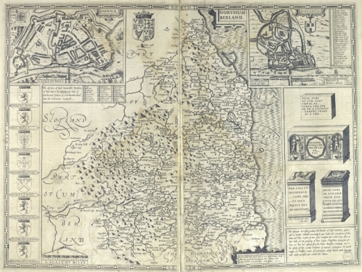
The theatre of the empire of Great Britaine : presenting an exact geography of the kingdomes of England, Scotland, Ireland, and the iles adioyning: with the shires, hundreds, cities and shire-townes, within ye kingdome of England.
London, : And are to be solde by I. Sudbury and G. Humble, 1611.
(Post Incunabula, Folio PI 912.42 SPE)
John Speed was born in Fardon, Cheshire in 1552. He was a tailor by trade, working in his father’s business until he was nearly 50. He then moved to London to work, but his main interest increasingly became the study of history. He joined the Society of Antiquaries. An allowance from Sir Fulke Greville enabled him to continue his research full time. William Camden encouraged him to begin a history of Britain.
The theatre of the empire of Great Britaine : presenting an exact geography of the kingdomes of England, Scotland, Ireland, and the iles adioyning: with the shires, hundreds, cities and shire-townes, within ye kingdome of England.
London, : And are to be solde by I. Sudbury and G. Humble, 1611.
(Post Incunabula, Folio PI 912.42 SPE)
The Historie of Great Britaine was published in 1611 but of greater importance was the atlas that accompanied it – The Theatre of the Empire of Great Britaine, published in the same year, which is the subject of this month’s Treasure.
The atlas contains maps for each of the counties of England and Wales, 5 maps of Ireland and a general map of Scotland.
The first map (Cheshire) had been ready for engraving in 1604 but the death, in that same year, of the person selected to engrave the maps caused a serious delay.
In 1607 Flemish engraver Jodocus Hondius Sr. based in Amsterdam was asked to carry out the engraving which was completed between 1607 and 1611.
The theatre of the empire of Great Britaine : presenting an exact geography of the kingdomes of England, Scotland, Ireland, and the iles adioyning: with the shires, hundreds, cities and shire-townes, within ye kingdome of England.
London, : And are to be solde by I. Sudbury and G. Humble, 1611.
(Post Incunabula, Folio PI 912.42 SPE)
Probably the earliest county atlas of England and Wales, most of the county maps contain town plans which in many cases were the first depiction of that town.
Although the county maps were based on earlier works many of the town plans were in fact surveyed by Speed.
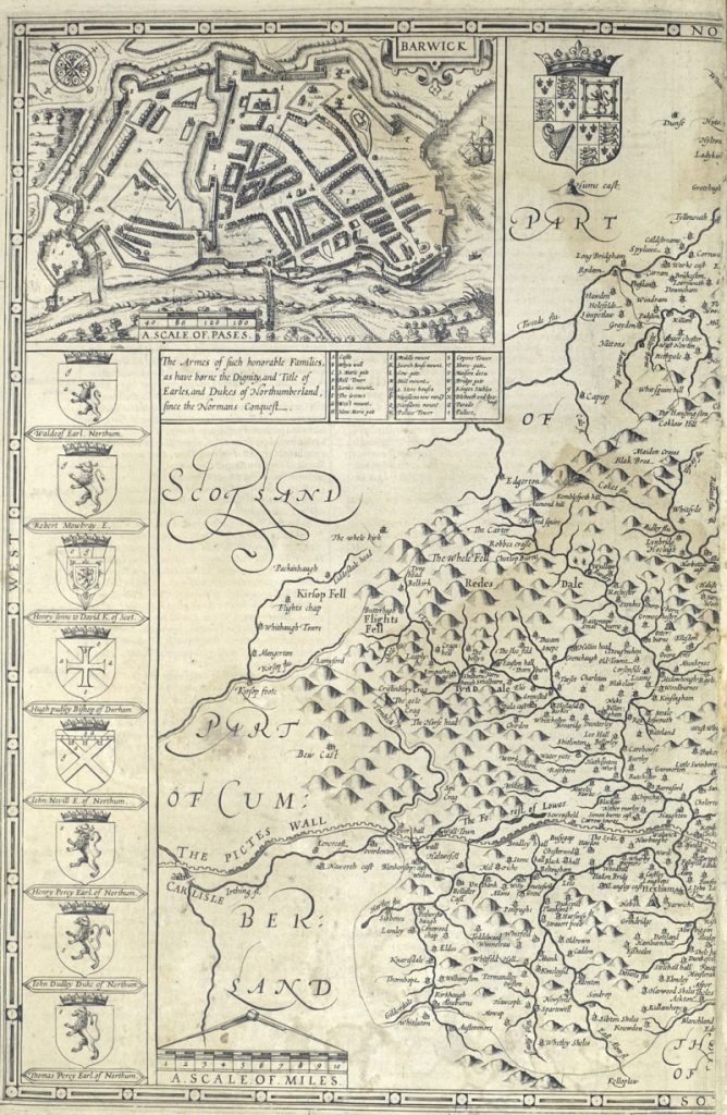
The town plans marked with a Scale of Passes [paces] being those that Speed had surveyed. A pace being equal to 5 feet.
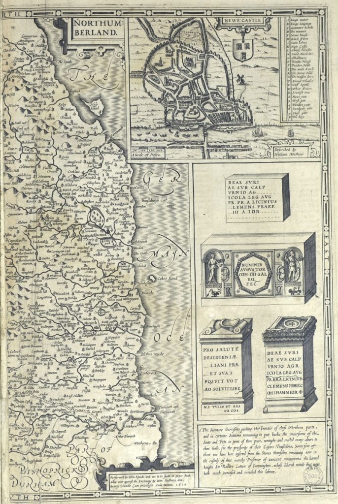
The Library’s copy of The Theatre of the Empire of Great Britaine is incomplete but does include the map for Northumberland. The eastern half of the map includes a plan of Newcastle and various antiquarian objects.
The theatre of the empire of Great Britaine : presenting an exact geography of the kingdomes of England, Scotland, Ireland, and the iles adioyning: with the shires, hundreds, cities and shire-townes, within ye kingdome of England.
London, : And are to be solde by I. Sudbury and G. Humble, 1611.
(Post Incunabula, Folio PI 912.42 SPE)
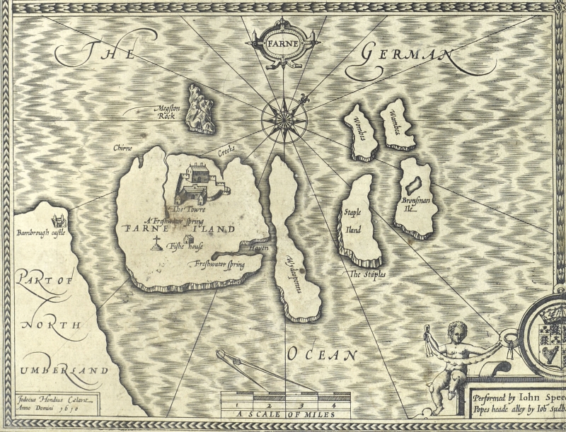
The western portion includes armorials of various local families and a town plan of Barwick [Berwick]. The Theatre of the Empire also includes maps of Farne and Holy Island.
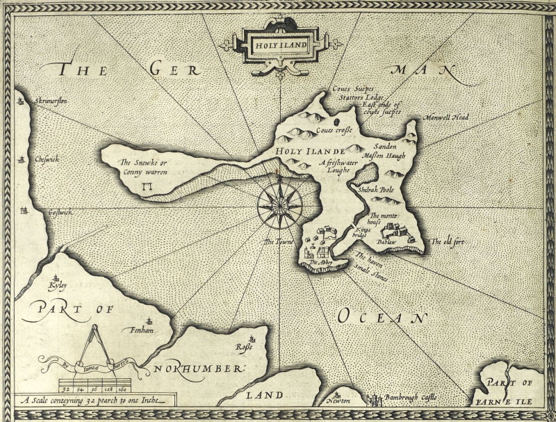
The theatre of the empire of Great Britaine : presenting an exact geography of the kingdomes of England, Scotland, Ireland, and the iles adioyning: with the shires, hundreds, cities and shire-townes, within ye kingdome of England.
London, : And are to be solde by I. Sudbury and G. Humble, 1611.
(Post Incunabula, Folio PI 912.42 SPE)
