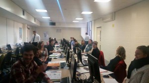
 This week we have over 20 NERC sponsored PhD students from across the country studying on a NERC sponsored Advanced Training Course. The students who come cover the whole gamut of NERC sponsored research are looking at how they can use GIS in their research. The course covers spatial analysis, spatial statistics, network analysis, terrain analysis, modelling tools and Python scripting. As well as working hard during the day the students are soaking up the famous Newcastle night life and making life long contacts. Hopefully, following the success of this course we will be able to provide future courses. Watch this space. This course is just one of the portfolio of GIS CPD and training courses that we offer see http://www.ncl.ac.uk/cegs.cpd/ for details.
Skip to content
