Where is Newcastle?

Following on from an early email exchange about how Google defined “Newcastle” it got me thinking about other providers and how they define the city. Twitter for instance provides a bounding box the centre of which is the middle of Nun’s Moor (as does Google but the point location is not the centroid of it). As you can see from the image there is wide variation. Note that a couple (Yahoo/Michelin) place the point location at the point roughly where the centre of the text “Newcastle upon Tyne” appears on certain map products.

The mean centre of the point locations excluding the centroids is shown as well.

Newcastle maps

So I visited a pile of map sites and extracted their default location (and/or bounding box) and plotted them on the map. For twitter I sent a tweet from “Newcastle upon Tyne” and captured the coordinates using the API. Just to be rigorous I installed TOR browser which obfuscates the IP address to ensure that location was not being picked up from the browser and tried different browsers as well. The OS point for Newcastle upon Tyne was collected from the Gazetteer service provided through Digimap.

The vaguely serious point here is that we now routinely use APIs to get data from and its location yet those locations provide spurious precision!

Instrumenting the City – @FutureCitiesCatapult

Just come back from a great workshop organised by Charlie Catlett from the University of Chicago Urban Center for Computation and Data and the Argonne National Laboratory. The outcome from this workshop has been a draft US/UK draft proposal for instrumenting cities. All we need now is the funding!

Charlie and Pete choosing Plan B - the wired option for Instrumenting the CIty
Charlie and Pete choosing Plan B – the wired option for Instrumenting the CIty

The workshop was hosted at the Future Cities Catapult new Urban Innovation Centre (freshly opened and still smelling of paint – btw geo people apparently the OS is taking a floor there for their Research and Innovation group). Over 2 days we discussed solar powered mini cells from Jacqueline Cole at Cambridge University/Argonne and were introduced to the Waggle platform and Array of Things by Pete Beckman and Rajesh Sankaran from the Argonne Lab – just a small part of the great stuff going on in Chicago. We also heard from Intel/Imperial’s Duncan Wilson about the work they are doing in London with Intel Collaborative Research Institute for Sustainable Connected Cites and the plans for instrumenting York from Alistair Boxall and the Capacitie project. One of the highlights was a tour of Umbrellium’s offices (and good Vietnamese food) in the company of Usman Haque the founder of Umbrellium (thingful.net and other things). Usman founded Pachube the sensor upload and data service.

We have already agreed to host some of Jacqui’s mini solar cell powered sensors and have already started to look at integrating Plenario (UCCD’s platform for displaying city metrics) as it is built on the same PostgreSQL/PostGIS/Python stack that we use for the Urban Observatory. Might be planning a trip to Chicago shortly!

NERC Advanced Environmental Analysis using GIS

nerccourseimage This week we have over 20 NERC sponsored PhD students from across the country studying on a NERC sponsored Advanced Training Course. The students who come cover the whole gamut of NERC sponsored research are looking at how they can use GIS in their research. The course covers spatial analysis, spatial statistics, network analysis, terrain analysis, modelling tools and Python scripting. As well as working hard during the day the students are soaking up the famous Newcastle night life and making life long contacts. Hopefully, following the success of this course we will be able to provide future courses. Watch this space. This course is just one of the portfolio of GIS CPD and training courses that we offer see http://www.ncl.ac.uk/cegs.cpd/ for details.

Geospatial Engineering in the Caribbean

This week myself and Neil Harris from the Geospatial Engineering group are participating in the second Technical workshop of the Cariwig project. Participants from the Climate Research Unit at UEA, the University of the West Indies Climate Studies Group, the Caribbean Community Climate Change Centre in Belize and representatives from the Instituto de Meteorología, Cuba have been discussing how best to use the web based climate data, analysis and visualisations tools developed by Neil and myself to create impactful case studies to show decision makers the potential impact of climate change across a variety of Caribbean countries and sectors.

A follow up meeting later this year will provide training in the web based tools to a large number of stakeholders in the region.

New PhD students join Geospatial Engineering

This September saw 5 new PhD students join the Geospatial Engineering group, working in the field of remote sensing and photogrammetry. Magdalena Smigaj is a NERC-funded student working with Forest Research and examining ways to improve early detection of tree health problems, with a focus on detection of disease in UK forests using airborne imagery, LiDAR and data from an unmanned aerial vehicle (UAV). Originally from Poland, Magdalena obtained a BSc in Surveying and Mapping Science from Newcastle University before commencing her PhD. Maria Peppa is jointly funded by the British Geological Survey and EPSRC, and is investigating the potential of UAVs for landslide monitoring, with focus on photogrammetric aspects. Originally a native of Athens, Greece, Maria recently completed a two year MSc in Geodesy and Geoinformatics at The Royal Institute of Technology, Stockholm, so has traded one chilly climate for another in her move to Newcastle. Elias Berra has come to Newcastle following a Masters in Remote Sensing at Universidade Federal do Rio Grande do Sol (UFRGS) in Brazil. Elias is funded by the Science Without Borders programme and will be developing methods for monitoring woodland phenology (seasonal changes) using the School’s UAV. Elias, Maria and Magda will be working together over the coming weeks and months to develop more practical skills related to piloting and planning UAV flights. Polpreecha Chidburee, who goes by the nickname of Aun, is a Thai-sponsored PhD student who will be developing a close range photogrammetric system for rapid assessment of slope instability hazard. Aun is expected to work closely with Maria and a number of other CEG PhDs focusing on slope failure challenges. Finally, Afrah Daham is the latest in a line of PhD students to join the group from Iraq. Afrah, who is sponsored by the Iraqi government, joined the group from the University of Baghdad, where she was a lecturer in photogrammetry. Afrah will be researching the field of feature extraction and building reconstruction from mobile laser scanning data, exploiting a unique mobile mapping dataset acquired for the Newcastle University campus over the summer of 2013.

From left to right: Maria Peppa, Afrah Daham, Magdalena Smigaj, Elias Berra and Polpreecha Chidburee

September.. it must be Kielder

As the leaves darken and the weather worsens, the new academic year starts with a bang as 50 students go off grid in Kielder, Northumberland to develop practical mapping and analysis  skills in a realistic setting.

Students from our Geographical Information Science, Surveying and Mapping Science, Physical Geography and Geography programmes spend 9 days collecting and analysing geospatial data using the latest technology.  We are based in the Calvert Trust Centre on the shores of Kielder Water surrounded by trees, midges and (well that’s about it…)

kielder
A fully networked geospatial gym!

Halfway through the fieldcourse, our students are “in the groove” , occasionally hampered by tricky conditions!  Students carry out a mix of detailed topographic survey tasks, DEM creation, Landuse mapping using remote sensed imagery and planning a new residential development site.  We are very grateful to the landowners and people of the Kielder valley who make us welcome each year.  So far, the torrential downpours of 2012 have been absent and conditions have been more benign, but there is time yet…

kielder dam in mist
Tricky survey conditions over Kielder dam

GISRUK 2013

A number of the Geospatial Engineering team attended GISRUK 2013 (Geographical Information Science Research UK)  http://liverpool.gisruk.org/ held at the University of Liverpool April 2nd ~ 5th.  Neil Harris presented a poster showing his work on the real-time air quality sensors and the NUIDAP architecture (Ncl Uni Integrated Data Access Platform) for transport and air quality modelling.  Javier Urquizo (Phd student in Architecture with Phil James and Carlos Calderon) presented  a paper his work on spatial urban energy models.

The short talks and lively atmosphere with a mix of young researchers and a digestive base of more mature academics and researchers provided a great platform for seeing the breadth and depth of GI research in the UK.  This year there were some interesting technology observations with R and PostGIS providing the underpinning to many analyses and research.   There were a also some great talks on visualisation (not a subject I normally warm to) including some great visualisations by keynote Jason Dykes (links can be found here: http://www.soi.city.ac.uk/gicentre/t/wordpress/jsndyks/gisruk-2013/).    GISRUK 2014 returns to Glasgow.  For those that remember the last time – bring on the beige food and the ceilidh dancing (or maybe not..).

Nice summary of some of the talks here: http://gogeo.blogs.edina.ac.uk/2013/04/09/gisruk-2013-liverpool/  Thanks to Addy Pope at EDINA.

Updating Geometry Columns for views in PostGIS

The recent upgrade to PostGIS has caused some issues with geometry types when creating views from geometry that don’t use the new typemod geometry modifiers.  The following workaround correctly inserts an entry into the geometry_columns view so you can see your data in QGIS and the like:

DROP VIEW myview;

CREATE OR REPLACE VIEW myview AS (

SELECT field1, field2, field3,

St_Transform(the_geom, 27700)::geometry(Point, 27700) as the_geom

FROM mytable

);

Change the geometry type and CRS as required.

Newcastle Geospatial Engineering part of the OSGEO labs for Research and Education

Press release:

We are pleased to announce the establishment of Open Source Geospatial Research and Education Laboratory at the University of Newcastle, United Kingdom. The laboratory is one of the members of a worldwide network developed under the auspices of the ICA-OSGeo Memorandum of Understanding (MoU).

In 2011, the International Cartographic Association (ICA) signed a Memorandum of Understanding (MoU) with the Open Source Geospatial Foundation (OSGeo) with a view to develop global collaboration opportunities for academia, industry and government organisations in the field of open source GIS software and data. The MoU aims to provide expertise and support for the establishment of Open Source Geospatial Laboratories and Research Centres across the world to support the development of open source geospatial software technologies, training and expertise.

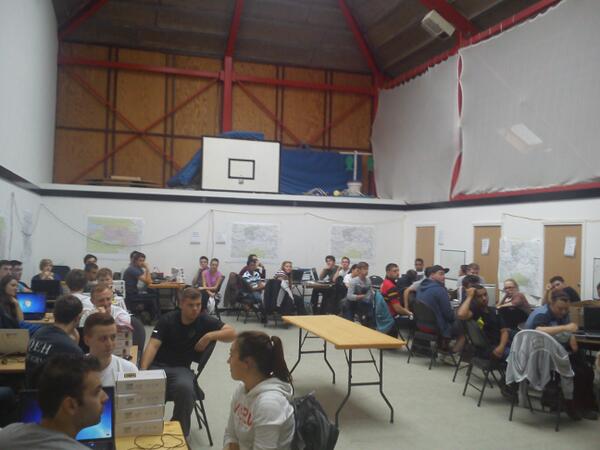
Newcastle University  is one of the leading geospatial research group in the UK and have very strong research and teaching expertise and well developed CPD programs etc.  The Open Source Geospatial Research and Education Laboratory  is run by the Geospatial Engineering Research Group but draws heavily on interactions with other research groups and partners within the University, nationally and internationally. The Geospatial Engineering Group supports the development and training of Open Source Geospatial technologies by utilising these technologies to carry out fundamental research and to deliver geospatial solutions to engineering problems.   They also provide training both as part of thier Undergraduate degree programmes in Surveying and Mapping Science, Geographic Information Science and Physical Geography as well as through short training courses.

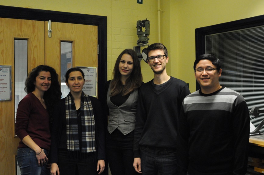
Open Source Geospatial Research and Education  Lab at Newcastle University is led by Dr Philip James. Key members of the lab are Dr Stuart Barr,Dr David Fairbairn,Dr Rachel Gaulton,David Alderson,Alistair Ford ,Dr Pauline Miller and Neil Harris.

The website of the new lab is at http://research.ncl.ac.uk/osgeolab/

Over the last 6 months,  we have a rapidly expanding network of Open Geospatial Labs and we are now in the process of setting up Open Geospatial Lab Network node site within OSGeo website  so that all participating labs urls can be added to this.

We are actively working in expanding this ICA-OSGeo initiative (http://www.osgeo.org/node/1230) globally in our aim to bring the benefits of geospatial technology to all.

We especially welcome applications from universities, educational institutes, government organisations in developing countries to develop capacity building in geospatial education by establishing Open Source Geo Labs. Details of how to apply for OSGeo Lab is at http://wiki.osgeo.org/wiki/Edu_current_initiatives

We wish you all the best for the Holiday Season and the New Year.

Best Wishes,

Dr Suchith Anand

Nottingham Geospatial Institute
Nottingham Geospatial Building

University of Nottingham NG7 2 TU
Tel: (0)115 82 32750

Google should do Google Geometry search (or why Inspire might be a waste of time)

I have spent the last 10 years organising, analysing and presenting spatial data in a variety of projects. My research has led me into the dark corners of transport modelling, climate statistics, energy modelling and a whole host of other fields. Spatial data underpins all these disparate activities (and we also make cool maps and use cool tech). However, I am increasingly frustrated by the effort that goes into finding and looking for spatial data. In the UK we are sort of OK as far as it goes as we have the Ordnance Survey and a few commercial and academic portals that provide (at a price) one stop shopping for most things. I suspect the situation is similar in most first world nations but that certainly is not the case in many other places.

I have now sat through a number of presentations on INSPIRE, have looked through geoportals both open and closed, battled with OGC metadata specs, geoserver config and openlayers and come to the realisation that we should just let Google do it. Think about it, they have the financial clout, the technical clout and they are probably (definitely in my case) smarter than us anyway. I envisage a Google geometry search so that I type a place name and I find spatial data stored as a file of geometry (raster or vector) as the result.

Ah, but will it be the right one – well surely this is just another good use for Page Rank? Is it not the case that more likely than not in the UK we will use an Ordance Survey Opendata admin boundary. Surely their metrics will show this? I mostly want the best information for the job and this could give it, quickly, easily and cleanly. Page rank for spatial can do what ISO 19115 will never do and provide a filter of perceived utility.

Ah, but “spatial data is more complex”. Is it really? What is complex about it that big compute and big tech cannot sort? Take projections – why can’t we just reproject our data a la Google translate (easier as it is just maths not language). What about layers of geometries that interact spatially – well this is resolved using a spatial index in a database – I suspect having a massive spatial index of all the objects in the world would not be a stretch for a company whose starting point is an Index. And format conversion – that is just compute – shouldn’t be an issue (or perhaps just index and cache call the converted versions for everything). Linking spatial data to a rich keyword based and natural language processing means we should be able to find things – alternative geographical names fall out of the system (and as a not insignificant byproduct the number of neogeography talks may dwindle).

Imagine a world where I want data on Nigeria Rivers and I type into Google Geometry such a query term – the result, peer reviewed by the vast caucus of humanity (or those special ones interested in spatial anyway) is a link to a file that I can visualise online, download and add value to or combine in a web based “mash up”. One suspects our tools would be simplified as well when data is easy to find, view and retrieve.

We can then ditch the metadataverse and multiple WMS/WFS endpoints and catalogue services that make up the current crop of portals and the INSPIRE vision and do what we do best – use spatial to help understand the world and make better decisions.  If this is the way that users expect spatial data then there is incentive to put your data out there (and let Google find it and index it).  There’ll need the spatial index anyway to do sensors properly (but that’s another story).

GeoAnorak. Changing the world one vertex at a time.