
NEW BLOG POST CORRECTING ERRORS HERE
As I imagine happens at many work places the coffee break for the Geospatial group often brings up some lively debates. Whilst today’s debate itself wasn’t exactly lively it did pose an interesting question. Which football ground is the further away from a mainline railway station? The answer put out there Hillsborough. Not content with this guesswork I ran a simple piece of analysis. Luckily we have the football grounds from the work we carries out with the football tweets (previous blog & site) and the the railway stations from work carried out for ITRC (http://www.itrc.org.uk/).
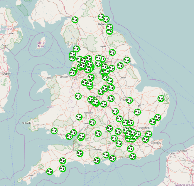
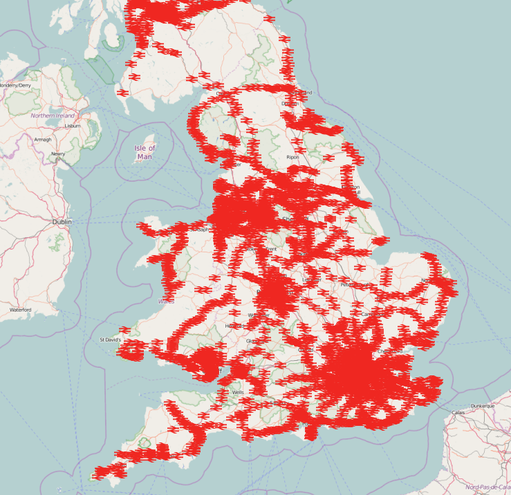
Therefore all i had to do was look at the nearest railway station to each ground and calculate the distance between them. I did this by loading both datasets into PostgreSQL + PostGIS and performing a few simple queries. The results are below: Whilst Hillsborough wasn’t the furthest it wasn’t far off.
Ideally we’d look at the distance along the UK road network and not straight line distance. But this seems somewhat overkill for answering this question.
Neil
| Football Club | Stadium Name | Railway Station | Distance (m) |
|---|---|---|---|
| Fleetwood Town | Highbury Stadium | Poulton-le-Fylde | 7908.11125559371 |
| Bury | Gigg Lane | Clifton | 6660.52530406908 |
| Sheffield Wednesday | Hillsborough | Sheffield | 4531.43899643992 |
| Yeovil Town | Huish Park | Yeovil Pen Mill | 4305.2978740895 |
| Oxford United | Kassam Stadium | Radley | 4089.74370918289 |
| Coventry City | Ricoh Arena | Bedworth | 3965.19467363248 |
| Wycombe Wanderers | Adams Park | High Wycombe | 3796.07635929164 |
| Reading | Madjeski Stadium | Reading West | 3669.95693983928 |
| Cheltenham Town | Whaddon Road | Cheltenham Spa | 2983.6953569951 |
| Dagenham and Redbridge | Victoria Road | Dagenham Dock | 2598.82359490238 |
| Colchester United | Weston Homes Community Stadium | Colchester | 2573.12612621598 |
| Scunthorpe United | Glanford Park | Althorpe | 2568.65402852626 |
| Shrewsbury Town | New Meadow | Shrewsbury | 2532.86554400019 |
| Cambridge United | Abbey Stadium | Cambridge | 2371.65580933094 |
| Preston North End | Deepdale | Preston | 2220.26792889295 |
| Doncaster Rovers | Keepmoat Stadium | Doncaster | 2207.80263428059 |
| Stoke City | Britannia Stadium | Stoke-on-Trent | 2201.7962708601 |
| Rochdale | Spotland Stadium | Rochdale | 2098.43404250318 |
| Burton Albion | Pirelli Stadium | Burton-on-Trent | 2091.47360872247 |
| Queens Park Rangers | Loftus Road | Kensington Olympia | 2050.97406409029 |
| Bristol Rovers | Memorial Stadium | Montpelier | 2015.77067665531 |
| Swansea City | Liberty Stadium | Swansea | 1980.92022136336 |
| West Ham | Boleyn Ground | Woodgrange Park | 1929.54896518672 |
| Macclesfield Town | Moss Rose | Macclesfield | 1901.57512833285 |
| Chesterfield | B2net Stadium | Chesterfield | 1856.0814157692 |
| Port Vale | Vale Park | Longport | 1840.42432657788 |
| Northampton Town | Sixfields Stadium | Northampton | 1821.98141599042 |
| Oldham Athletic | Boundary Park | Oldham Werneth | 1808.16787682106 |
| Liverpool | Anfield | Kirkdale | 1738.52974959448 |
| Leicester City | King Power Stadium | Leicester | 1725.57185592057 |
| Manchester United | Old Trafford | Trafford Park | 1671.87218748047 |
| Torquay United | Plainmoor | Torre | 1667.13531194068 |
| Stevenage Borough | The Lamex Stadium | Stevenage | 1595.47056887281 |
| Fulham | Craven Cottage | Putney | 1586.58592171703 |
| MK Dons | Stadiummk | Fenny Stratford | 1555.74401416301 |
| Crawley Town | Broadfield Stadium | Crawley | 1483.25999132287 |
| Tranmere Rovers | Prenton Park | Rock Ferry | 1461.01057568374 |
| Leeds United | Elland Road | Cottingley | 1460.72706001557 |
| York City | Bootham Crescent | York | 1424.83761465897 |
| Carlisle United | Brunton Park | Carlisle | 1400.33683628771 |
| Accrington Stanley | Crown Ground | Accrington | 1386.80058458418 |
| Hull City | KC Stadium | Hull | 1372.8238336756 |
| Wigan Athletic | DW Stadium | Wigan Wallgate | 1354.71103755325 |
| Barnet | Underhill Stadium | New Barnet | 1331.81735155781 |
| Peterborough United | London Road | Peterborough | 1291.81586333005 |
| Manchester City | Etihad Stadium | Ashburys | 1283.26185362597 |
| Southampton | St Mary’s Stadium | Woolston | 1242.27676803219 |
| Plymouth Argyle | Home Park | Plymouth | 1241.72387816119 |
| Huddersfield Town | The Galpharm Stadium | Huddersfield | 1223.89758310361 |
| Luton Town | Kenilworth Road | Luton | 1207.43855797424 |
| Nottingham Forest | The City Ground | Nottingham | 1190.56463654538 |
| Bristol City | Ashton Gate | Parson Street | 1118.57856017793 |
| Blackburn Rovers | Ewood Park | Mill Hill (Lancashire) | 1118.44597418967 |
| Leyton Orient | Brisbane Road | Leyton Midland Road | 1110.75176145117 |
| Morecambe | Globe Arena | Bare Lane | 1104.26121401745 |
| Burnley | Turf Moor | Burnley Central | 1099.33701322422 |
| Sunderland | Stadium of Light | Sunderland | 1055.4979571639 |
| Sheffield United | Bramall Lane | Sheffield | 1049.19338825299 |
| Swindon Town | The County Ground | Swindon | 1046.99266525118 |
| Middlesbrough | Riverside | Middlesbrough | 1039.53610939064 |
| Derby County | Pride Park | Derby | 1036.0030157922 |
| Everton | Goodison Park | Kirkdale | 1023.2951415739 |
| Bournemouth | Seward Stadium | Pokesdown | 948.719417631076 |
| Bradford City | Valley Parade | Bradford Forster Square | 887.461708978663 |
| Newcastle United | St James Park | Newcastle | 882.06576774756 |
| Notts County | Meadow Lane | Nottingham | 774.620214342908 |
| Wolverhampton Wanderers | Molineux | Wolverhampton | 765.334742248787 |
| Birmingham City | St Andrews | Bordesley | 739.514349756714 |
| Gillingham | Priestfield Stadium | Gillingham (Kent) | 739.141518305716 |
| Portsmouth | Fratton Park | Fratton | 723.641439892184 |
| Watford | Vicarage Road | Watford High Street | 723.345746538908 |
| Newport County | Rodney Parade | Newport (South Wales) | 698.880470762071 |
| Blackpool | Bloomfield Road | Blackpool South | 697.435988426917 |
| Barnsley | Oakwell | Barnsley | 682.917115524344 |
| Crystal Palace | Selhurst Park | Selhurst | 677.760455528003 |
| AFC Wimbledon, Kingstonian | Kingsmeadow | Berrylands | 674.163052791649 |
| Chelsea | Stamford Bridge | West Brompton | 669.65763374968 |
| Southend United | Roots Hall | Prittlewell | 648.744802036577 |
| Hereford United | Edgar Street | Hereford | 641.878247423655 |
| Mansfield Town | Field Mill | Mansfield | 519.745391130574 |
| Brighton and Hove Albion | Amex Stadium | Falmer | 508.088645989644 |
| Norwich City | Carrow Road | Norwich | 502.075507307756 |
| Brentford | Griffin Park | Brentford | 469.248811545038 |
| Ipswich Town | Portman Road | Ipswich | 449.735676979146 |
| Cardiff City | Cardiff City Stadium | Ninian Park | 446.968827575298 |
| England | Wembley | Wembley Stadium | 444.804879003609 |
| Wales | Millennium Stadium | Cardiff Central | 435.803806645578 |
| Hartlepool United | Victoria Park | Hartlepool | 427.446542975968 |
| Aldershot Town | Recreation Ground | Aldershot | 427.090743110385 |
| Rotherham United | New York Stadiumn | Rotherham Central | 423.627007354715 |
| Charlton Athletic | The Valley | Charlton | 417.116709260371 |
| Tottenham Hotspur | White Hart Lane | White Hart Lane | 409.064526485295 |
| West Bromwich Albion | The Hawthorns | The Hawthorns | 394.729198538797 |
| Bolton Wanderers | Macron Stadium | Horwich Parkway | 385.009392892004 |
| Aston Villa | Villa Park | Witton | 337.23715256677 |
| Millwall | The Den | South Bermondsey | 331.809250300019 |
| Walsall | Bescot Stadium | Bescot Stadium | 304.080986833392 |
| Arsenal | Emirates Stadium | Drayton Park | 301.141025758736 |
| Crewe Alexandra | Gresty Road | Crewe | 248.015731120882 |
| Exeter City | St James Park, Exeter | St James’ Park | 140.15324879625 |
If Kensington Olympia is a mainline station, then surely Shepherds Bush must be as well. Making QPR’s nearest station 1127 metres away and not the 2050 metres you’ve stated.
Yes you are correct. For one reason or another Shepherds Bush was not in our dataset and probably should have been. well spotted
You’ve referenced Bedworth as being the nearest mainline station to theRicoh Arena. In fact if that line (Coventry – Nuneaton) is a main line, then the nearest station is actually at the Arena itself, less than 200 metres away.
The station was specifically built to cater for the Arena and the nearby shopping centre. The only problem football and rugby fans have is that the trains stopping there consist of one carriage every hour!
However, London Midland don’t operate a service to that station on CCFC match days…
Yes the dataset we had didn’t have this station in because of it not being open that long.
Given that a few people have spotted little errors like this we’re probably going to run the analysis again.
Yes, so using that station is a fallacy.
Woodgrange Park (WHUFC) no longer “mainline” – absorbed into the London Overground network in April 2015. Nearest station now I guess either Forest Gate or Barking?
London Overground network is part of the National Rail network and so is still ” mainline “.
Only Royston Town fans travel to their stadium in a straight line #crows
The Amex Stadium is nothing like 508m from Falmer Station. More like 120m.
Yes. Well spotted, you are correct to flag this distance up. Unfortunately the location of the Amex stadium in our db is not quite correct which we were not aware of.
Is we get the time to run this quick piece of analysis again we’ll try and rectify the errors the eagle-eyed fans have spotted
Surely the Fleetwood tram station should qualify?
For this quick piece of analysis we didn’t consider tram stops only the pre-existing dataset we had. But should we get more time and run this again we probably should include tram stops.
A fascinating bit of data analysis but also a few more annoying bits of pedantry for you.
Aldershot, barnet, hereford, Torquay and tranmere and Cheltenham are currently not league clubs so should probably only be on the list if you include the other conference national clubs.
Oldham Werneth station closed in 2009
Manchester United Football Ground station may only have a limited matchday service but it is still officially a mainline station
To be really anal the location used for Exeter City appears to be the reception area which , ironically is the furthest part of the ground from the station; the closest entrance is more like 20 metres away
bits of pedantry are both noted and appreciated.
Yes I’ve now noticed that a few non-league teams slipped into this test. These are possibly newly relegated clubs we had from analysis done in the past of football tweets.
Yep think again the age of the station dataset resulted in errors like this.
Not sure why MUFC’s station was missing but we have it now.
All distances are measured from the centre of the station to the centre of the ground this.
I’ve run the analysis again here
https://blogs.ncl.ac.uk/geospatialengineering/2016/04/20/football-ground-nearest-station-mark-ii/
Barnet’s ground moved from Underhill to the hive, possibly making Kenton the nearest station?
This has been recitfied in this blog post https://blogs.ncl.ac.uk/geospatialengineering/2016/04/20/football-ground-nearest-station-mark-ii/
….leading to a new debate…..The Importance of Data Quality….
Indeed! and the power of the crowd. Identifying that there were errors manually would have taken too long for what was a simple test.
https://blogs.ncl.ac.uk/geospatialengineering/2016/04/20/football-ground-nearest-station-mark-ii/
Nice initial analysis. Definitely need to try to include the likes of the Manchester Metrolink though, e.g. Bury Bolton Street station is not that far from Gigg Lane, and hence the light railways / tram services skew the stats somewhat now. Not sure about displaying the distances to the nearest 10 picometres though!