Summer 2015

After a long summer of glorious sunshine and topical temperatures the new academic year us upon us. Ok, so it may not have been that warm, or in fact that sunny, but that has not stopped us from getting on with our research.

To start with the PhD office has had a bit of a refurb, with a new coat of paint adorning the walls. As well as this, the wall, if you could call it that, between the two half’s of the room has been made permanent giving the PhD’s some piece and quite from the (excited?) undergraduates. At the same time the room was expanded to accommodate a further 8 desks, which brings me on to the next news..

Following the successful award of the DREAM CDT amongst other things, a total of 7 new PhD students are due to start in the coming weeks across both the geospatial engineering group and the geodesy group, meaning those new desks will soon be filled with excited and ambitious students.

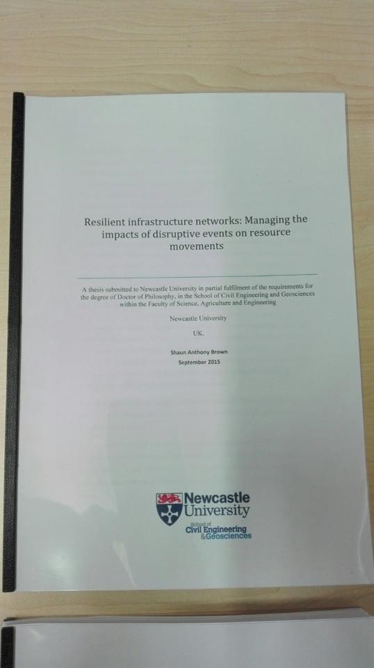
And to round off the news on PhD students, Shaun Brown, Daniel Caparros-Midwood and Stephen Obrike have submitted or are about to, with both Shaun and Dan taking jobs up earlier in the year. All have clearly been making full use of their time, submitting within two weeks of their deadlines. A with all PhD submissions, the final step is the photo..

Shaun_Brown_Thesis

That’s all the PhD news for now, and more posts will follow on other activities during the summer and throughout the autumn. We have been busy…honest…


Pastures new for the nearly done boys

In the past few months two of our current PhD students have departed for pastures new, but of course neither could leave the field of geospatial science and technology.

Shaun has joined Ordnance Survey working within their photogrammetry team and assisting with the digitising of data from the collected aerial imagery. However, as an unforeseen consequence of this move (for this born and bread Newcastle supporter), he now wears the red and white colours of his adopted running club in Southampton. I’m not too sure he will ever live this down…

More recently Dan has left the group after six and a half (some may say eventful) years; three years as an undergraduate and the remainder as a PhD student. He has moved to AMEC in Shrewsbury where he now works as a GIS consultant. To our surprise we have been told the England students and lion’s student rugby league player has also retired from rugby as a result of this move, though we would not be surprised to hear otherwise when he next returns.

Good luck to them both and no doubt we will be seeing them again as they return for meetings and their viva’s throughout the next 6 months.

GISRUK 2015

A group of 6 staff and PhD students attended the annual UK GIS conference (GISRUK) being hosted by Leeds University. With all but one presenting (though now GISRUK regular Phil James was named on three of the six presentations), the groups diverse and interdisciplinary range of work which related to GIS was well covered.

Congratulations must be given to Neil Harris and Craig Robson who won best paper for their paper entitled “Real time coupled network failure modelling and visualisation”. No doubt this was (at least in part anyway) down to a live demonstration by Neil during the presentation of the developed software/framework which worked (or so it appeared to those less who hadn’t seen it before!). See below for a link to the abstract and presentation.

It was also good to see a number of alumni who have continued to work in the field of GIS upon departing our department after three years of study.

Finally a thanks to organizing committee for putting together a great conference and for the bursary awarded to Craig.

The official conference proceedings can be found here.

Links to the six presentations (and abstracts) are below:

  • “Real time coupled network failure modelling and visualisation”,  Neil Harris, Craig Robson, Stuart Barr and Phil James (Winning paper).
  • “Assessing the need for infrastructure adaptation by simulating impacts of extreme weather events on urban transport infrastructure”, Alistair Ford, Maria Pregnolato, Katie Jenkins, Stuart Barr, and Richard Dawson.
  • “Evolutionary Computing for Multi-Objective Spatial Optimisation”,  Daniel Caparros-Midwood, Stuart Barr and Richard Dawson.
  • “A geospatial relational database schema for interdependent network analysis and modelling”, David Alderson, Stuart Barr, Tomas Holderness, Craig Robson, Alistair Ford and Ruth Kennedy-Walker.
  • “Football fan locality- An analysis of football fans tweet locations”, Neil Harris and Phil James.
  • “Spatially modelling dependent infrastructure networks”, Craig Robson, Stuart Barr, Phil James and Alistair Ford

NERC Centre for Doctoral Training on Risk and Mitigation using Big Data award

School of Civil Engineering and Geosciences consortium awarded NERC Centre for Doctoral Training on Risk and Mitigation using Big Data.

The School of Civil Engineering, as part of a consortium between Cranfield, Newcastle, Cambridge and Birmingham Universities, have been awarded a NERC Centre for Doctoral Training on Risk and Mitigation using Big Data. The DREAM (Data, Risk And Environmental Analytical Methods) consortium comprises academics with expertise in environmental risk management and big data technologies and techniques. The consortium will train the next generation of risk specialists on the opportunities of ‘big data’ to improve our understanding of environmental risk mitigation options for industry, businesses, government and society. Over the coming years, DREAM will support 30 PhD students undertaking postgraduate research that seize the opportunities of ‘big data’ analytics to develop effective risk management strategies across the environmental sciences.

As part of the DREAM consortium, staff from the Water Resources and Geomatics research groups in the School of Civil Engineering and Geosciences will work with doctoral students on developing the next generation of big data and high performance computing approaches required to refine, scale and expand our ability to address key research questions being posed by industry and government in relation to risk assessment of geohazards, mitigation and management of extreme climate events, understanding and managing environmental risks faced by critical infrastructure systems and developing robust  long term sustainable protection plans of the Earths geobiophysical systems.

DREAM doctoral students at Newcastle will develop during the course of their research a comprehensive scientific skills set to address the challenges of risk mitigation in the environmental sciences. As our ability to monitor the Earth’s processes improves through a diverse range of different sources of data ranging from satellite observations through to ‘crowd sourcing’ it is imperative that modern environmental scientists are able to leverage maximum utility from the often diverse and large volumes of data available. DREAM students will receive training in how ‘Big Data Science’ can facilitate this, from the utilisation of different forms of high performance computing such as the cloud, utilising modern approaches to manage large heterogeneous environmental databases, through to the development of new computational approaches for analysis, modelling and synthesis of complex large volume environmental data-sets. In addition to developing skills in the use of ‘Big Data Science’ students will also receive project specific training in relation to environmental hazards, environmental impact and risk analysis methodologies, and training in risk mitigation and management.

The DREAM consortium is led in Newcastle University by Professor Chris Kilsby (Newcastle Director: chris.kilsby@newcastle.ac.uk) and Dr Stuart Barr (Academic Manager: stuart.barr@newcastle.ac.uk). Overall coordination of the consortium is being led by Cranfield University. Further details reading the award can be found at http://www.nerc.ac.uk/latest/news/nerc/bigdata/.

Autumn in the PhD office

To begin with, in September we welcomed three new PhD’ students to our group, Ben Grayson, Lyndsey Graham and Mustafa Hameed. The former, Ben, is used to the surroundings having completed our surveying and mapping science degree (BSc), graduating over the summer. Lyndsey and Mustafa join us from other institutions, adding to the diverse range of students currently amongst the cohort of PhD students. They will soon submit their proposals so look out here for updates on their research subjects.

Back to the more experienced PhD students, Daniel Caparros-Midwood (4th year) attended and presented at a conference in Taiwan on his work in finding the optimal spatial locations for developments given the changing climatic conditions. Also, this week Andrew McClune is attending and presenting in Southampton at an Ordnance Survey’s research event for their researchers, affiliated researchers (including PhD students) and invited guests.

Looking forward within the past month a number of PhD students, researchers and staff have submitted abstracts for the GISRUK (GIS Research UK) conference, being hosted by the University of Leeds in 2015. Being an annual dedicated GIS conference in the UK it usually attracts a good mix of presenters and attendees from a spectrum of backgrounds, with our group usually well represented at the conference. If interested, the conference is still open to submissions for presentations and posters.

Finally, Andrew McClune has been working hard over the past few months in arranging the annual RSPSOC (Remote Sensing and Photogrammetry Society) student and early career researchers conference, wavelength, which is to be hosted by our department in the spring, March 30th – April 1st. The abstract deadline for submissions is 9th January, and for those wishing to attend and/or experience Newcastle, recently voted the UK’s best city (which to be honest we already new!), details will be released closer to the event so keep an eye on this blog, the website@rspsoc_wlength  or @GeospatialNCL.

GIScience – Vienna

Craig Robson made the trip to Vienna for the 8th GIScience conference, hosted by the Technical University of Vienna (TU). This four day conference, showcasing some of the leading research in the science of geographic information, consisted of a day of workshops and three days of presentations, a poster session and a panel session. Sessions covered a whole host of topics from work related to landcover/use, use and issues of user generated data, spatial analysis and many other areas (see here for programme). The varied nature of the session themes highlights not only the interdisciplinary aspect to the conference, but also the GI science field in which we find ourselves in.

During the conference a number of talks were of particular interest, including a talk on “Detecting Origin-Destination Mobility Flows From Geotagged Tweets in Greater Los Angeles Area”,  which talked about how using tweets from twitter commuting patterns could be mapped for a large area, such as Los Angeles, similar work to that done by Neil Harris for Tyne and Wear (a precursor to the work Craig was presenting).  As well as this a talk on how we can map population distributions, using mobile phone call data, where it is possible to map the shift between weekdays and weekends as well as during holiday periods of the population distributions. The talk used an area of northern France as an example, including Paris, where significant trends, such as shift away from Paris and towards the coast could be seen for example at weekends during the summer as well an increase around tourist locations such as Disneyland Paris. There are too many talks which were of interest to go through, though tracks of particular note included those on Spatial Analysis as well as the key note sessions, with all three providing insights into a different are of GIScience (speakers were Herbert Edelsbrunner, Renee Sieber and Jason Dykes).

Below, the  location for the conference dinner, the Rathaus (the city town hall), a splendid surround showing off the history and culture of the host city (even if it did have the Roncalli circus outside).

20140929_154924

Craig himself presented a poster on research undertaken with Neil Harris (with the supervision of Dr Stuart Barr and Phil James) on the spatial and temporal dynamics of critical infrastructures when exposed to perturbations. The poster, the extended abstract and an example failure video are available at/through the above link, or the video can be found directly here.

This was the first of two conferences Craig was attending in Vienna, the second being the second conference on Next Generation Infrastructure, for which a number of staff and fellow students joined him for. A post on this conference will shortly follow.

SCCS – student conference on complex systems

Craig Robson attended the SCCS conference (Student Conference on Complex Systems), organised by PhD students from the University of Southampton’s Institute for Complex Systems Simulation, hosted by Sussex University (not to be confused with the University of Brighton just the other side of Falmer railway station!). With a selection of workshops on the Tuesday afternoon to kick the conference off, it started well and continued in the same fashion. Professor Mark Newman began a series of four key note sessions which would run throughout the conference, talking about some of his work on complex networks (providing a good introduction for those who were less than familiar with the field of network science), while providing thoughtful insight into the on complex networks research.

The second day was opened by a key note presentation from Gilbert on ‘Quality in computational modelling’, providing some useful thoughts on ensuring research results are statistically valid. Following this saw the beginning of the student presentations, with four sessions running in parallel offering a wide and varied selection of topics to the 200+ delegates in attendance for the rest of the day. Sessions ranged from ‘Language and Social Dynamics’, to ‘Swarm Robotics’ through to ‘Network Science Applications’. With 48 presentations in total there was no end of choice and from a range of complex systems related fields, with presenters mostly PhD students. The second day was closed by the third keynote, Henrik Jensen, speaking on ‘emergent collective behaviour’ with reference to neuroscience and ecology.

The final academic day of the conference saw the completion of the academic track of the conference with a further 36 presentations and a key note from Eors Szathmary on ‘growth, selection, evolution and learning’. Sandwiched between these were two panel sessions; the first based around careers, and the second the area of complex science and how this will/is evolving. The panels consisted on invited speakers and guests from a range of backgrounds, including academia and business. These provided a wider view of the applicability of complex systems science to the wider world and the future direction which the field may take.

To round the conference of the obligatory conference dinner followed, held at the Grand Hotel, with a SpaceDog chosen to provide the music for evening, something which certainly made the dinner stand out from other such events.

When in Brighton…

Brighton Pier - seen better days
Brighton Pier – seen better days

And the slightly better one…

Photo of Brighton Pier
Brighton Pier

While in attendance Craig gave an oral presentation.

Seminar by Prof. Pascal Perez on urban simulation and planning

TransMob: A micro-simulation model for integrated transport and urban planning.

Prof Pascal Perez, SMART Infrastructure Facility, University of Wollongong, NSW

4-5pm, 24th May, Room 2.32: Cassie Building, Newcastle University

To book your place please register online


How will current socio-demographic evolution affect future transport patterns and traffic conditions?

How will urban development and transport policy influence the quality of life of various segments of the local community?

The ‘Shaping the Sydney of Tomorrow’ Project (StSoT) was commissioned by Transport for NSW (Australia) to better understand the interactions between transport and land-use dynamics as experienced by individuals and households over extensive periods of time (15-20 years). Stepping away from traditional optimisation, our model focuses on anticipating short and long-term emergent consequences and feedbacks resulting from interactions between people and their urban environment, through the creation of ‘what-if’ scenarios (risk assessment approach).  The innovative design and development of TransMob aims to challenge three traditional but highly limiting modelling assumptions:

•Long-term steady-state equilibrium of the system: in fact, transport services and urban development co-evolve along with socio-demographic changes in highly dynamic ways and out of equilibrium.
•Feed-forward effect of urban development on transport networks: in fact, evidence suggests that there is a strong feedback effect of transport solutions onto land-use changes.
•Homogeneous and utility-based social responses to transport and land-use planning: in fact, there is more to decisions on transport modes or residential locations than pure micro-economic reasoning; most unintended consequences stem from unexpected heterogeneous individual considerations.

TransMob is made of six modelling components: (1) synthetic population, (2) perceived liveability, (3) travel diaries, (4) traffic micro-simulator, (5) transport mode choice and (6) residential location choice. The model is applied to the inner south-east area of Sydney metropolitan area and simulates the evolution of around 110,000 individuals and 50,000 households over 20 years, according to various transport and land use scenarios.

Adaptation Training School – Bilbao

From the 18-22 February 2013 the Adaptation Training School (COST Action TU-0902) was held in Bilbao, Spain. The main objective of the training school was to generate basic knowledge for adaptation management in beginner cities. It also aimed to provide an opportunity to identify key policy needs to overcome difficulties for adaptation implementation at local level, helping scientific agents to scope and align their research with those needs.

Each day was split into to three main sections; firstly a group of presentations in the morning, with secondly a practical exercise in the afternoon (outlined before).

On the Monday sessions were led by Efrén Feliu, and some of his colleagues from Tecnalia in which an overview of the week’s timetable, as well as to an introduction to vulnerability assessment. Tuesday consisted of presentation & a practical exercise from Astrid Westerlind Wigström on the Adaptation Management cycle. In addition Birgit Georgi discussed policies, initiatives, tools and upcoming EU Adaptation Strategy. Wednesday Juergen Kropp introduced uncertainty management and Alistair Ford discussing integrated assessment of urban sustainability, including a practical exercise.  Thursday Johannes Flacke outlined co-benefits and trade- and Peter Bosch provided information and a practical on integrating adaptation in land use and urban planning. Friday’s presentations were: green Infrastructures and ecosystem services role in adaptation measures (Kari Oinonen); regeneration of Bilbao; Urban metabolism and industrial ecology (Rolf Bohne); and Economics of adaptation (Graham Floater).

Finally a discussion focusing on both; the key take home messages from the day’s work, and how the scientific community can aid local authorities in initiating such programs. These discussions had familiar themes, such as: practitioners being unaware of the tools that exist; language differences; a lack of expertise to produce maps, etc., required for decision making purposes; a “gap” between scientists and local authorities.

Various ideas to counter these issues were also discussed, with the idea of knowledge mapping of tools and research seen as an important step to allow for beginner cities to start on the road of climate change adaptation, as well as the age old need for science to be presented in a useful form for those who are to apply it. A further suggestion was to address a funding gap which may exist been when a research project is completed and the dissemination of methods to local authorities. It was proposed that funding applications in the future could be adapted to include the resources to allow academics to spend time with practitioners at the end of a project to increase the likelihood of ideas to be implemented.

The training school, in my opinion, was an initial success as it brought representatives of sixteen European cities together (with four early career researchers) to discuss how cities could begin to adapt to climate change. Although, if it is to be seen as a long term success these cities must assimilate what they have learnt and implement it within planning and policy to allow for adaptation to take place.

Shaun Brown

Urban heat island analysis for London

Identifying the pattern trends of temperature in a city of a difficult and challenging subject, though through the use of Advanced Very High Resolution Radiometer (AVHRR), our researchers have shown the extent of the variability across a major city can be tremendous. Using data for London, it has been shown that there is a high degree of sensitivity to local meteorological effects and daily cycles.

Comparison of the Urban Heat Island Intensity (UHII) [the maximum difference between urban and rural temperatures during one day] in a statistically robust manner showed that the 2003 heatwave UHII data sets for both image surface and ground air temperatures did not exhibit significantly greater intensities than the other years under consideration.  This is in contrast to other work on this topic (e.g. Cheval et al., 2009Tomlinson et al., 2010) that indicates that not only is the UHII metric a relatively poor means by which to distinguish between a heatwave summer in London, but also the need for further scrutiny of the use of the UHII.

The full paper can be downloaded by following the link:
Holderness, T., Barr, S.L., Dawson, R.J. and Hall, J.W. (2013) An evaluation of thermal Earth observation for characterising urban heatwave event dynamics using the urban heat island intensity metricInt. J. Remote Sensing, 34(3):864–884

Please contact Stuart Barr for more information.