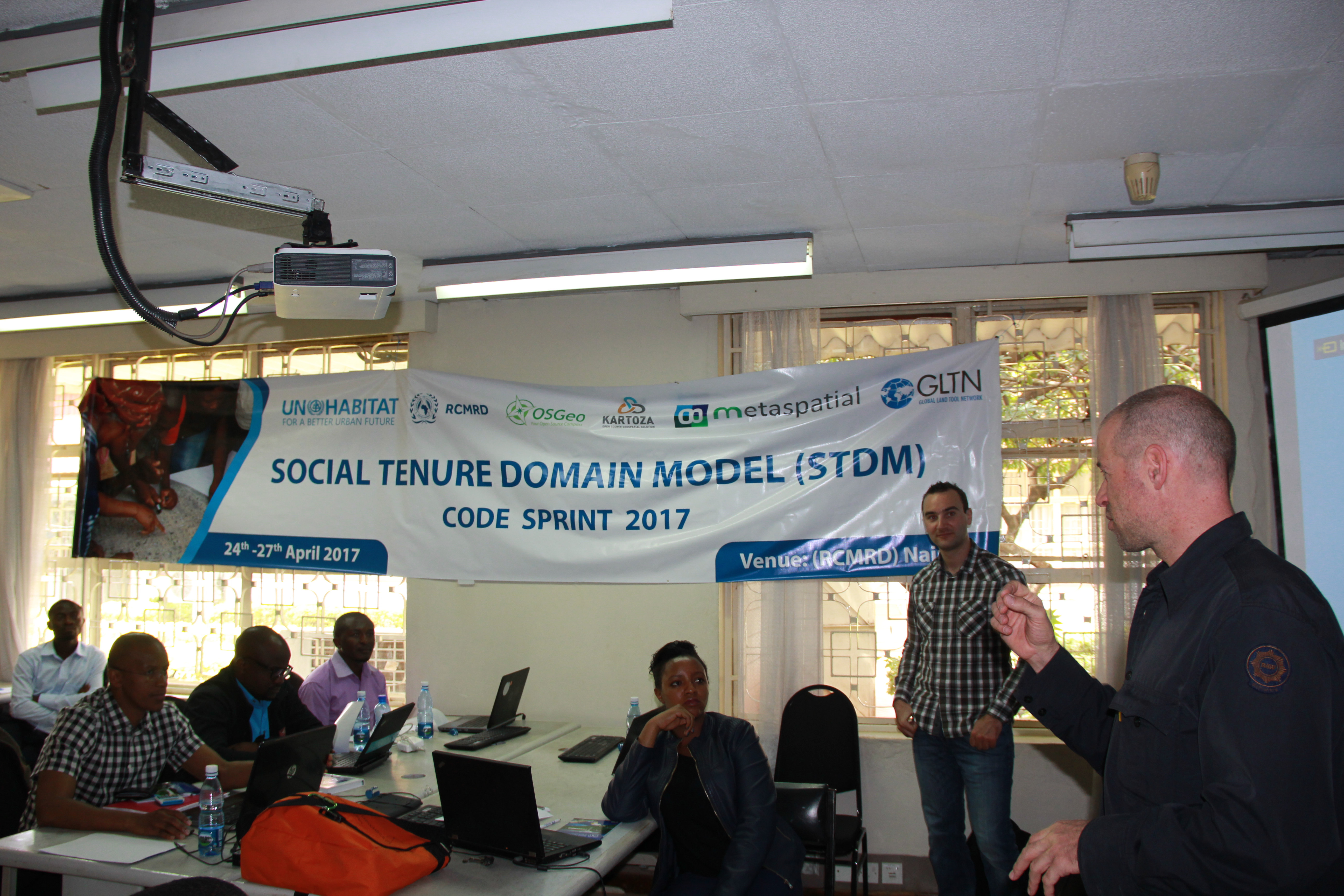
Kaizer Moreri, CEG PhD student from Botswana, researching aspects of Volunteered Geographic Information in improving Land Administration Systems, was awarded a full travel scholarship to contribute to a ‘code sprint’ in Kenya this week. Second from left in the attached photo, Kaizer was invited along with 25 others from Europe and Africa to develop and contribute code to enhance the Social Tenure Domain Model (STDM) – a pro-poor, gender responsive and participatory land information system developed by the Global Land Tool Network (GLTN). This intensive four day workshop was held at the Regional Centre for Mapping and Rural Development (RCMRD), a pan African institution located in Nairobi, and tweets (https://twicopy.org/tag/STDMCodeSprint) report that this was an exciting event.
We are now looking for applications for our available fully funded PhD studentships with the DREAM CDT (Centre for Doctoral Training). DREAM, Data, Risk and Environmental Analytical Methods, is a partnership between four leading universities based within the UK, Cranfield, Newcastle, Cambridge and Birmingham, and is now into its 3rd year. The CDT focuses on the use of big data to solve environmental risks, with topics covering a wide field of research. All PhD students have a wealth of training opportunities available to them as well as regular networking opportunities with those based at the other partner universities.
Newcastle are looking for applicants interested in any of the PhD’s listed below, with anyone interested asked to contact Dr Stuart Barr.
Massive multi-agent simulation of environmental risks to interdependent infrastructure
Environmental risks to global resource flows
High resolution modelling of real-world floods – models, forecasts and uncertainties
Extreme rainfall forecasting: new statistical simulation and Big Data methods for making sense of rainfall radar and rain gauges
Capturing Tsunamis and Storm Surges: Coupling the Human and Natural Systems through Games Technology
Earth observation for UK-wide flood infrastructure risk management
Preserving Privacy for Urban Data in the Internet of Things
Big data real-time online analysis of urban flooding impact on traffic flows
Improving decision making in hazard situations using geovisualisation
Can citizen science observations improve real-time flood risk assessment – bringing the crowd to the cloud?
More information on these PhD’s are available on the DREAM website, where you can also find more details on the CDT and how to apply.
In recent years, television broadcasters have pumped more and more money into the football industry, resulting in Premier League clubs in particular receiving both more TV money and more TV coverage. This extra coverage, however, has come at a cost to the fan on the terrace. There are more and more instances of last-minute fixture alterations being made to accommodate televised games. These last-minute changes often result in fans having to rebook travel plans, getting home even later, or in some cases staying overnight in a hotel. I personally remember having to rebook trains twice, and book and subsequently cancel accommodation (losing my deposit) as an Aston Villa vs Norwich City game had its kick-off time changed twice because of TV.
In previous work we have investigated the travel times of football fans and how they could be affected by fixture changes. This looked at the additional time and difficult faced by travelling supporters but did not consider the cost of these changes. Therefore in this piece of work we wanted to determine which fixture changes would result in the biggest cost increase for a fan travelling to the game by public transport. For this we used an API from British Rail Fares Queries (http://www.brfares.com/api/ ) which allowed us to determine the both the cheapest possible advance tickets and the cheapest possible ticket that a fan could buy on the day. As in the previous work, the Google Travel API (https://developers.google.com/maps/documentation/distance-matrix/) was used to determine the amount of time travelling and whether a fan would have to stay overnight either the night before or after a match.
As we didn’t want to just consider the cost of new rail tickets but the cost of having to potentially spend more leisure time travelling to and from the game due to the fixture change, we wanted to apply a “cost” to the fan for each extra minute spent travelling. The Department for Transport determined a value of £8 per hour for a non-work related journey using their ‘Value of Time method (https://www.gov.uk/government/uploads/system/uploads/attachment_data/file/313222/webtag-tag-unit-a1-3-user-and-provider-impacts.pdf).We consequently applied this cost to the time a fan would spend travelling to and from the game to give an approximate monetary value.
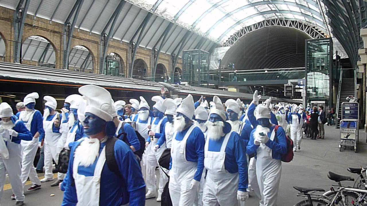
Hartlepool fans on their yearly fancy dress trip
Finally, if the fixture meant a fan would have to stay overnight we added an extra £50 to the journey cost to represent an approximate value of a night in a cheap hotel. Whilst all of these costs make assumptions (that the supporter is diligent enough to buy the cheapest available Advance ticket to travel to the match when they are initially released, that the rearranged game means the purchase of an Off-peak ticket rather than another Advance ticket, that they will not be able to stay with friends) they are a first attempt at capturing the extra personal cost of these TV fixture moves.
The results of this piece of analysis are available here: Full Results
With the top 10 biggest cost increases shown below.
It’s a good job that no-one chose to televise Bournemouth vs Sunderland…
We have funding available for a number of PhD’s in the area of big data, risk and environmental analysis, with a start date no later than March 2017. The funding is available through the DREAM CDT (http://www.dream-cdt.ac.uk/), offering students access to world leading research teams and a large selection of training and development opportunities. This funding comes with the freedom to devise your very own reaserch project with the aid of experts from a range of fields who will help guide and support you from the developemnt of the project to the completion of the PhD.
For more information on taking up a PhD with the DREAM CDT, please contact Stuart Barr (stuart.barr@ncl.ac.uk).
Four new professorial appointments are now being advertised at Newcastle University on the theme of Spatial Analytics and Modelling (SAM). These fall across four areas:
A new job opportunity has arisen for a researcher (assistant/associate) for a 24month position working within our group. The position is tied to the recently awarded multi-million pound ITRC MISTRAL programme grant, a joint project between seven UK based universities, investigating the future of national infrastructure. The appointed person will work on the development of a building classification model for the entire UK, working primarily with Ordnance Survey data. In collaboration with other MISTRAL researchers demographic and economic profiles will then be assigned to buildings providing data to be employed across infrastructure models developed across the consortium.
We are pleased to announce that we have a new four year fully funded PhD studentship available in spatial data modelling with BIM/GIS. Proposed to start in September 2016, the PhD will aim to develop tools for modelling and understanding flows across a city; from the broad city-scale to within individual buildings. Funded by EPSRC, the PhD is a partnership between ourselves at Newcastle University (the Geomaticts group in the School of Civil Engineering and Geosciences) and Ordnance Survey, and affiliated with the EPSRC funded ITRC-MISTRAL programme.
For more details on the PhD including how to apply, please see here.
At the end of May Stuart Barr attended the launch of the ITRC (Infrastructure Transitions Research Consortium) MISTRAL (Multi-Scale Infrastructure Systems Analytics) programme, an EPSRC funded 5year programme between seven universities, including ourselves, with Stuart being one of the co-investigators. Hosted at the ICE (Institute of Civil Engineers) in London, the event presented the vision and ideas behind the new programme, the next step in infrastructure systems-of-systems analysis research following the completion of the previously funded ITRC programme. Attended by over 150 people, including representatives from academia, private sector businesses and public sector organisations, the event included speeches from Professor Jim Hall, the lead investigator on the ITRC MISTRAL project, Lord Adonis, chair of the National Infrastructure Commission and Keith Clarke, the ICE vice president. A question and answer session then followed providing the opportunity for the attendees to find out more about the ITRC MISTRAL project from the key persons involved, including Stuart.
A video has since been released including snippets from some of the speakers, providing an insight into the work which will be undertaken in the ITRC MISTRAL project and the important role it can play in the future of infrastructure systems.
Between June, 10th and 18th, 2016, I travelled to Boston in USA, for attending the NECSI (New England Complex Science Institute) 2016 summer school course, which was about general theory and models of complex science. The course was held in MIT tang center, where there was roughly thirty attendies from diverse backgrounds (economics, neurosciences, physics, biology, civil engineering, etc.). Besides those from USA, many of us came from different continents (New Zealand, Malaysia, UK, Japan, etc.), so it was rather cool to meet Francesco Castellani from same university of mine! Francesco was a very interesting Italian PhD student, who was studying urban infrastructure vulnerability and resilience against external hazards.
The main course lasted for four days, and was chaired by Assistant Professor Hiroki Sayama, Professor Dan Braha (Fig 1). We were introduced to the basic concepts in complex systems and some specific and most commonly used models for dealing with them, such as cellular automata, networks and agent based models.
Fig 1. Professor Dan Bara and students were discussing about network metrics.
Then Joseph Norman and Alfredo Morales joined them to show us some real life case studies (data mining and machine learning) using such models. One interesting moment during the course was about the social network analysis. Alfredo demonstrated how to listen to social media, such as twitter and to extract the user information to construct a social network in Python. All attendies were asked to register a twitter account and to tweet for any information he/she wanted using a hashtag. In the end, we got a cool social network (tweeting network) which was ready for visualization and network-related analysis (Fig 2).
Fig 2. Tweeting social network from attendances, visualization in Gephi. Each node is a registered user and edges are based on tweets where other users are mentioned.
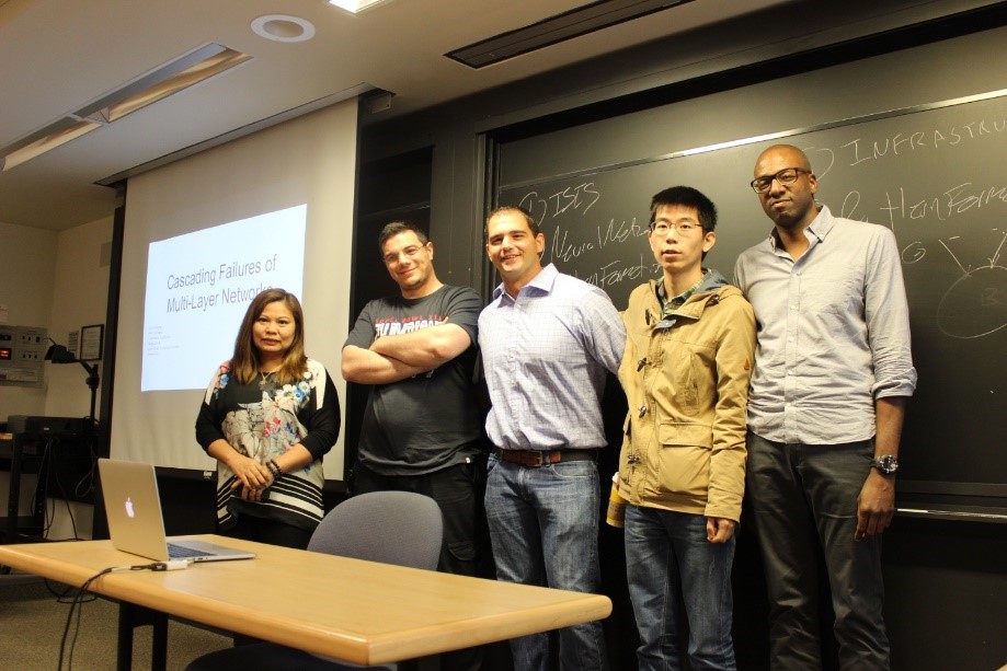
During the course, we were also required to form teams to do a project using the tools and techniques we had learned. I teamed with Cristi, Francesco, Alex and John (Fig 3) to finish an interesting project about interdependent urban infrastructure networks and the cascading failures from them to economic sectors. Francesco and I were in the urban infrastructure network research field, while Cristi, Alex and John were economic data users in their daily work. That’s why we had the idea for this project. We used a very simple model of interdependent infrastructure networks (power, water supply and telecom) and simulated different failure scenarios to model the cascading failure and its impact on the economic sectors using some economic models.
Fig 3. Cool team members, from left to right: Cristi (Malaysia), Francesco, Alex (USA), me, John (Canada).
The course was short but intensive, and it was interesting to learn and team up with people from different backgrounds and with different experiences. I wish all the best for my team members in the future work and it was a pleasure to meet them.
Besides academic work
The course started on Monday, June 13th, while I arrived at Boston on Friday, June 10th, which means I was to lucky to have two free days for some adventures and sight-seeing in the city before the course!
One thing I would never forget was the extremely pleasant weather in Boston. Being at almost the same latitude of Spain created warm and sunny days during my stay there. Since it is at coastal area, there was always breeze, which is really nice in the summer. The city was highly connected by its underground train system, which made my travelling plan even easier. And let’s start!
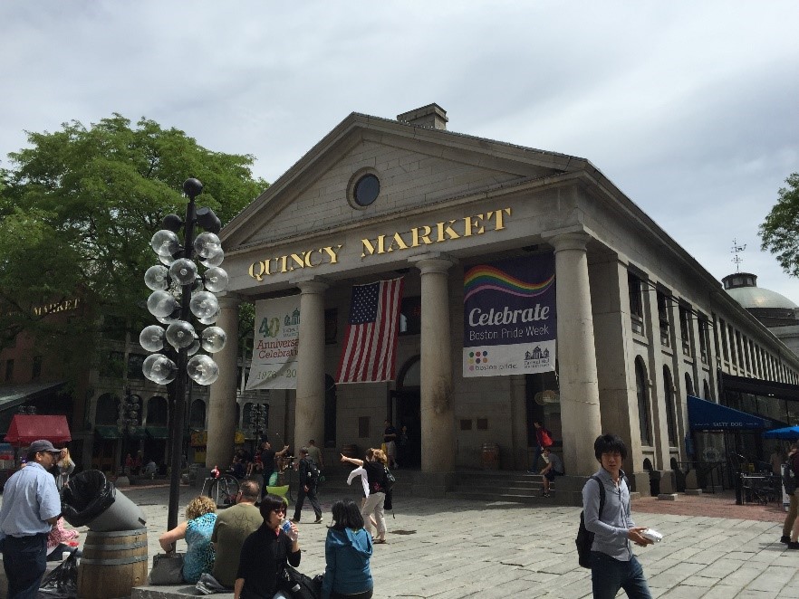
Quincy market is always the most welcome place for the first time travelers. It is a Roman style architectures (Fig 4) where there are lots of stores for fancy food and souvenirs. You can always find a place to have meals of tasty lobsters at a decent price!
Fig 4. Quincy Market, in the center of Boston.
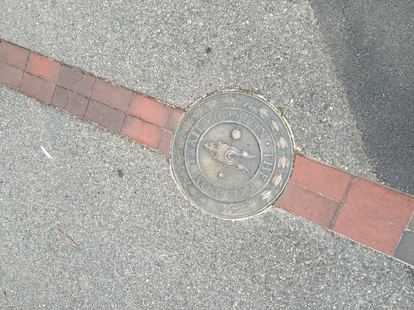
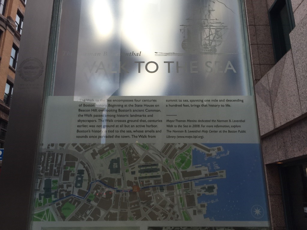
Another thing that makes Boston a little different from other US cities is its colonial history. This was the place where the British adventurers landed in the American continent, which was why this region was called “New England”. There is a very special road in the city, which is call “Trial of freedom”, it is a long route (around 5km) made of red bricks on the road (Fig 5). This trail of freedom leads to the coast, and following this road, you will see many historical architectures, which represents the colonial history of Boston (Fig 6). It was a long road, and I was lucky enough to have the time to reach the sea side following this road! (Fig 7).
Fig 5. The sign of “Trail of freedom” on the road.Fig 6. Walking to the sea, following the trail of freedom.Fig 7. And we reached the destination, the sea side, always nice weather!
Despite the exciting sightseeing, I still felt a little regret for not having enough time to explore more about city. While it is a dynamic young city (the same age of USA), it was a city mixed with modern and historical culture and architectures, and a really nice place to live. I wish I can visit this beautiful city again sometime in the future.
In the latest issue of GeoConnexion UK a short article, written by Stuart Barr and Craig Robson, details the ongoing work they are doing to develop the UK’s first national infrastructure database. Over the course of the 5 year ESPRC funded ITRC MISTRAL programme, by 2020 a national infrastructure portal will be developed as a resource that will be open to those across academia and industry as well as policy makers. This will provide access to infrastructure datasets and simulation and modelling results, including those from the already completed ITRC project, such as the results from the first national infrastructure long term planning tool. Some of the software developed and employed in the analysis undertaken will also be available under open licenses allowing the research to continue beyond the life of the ITRC MISTRAL project.
Both are based in the Geomatics group in the School of Civil Engineering and Geosciences at Newcastle University, with Stuart a lecturer on the two undergraduate degrees offered, BSc Geographic Information Science and BSc Surveying and Mapping Science, while Craig is a recent graduate of the GIS programme.