ITRC MISTRAL Launch event

At the end of May Stuart Barr attended the launch of the ITRC (Infrastructure Transitions Research Consortium) MISTRAL (Multi-Scale Infrastructure Systems Analytics) programme, an EPSRC funded 5year programme between seven universities, including ourselves, with Stuart being one of the co-investigators. Hosted at the ICE (Institute of Civil Engineers) in London, the event presented the vision and ideas behind the new programme, the next step in infrastructure systems-of-systems analysis research following the completion of the previously funded ITRC programme. Attended by over 150 people, including representatives from academia, private sector businesses and public sector organisations, the event included speeches from Professor Jim Hall, the lead investigator on the ITRC MISTRAL project, Lord Adonis, chair of the National Infrastructure Commission and Keith Clarke, the ICE vice president. A question and answer session then followed providing the opportunity for the attendees to find out more about the ITRC MISTRAL project from the key persons involved, including Stuart.

A video has since been released including snippets from some of the speakers, providing an insight into the work which will be undertaken in the ITRC MISTRAL project and the important role it can play in the future of infrastructure systems.


GeoConnexion article – NISMOD-DB

In the latest issue of GeoConnexion UK a short article, written by Stuart Barr and Craig Robson, details the ongoing work they are doing to develop the UK’s first national infrastructure database. Over the course of the 5 year ESPRC funded ITRC MISTRAL programme, by 2020 a national infrastructure portal will be developed as a resource that will be open to those across academia and industry as well as policy makers. This will provide access to infrastructure datasets and simulation and modelling results, including those from the already completed ITRC project, such as the results from the first national infrastructure long term planning tool. Some of the software developed and employed in the analysis undertaken will also be available under open licenses allowing the research to continue beyond the life of the ITRC MISTRAL project.

Both are based in the Geomatics group in the School of Civil Engineering and Geosciences at Newcastle University, with Stuart a lecturer on the two undergraduate degrees offered, BSc Geographic Information Science and BSc Surveying and Mapping Science, while Craig is a recent graduate of the GIS programme.

New paper: Reducing the impact of extreme weather on infrastructure networks

Last week our latest paper was published entitled ‘Assessing urban strategies for reducing the impacts of extreme weather on infrastructure networks’ in the Royal Socities Open Science journal. Alistair Ford, Craig Robson and Stuart Barr all contributed to the artical alongside colleagues from civil engineering, Maria Pregnolato (lead authour), Vassilis Glenis and Richard Dawson. A summary is given below.

“A framework for assessing the disruption from flood events to transport systems is presented that couples a high-resolution urban flood model with transport modelling and network analytics to assess the impacts of extreme rainfall events, and to quantify the resilience value of different adaptation options. A case study in Newcastle upon Tyne in the UK is presented and shows that both green roof infrastructure and traditional engineering interventions such as culverts or flood walls can reduce transport disruption from flooding.The magnitude of these benefits depends on the flood event and adaptation strategy, but for the scenarios considered here 3–22% improvements in city-wide travel times are achieved.

Both options should form part of an urban flood risk management strategy, but this method can be used to optimize investment and target limited resources at critical locations, enabling green infrastructure strategies to be gradually implemented over the longer term to provide city-wide benefits. This framework provides a means of prioritizing limited financial resources to improve resilience. By capturing the value to the transport network from flood management interventions, it is possible to create new business models that provide benefits to, and enhance the resilience of, both transport and flood risk management infrastructures.”

Inaugural QGIS northern group meeting

A group of us attended the inaugural QGIS northern group meeting, kindly organised and hosted by Seraphim Alvanides at Northumbria University. The meeting focused on the use of QGIS in teaching at university level followed by a broader session on the use of QGIS in other sectors and its development.

From the strong mixture of representatives, presentations from Leeds (Helen Durham) and Newcastle University (David Fairbairn) gave insights into the teaching of QGIS and more broadly open source spatial technologies at both undergraduate and postgraduate levels. Josephine Ellis, from Blue Kayak, gave an overview of how the skills learnt on these courses are being implemented in a professional environment to move away from proprietary software. Our own David Fairbairn presented details of the teaching some members of group do across a range of degree programmes, including the content on our own GIS and SMS (Surveying and Mapping Sciences) degree courses, but also those modules which we give on Civil Engineering courses as well as to other programmes within the schools of geography and biology . A brief mention was also given to some of the CPD courses which both Leeds and we run, with Laura Hanson (ARUP, formally our group), also referring to these within her talk on experiences with GIS and QGIS.

The later talks were more focused on the application of QGIS and developments of the software and plugins. This was mostly led by public sector inputs, with talks from Stockton-on-Tees Borough Council (David Renn), Newcastle City Council and Lutra Consulting (Brian Williams and Saber Razmjooei respectively) as well as a talk from Northumberland National Park (Tom Chadwin). These series of talks focused on the adoption of QGIS (from ArcGIS) and the development of plugins to fill gaps within the functionality of QGIS to make it the GIS software of choice for many within the organisations.

From the perspective of researcher within an academic environment and a current QGIS user (as well ArcMap user), it was informative and useful to discover how such software was being applied and developed within different environments.

Plans are being made for further meetings, with suggestions from those interested welcome.

Viva success – Daniel Caparros-Midwood

Last week, on the 7th March, Daniel Caparros-Midwood successfully passed his viva with 1 months corrections. Dan has been in the department since 2008 when he started as an undergraduate on our GIS degree. After graduating he immediatly started a PhD on optimised spatial planning with us under the supervision of Stuart Barr and Richard Dawson, and then left around six months ago to begin his carrer in GIS at AMEC after submitting his PhD.

Well done Dan and good look in the future!

ITRC book published

Last week a book, ‘The Future of National Infrastructure: A Systems-of-Systems Approach’, by reasearchers from the ITRC (Infrastructure Transitions Research Consortium), was released and made available for purchase. The book provides insights into a range of the work undertaken in the ITRC project, from the economic and demographic projections to 2100 for the UK, to the analysis performed with developed national scale models for critical infrastructure systems and the developed underlying database and visualisation tools used. Synopsis:

“The future of national infrastructure: A system-of-systems approach provides practitioners, decision-makers, and academics with the concepts, models and tools needed to identify and test robust, sustainable, and resilient strategies for the provision of national-scale infrastructure. It takes a “system-of-systems” view on the interconnected infrastructure networks – including transport, telecommunications, energy, water, and waste-management – and derives an integrated vision on infrastructure provision required to ensure that nations have an infrastructure system that is fit for the future.”

Our own Stuart Barr, David Alderson and Craig Robson have all been involved in the research behind the book which has been carried out over the past five years, with a single chapter devoted to the work where their time has been focused, though they have also contributed to much of the other work. The chapter, ‘Database, simulation modelling and visualisation for national infrastructure assessment’, documents the tools developed here at Newcastle; the underlying database for the infrastructure models including developed schema’s as well as the visualisation and reporting tools for both the data used for the modelling and for the results from the simulation work and subsequent analysis. This research has involved the development of a national infrastructure database containing a suite of data for many of the critical infrastructures in the UK along with the associated data such as economic and demographic modelling outputs for demand modelling as well as hazard data for modelling the resilience of the infrastructure networks/systems. Along with this, a schema and associated functions for the simulation and modelling of national infrastructures has been developed as well as a PostgreSQL/postgis schema for networks and the wrappers for integration into the python package NetworkX. On top of these, a suite of web based visualisation tools have been developed with facilities to view and interrogate the results from the infrastructure modelling and simulation, tools to view the underlying demographic data, one of the main drivers for the modelling. More details of these outputs are available in the book, and further publications in the form of journal articles are in preparation.

Visualisation workshop

A number of us last week attended a workshop on visualisation, organised by Nick Holliman, professor of visualisation in the school of computing scince. After successfully having abstracts accepted David Fairbairn gave a presentation on ‘using geovisualisation in the decision theatre’ and Neil Harris presented his and Craig Robson’s work entitled ‘spatio-temporal network simulation and failure visualisation’ (as presented at GISRUK earlier in the year).

The aim of the workshop was to firstly share the work going on in the visualisation of data in research around different groups and departments across the university. This was achieved through a series of presentations giving an opportunity for people to present their work on visualisations as used in their research. This also gave the opportunity for them to raise questions about their work with regard to how to improve the visual outputs as well as pose thought provoking questions in the area of visualistion. This session provoked some productive discusions on the area of visualisation in gereneral in repsonce to the material presented.

The afternoon session focused on two questions; (1) what tools and methods are commonly used for visualisation in research and (2) what is required for the future of visualisations in research. Breakout groups were used to facilitate disscusions around these questions as well as full group discussions allowing key points to be discussed by the wider group.

The day proved useful in many ways by combining a range of people with varying thoughts and interests with regard to the visualisation of data. By the end of the day future meetings and collaborations were being discsused along with ideas on how to continue such meetings/workshops in the future.


Goodbye to David A. and Laura

This autumn we have already said goodbye to David Alderson who is destined for New Zealand. He has worked within the group for the past 10 years after studying the GIS degree as an undergraduate with us. He has played a large and significant role within the group and the wider school being actively involved in many research projects including UKCP09 and ITRC as well assisting in many others. He will be missed by many who have become used to seeking help and advice from him on all things to do with GIS, databases and websites (and probably on other matters as well). We wish him the best of luck in the future in whatever he ends up doing and will look forward to welcoming him back to the department if he ever chooses to drop by when/if he is back in the UK.

We have also just said goodbye to Laura Hanson (last week), who has been here 6 six as the GIS teaching assistant, though her role as extended well beyond that title during the years. As well as helping with the teaching on our undergraduate courses (GIS and SMS) she has also developed our suite of GIS based CPD courses which have been going strong over the last few years, attracting people from not just the UK, but also the rest of the world. Laura like Dave has been involved in many research projects with her extensive knowledge of GIS systems, and thus will be missed by all and especially those who have become used to calling upon here help. However, unlike David, we will be seeing Laura again when she returns to carry on some of the teaching she has been doing, though fortunately for her she is only moving across the city centre to ARUP and not the other side of the world so doesn’t have to travel too far. We wish Laura good luck in her new role at ARUP and look forward welcoming her back to fulfil her continuing duties with us.

ITRC @Newcastle – autumn 2015

As a research group a small number of us have been involved in the ITRC project over the past five years, namely Stuart Barr and Dave Alderson. Craig Robson joined the ITRC ranks in January, pausing his PhD work to help complete the final phase of the research required by autumn 2015. ITRC (Infrastructure Transitions Research Consortium) has been investigating the future of the UK’s national scale infrastructure with regards to how it must develop to meet ever changing demands and how climate change amoungst other factors will affect the resilience of those networks we rely on.

Our role in the project has centered around the development of the tools which would allow the five year project to be completed and included, but was not limited to, the development of the central database for all data for the project, and the support tools which would enable the analysis to be undertaken and results reported. It is on this later point where most of the past 6 months have been spent; developing a reporting tool for the presentation of the results from the long-term infrastructure planning aspect of the project.

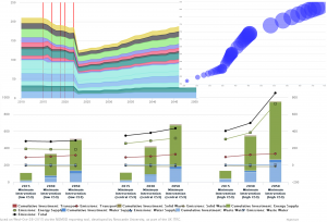
The developed reporting tool allows users to view results from the each infrastructure sector (e.g. transport or waster supply), or view cross sector results, a set of similar metrics computed for each sector allowing for direct comparisons between them on there performance. For each sector a range of model outputs can be viewed from the level of emissions produced, to the running costs per year to the cumulative capital investment required. Results are shown not only at the regional level, but where possible at the sub-national level through the government office regions for example where the models output data at this granularity. This allows the tool to show data not just in charts, but also through maps, allowing new insights to be learned which may not be identified through non-spatial results. More detail on the tool, along with images and the like will be provided in a specific post at a later date, but for now a small selection of images below exemplify the tool.

Drawing1

With the end of the project looming near an event was organised at the ICE in London on the 15th October where the key results and impacts from the project could be disseminated to a wider audience with those key members behind the research all being present to answer questions and discuss their work. At the event we were available to demo the reporting tool and discuss the complexities behind the database for those interested, while a set of slides were used to give a overview of our work. More generally two videos (below) were produced giving an overview of the project and the one on the resilience of the UK’s national infrastructure.

Pub statistics (1)

Anyone with any experience of working/visiting the Geomatics group will know that, just like in most other academic establishments, visits to the pub at the end of a hard week are just as important as anything else that happens during the working week. To this end, the Friday night pub call is now well and truly part of the culture of the group, and without some would be inclined to say they would feel lost without this. However, the visit to the pub could be argued to have fallen into the shadow of the call email itself, which depending on the sender, can tell a complex story which few understand and can only read with a face of utter bewilderment.

So, to cut to the chase, as an exploratory piece of ‘academic research’ we have compiled a comprehensive database, going back to the creation of the GWRS call email list, 2008, until the current day. Every pub call ever made over the past 7 years, that’s 397 Fridays, the pub and the person who made the call have been recorded (though some are blank due to public holidays and missing data). Further data has then been added including the weather to allow us to explore the call data in more detail, and attempt to understand any patterns which may or may not be present.

To start with, and to end this initial post here, below are some key initial statistics on the data we have collected.


Top 10 Pub Calls

Hotspur 50
Bacchus 48
Strawberry 42
Bodega 29
Lady Grey 20
Newcastle Arms 12
Town Wall 11
Bridge Hotel 10
LYH 9
Five Swans 9


Caller Stats

Caller Favourite Pub Number of Calls Number of Unique Pubs called
Martin Robertson Strawberry ( 33 ) 207 34
Laura Hanson Hotspur ( 11 ) 37 15
Ali Ford Bodega ( 10 ) 27 12
Matt Goode Five Swans ( 3 ) 15 11
Claire Walsh Cluny & Tilleys & Bacchus & Town Wall & Bodega & Strawberry & Trent House & Collingwood & Hotspur & Forth ( 1 ) 10 10
Richard Dawson Bacchus & Hotspur ( 2 ) 7 5
Peter Clarke Hotspur ( 2 ) 4 3
Tom Holderness Carriage & Bodega & Hotspur ( 1 ) 3 3
Ian Thomas Hotspur ( 2 ) 3 2


Top 10 Warmest Pubs

Average Temperature recorded in Newcastle at 5pm (c) Pub Number of Calls
16.5 Free Trade 4
14.5 Centurion 2
14 Northern Stage 3
13.5 Tilleys 4
13.4444444444 Five Swans 9
13.2 Pleased To Meet You 5
13.2 Bridge Hotel 10
12.6666666667 Bar Loco 6
12.5 City Tavern 4
12.0344827586 Bodega 29


Mean Weighted cntre of pub clalsmean_cntre


Craig and Neil.