Python I

The Understanding Code workshop, given at Campus North, is a series of six sessions learning various aspects of code, held on Monday evenings. The first three sessions covered an introduction to HTML, CSS and styling followed by Javascript and Dynamic Content. The fourth session, given on 22nd February, was the start of three workshops on Python. Whilst there are many different languages available Python is proving to be one of the most popular (http://spectrum.ieee.org/computing/software/the-2015-top-ten-programming-languages).

Python I was well attended with approximately 30 people from all different backgrounds present, including several PhD researchers from within the School of Civil Engineering and Geosciences. The seminar was an introduction to Python involving some basic processing: variables, while, for, if statements and when these might be useful. Classes were briefly introduced at the end of the seminar in preparation for next week’s Python II course.

The course was a really good introduction to Python, keeping it simple and straightforward whilst starting to look at how basic principles can be use in complex cases.

Ordnance Survey PhD Workshop

February 9th and 10th was the third of what has become an established annual event for Ordnance Survey (OS); inviting all sponsored PhD and postdoc researchers to present their latest research at the Ordnance Survey head office in Southampton. Whilst many know OS mainly for their paper maps, there is a wide range of research that is being undertaken to keep OS at the forefront of mapping technologies. This diversity in research was presented over the two days in four themed sessions. The opening session was ‘3D’ and was opened with my research on automatic reconstruction from a dense image matching dataset. Other 3D research presented included automatically adding texture maps and semantic information to 3D building models (Jon Slade, Cardiff University), why people need 3D (Kelvin Wong, University College London) and real-time urban dataspace modelling (Oliver Dawkins, University College London).

As well as giving oral presentations, a panel session was held at the end of each session where the session’s presenters and OS employees working in the relevant field were asked questions on the overriding theme of the session. This generally led to some really interesting and insightful discussions about how the panel saw the discussed research fitting into the OS remit. It also became apparent that parts of the research presented in the session as well as the other session had several overlapping themes, opening the opportunities for future collaboration. A poster session was also held after lunch each day which allowed OS employees who may not be directly involved with the research to view what studies are currently being undertaken, whilst giving the authors an opportunity to network and discuss their results.

The final session of day one was themed ‘Data Analysis’. The first two presentations from Robin Frew, University of South Wales, and Rebecca King, University of Southampton, addressed spatial usability issues and temporal modelling, respectively. The final two speakers of this session were first year PhD students presenting an overview of their research; Nick Bennett, University of Southampton, and Judit Varga, University of Nottingham, will be investigating similar topics in the use of data mining to map events and update mapping at different scales.

The second day opened with the theme of ‘People and Places’, the social sciences side of Ordnance Survey research. This covered a wide range of research included mapping vernacular geographies (Katherine Stansfeld, Royal Holloway, University of London), how people identify with narratives and place (Iona Fitzpatrick, University of Nottingham) and how different users interact with geo-spatial technology (Mike Duggan, Royal Holloway, University of London).

To close the workshop the final session theme was ‘Machine Learning’. Presenters Ce Zhang (Lancaster University) and postdoc David Young (University of Southampton) discussed their research utilising deep learning for supervised and unsupervised image classification.

As well as giving us the chance to see the various research projects undertaken by OS as well as getting to see our external supervisors, it also gives the chance to see how fellow PhDs are progressing through their projects and share an tips or advice of how to overcome the next hurdle. As I am now approach the writing up stages of my research, this will unfortunately be my last OS PhD workshop. I would therefore like to take this opportunity to thank Ordnance Survey for the data supplied and their continuing support throughout the progression on this research.

Andrew McClune

Final year PhD Researcher

LiDAR & hedgerows at the British Ecological Society Conference

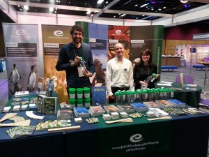
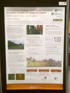
I attended the British Ecological Societies 2015 conference over 4 days in December in the beautiful city of Edinburgh complete with Christmas jumpers and a ceilidh. It was a great opportunity to present my work – using LiDAR to model and measure the effects of cutting and rejuvenation management on hedgerow structural condition as wildlife habitat; to over 1500 delegates and to engage with the more ecology focused side of my PhD.

(image credit: BES on twitter)

The conference saw talks and posters from across a range of ecological disciplines including using various remote sensing techniques to measure and monitor forests from the global to the local scale. This included Markus Eichhorn from The University of Nottingham who has invited me to present my work to his research group in the new year and was keen to hear of other relevant work going on in Newcastle CEG. I would encourage anyone in CEG whose work is based around forest ecology to consider attending next year’s meeting as their was a decent sized community of forest modelers in attendance.

poster (2)

Ensuring I could effectively communicate the potential of my work to such a broad range of scientists attending the conference was a big challenge and exciting opportunity. The conference was a great reminder for those working with emerging technologies or applying existing technologies to new challenges that communicating to the end users of your work is key. In my case this includes agricultural ecologists and policy makers with a range of interest and familiarity with remote sensing and LiDAR. I was asked everything from “What is LiDAR?” to questions about how LiDAR could add to a huge range of ecological monitoring challenges, stressing the real need for communication and sharing of ideas across disciplines. I also believe attending BES was a great way for my work to stand out and to really engage with what is novel about my project, as the only presenter (that I heard of) attending from a civil engineering discipline I was in a really unique position.

Lyndsey

Visualisation workshop

A number of us last week attended a workshop on visualisation, organised by Nick Holliman, professor of visualisation in the school of computing scince. After successfully having abstracts accepted David Fairbairn gave a presentation on ‘using geovisualisation in the decision theatre’ and Neil Harris presented his and Craig Robson’s work entitled ‘spatio-temporal network simulation and failure visualisation’ (as presented at GISRUK earlier in the year).

The aim of the workshop was to firstly share the work going on in the visualisation of data in research around different groups and departments across the university. This was achieved through a series of presentations giving an opportunity for people to present their work on visualisations as used in their research. This also gave the opportunity for them to raise questions about their work with regard to how to improve the visual outputs as well as pose thought provoking questions in the area of visualistion. This session provoked some productive discusions on the area of visualisation in gereneral in repsonce to the material presented.

The afternoon session focused on two questions; (1) what tools and methods are commonly used for visualisation in research and (2) what is required for the future of visualisations in research. Breakout groups were used to facilitate disscusions around these questions as well as full group discussions allowing key points to be discussed by the wider group.

The day proved useful in many ways by combining a range of people with varying thoughts and interests with regard to the visualisation of data. By the end of the day future meetings and collaborations were being discsused along with ideas on how to continue such meetings/workshops in the future.


Goodbye to David A. and Laura

This autumn we have already said goodbye to David Alderson who is destined for New Zealand. He has worked within the group for the past 10 years after studying the GIS degree as an undergraduate with us. He has played a large and significant role within the group and the wider school being actively involved in many research projects including UKCP09 and ITRC as well assisting in many others. He will be missed by many who have become used to seeking help and advice from him on all things to do with GIS, databases and websites (and probably on other matters as well). We wish him the best of luck in the future in whatever he ends up doing and will look forward to welcoming him back to the department if he ever chooses to drop by when/if he is back in the UK.

We have also just said goodbye to Laura Hanson (last week), who has been here 6 six as the GIS teaching assistant, though her role as extended well beyond that title during the years. As well as helping with the teaching on our undergraduate courses (GIS and SMS) she has also developed our suite of GIS based CPD courses which have been going strong over the last few years, attracting people from not just the UK, but also the rest of the world. Laura like Dave has been involved in many research projects with her extensive knowledge of GIS systems, and thus will be missed by all and especially those who have become used to calling upon here help. However, unlike David, we will be seeing Laura again when she returns to carry on some of the teaching she has been doing, though fortunately for her she is only moving across the city centre to ARUP and not the other side of the world so doesn’t have to travel too far. We wish Laura good luck in her new role at ARUP and look forward welcoming her back to fulfil her continuing duties with us.

ITRC @Newcastle – autumn 2015

As a research group a small number of us have been involved in the ITRC project over the past five years, namely Stuart Barr and Dave Alderson. Craig Robson joined the ITRC ranks in January, pausing his PhD work to help complete the final phase of the research required by autumn 2015. ITRC (Infrastructure Transitions Research Consortium) has been investigating the future of the UK’s national scale infrastructure with regards to how it must develop to meet ever changing demands and how climate change amoungst other factors will affect the resilience of those networks we rely on.

Our role in the project has centered around the development of the tools which would allow the five year project to be completed and included, but was not limited to, the development of the central database for all data for the project, and the support tools which would enable the analysis to be undertaken and results reported. It is on this later point where most of the past 6 months have been spent; developing a reporting tool for the presentation of the results from the long-term infrastructure planning aspect of the project.

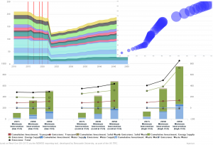
The developed reporting tool allows users to view results from the each infrastructure sector (e.g. transport or waster supply), or view cross sector results, a set of similar metrics computed for each sector allowing for direct comparisons between them on there performance. For each sector a range of model outputs can be viewed from the level of emissions produced, to the running costs per year to the cumulative capital investment required. Results are shown not only at the regional level, but where possible at the sub-national level through the government office regions for example where the models output data at this granularity. This allows the tool to show data not just in charts, but also through maps, allowing new insights to be learned which may not be identified through non-spatial results. More detail on the tool, along with images and the like will be provided in a specific post at a later date, but for now a small selection of images below exemplify the tool.

Drawing1

With the end of the project looming near an event was organised at the ICE in London on the 15th October where the key results and impacts from the project could be disseminated to a wider audience with those key members behind the research all being present to answer questions and discuss their work. At the event we were available to demo the reporting tool and discuss the complexities behind the database for those interested, while a set of slides were used to give a overview of our work. More generally two videos (below) were produced giving an overview of the project and the one on the resilience of the UK’s national infrastructure.

Pub statistics (1)

Anyone with any experience of working/visiting the Geomatics group will know that, just like in most other academic establishments, visits to the pub at the end of a hard week are just as important as anything else that happens during the working week. To this end, the Friday night pub call is now well and truly part of the culture of the group, and without some would be inclined to say they would feel lost without this. However, the visit to the pub could be argued to have fallen into the shadow of the call email itself, which depending on the sender, can tell a complex story which few understand and can only read with a face of utter bewilderment.

So, to cut to the chase, as an exploratory piece of ‘academic research’ we have compiled a comprehensive database, going back to the creation of the GWRS call email list, 2008, until the current day. Every pub call ever made over the past 7 years, that’s 397 Fridays, the pub and the person who made the call have been recorded (though some are blank due to public holidays and missing data). Further data has then been added including the weather to allow us to explore the call data in more detail, and attempt to understand any patterns which may or may not be present.

To start with, and to end this initial post here, below are some key initial statistics on the data we have collected.


Top 10 Pub Calls

Hotspur 50
Bacchus 48
Strawberry 42
Bodega 29
Lady Grey 20
Newcastle Arms 12
Town Wall 11
Bridge Hotel 10
LYH 9
Five Swans 9


Caller Stats

Caller Favourite Pub Number of Calls Number of Unique Pubs called
Martin Robertson Strawberry ( 33 ) 207 34
Laura Hanson Hotspur ( 11 ) 37 15
Ali Ford Bodega ( 10 ) 27 12
Matt Goode Five Swans ( 3 ) 15 11
Claire Walsh Cluny & Tilleys & Bacchus & Town Wall & Bodega & Strawberry & Trent House & Collingwood & Hotspur & Forth ( 1 ) 10 10
Richard Dawson Bacchus & Hotspur ( 2 ) 7 5
Peter Clarke Hotspur ( 2 ) 4 3
Tom Holderness Carriage & Bodega & Hotspur ( 1 ) 3 3
Ian Thomas Hotspur ( 2 ) 3 2


Top 10 Warmest Pubs

Average Temperature recorded in Newcastle at 5pm (c) Pub Number of Calls
16.5 Free Trade 4
14.5 Centurion 2
14 Northern Stage 3
13.5 Tilleys 4
13.4444444444 Five Swans 9
13.2 Pleased To Meet You 5
13.2 Bridge Hotel 10
12.6666666667 Bar Loco 6
12.5 City Tavern 4
12.0344827586 Bodega 29


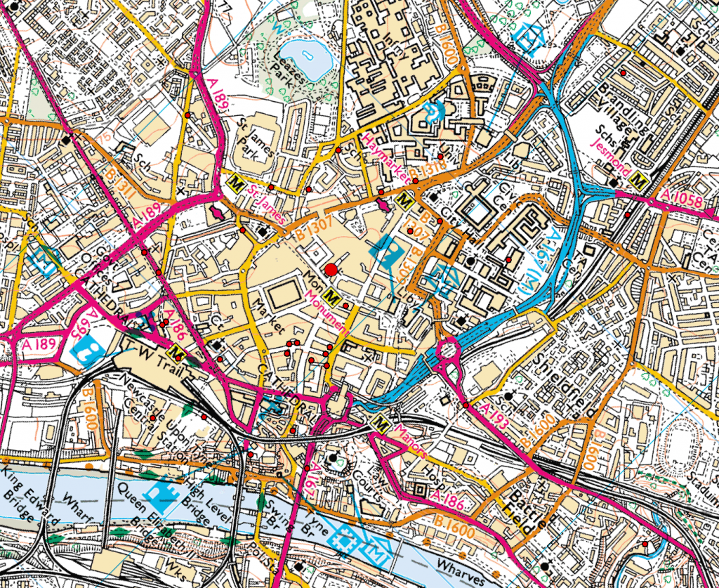
Mean Weighted cntre of pub clalsmean_cntre


Craig and Neil.

Summer 2015

After a long summer of glorious sunshine and topical temperatures the new academic year us upon us. Ok, so it may not have been that warm, or in fact that sunny, but that has not stopped us from getting on with our research.

To start with the PhD office has had a bit of a refurb, with a new coat of paint adorning the walls. As well as this, the wall, if you could call it that, between the two half’s of the room has been made permanent giving the PhD’s some piece and quite from the (excited?) undergraduates. At the same time the room was expanded to accommodate a further 8 desks, which brings me on to the next news..

Following the successful award of the DREAM CDT amongst other things, a total of 7 new PhD students are due to start in the coming weeks across both the geospatial engineering group and the geodesy group, meaning those new desks will soon be filled with excited and ambitious students.

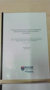
And to round off the news on PhD students, Shaun Brown, Daniel Caparros-Midwood and Stephen Obrike have submitted or are about to, with both Shaun and Dan taking jobs up earlier in the year. All have clearly been making full use of their time, submitting within two weeks of their deadlines. A with all PhD submissions, the final step is the photo..

Shaun_Brown_Thesis

That’s all the PhD news for now, and more posts will follow on other activities during the summer and throughout the autumn. We have been busy…honest…


Summer school in Obergurgl


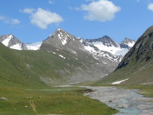
glaciers
glaciers
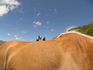
Geodetic ride
Geodetic ride

An amazing summer school took place last week in Obergurgl, Austria (http://www.uibk.ac.at/geographie/summerschool/). The focus was to investigate the various close range photogrammetry remote sensing techniques for alpine terrain research. Such an international environment made the atmosphere very interesting. I met other researchers from Austria, Germany, Italy, Poland and even Equador!!! Professors in remote sensing and photogrammetry from Germany and Italy insipred us with their talks.

The days were very busy with data collection in the alps and data processing, however the fieldwork gave us the opportunity to explore the beautiful mountains and refresh our minds. The best part of course was the social events with tasty austrian beers. The weather was incredibly warm, even the locals became crazy in such a warm environment; I couldn’t believe that Austrian drivers use the horn, this is a Greek habit!

The local newspaper reported the event on their website: http://www.tt.com/panorama/katastrophe/10251350-91/katastrophen-besser-lesen-lernen.csp

The organiser Dr. Martin Rutzinger successfully managed to create a great event and make everybody happy.
The 2nd attached picture shows how engineering is combined with nature. 🙂

Maria Valasia Peppa

Pastures new for the nearly done boys

In the past few months two of our current PhD students have departed for pastures new, but of course neither could leave the field of geospatial science and technology.

Shaun has joined Ordnance Survey working within their photogrammetry team and assisting with the digitising of data from the collected aerial imagery. However, as an unforeseen consequence of this move (for this born and bread Newcastle supporter), he now wears the red and white colours of his adopted running club in Southampton. I’m not too sure he will ever live this down…

More recently Dan has left the group after six and a half (some may say eventful) years; three years as an undergraduate and the remainder as a PhD student. He has moved to AMEC in Shrewsbury where he now works as a GIS consultant. To our surprise we have been told the England students and lion’s student rugby league player has also retired from rugby as a result of this move, though we would not be surprised to hear otherwise when he next returns.

Good luck to them both and no doubt we will be seeing them again as they return for meetings and their viva’s throughout the next 6 months.