Englands Field Names

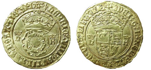
Every field in the land has a name and many of these names are recorded on Victorian Tithe Maps. Copies of these documents for Somerset are held by the Somerset Records Office. As part of the project we’ve been looking at the field names recorded on the Tithe Maps for Lufton and the surrounding parishes.

The names given to fields by people who worked them in the past often reflect something important about those pieces of land. They might tell us who owned the land (Ball’s Mead), they might describe the piece of land (Three Cornered Field), or they might tell us about the history of the piece of land. Chester would indicate a Roman site, Blacklands a site that might have been occupied intensely in the past. So far our work hasn’t turned up any of these names but there are an interesting group of fields over in Odcombe.

Just north of the village of Odcombe are a series of fields with ‘Englands’ names. This name is likely to derive from inland and this term is often associated with parts of early medieval estates that were under direct lordly control. Two recent pieces of archaeological fieldwork on fields with ‘Englands’ names in Charleton Horethorne and Sparkford have demonstrated that both of these sites were occupied in antiquity. The fields in Odcombe might also contain similar evidence.

Englands Field Names near Odcombe © The Lufton Project and Andrew Agate

A short article on this discovery will be published in the journal of the Medieval Settlement Research Group.


Coin of Henry VIII

One of the exciting aspects of archaeology is never knowing what you might find. This is the story of an object that post-dates the villa by a thousand years.

In 2009 we trialled some systematic metal detecting using the grid system that had been set up for the geophysics. We found a small number of Roman coins (which I’ll try and post something about in the future) and much to our surprise a gold coin struck in the name of Henry VIII and Katherine of Aragon (1526-1533).

The coin was identified as a ‘Crown of the Double Rose‘ by Dr Rob Collins and logged on the Portable Antiquities Scheme as NCL-833393.

doublecrownHVIII

Gold coin of Henry VIII and Katherine of Aragon © The Lufton Project

Obverse description: double rose crowned, with crowned initials (h & K) to each side

Obverse inscription: hENRIC VIII RVTILANS ROSA SIE SPIA

Reverse description: shield bearing royal arms of England crowned, with crowned initials (h & K) to each side
Reverse inscription: DEI G R AGLIE FRANC DNS hIBERNIE
Initial mark: lis
Degree of wear: Hardly worn: extremely fine

Lifting the corner: Magnetometry 2009

At the same time that we carried out the resistivity survey of the villa we also carried out a much larger survey using a Bartington gradiometer. This type of instrument senses very slight changes in the earth’s magnetic field caused by burning, silting or the dumping of refuse.

Geophysics near the villa in 2009 © The Lufton Villa Project

The survey was designed to identify the extent of the Roman villa (visible in the SE corner of the western field) and to see if there were any associated buildings or features like roads, trackways and field boundaries. The results showed that these heavy clay fields had a lot of modern field drains in them (these are visible as parallel lines running NNW to SSE on the graphic below). There were also hints that an archaeological landscape was preserved in these fields.

A greyscale plot of the results of the gradiometer survey (Caldwell 2009, Fig 4)

As we were to discover, this survey was a little bit like lifting the corner of a rug. When we carried out a more extensive survey to the south incredible things were revealed…

The Origins of the Landscape Project 2009: Resistivity Survey of the Villa

The current project began when James was a post-doctoral resesearcher at Cambridge University. He was (and remains) interested in the end of the Roman Empire and the late Roman villa on the outskirts of his home town seemed an exciting site to study.

Since Leonard Hayward’s excavations no archaeological work had been carried out on the villa. For a long time the villa was being regularly ploughed and we were unsure what impact this was having on the buried remains. It was also unclear whether Leonard Hayward had uncovered the whole of the building, or just one wing of a grander structure (like the villa excavated not far away at Dinnington by Winchester University).

In 2009 James received permission from English Heritage and the landowners to geophysically survey the villa site. This survey was carried out in March with the assistance of Liz Caldwell and Nigel Harvey of GeoFlo and volunteers from the South Somerset Archaeological Research Group and the Yeovil Archaeological and Local History Society.


Resistivity survey of the Roman villa at Lufton (Caldwell 2009, Figs 6 & 7) © GeoFlo and the Lufton Project
The resistivity survey (which is good at detecting differences between dry features such as stone walls and damp features like ditches) showed that the villa building did survive. It also demonstrated that the range of rooms excavated by Hayward was not part of a grander structure.
Further Reading:
Caldwell, E. 2009 Lufton Villa, Yeovil, Somerset: Geophysical Survey, March 2009. Taunton, Unpublished SSARG Report GS1003

The discovery of the villa 1946-1963

The Roman villa at Lufton was discovered by Mr K. C. J. Hill in 1945. Mr Hill was ploughing a field and realised that his plough had hit the ruins of a stone building. The site was soon confirmed as that of a Roman Villa and it was excavated by Mr Leonard Hayward FSA and the boys of Yeovil Grammar School between 1946 and 1952 and again between 1960 and 1963.

The excavations identified a fourth-century corridor house richly adorned with painted wall plaster and mosaics. Many of the finds from the excavations are now in the Community Heritage Access Centre in Yeovil. Today the site of the villa is a scheduled ancient monument and protected by law.

The villa has attracted considerable academic attention because it is one of a small number of excavated corridor houses that include a large and ostentatious octagonal bath suite.


Mosaic from the Villa

Further Reading:

Hayward, L. 1952 ‘The Roman villa at Lufton, near Yeovil’, Proceedings of the Somerset Archaeological and Natural History Society 97:  91-112.

Hayward, L. 1972 ‘The Roman villa at Lufton, near Yeovil’, Proceedings of the Somerset Archaeological and Natural History Society 116: 59-77.