Following the interview with the user representatives and planners from North Tyneside Council, our project partner, we have been invited to go on a site visit in Murton, where the site concerned was.
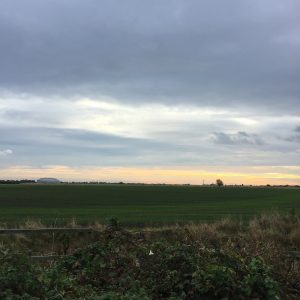
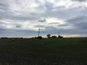
When we reached the site, we were given some maps printed in different scales. These maps certainly helped us to have a broader view of Murton. Situated about 15 minutes away from the Quadrant, which was the North Tyneside Council’s offices, it was a small village consisted mainly of houses, with a few services to complement. Residents and visitors could only access the site through a winding yet narrow road. At the heart of the site were some moors and farmlands, which was fascinatingly refreshing, given that the site was in the central part of North Tyneside. Although, as we were told, some of the land there were privately owned, it was well used by the public. It was morning when we went there, some joggers were seen, with a few others walking their dogs.

 Please allow us to show off our photography skills for a minute… #nofilter
Obviously it would be a shame to have to build on such a lovely site with extensive public, green spaces, the planners reassured us that green spaces would take up 50% of the whole development area. However, the challenging bit was that the current residents chose to live there because of its proximity to the city centre as well as the amount of green space it currently offered, which were something that would be impossible to compensate if the project got the go-ahead. In fact, the residents were already voicing out their objection to the development by putting up “save our green belt” and “no build” signage at the site.
Despite the adverse comments made by the residents, the user representatives, who also went on this trip and were locals of North Tyneside, showed their understanding as to why the development was needed. They recognised the increasing number of people moving to North Tyneside, which caused some housing problem to the area and they agreed that personal interests should have a lesser priority than the general public’s. Moreover, they had noticed the lack of leisure facilities in the area. Indeed, the major public facilities in the area were only hospitals and schools.
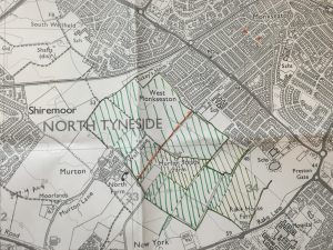
 Area hatched with green Sharpies was the moor and farmland, whereas the orange dotted line in the middle was the proposed north-south link road, an extension of the current access road.
During the course, the user representatives showed their efforts to balance the benefits of different stakeholders and strong critical thinking. They were also keen on seeing new developments in the area and embracing changes. Some of the suggestions they made regarding the development were undoubtedly valuable and very much viable to the Council and developers. Back into our office in Newcastle, we are going to come up with some ideas to help these suggestions to get across very soon…