Digital Civics 2020 Blog Entry 4

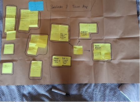
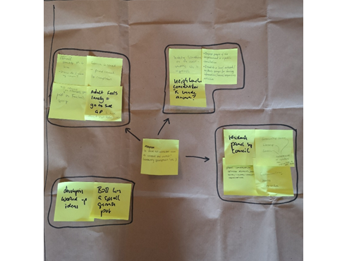
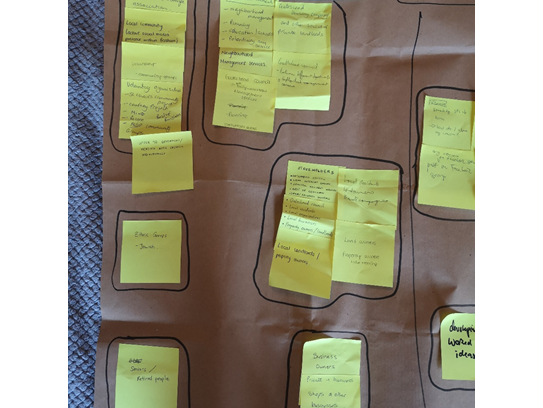
The most important topic this week was to further define the goals that we want to achieve with our project with the help of a series of ‘How might we’ questions that were devised in this session. With those in mind, we were presented a few examples of existing applications to facilitate an understanding of their contexts of use, with which we will be designing our project aim.

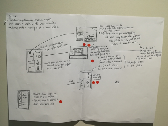
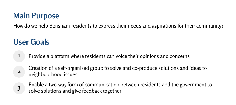
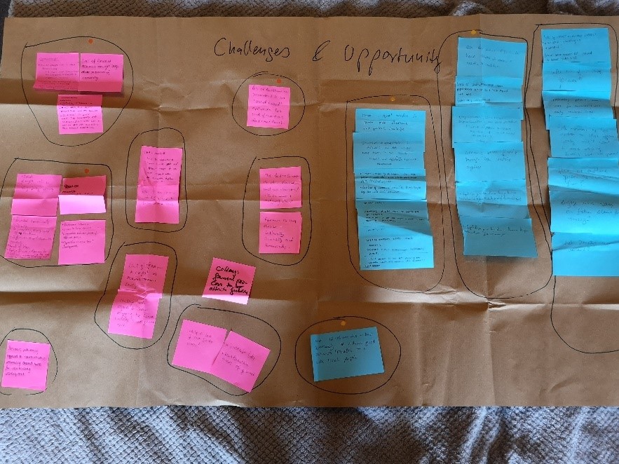
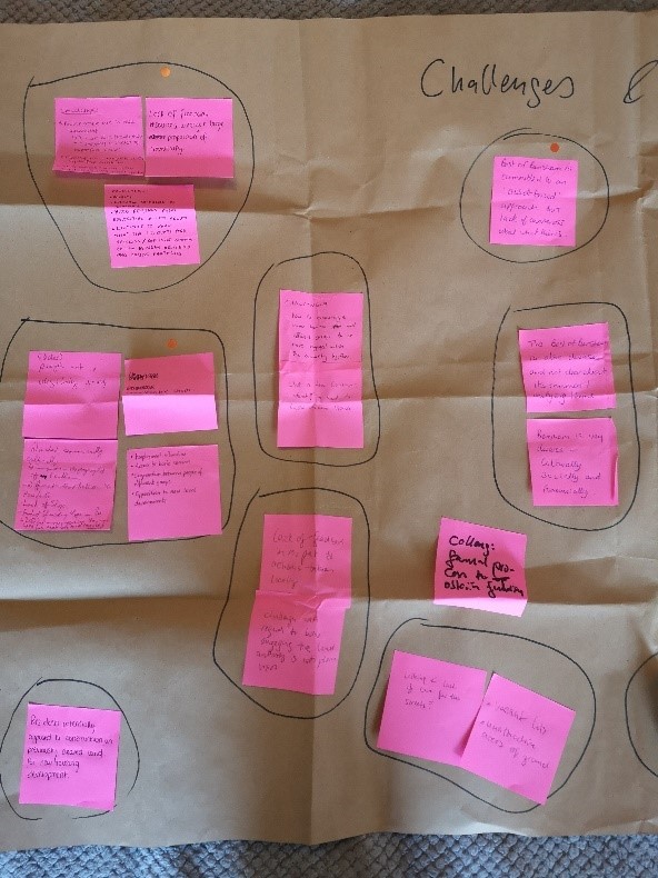
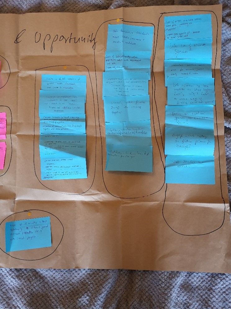
With our main aim being to help the residents in Bensham express their needs and aspirations for their community, these are the questions and points that came to mind:

  • How might we develop a process of co-production between the residents and the ‘Best of Bensham’ group or between the ‘Best of Bensham’ group and the city council?
  • Help creating a community-led group that works to solve issues of their neighbourhood and holds close contact with members of the community
  • How can we help create a self-organised group among Bensham residents that is able to voice their views and establish a better connection with the council?
  • How might a community group be able to relieve some pressure that the council is overburdened with?

For our search for relevant existing applications, we first established a list of core criteria based on the questions above and a few examples that were presented during the seminar, which included both analogue devices and fully digital website-based means, to make our search for further examples more accurate and goal-oriented:

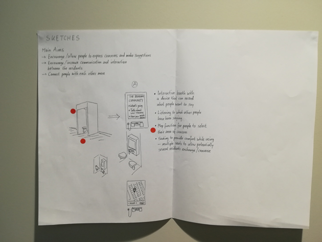
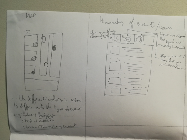
  • Enable residents to voice their concerns to the community
  • Provide a way where the residents and the council can communicate more directly with each other
  • Provide a means where residents would be able to connect with each other and co-produce solutions with the council

Following these criteria for our search, we have identified multiple applications and platforms which employ means that are uncomplicated to handle and make use of state-of-the-art technology, thus having the potential to gain a wide reach among members of a community.

  • Commonplace: An online platform which seeks to bring citizens and planning authorities as well as councils together to shape the living environment. It comes with the functionality of submitting online feedback, which can be seen and reviewed by the respective council and authorities and reduces the effort that needs to be put into organising in-person interviews.
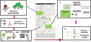
  • FixMyStreet: This mobile application allows residents to document issues they come across and report them to the local council. The main page provides easy-to-follow instructions for its users, as well as an overview of new and updated reports. Residents are also saved from the trouble of searching for contact persons in the council to report an issue to, as the application does it automatically with its submissions, and provides the space for the respective council to write responses and updates.
  • Block by Block: This collaboration makes use of a popular 3-D sandbox video game called ‘Minecraft’ to involve people from all over the world to partake in public projects where they are otherwise excluded. The virtual world in the game provides an easy way of three-dimensional modelling to tackle a respective issue, and it is not limited by materials. It allows people of a community to come together and express their ideas and suggestions in form of easy-to-make visualisations that are visible to everyone.

While each of these applications focus on a different aspect of engaging people through the employment of state-of-the-art technology, the common point here is to bring people together to reach a common goal and cut down the efforts of establishing communication with local governments. This is an important step to encourage more active participation from citizens in local matters, which will be the main aim of our project.

Sources

Commonplace. (n.d.) Conversations to create better places. Available from: https://www.commonplace.is [Accessed 9th March 2020]

FixMyStreet. (n.d.) Report, view or discuss local problems. Available from: https://www.fixmystreet.com/ [Accessed 9th March 2020]

Mojang, Microsoft, UN-Habitat. (n.d.) Block by Block. Available from: https://www.blockbyblock.org/about [Accessed 7th March 2020]

Falco, E., & Kleinhans, R. (2018). Digital Participatory Platforms for Co-Production in Urban Development. International Journal of E-Planning Research7(3), 1-27. doi: 10.4018/ijepr.2018070105

Digital Civics 2020 Blog Entry 5

This week we worked on the first steps on designing a prototype for our project through sketching. Before drawing our ideas, we review all the work that has been done so far and addressed the objectives so every individual knew what our design would lean towards to. We divided our work into 2 parts. On the first part each individual generated and shared a broad range of ideas through sketching in a certain amount of time. The sketches were influence by the research and interviews that has been conducted in the past. Those ideas once shared were discussed with the group. Each member of the group was given 3 red stickers in order to vote for the ideas that were the most relevant for them. As a result, ideas that had the most stickers were the most relevant as we can see on photo 1 and 2 below. This had an impact on the final decisions we made about the prototype we want to design.

PHOTO 1

PHOTO 2

On PHOTO 1 the prototype presented is a digital based application that permit to report issues to the local authority but also share it with the other residents. Through a voting system and enabling people to leave comments it has the purpose to make the voices of the residents to be heard. This prototype has also the purpose of enhancing interaction between residents by creating profiles where they can share their interest skills and knowledge. This prototype has the purpose to enhance connectivity between the local authority and the residents but also between the residents.

On PHOTO 2 the prototype presented is a box with a device that enable to record and listen what other people have been saying notably concerns and suggestions. In the box you have chairs where you could interact directly with other residents. It aims to encourage communication and interaction between residents.

For the second part we took one or several ideas (but no more than 2,3) that were discussed and presented during the first part and sketch 8 variations of it within a short amount of time. When sketching we considered improvement or alternative that could be done with those ideas. After the time passed, we shared and discussed about the variations of our ideas.

PHOTO 3

On PHOTO 3 two variations of an idea is presented. The idea is a digital application that shows event and issues happening in an area. The left variation is a visual prototype that enables to look on projects/issues/events that has happened, going to happen and happening on a map where you just need to click on the coloured dots in order to have more information. The right variation is a descriptive prototype that enables to look on project/issues/events in a chronological way, personal interest and popularity way. In order to have more information you just need to click on the article.

During this session the main challenges we have encountered was to express our ideas through sketching in a short amount of time and to choose ideas that would become the basis for our future prototype. After this session influenced by the discussion we made on the ideas presented, we decided to work towards a digital application prototype that would promote/strengthen connection between the residents and the local authority and between residents. Further research with the prototype design, notably learning from existing application as examples will permit us to create a viable digital based service.

Digital Civics Entry Blog 3

User Research Methods

The team decided to conduct interviews and site visits for user research. We will be interviewing people who are representatives of the government, local residents and community organizer. These people are highly knowledgeable about their community needs, as they either live in the city or work directly with the community. Additionally, the team will conduct site visits in understanding the spatial connections and relationships with the residents. During the site visit, the interviewers will ask the residents to identify meeting points and vacant properties. This will help us figure out where the residents gathers and which areas could have the potential to be redeveloped for community needs.

Aside from the interviews and observations, we are doing literature reviews on digital platforms that could create co-production in the community. Falco and Kleinhans (2018) displays the different types of digital participatory platforms (DPP). DDP functions as a two-way form of communication, bridging the gap between the residents and government. In this article, it provides successful DPP that are exercised in other cities and countries. We will be conducting research on DPPs that foster collaboration and co-production of ideas within the community. Ultimately, we hope to find DPPs that would align with the three User Goals.

These examples include CitySpidey, Commonplace, Block By Block, Fix My Street, Co-Urbanize, and Bang the Table. These digital application examples research serve as references to how we could potentially develop a product for the community.

After these interviews and observations, personas and customer journey mapping would be explored. Grudin and Pruitt (2002) show that persona is an excellent technique to focus on the main audience and enhance awareness on the user experience. The personas could be created after these interviews and site visits. Marquez, Downey, & Clement (2015) demonstrate that customer journey mapping is essential for understanding the overall experience and paths taken by the users. This method is important in establishing a connection between the designers and users, so the designers could determine which pathways would fit best for the users. These two techniques will be further explored in our research, prior to developing a digital application for the community.

Interview Questions & Observations

References

Falco, E., & Kleinhans, R. (2018). Digital Participatory Platforms for Co-Production in Urban Development. International Journal of E-Planning Research7(3), 52–79. doi: 10.4018/ijepr.2018070105

Grudin , J., & Pruitt, J. (2002). Personas, Participatory Design and Product Development: An Infrastructure for Engagement. Retrieved from https://pdfs.semanticscholar.org/9b03/ca765977dc9cf2dbcc25377e71aefa986164.pdf

Marquez, J. J., Downey, A., & Clement, R. (2015). Walking a Mile in the Users Shoes: Customer Journey Mapping as a Method to Understanding the User Experience. Internet Reference Services Quarterly, 20(3-4), 135–150. doi: 10.1080/10875301.2015.1107000

Lois

Digi Civics 2020 Blog Entry 2

This week we met with Jayne Hopkins, our project partner from Best of Bensham, with which we discussed our project brief and gained a greater understanding of the area of Bensham and its community. 

We addressed the challenges and opportunities within Bensham as a starting point for our project focus, some of which included: 

Challenges: 

  • Lack of financial resource amongst large proportion of population. 
  • Inaccessibility to shops for residents who don’t have access to a car. 
  • Unclean streets (Littering/ Vacant lots). 
  • Best of Bensham is unclear of its unifying theme. 
  • Best of Bensham is set on an asset-based approach but there is a lack of understanding about what this is. 

Opportunities: 

  • Bensham is a very diverse area. 
  • The population possess many valuable skills (especially its affluent residents)/ knowledge. 
  • There is a large opportunity to achieve results with the locals within the next 12-18 months due to the current motivation surrounding the topic. 
  • There is a great interest in the creation of more outdoor spaces within Bensham, specifically focusing on garden areas for growing plants/ vegetables. 
  • The group ‘Best of Bensham’, is well-resourced regarding grant funding; can give 10 grants of up to £250 to smaller organisations (e.g. To churches running Christmas day dinners for those who don’t have family to share it with). 

After identifying the challenges and opportunities within Bensham we established a key issue for us to concentrate on, which was to help the residents of Bensham express their needs and aspirations for their community.  

We then discussed potential stakeholders in the project, which we identified consisted of a few main groups: 

  • Gateshead Council; Including Neighbourhood Management Services. 
  • Local Community Groups/ Voluntary Organisations. 
  • Business Owners and Private Landlords. 

Our stakeholders influenced the next steps in our project, which were to determine a number of activities which would help us in developing our research further. We decided to arrange some next steps regarding our project plan which were to organize a series of interviews/ meetings with known residents and community members who are involved in the community activity in their area, and one member of the council. These include people such as, Dave Andrew, Phil Donovan and Robert and Marilyn Rae. The aims of these meetings are to gain knowledge about residents’ opinions of Bensham, relating to the challenges and opportunities we have discussed and learn their thoughts on residents’ ability to express their opinions about the community, as well as the councils point of view regarding the matter. 

There was also some mention of conducting a workshop which the general public of Bensham could get involved with to share their opinions on the matter. This approach was considered to be potentially more effective than individually questioning members of the public on the streets yet would be a challenge to organize. 

We also decided it would be a good idea for some of us to conduct a site visit and  take photographs of the area so we could better understand the characteristics of the location, such as the amount of green/ outdoor space in the area, number of vacant lots and the levels of litter throughout the streets.  

Here are our mind maps regarding the challenges and opportunities identified within Bensham, our stakeholder and process map, and our initial suggestions for project actions. 

Digi Civics 2020 Blog Entry 1

Welcome to the first blog entry for TCP2031 Digital Civics. Today we had our first seminar where we all met each other and Sebastian – who will be our module leader this semester. Our team is made up of urban planning students and architecture and planning students. In our group we have me, Juliet from London, Jimmy from Germany, Hadrien from France, Lois from Canada, Mindaugas from Lithuania, Patrick from York and Angus from Alnwick, who unfortunately could not make the first seminar.

After introductions, we took a look at what our own strengths and weaknesses are and shared this with one another, from doing so we realised that overall we have a collective strength with visualisations and are individuals with an eye for detail and that we all have the ability to do research and analysis but we prefer to work with visuals and design work mostly.

During the seminar we discussed the project brief, covering what the overall aim of the project would be and talking about the area of Bensham in Gateshead; where our project is based. We looked at the area on Google Maps seeing its location to us at the University and also some of the statistical information such as deprivation levels, employment, and feeling of belonging. We had to set out some aims and objectives to what we want to achieve through the project this semester, our main objective is to produce an app or website that supports an issue that we will identify with our project partner so that we can help the locals of Bensham. This highlighted to us that the purpose of the module is to enable a connection between people and their community digitally. Lastly, we had to prepare some questions we would ask our project partner (when Jayne from Best of Bensham comes in) and to residents of Bensham.

Here is a list of some of the questions we have prepared to ask Jane next week so that we are informed on the needs and wants of Benham and the Best of Bensham group.

  1. What groups of people is Best of Bensham comprised of?
  2. What led to the formation of Best of Bensham?
  3. What are the key issues that Best of Bensham feel are present in the area?
  4. What is the typical method to event promotion by the group?
  5. What groups of people are most in need of help?
  6. What kinds of community involvement are already in place?
  7. Is there a main meeting place for locals to speak with those working for Best of Bensham?
  8. What groups of people live in Bensham?

Juliet

Storyboard (Extra) of SIA

Here is the storyboard of SIA in today’s presentation and here I will explain it in detail.

Our aim is to introduce the treasure hunter game to the young children within the community and the idea is to enhance the neighbourhood relationship within the community. Treasure hunter game will be a team work. Children will be set up into groups with 2 or 3 members. It is better for the game as well as knowing each other. Firstly the treasure hunter game will be started from the gate of nearby park or a street the community. The start point can be vary but the concept is to relate to the community, but need to consider the safety of players as there will be many people gather together in a place. Secondly, there is a function called ‘Map’ on the app and players can use it to find locations they need to go next. First place’s location will be give to the player and use the map function to find the place. The clue of the location can become harder step by step. Thirdly, when reach a location, take photos and the player’s QR code will be scanned by the staffs. Volunteers and parents will become stuffs in the game and the QR code is in the ‘My Account’ function and players using cellphone to take photos so easier to upload the photos later in the App and the key idea is to let players know each place in the community better. After that players have to go to all locations shown on the map, take photos, let the QR code be scanned. Finally the finish point of the game will be at the Arthur’s Hill. After the game players can upload their photos taken during the game and give some interactive feedback of the game, for example, what activities you would like to see in the Arthur Hall.

This is the general idea of the storyboard.


Week Log 10 – NUTC

This week we met with Ali, Mark and John who we had decided would be our user testers. We finished our prototype last week so wanted to test it firsthand with stakeholders who could give us an honest opinion on how successful they believe our prototype to be. We completed this test at the civic centre, gaining a lot of very helpful feedback. And decided to leed our user test with the 5 act interview and by giving each one a computer to test and respond with no exterior influence.

Some examples of the feedback were:

  • “We don’t have any strong, clear messages so that’s what I really like, something that’s hard hitting and to the point, talking to driving rather than alternatives.”
  • “Will grab peoples attention”
  • “Directly targets people” – especially the travelling public
  • “Really likable”
  • “Very positive way of reaching out to the people.”
  • “Way of seeing how people feel in a positive sense not just always the negatives”

This was all very helpful as it gave us a lot more confidence in the prototype we have made and it was nice to hear how the council liked our idea and found it believable even thinking of a way they could make our project a reality. The only concerns brought up were the fact that traffic administration people only allow signs in relation to road safety. Although they liked our idea so much they began to think about and suggest to us ways it could become a reality through the likes of roadside signs instead or using modes of transport to display the signs.  

Later in the week we had a workshop on business modelling by Steve Bowden. This  helped us understand how to better our pitch for the proposition of our idea. And taught us how to make a Business Model Canvas.

Business model canvas are based on key partners, key activities, key resources, value proposition, cost structure, customer relationships, channels, customer segments. We figured while doing ours and talking to Steve, that we would have customers (City Council) and users (Heaton Road passers-by) and we could both see our design as a service or product.

Next week we plan to finalise our presentation more, adding the final information with the prototype test feedback, and correct it based on the last presentation feedback, to get it ready ready to present the week after, and to start bringing our blog posts together into a final log for for assignment due dates.


Week 10 – Team 2

This week we began our prototype testing process. We met with Clare Ross, from Gateshead Council at the Civic Centre to show her the PowerPoint presentation prototype of our app for Chase Park. As Clare is one of the stakeholders in our project, it was essential we gained feedback from her for the prototype to ensure we had fulfilled the project goals which were based around the stakeholders’ requests.

Overall Clare responded very positively to our prototype. She was especially impressed with the volunteer hours log section and explained how the volunteers currently use Whatsapp for this, but having this facility on the app would improve communication, make the volunteers feel that they were part of something and make volunteering more sociable. Clare also highlighted that having a public log for individuals’ hours, this could encourage volunteers to complete more hours as it may result in competitiveness. This would have a positive impact on the park and the log could be submitted to the Heritage Lottery Fund as proof of the volunteer hours completed. Clare also gave positive feedback regarding the location service and the ability to share photographs of the park within the app.

Clare only had two concerns about the app. Firstly, she suggested we label the options on the main menu rather than only using symbols; to avoid confusion or doubt of what the symbols meant. Clare also highlighted the obvious issue around safeguarding. Safeguarding is something we need to discuss further as a group and find the most effective way of using security measures within the app without taking the fun out of it.

Clare used the prototype as we intended and we asked her to think out loud as she did. This was useful as we gained feedback from her regarding every aspect of the app. Overall, this prototype test left us feeling positive about our progress but highlighted that we need to think further about the clarity of the visuals and explore the best measures we can introduce for high levels of security and safety.

Our next step will be to hopefully meet with Alan from the Friends of Chase Park to also test our prototype with him and gain feedback from another of our stakeholders.

LOG WEEK 9 – NUTC

This week we focused on getting the prototype test scenes done. Since we do not have the technology of the sensor (to identify the thumb up or down), we chose to do the prototype in a powerpoint presentation, we believe this method will be most efficient to display our ideas and present them in the most realistic and interactive way.

The slides show a scene sequence explaining how our design works and what would be the order we imagined it displaying, starting with a newspaper ad, followed by a street viewer scene and the drivers view of the traffic light. Then the different signs are shown and a voting system in powerpoint allows the user to actually vote as it would happen in real life. Depending of the users choice, a different sign or the Twitter handle will follow.

The scenes were made using Canva, Photoshop and Balsamiq, to create the signs layouts and the slides scenes, and a decision map was made explaining how the order the signs would be shown depending of the vote.

We have arranged to meet with Mark, Julie and Ali to test our prototype and see if they approve of our designs. We plan to do this within the civic centre which will be a fairly formal setting but very appropriate as this is where elections sometimes take place or ballots involving the public. We aren’t planning to ask questions during the prototyping but to explain our ideas more and how did we prepare the presentation so they understand when we expect them to actually interact and vote, so we can let our testers have a play around with our project to get to know it a bit better.

User Test Plan:

We believe our prototype is more a service than an actual device and we expect to find out if our users believe it would be effective for Heaton. We also want to find out if after testing it they agree that it would be a good method to introduce the idea that cycle routes are beneficial.

We know the ideal participants would be Heaton road passers by and residents such as Julie herself. But due to Ali’s wishes for us to keep this out of the public as much as possible, we decided to include her, Mark and third party to test it also.

We intend to start the testing with 5 act interview, welcoming the users, asking what kind of travellers are they, if they normally pass by Heaton road… Then, introduce the prototype, explain what it is and how we expect them to interact (after the scenes start voting). Fourthly, task – get them to carry out tasks on the presentation. Fifth, quick debrief to confirm whether they believe it is effective and would be successful.

For this testing we will only need a computer with the presentation and the users. We believe it will be very accessible and easy to perform the testing.


Week 8 Log – NUTC

Log week 8

This week, we started to polish our prototype ideas and which softwares will we use to accomplish our prototype design. We decided to use Balsamiq, Invision, Photoshop, InDesign, Sketchapp and Powerpoint. We have interpreted an interactive prototype as something visual where the people themselves can follow the storyboard that we will present, compared to as if they would play a video or computer game.

For our prototype, we decided to do a scene presentation explaining how would it work from the drivers or pedestrians vision. We intend to create the signs design and to explain how would the entire process work. As we have explained on the previous logs, the prototype is a informative digital sign with a sensor, which the participant after reading a fact would respond with a thumbs up or down to then get a Twitter handle or another fact. On our presentation we hope to be able to show exactly what would be presented to the passers-by, and what their next move would be.

Our group is currently refining the final ideas and trying to get to a final key concept to present in the end of this module. We have divided the work by taking different roles, that is, maker, stitcher, writer, collector and interviewer. Although, we decided that the group will work together and be apart of any role, in order for everybody to be on the same page during the whole process. But we do keep in mind that some of us are more skilled in some of the roles, for instance Gabriela has created the latest visuals for the final presentation, while the others have been collecting information and researching facts about the benefits with cycling as a transportation mode. We have not yet decided who is going to be the interviewer during the final presentation, as well as who to invite for it (but we intend to make Ali, Mark and Julie part of this).

Next step is to continue further with the research about the sensors and how they would work for our interactive signs. We will also continue to read on the different example projects (Australia for Vote etc.) in order to be able to back up our project as well as possible during the final presentation.

These pictures below show the creative process of some of the visuals that we are planning to use for when presenting the final prototype. These were made on Balsamiq and Photoshop.

The visual part of our presentation will be composed by, besides an introduction of the project and example research, introductory scenes that shows the storyboard from different perspectives, for example Heaton Road looking from the “outside” and from a “car view”, signs, thumbs up and thumbs down, responses and a phone with the twitter hashtag #thumbsupheaton.

For the prototype completion we would need more pictures, and the final designs of the facts signs and the Twitter handle sign, in order to include the whole story board that we have created earlier. Combining the new examples and the further research with the prototype designs we believe the we would be able to start with the final presentation.