
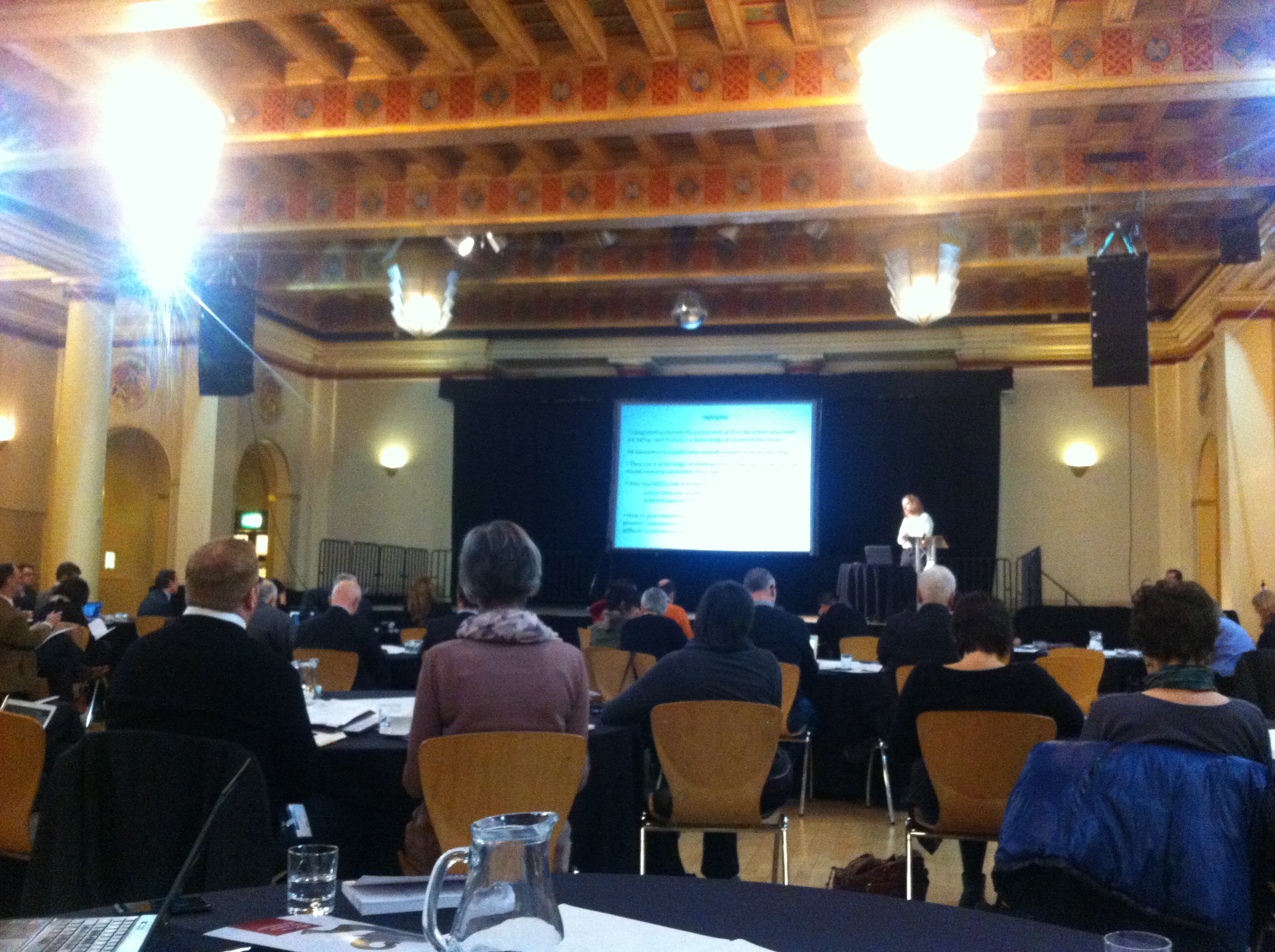
The 2014 Adaptation and Resilience in the Context of Change Network (ARCC Network) Assembly was held at Austin Court, Birmingham over June 10th and 11th. The events theme this year was “Urban areas as systems: adapting for the future”, and had excellent representation from the academic research community, policy-makers, and practitioners involved in the delivery, maintenance and management of services and assets related to the build environment. Some of the keynote addresses were delivered by Atti Emecz and Chris White from EPSRC, outlining the current EPSRC portfolio of built environment-related projects, and the current and future funding landscape. In particular, the alternative mechanisms for trying to maximise research impact, such as secondments, or impact accelerator accounts were highlighted as being potentially useful for engaging with those outside the academic community. David Penhallurick of Infrastructure UK (HM Treasury) gave two presentations on his attempts to break down the silo approach to infrastructure service delivery in the UK, and begin to encourage more collective and collaborative thinking in infrastructure service and project delivery. Good luck with that one David! Interestingly, one area that repeatedly arose from the two-day event was the need to study and grapple with the potential impacts of the built environment on the health and well-being of people who use it and interact with it. Nick Grayson, of Birmingham City Council raised the point that in the future many health-related issues will not be from communicable diseases, but by those potentially related to stress and lack of physical activity. The study of health-related impacts of the built-environment is a potentially interesting future area or theme for EPSRC and ARCC to pursue.
The event itself is was a great success and a great opportunity to network and discuss current and future research areas with policy makers and practitioners. The links to the slide packs generated from the event should be available on the ARCC website in the near future.
Category: Conferences
Feedback from attendance of a conference or similar
Wavelength 14 – laser quest will never be the same again…..
From the 14th to the 16th April the annual RSPSoc Wavelength conference, aimed at students and young professionals to present their work to their fellow peers in an informal environment, was hosted among the quaint hills of Great Malvern, Worcestershire.
I was given the pleasure of opening the conference with a presentation on the work I have been undertaking on automatic 3D city modelling. This was followed by presentations on change detection, archive stereo imagery and forestry applications from various remote sensing satellites. Other presentations during the conference included the use of UAV and structure from motion, atmospheric correction of remote sensing data and the fusion of imagery and lidar.
During the three days keynote speakers included Dr Alastair Graham of Geoger Ltd, Dr Matthew Blackett from Coventry University and Professor James Brasington from Queen Mary University, who all gave invaluable advise of skills and abilities needed to progress during these early steps of research. A consistent theme mentioned by all was the need to be able to write software via different programming languages. A good historical overview was given by all of how data capture, storage and processing has changed. This was also the first year that a sponsor session was held allowing sponsors to present what their respective companies do and how our work fits into these remits. Simon Mears from Leica Geosystems presented some of their recent hardware, particular the Aibotix UAV which was on display, and software developments. Dr Andy Wells from Sterling Geo gave a good overview of the developments of the ERDAS Imagine software and linked this to the topics that had already been presented that day.
The always popular poster session saw a wide range of topics being presented from mass grave detection to how soil moisture content change can be detected. The sessions was almost dominated by Newcastle University with posters presented by first year PhD students Polpreecha Chidburee, Maria Peppa, Magdalena Smigaj, Elias Berra, who presented work on how they intend to undertaken their individual research projects, and Mitko Delev, who presented work undertaken as part of his masters project on using photogrammetry for structural gauging in a railway environment. A poster was also presented by undergraduate student Cedric Meyer who presented his dissertation work on the potential for bio-physical information retrieval.
As well as having a strong scientific program , several social activities were also offered including high pole activities, a trip to Worcester and a guided walk around the hills of Great Malvern. Luckily the sun shone all week, which made the walk much more enjoyable. An evening activity of laser quest was well attended with individuals battling it out to become the ultimate champion. With many references being made about laser scanning and how a scanner could be set up in the arena to make it even harder, it is fair to say I will never look at laser quest in the same way. Drinks were enjoyed at the end of both days allowing delegates to discuss their research work further as well as taking the opportunity to talk to the sponsors and keynote speakers.
A huge congratulation goes to Amy Woodget of Worcester University for organising such a successful conference. As I am about to take over as RSPSoc Wavelength Representative and start to organise next year’s conference here in Newcastle, I hope to build on the success on this year’s conference as well as show everybody what a vibrant city Newcastle is and what it has to offer.
Andrew McClune
GISRUK 2014 – Céilidhs, kilts and k-means cluster analysis
From the 16th April to 18th April I attended GISRUK in a surprisingly sunny Glasgow. The started with a welcome from Jane Drummond followed by an interesting key-note talk from Mike Worboys , A Theoretician’s eye view of GIS Research. He talked about how GISRUK has developed there has been a dramatic fall in the proportion of papers that covered the theoretical side of GIS, with the focus now being on Application.
Talks from the first day that I particularly enjoyed focused on Spacebook, a system of delivering directions via audio as users encountered various way points on a route. William Mackaness talked about his research in comparing directions given using street names and direction given using landmarks.
Phil Bartie, who was a researcher on William Mackness’s paper delved deeper into the issue of Landmarks. Using images he looked at what people identified as landmarks and then analysed them semantically and spatially to distinguish related and unrelated features.
The following day saw me presenting a talk on some of the sensor infrastructure work we’ve done at Newcastle using HStore as a key-value based approach to storing heterogeneous data. Robin Lovelace’s talk round the merits of twitter data in research. Sparking some interesting debate about how research using twitter data uses data from the public so should benefit the public.
Thursday evening then featured the conference dinner followed by the Céilidh, an event that I was secretly dreading, dancer I am not. So was pleasantly surprised at how much fun the event was, as someone pointed out to me; it’s dancing but dancing with an algorithm.
Friday morning then featured my favorite talk of the conference with Paul Brindley talking about his Phd work on extracting the additional address information from addresse listed on the internet to map out neighborhoods. A simple idea but with fascinating results.
The conference was then wrapped up with a keynote from Professor Alias Abdul Rahman who gave an interesting overview on the state of 3D GIS work.
The event was a fun filled thought provoking and thoroughly interesting. Thanks must go to Jane Drummond for seamlessly organizing the event, even managing the weather. I would also like to thank William Mackness who brilliantly chaired my session.
Bring on Leeds 2015. Wonder what there version of Céilidh will be?
Neil – @neil_py_harris
AUM 2014
Alistair Ford has just returned from the fourth annual Applied Urban Modelling symposium (link) in Cambridge where cutting-edge research in spatial simulation of cities, including land-use transport interaction models, agent-based modelling, and big data analysis, was presented and discussed. The conference started four years ago as a reunion of the spatial interaction community of the 1970s to examine progress over the intervening decades, but has grown to include other types of dynamic urban simulation, visualisation, and data analytics.
Michael Wegener (formerly Professor of Spatial Planning at the University of Dortmund) gave a fascinating opening address looking at predictions made by models and modellers 20 years ago and how accurate they had been, This included a discussion of Aldous Huxley’s 1931 book ‘Brave New World’ and whether current advances in data-gathering technologies are taking us in the direction of the future described in that novel! Other presentations on the first day included an attempt to map Lima’s slums using UAVs (ReMap Lima), modelling of all 654 Chinese cities using a parcel-based vector cellular automata model, and a new analysis of Singapore using community detection from transport network flows using analysis of smartcard data (link). Light relief was provided by a presentation of the Imaginary Lines project, a cross between an art project and an infrastructure model! To end the first day Paul Waddell from Berkley presented the latest developments from the UrbanSim stable including GeoCanvas, (now available to download for Beta testing) which allows fast 3D visualisation of large urban datasets, and the developments of UrbanSim to include an IPython interface and PostGIS support.
Mike Batty from CASA at UCL started the second day with a review of progress on urban modelling and the big issues facing the community today (including a loss of faith in predictive ability, loss of parsimony, the need for money and information flows as well as people and goods flows, inclusion of data about transport trips for non-work purposes (which are only ~25% of journeys in cities now), the challenge of growing city regions and globalisation, and the rapid change in cities today). Paul Buchanan from Volterra gave a critique of transport economics, showing how wrong a lot of assumptions (i.e. Value of Time measures) are, before Coen Tuellings from Cambridge University presented his model of land economics and transport in The Netherlands. Pascal Perez from SMART in Australia showed his work on TransMob, an agent-based model of urban travel and residences. The day finished with a fascinating session on the redevelopment of the King’s Cross area of London, giving a real insight into the planning and development process and showing us all just how difficult it is to model the ways that decisions are made in cities!
The final day included sessions on standards and benchmarking (including ISO standards for urban data) and urban dynamics (with some network analysis of city street networks and their evolution). The day, and conference, concluded with a 2-hour round-table discussion about emerging issues, where it was agreed that urban modelling needs to focus on new applications, particularly the challenges posed by climate change and the need for sustainability. Challenges that we in the School of Civil Engineering and Geosciences are well-placed to meet!
Urban Integration 2014
Researchers from the Geospatial Engineering group (Alistair Ford, Daniel Caparos-Midwood, Shaun Brown) recently attended the Urban Integration conference in Sheffield which marked the end of the EU Cost Action on Integrated Assessment of Climate Change (link). This cost action was led by Prof Richard Dawson, also of the School of Civil Engineering and Geosciences, and aimed at bringing together practicioners from across Europe who are looking at the problems facing cities in an integrated way.
A number of topics were addressed across a broad range of fields, but papers of particular interest to geospatial engineers included Jonathan Kohler (Fraunhofer Institute) on why we need urban models and what characteristics they possess (e.g. simplifying reality, explicitly stating theories and assumptions, simulating future scenarios), Christoph Reinhart from the MIT Sustainable Design Lab on the combination of Building Performance Simulation with other urban models in the Urban Modelling Interface (urbanmodeling.net) and Reinhard Koning from ETH Zurich (check!) who presented his simulation integration platform which allows the combination of model outputs to form an urban planning support system using big data to understand the urban system and find high suitability areas for sustainable development.

- Jonathan Kohler at UI.
Other interesting research projects included the iGuess project (link) from the Henri Tudor Institute in Luxembourg, presented by Ulrich Leopold, which is an open-source platform in a database-driven web-based modular framework for performing urban simulations and Vincent Viguie from CIRED in Paris who showed his model of urban growth, NEDUM, linked to the Town Energy Balance (TEB) urban climate model (link) to assess heatwaves and associated health effects (and that even demolishing 10% of Paris’ buildings to create parks will have little effect on urban temperatures!
The conference was a great success and a fitting end to the COST Action.
EuroSDR EduServ E-Learning 2014
Monday 3rd till Tuesday 4th March saw the introductory lectures held for the 12th EuroSDR EduServ e-learning course at the University of Trento, Italy. Located just south of the Alps, the city sits in the Adige Valley so is surrounded by snow-caped mountains to give a picturesque view. The lectures were attended by a small delegation, mainly from national mapping agencies and universities from across mainland Europe. The four courses of the EduServ programme were introduced and presented by the various course leaders over the two days.

View from Bruno Kessler Foundation, Trento University
On the first day Professor Norbert Haala, of Stuttgart University, started proceedings and presented material for his course on high density imaging matching. He presented some of the results of DSM creation from different software packages as part of his EuroSDR benchmark on image matching, whilst giving an overview of the Semi-Global Matching (SGM) algorithm, which I am using as part of my PhD, It was shown how a dense point cloud can be created from UAV and aerial photography by using the SGM approach. Hopefully this workshop will give greater insight and help overcome issues that have been experienced with ‘noisy’ photogrammetric point cloud.
Afterwards Dr Petri Ronnholm, of Aalto University in Finland, presented his course on the integrated use of airborne laser scanning and aerial photogrammetry. This was again based around a EuroSDR benchmark which tested different methods for the integration of the two dataset, some of which will be used in the course. The lecture was concluded with an interactive session to discuss the advantages and disadvantages of integrating the two dataset and what future applications this could be used for. One point that arose and was discussed was whether there was a need to integrate the two datasets due to high density point clouds being created from imagery, by the principles outline previously by Professor Haala. It was concluded that although lidar is still essential for forestry application, research may prove that photogrammetric point clouds are just as suitable as lidar for other applications.
A meal was held after the first day’s lectures at a local restaurant in Trento, with exquisite pasta and other traditional Italian food enjoyed over four courses and wash down with a glass (or two) of local wine. This offered a great ice breaker and a way to get to know other delegates as well as the course leaders.
Dr Clement Mallet, of IGN France, started the second day by presenting material for his course on change detection in high-resolution land-use/land-cover geodatabases and presented work from his EuroSDR benchmark regarding change detection methods. The need for land cover and land use was introduced followed by many different approaches presented, which mainly used satellite imagery.
Dr Daniella Poli, of Terra Messflug GmbH, closed proceedings with the last of the four courses on mapping using high-resolution satellite imagery. An insightful overview was given of low resolution film-based satellites to new high resolution digital-based sensors as well as the processing that is required for processing the data. This carried on from some of the principles covered by Dr Mallet, giving more details on the processing that may be required in order to use satellite imagery including radiometric corrections and Rational Polynomial Coefficients.
Thanks to Fabio Remondino of Trento University for hosting an excellent introductory workshop. With the first course starting today (10th March) and the final course finishing on the on the 13th June it is hope many new skills will be learnt over the next four months.
Andrew McClune
PhD Student in Photogrammetry
Strewth, these guys are SMART!
The inaugural International Symposium for Next Generation Infrastructure was held between 1st and 4th October 2013, at the SMART Infrastructure Research Facility at the University of Wollongong, Australia, and one lucky Geospatial Engineering researcher from Newcastle was able to attend. David Alderson gave a 20 minute presentation entitled “A National-Scale Infrastructure Database and Modelling Environment for the UK” following a successful submission of a conference paper to the conference committee, under the same title. The work contained within the paper and the presentation represented an amalgamation of work conducted by David and other researchers from the Geospatial Engineering group at Newcastle and other research institutes and universities involved in the Infrastructure Transitions Research Consortium (UK ITRC) programme. The focus of the paper and presentation was to give readers and delegates alike a glimpse of some of the work undertaken in the process of constructing a database of infrastructure-related data relevant to the UK. This included not only an overview of some of the datasets that may be found within the database, but also a preview of some of the visualisation tools that are being developed on top of the data. An overview of these visualisation tools can be found within other posts in this blog site here.
A copy of the slides can also be found here and here. Unfortunately the presentation has had to be split into two parts, so please download from both links to get the full presentation.
Other representatives from the School of Civil Engineering and Geosciences at Newcastle University, UK could also be found delivering presentations at the event including:
Miss Sarah Dunn, PhD Student – Modelling infrastructure systems for resilience and sustainability (part one, part two)
Mr Shaun Brown, PhD Student – Resilience of resource movements to disruptive events
Mr Matthew Holmes, STREAM PhD Student – How do we ensure the assessment of infrastructure resilience is proportionate to the risk?
Further to this fantastic opportunity, a further round of meetings looking to develop collaborations between researchers at SMART, including former Newcastle-based PhD student and post-doctoral researcher Dr Tomas Holderness, and the Geospatial Engineering group at Newcastle, is being held at the SMART infrastructure facility between October 8th and 11th 2013. These meetings will look to focus on potential collaborative opportunities regarding network interdependencies between infrastructure networks, and also web-based data dashboards for visualisation and dissemination purposes.
Watch this space for more information…
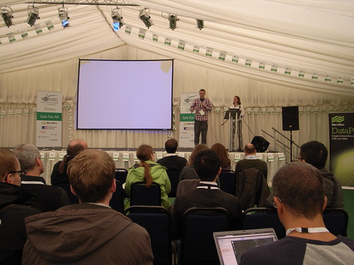
FOSS4G13 – 3 days of peace love and maps
From the 18th to 21st September Phil James and I attended FOSS4G 2013 (Free and Open Source Software 4 Geospatial) in Nottingham. The conference kick started on the Wednesday evening with an Ice-breaker event featuring a pub-quiz following by a light-hearted talk given by Mike Parker, the author of Map Addict. The talk was very enjoyable but the quiz proved somewhat challenging and my sole contribution to my team’s effort being that I knew which animal Friar Tuck is in the Disney Robin Hood. He’s a badger.


The conference then truly came to life over the next two days with some great keynote talks. Particular highlights being Chris Tucker from MapStory.org, Tim Sutton from QGIS and Paul Ramsey from POSTGIS who’s sermon on being an open source citizen was one of the best talks I’ve ever been to. These were interspersed with a great selection of talks (some of which are available here ) showing the uses of software as well as outlining releases of new software such as the OpenLayers 3 which looks very exciting.

The conference was also complimented brilliantly with some great evening events featuring comedy, music and drinks. I would like to thank Steven Feldman and all of the FOSS4G heroes for putting on what was a thoroughly enjoyable event
FOSS4G13 Geohack.
![]()
From the 17th-18th of September I attended the Geohack event at FOSS4G conference in Nottingham. The event was sponsored by the MetOffice in partnerships with many other of organizations within Environmental Science to Services Partnership. A number of challenges were presented for hackers to work on, these are listed here http://2013.foss4g.org/geohack/challenges/ . As part of the LTURF project I have found myself working with a number of APIs trying to extract any information for around Newcastle. This lead me to picking the outdoor event challenge as it was making use of several APIs http://2013.foss4g.org/geohack/challenges/events/ .

This aim of this challenge was to estimate the effect that weather has on outdoor events in the UK. The first task was to retrieve information about any outdoor events happening in a given location. This was achieved by using the skiddle.com, an events listing website, and their API. Which allows you to search for events planned using a point and a buffer. Once we had the events the next goal was to gain an estimate of the number of people attending each event. This task was assigned to me, and for this I used both the Facebook and the twitter APIs. With Facebook returning the numbers of attending and maybe responses to the event, and twitter returning a popularity score. The final step was to use Met Office DataPoint API to get the weather forecast of the event. These were then all integrated into a very simple web portal. This is live here , we had little over 24 hours to complete this task so the portal is very much substance over style.
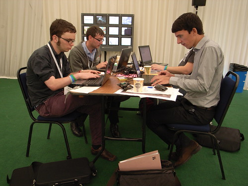
At 1pm on the second day everybody had to stop developing and then present they work for it to be judged. It was very interesting to see what the other groups had achieved , with some of the achievements being very impressive given the amount of development time. Phonegap, which is a free and open source framework that allows you to create mobile apps using standardized web APIs across many platforms, was used by a number of groups. And is clearly a very powerful tool with some groups having a completed app developed in just 24 hours. Unfortunately my group didn’t finish in the top 3 which I’m certain is only because the complexity of our app was hidden, in short we lost because it was too good.
The event was brilliantly run with plenty of food, drink and electricity to go round and I would like to thank the members of the Met office and the foss4g volunteers for organizing the event. And Also Steven Citron-Pousty who setup the OpenShift server for our app.
ITRC Assembly, June 10th-12th 2013, Chilworth Manor Hotel, Southampton
During the early summer of 2013, the UK Infrastructure Transitions Research Consortium (ITRC) underwent a mid-term review, approximately two and half years after the inception of the research programme, which coincided with the annual ITRC Assembly. The assembly and review gave all of those working within the consortium, and also invited guests and delegates, the opportunity to hear about the work accomplished during the initial half of the research programme. The 5 year research consortium is funded through an EPSRC Programme Grant, with the mid-term review offering the chance to discuss the future of the flexible funding available for the final two and half years of the programme.
The three day meeting was held at Chilworth Manor Hotel in Southampton, and was facilitated by a facilitation group, Dialogue Matters to help coordinate and focus a delegation of researchers, academics, stakeholders and partners. Monday offered the chance for the Expert Advisory Group (EAG) to review the documentation and work completed under the five different work streams. Whilst part of this review took place behind closed doors alongside the program’s principal and co-investigators, subsequently the EAG gave direct feedback to all of those attending the three day meeting. This session was then followed by an open floor discussion and questioning by researchers, PhD students and investigators from the program of the EAG panel. The utility of the EAG in particular was felt by the program during these discussions, and also via their continued guidance on the cycle 2 and 3 assessments due for release in January 2014 and in the autumn of 2015 respectively. Further to the feedback delivered, the post-lunch slot was dedicated to researchers and investigators funded through the program the chance to present some more specifics about the tasks undertaken during the first half of the program. This was particularly effective in getting everyone up to speed with what others within the consortium had been working on, and helped certainly to set the scene for discussions about future directions assigned to day two and three. Finally, a group of ITRC-affiliated PhD students presented some scoping research they had carried out to try to pull together a set of data on projects, research centres and institutes at the global scale who are also working on similar research as that conducted under the ITRC banner. Not only was the presentation interesting in the manner in which it was delivered, the data and information collected offered a great starting point for further development of the ever-growing research community, acting as a focal point for information about the community at large.
Day two began to offer the affiliated researchers and investigated across the many universities represented within the program, the opportunity to address some of the following questions:
- Where have we got to?
- What is happening in this field, in other projects and around the world?
- What externalities may adjust the way this research is conducted, or will influence the likely impact the research has e.g. changes in policy, education, funding, society, environment, markets etc)
Whilst discussions of these questions began immediately in the morning session to broaden the horizon of future possible directions, a selection of “seed” ideas or possible projects that were a priori selected as being potential key research directions were also considered. The opportunities to think more broadly about possible research directions for the final two and half years of the project and also consideration of ideas already identified as of interest, gave everyone the chance to give their opinion on what could or could not feasibly be achieved given the available remaining time and resource. From a personal perspective, I think this gave everyone a real sense of ownership of the future direction of the research and certainly helped to gauge the relative importance of the different tasks identified by researchers from wholly different backgrounds. Subsequently this session allowed researchers to consider new ideas and areas based on the knowledge gained during the first half of the program. The breadth of ideas was enormous, ranging from the need for autonomous analytics for infrastructure planning, provision, monitoring and recovery to the need for new systems to manage the proposed integration of unmanned aerial vehicles within commercially used airspace in the United States, currently being considered by FAA.
Whilst the majority of the second day was spent considering the future direction of program, the afternoon session gave an opportunity for those involved to take stock of the success of the mechanisms employed for internal communication within the consortium. As the consortium is spread over many research centres and universities, effective communication between them and within the consortium is critical to ensuring objectives are achieved. The qualitative review considered the utility of using social media to facilitate communication both internally and externally, such as the use of Twitter and Skype for external dissemination and internal discussions, whilst also appraising the use of the ITRC intranet for collaborative working, and assessing the state of the external facing ITRC website.
With Tuesday giving plenty of opportunity to widen the research agenda and look at possible future research directions that the consortium could move in to, as well as assessing what tasks are to be achieved within the remaining two and half years of the project, Wednesday’s agenda focussed on narrowing this scope. A series of research themes had been identified from Tuesday’s discussions, and researchers were invited to select a theme upon which to discuss what the key areas of interest within that theme might be. However, not only were ideas generated, but challenges to achieving success in these areas were also highlighted, to give an impression of the relative difficulty of each theme. The results of many of the discussions held on day two and three have certainly helped the principal and co-investigators of the program to coordinate what tasks and objectives are to be achieved within the final years of the program.
Overall the assembly and mid-term Review offered everyone involved in the program to take stock of the achievements to date, whilst recognising the significant challenges that lay ahead when trying to deliver on a program which is trying to understand the complex nature of infrastructure, how it is operated, and it’s likely resilience to impending changes in demography, economy and climate.
The following table offers a summary of those people who were involved in the three day meeting:
| Role | Name | Affiliation |
| ITRC Expert Advisory Group (EAG)
Chairman |
Colin Harris | Independent |
| ITRC Expert Advisory Group (EAG)
Members |
Rosemary Albinson | BP |
| Theresa Brown | Sandia National Laboratories | |
| Jeremy Cooper | Laing O’Rourke | |
| Yacov Haimes | University of Virginia | |
| Geoffrey Hewings | University of Illinois | |
| David Penhallurick | HM Treasury | |
| Margot Weijnen | TU Delft | |
| EPSRC Representatives | Christopher White | EPSRC |
| Iain Larmour | EPSRC | |
| ITRC Principal Investigator | Professor Jim Hall | University of Oxford |
| ITRC Program Manager | Miriam Mendes | University of Oxford |
| ITRC Investigators | Dr Nick Eyre | University of Oxford |
| Professor John Preston | University of Southampton | |
| Professor Chris Kilsby | Newcastle University | |
| Professor William Powrie | University of Southampton | |
| Professor Cliff Jones | Newcastle University | |
| Dr Stuart Barr | Newcastle University | |
| Dr Stephen Hallet | Cranfield University | |
| Professor Pete Tyler | University of Cambridge | |
| Professor Mark Birkin | University of Leeds | |
| Dr Jim Watson | University of Sussex | |
| ITRC Researchers | Simon Abele | University of Oxford |
| David Alderson | Newcastle University | |
| Pranab Baruah | University of Oxford | |
| Simon Blainey | University of Southampton | |
| Modassar Chaudry | Cardiff University | |
| Adrian Hickford | University of Southampton | |
| Scott Kelly | University of Cambridge | |
| Alexander Otto | University of Oxford | |
| Raghav Pant | University of Oxford | |
| Meysam Qadrdan | Cardiff University | |
| Chris Thoung | Cambridge Econometrics | |
| Rachel Beaven | Cambridge Econometrics | |
| Martino Tran | University of Oxford | |
| Chengchao Zuo | University of Leeds | |
| ITRC-affiliated PhD students | Edward Byers | Newcastle University |
| Robert Carlsson | University of Oxford | |
| Razgar Ebrahimy | Newcastle University | |
| Timothy Farewell? | Cranfield University? | |
| Ed Oughton | University of Cambridge | |
| Oliver Pritchard | Cranfield University | |
| Scott Thacker | University of Oxford | |
| Katherine Young | University of Oxford |