My GISRUK 2016 Experience

So this year I (Kaizer) managed to attend the GISRUK conference in London with Dr. David Fairbairn. I must admit it was quite a good experience to meet other researchers working in the GIS field. I also had a chance to present my poster to a large number of people who never gave me a breather because they kept on coming and asking more questions. It was a good experience, to share with them what my work entailed. Their fascination was mostly on the fact that I was working towards introducing a novel concept of VGI, to a developing country (Botswana). Volunteered Geographic Information in Land Administration has a big role to play in developing countries. This research with its objectives of investigating how such a technology can be used to improve Land Administration Systems in developing countries is very optimistic that it is what the doctor ordered for regions with limited resources, dysfunctional, closed and ineffective land administration systems.

Having standards based systems has worked diligently for western countries and a large number of developing countries have tried to follow suit, with less success. The reasons being that they are simply not affordable to these countries, while in other cases they lack capacity to carry them forward after they have been implemented. As such, alternative solutions like VGI, which aim to develop affordable, fit for purpose, more open and participatory solutions are worth investigating. Our belief is that they are the answer to these countries especially in rural areas where there is little or no land information to help rural communities secure tenure. In addition, the participatory nature of VGI helps individuals become aware of activities in the communities and they are better poised to manage their land and its resources. With VGI, there can be clarity of who owns what, where, and in what proportions. Conflicts can also be reduced amongst neighbouring villagers in the community.

Inaugural QGIS northern group meeting

A group of us attended the inaugural QGIS northern group meeting, kindly organised and hosted by Seraphim Alvanides at Northumbria University. The meeting focused on the use of QGIS in teaching at university level followed by a broader session on the use of QGIS in other sectors and its development.

From the strong mixture of representatives, presentations from Leeds (Helen Durham) and Newcastle University (David Fairbairn) gave insights into the teaching of QGIS and more broadly open source spatial technologies at both undergraduate and postgraduate levels. Josephine Ellis, from Blue Kayak, gave an overview of how the skills learnt on these courses are being implemented in a professional environment to move away from proprietary software. Our own David Fairbairn presented details of the teaching some members of group do across a range of degree programmes, including the content on our own GIS and SMS (Surveying and Mapping Sciences) degree courses, but also those modules which we give on Civil Engineering courses as well as to other programmes within the schools of geography and biology . A brief mention was also given to some of the CPD courses which both Leeds and we run, with Laura Hanson (ARUP, formally our group), also referring to these within her talk on experiences with GIS and QGIS.

The later talks were more focused on the application of QGIS and developments of the software and plugins. This was mostly led by public sector inputs, with talks from Stockton-on-Tees Borough Council (David Renn), Newcastle City Council and Lutra Consulting (Brian Williams and Saber Razmjooei respectively) as well as a talk from Northumberland National Park (Tom Chadwin). These series of talks focused on the adoption of QGIS (from ArcGIS) and the development of plugins to fill gaps within the functionality of QGIS to make it the GIS software of choice for many within the organisations.

From the perspective of researcher within an academic environment and a current QGIS user (as well ArcMap user), it was informative and useful to discover how such software was being applied and developed within different environments.

Plans are being made for further meetings, with suggestions from those interested welcome.

Football Ground Nearest Station Mark II

When I wrote the blog post “Settling a Coffee Break Debate – Football Travel Distance” It was done to do just that, settle a coffee break debate. Getting the Football Supporters’ Federation to share it came as an afterthought. In doing so the true power of the crowd was unleashed and we received several comments from fans pointing out minor errors in the results. Mainly missing railway stations or errors in the location of the football ground. As such I wanted to prove that the Geospatial Engineering group are nothing short of perfectionists and rectify these results.

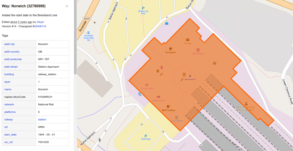
Firstly I had to retrieve all the locations of railway stations in the UK. I did this by using the OpenStreetMap extended API and download all features in the UK bounding box that contained the tag “railway=station”. This gave me a selection of nodes and polygons. I generated centroids of the polygons and merged them with the nodes. As a few commenters pointed out the last piece of analysis didn’t include tram, light railway and subways. So for completeness I also carried out the same process on features marked “railway=tram_stop” (light rail and subway stations are included in “railway=station”).

Screenshot_2016-04-20_09-57-22

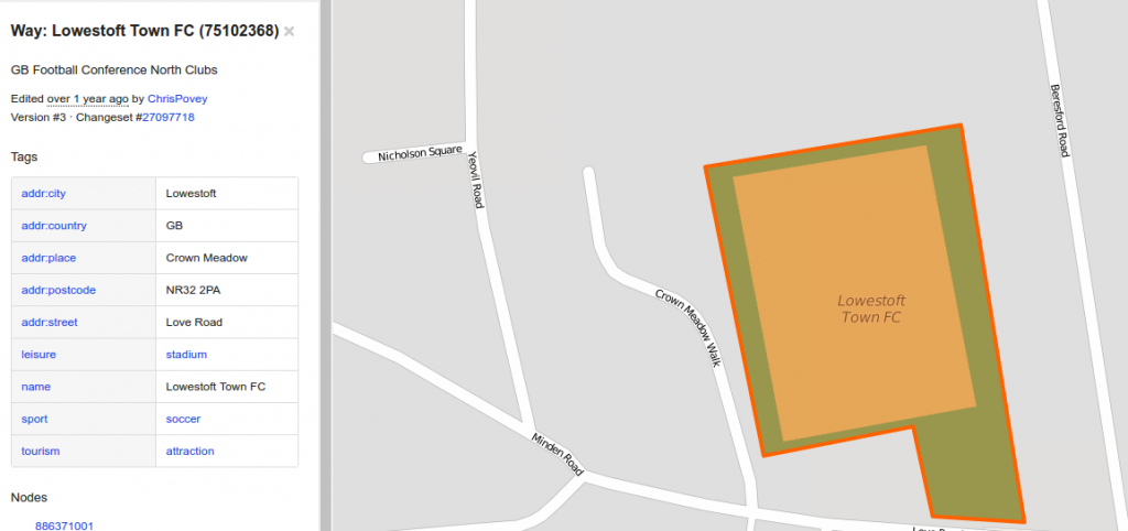
I then had to retrieve the locations of football stadiums. Again I used the OpenStreetMap extended API and downloaded all features that contained both “sport=soccer” & “leisure=stadium” tags. And likewise generated centroid of the polygons and merged with the points. However due to either the stadium not being tagged as such or simply not mapped out yet a few grounds were missing so in these places I have used the previous locations. I also had the problem that the openstreetmap features didn’t contain information on the club and the stadium name were in some cases slightly different to the names I had stored ( e.g. Emirates, and Emirates Stadium) so I had to do some fuzzy text matching to complete this mapping.

Screenshot_2016-04-20_10-12-56
Lowestoft fc’s ground is mapped out but Norwich City’s isn’t

Once I had the 2 new datasets it was just a simple case of calculating the nearest station/stop to each stadium and the distance between them. Again I achieved this by loading both datasets into PostgreSQL/PostGIS. Below are the full set of results. With the representing the distance from the centre of station/stop to the centre of the stadium, so not necessarily the distance a fan would walk. Also this does not take into consideration that the station or stop might not be open on match day.


Club Ground Name Railway Station/Tram Stop Distance (m)
Yeovil Town Huish Park Yeovil Pen Mill 4334
Oxford United Kassam Stadium Radley 4059
Wycombe Wanderers Adams Park High Wycombe 3761
Reading Madejski Stadium Reading West 3634
Shrewsbury Town New Meadow Shrewsbury 2575
Colchester United Community Stadium Colchester 2559
Scunthorpe United Glanford Park Althorpe 2500
Cambridge United Abbey Stadium Cambridge 2296
Preston North End Deepdale Preston 2243
Stoke City Britannia Stadium Stoke-on-Trent 2212
Doncaster Rovers Keepmoat Stadium Doncaster 2159
Burton Albion Pirelli Stadium Burton-upon-Trent 2033
Bristol Rovers Memorial Stadium Montpelier 2029
Swansea City Liberty Stadium Swansea 1978
Port Vale Vale Park Longport 1854
Northampton Town Sixfields Stadium Northampton 1831
Leicester City King Power Stadium Leicester 1755
Chesterfield Proact Stadium Chesterfield 1753
Liverpool Anfield Kirkdale 1753
Rochdale Spotland Rochdale Town Centre 1652
Stevenage Broadhall Way Stevenage 1603
Leeds United Elland Road Cottingley 1510
MK Dons Stadium:mk Fenny Stratford 1507
Crawley Town Broadfield Stadium Crawley 1488
Oldham Athletic Boundary Park Westwood 1430
Accrington Stanley Crown Ground Accrington 1403
Hull City KC Stadium Hull Paragon Interchange 1397
Wigan Athletic DW Stadium Wigan Wallgate 1359
Carlisle United Brunton Park Carlisle 1352
York City Bootham Crescent York 1290
Huddersfield Town The John Smiths Stadium Huddersfield 1263
Plymouth Argyle Home Park Plymouth 1252
Southampton St Marys Stadium Woolston Railway Station 1244
Luton Town Kenilworth Road Luton 1217
Fulham Craven Cottage Putney Bridge 1160
Middlesbrough Riverside Stadium Middlesbrough 1148
Nottingham Forest City Ground Nottingham Station 1147
Bristol City Ashton Gate Parson Street 1135
Bury Gigg Lane Bury 1131
Blackburn Rovers Ewood Park Mill Hill 1123
Burnley Turf Moor Burnley Central 1108
Derby County Pride Park Derby 1051
Everton Goodison Park Kirkdale 1005
Swindon Town County Ground Swindon 994
Morecambe Globe Arena Morecambe 989
Bournemouth Dean Court Pokesdown 966
Bradford City Valley Parade Bradford Forster Square 907
Newport County Rodney Parade Newport 789
Birmingham City St Andrews Bordesley 760
Wolverhampton Wanderers Molineux Wolverhampton railway station 759
Gillingham Priestfield Stadium Gillingham 753
Sheffield United Bramall Lane Granville Road / The Sheffield College 749
Notts County Meadow Lane Nottingham Station 739
Watford Vicarage Road Watford High Street 722
Crystal Palace Selhurst Park Selhurst 707
AFC Wimbledon Kingsmeadow Berrylands 684
Barnsley Oakwell Barnsley Interchange 682
Portsmouth Fratton Park Fratton 663
Southend United Roots Hall Prittlewell 651
Leyton Orient Brisbane Road Leyton 631
Peterborough United London Road Peterborough (NVR) 602
Barnet The Hive Canons Park 593
Dagenham and Redbridge Victoria Road Dagenham East 560
Queens Park Rangers Loftus Road Shepherd’s Bush Market 552
Rotherham United New York Stadium Rotherham Central 551
Norwich City Carrow Road Norwich 543
Blackpool Bloomfield Road St Chad’s Road 531
Brentford Griffin Park Brentford 494
Ipswich Town Portman Road Ipswich 494
West Ham United Boleyn Ground Upton Park station 484
Sunderland Stadium of Light St Peter’s 481
Mansfield Town Field Mill Mansfield 461
Cardiff City Cardiff City Stadium Ninian Park 449
Hartlepool United Victoria Park Hartlepool Railway Station 418
Bolton Wanderers Reebok Stadium Horwich Parkway 398
Tottenham Hotspur White Hart Lane White Hart Lane 392
Charlton Athletic The Valley Charlton 371
West Bromwich Albion The Hawthorns The Hawthorns 368
Millwall New Den South Bermondsey 362
Aston Villa Villa Park Witton 359
Arsenal Emirates Stadium Drayton Park 344
Walsall Bescot Stadium Bescot Stadium 279
Fleetwood Town Highbury Stadium (Fleetwood) Stanley Road 278
Crewe Alexandra Gresty Road Crewe 272
Brighton and Hove Albion Falmer Stadium Falmer 261
Sheffield Wednesday Hillsborough Leppings Lane 258
Manchester City City of Manchester Stadium Etihad Campus 255
Chelsea Stamford Bridge Fulham Broadway 242
Coventry City Ricoh Arena Coventry Arena 185
Newcastle United St James Park St James 160
Manchester United Old Trafford Manchester United F.C. Halt 122
Exeter City St James Park (Exeter) St James’ Park 113

Reflections on GISRUK 2016

The 24th GISRUK conference took place last week in the University of Greenwich.  After significant Newcastle input to the 2015 GISRUK in Leeds, this year saw a smaller presence – just David Fairbairn and Kaizer Moreri attended, each with a poster, each on VGI and the fidelity and value of such citizen-sourced data for applications in national mapping and in land registration systems; the overall attendance and size of programme was certainly smaller than previously. 

The venue was certainly impressive, Greenwich (a UNESCO World Heritage Site) looking stunning in the spring sunshine.  The university’s vice-chancellor, David Maguire – GIS guru from his time at ESRI and his continued joint authorship of ‘the book(s)’ – welcomed us, thanking the main organisers, Zena Wood and Mike Worboys from the Greenwich GIS Research Group.

There was the usual variety of sessions and papers, with some unusual focus on gazetteers, on novel systems and applications (e.g. an innovative tourist guide to Lancaster), and on VGI issues and uses.  Those ex-Newcastle GISRUK stalwarts from Maynooth introduced us to some interesting personalities, responsible to addressing GIS concepts long before GIS was ever thought of …

Workshops and challenges, and an appeal to informality which benefits the large number of MSc students brought along to GISRUK every year, are what can be expected from this annual meet-up.

The three keynotes, well-scheduled throughout the programme, were the highlights: Ross Purves (University of Zurich) demonstrated the enduring value of his long-standing research on tags, semantics, ontologies, and full text retrieval and analysis; Nye Parry (University of Greenwich) took us on a tour of music (and dissonance) which had a spatial aspect to it; and Jeremy Morley (an external examiner at Newcastle in a previous life), demonstrated, amongst other things, the response of Ordnance Survey to changes and opportunities in GIS technologies, in a wide-ranging and thoughtful presentation.  Amongst his assertions was that fundamentally GIS has not changed in the past 30 years, and that all developments have been incremental ‘add-ons’.  It was ever thus, of course, with Ordnance Survey itself being recognisable, even today, to the apocryphal cavalry officer for whom its maps were created from 1791.  The main debate of the conference, and perhaps one its main outcomes, was about the nature of change in GIS, and whether GIS needs a revolution or continued evolution.

Settling a Coffee Break Debate – Football Travel Distance

NEW BLOG POST CORRECTING ERRORS HERE 

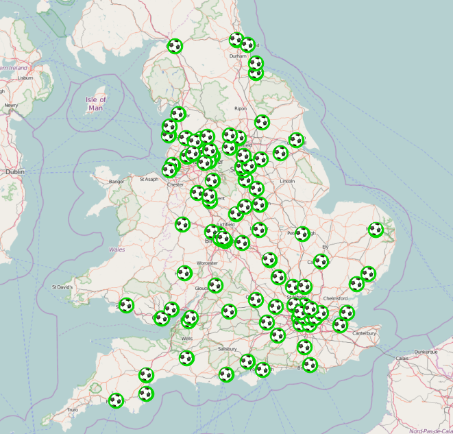
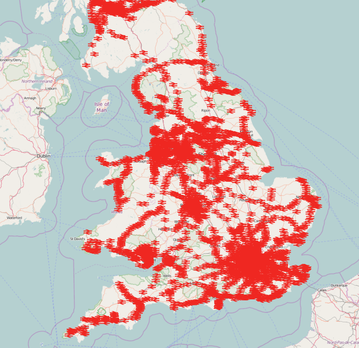
As I imagine happens at many work places the coffee break for the Geospatial group often brings up some lively debates. Whilst today’s debate itself wasn’t exactly lively it did pose an interesting question. Which football ground is the further away from a mainline railway station? The answer put out there Hillsborough. Not content with this guesswork I ran a simple piece of analysis. Luckily we have the football grounds from the work we carries out with the football tweets (previous blog & site) and the the railway stations from work carried out for ITRC (http://www.itrc.org.uk/).

Football League Stadia


Screenshot_2016-04-04_12-44-09
GB Railway Stations

Therefore all i had to do was look at the nearest railway station to each ground and calculate the distance between them. I did this by loading both datasets into PostgreSQL + PostGIS and performing a few simple queries.  The results are below: Whilst Hillsborough wasn’t the furthest it wasn’t far off.

Ideally we’d look at the distance along the UK road network and not straight line distance. But this seems somewhat overkill for answering this question.

Neil


Football Club Stadium Name Railway Station Distance (m)
Fleetwood Town Highbury Stadium Poulton-le-Fylde 7908.11125559371
Bury Gigg Lane Clifton 6660.52530406908
Sheffield Wednesday Hillsborough Sheffield 4531.43899643992
Yeovil Town Huish Park Yeovil Pen Mill 4305.2978740895
Oxford United Kassam Stadium Radley 4089.74370918289
Coventry City Ricoh Arena Bedworth 3965.19467363248
Wycombe Wanderers Adams Park High Wycombe 3796.07635929164
Reading Madjeski Stadium Reading West 3669.95693983928
Cheltenham Town Whaddon Road Cheltenham Spa 2983.6953569951
Dagenham and Redbridge Victoria Road Dagenham Dock 2598.82359490238
Colchester United Weston Homes Community Stadium Colchester 2573.12612621598
Scunthorpe United Glanford Park Althorpe 2568.65402852626
Shrewsbury Town New Meadow Shrewsbury 2532.86554400019
Cambridge United Abbey Stadium Cambridge 2371.65580933094
Preston North End Deepdale Preston 2220.26792889295
Doncaster Rovers Keepmoat Stadium Doncaster 2207.80263428059
Stoke City Britannia Stadium Stoke-on-Trent 2201.7962708601
Rochdale Spotland Stadium Rochdale 2098.43404250318
Burton Albion Pirelli Stadium Burton-on-Trent 2091.47360872247
Queens Park Rangers Loftus Road Kensington Olympia 2050.97406409029
Bristol Rovers Memorial Stadium Montpelier 2015.77067665531
Swansea City Liberty Stadium Swansea 1980.92022136336
West Ham Boleyn Ground Woodgrange Park 1929.54896518672
Macclesfield Town Moss Rose Macclesfield 1901.57512833285
Chesterfield B2net Stadium Chesterfield 1856.0814157692
Port Vale Vale Park Longport 1840.42432657788
Northampton Town Sixfields Stadium Northampton 1821.98141599042
Oldham Athletic Boundary Park Oldham Werneth 1808.16787682106
Liverpool Anfield Kirkdale 1738.52974959448
Leicester City King Power Stadium Leicester 1725.57185592057
Manchester United Old Trafford Trafford Park 1671.87218748047
Torquay United Plainmoor Torre 1667.13531194068
Stevenage Borough The Lamex Stadium Stevenage 1595.47056887281
Fulham Craven Cottage Putney 1586.58592171703
MK Dons Stadiummk Fenny Stratford 1555.74401416301
Crawley Town Broadfield Stadium Crawley 1483.25999132287
Tranmere Rovers Prenton Park Rock Ferry 1461.01057568374
Leeds United Elland Road Cottingley 1460.72706001557
York City Bootham Crescent York 1424.83761465897
Carlisle United Brunton Park Carlisle 1400.33683628771
Accrington Stanley Crown Ground Accrington 1386.80058458418
Hull City KC Stadium Hull 1372.8238336756
Wigan Athletic DW Stadium Wigan Wallgate 1354.71103755325
Barnet Underhill Stadium New Barnet 1331.81735155781
Peterborough United London Road Peterborough 1291.81586333005
Manchester City Etihad Stadium Ashburys 1283.26185362597
Southampton St Mary’s Stadium Woolston 1242.27676803219
Plymouth Argyle Home Park Plymouth 1241.72387816119
Huddersfield Town The Galpharm Stadium Huddersfield 1223.89758310361
Luton Town Kenilworth Road Luton 1207.43855797424
Nottingham Forest The City Ground Nottingham 1190.56463654538
Bristol City Ashton Gate Parson Street 1118.57856017793
Blackburn Rovers Ewood Park Mill Hill (Lancashire) 1118.44597418967
Leyton Orient Brisbane Road Leyton Midland Road 1110.75176145117
Morecambe Globe Arena Bare Lane 1104.26121401745
Burnley Turf Moor Burnley Central 1099.33701322422
Sunderland Stadium of Light Sunderland 1055.4979571639
Sheffield United Bramall Lane Sheffield 1049.19338825299
Swindon Town The County Ground Swindon 1046.99266525118
Middlesbrough Riverside Middlesbrough 1039.53610939064
Derby County Pride Park Derby 1036.0030157922
Everton Goodison Park Kirkdale 1023.2951415739
Bournemouth Seward Stadium Pokesdown 948.719417631076
Bradford City Valley Parade Bradford Forster Square 887.461708978663
Newcastle United St James Park Newcastle 882.06576774756
Notts County Meadow Lane Nottingham 774.620214342908
Wolverhampton Wanderers Molineux Wolverhampton 765.334742248787
Birmingham City St Andrews Bordesley 739.514349756714
Gillingham Priestfield Stadium Gillingham (Kent) 739.141518305716
Portsmouth Fratton Park Fratton 723.641439892184
Watford Vicarage Road Watford High Street 723.345746538908
Newport County Rodney Parade Newport (South Wales) 698.880470762071
Blackpool Bloomfield Road Blackpool South 697.435988426917
Barnsley Oakwell Barnsley 682.917115524344
Crystal Palace Selhurst Park Selhurst 677.760455528003
AFC Wimbledon, Kingstonian Kingsmeadow Berrylands 674.163052791649
Chelsea Stamford Bridge West Brompton 669.65763374968
Southend United Roots Hall Prittlewell 648.744802036577
Hereford United Edgar Street Hereford 641.878247423655
Mansfield Town Field Mill Mansfield 519.745391130574
Brighton and Hove Albion Amex Stadium Falmer 508.088645989644
Norwich City Carrow Road Norwich 502.075507307756
Brentford Griffin Park Brentford 469.248811545038
Ipswich Town Portman Road Ipswich 449.735676979146
Cardiff City Cardiff City Stadium Ninian Park 446.968827575298
England Wembley Wembley Stadium 444.804879003609
Wales Millennium Stadium Cardiff Central 435.803806645578
Hartlepool United Victoria Park Hartlepool 427.446542975968
Aldershot Town Recreation Ground Aldershot 427.090743110385
Rotherham United New York Stadiumn Rotherham Central 423.627007354715
Charlton Athletic The Valley Charlton 417.116709260371
Tottenham Hotspur White Hart Lane White Hart Lane 409.064526485295
West Bromwich Albion The Hawthorns The Hawthorns 394.729198538797
Bolton Wanderers Macron Stadium Horwich Parkway 385.009392892004
Aston Villa Villa Park Witton 337.23715256677
Millwall The Den South Bermondsey 331.809250300019
Walsall Bescot Stadium Bescot Stadium 304.080986833392
Arsenal Emirates Stadium Drayton Park 301.141025758736
Crewe Alexandra Gresty Road Crewe 248.015731120882
Exeter City St James Park, Exeter St James’ Park 140.15324879625

Dr Rachel Gaulton to co-organise Royal Society international research meeting

Dr Rachel Gaulton, School of Civil Engineering and Geosciences, with colleagues from Salford University (Professor Mark Danson, lead organiser), University of Massachusetts Boston, and University College London, has won support from the Royal Society to hold a Theo Murphy International Scientific Meeting at The Society’s Chicheley Hall. The meeting will bring together key researchers from around the world to discuss “The terrestrial laser scanning revolution in forest ecology” and amongst the sixteen invited speakers are researchers from Australia, United States, Finland, Netherlands and the UK. The meeting will lead to a special themed issue of the Royal Society’s inter-disciplinary journal Interface Focus.

Forest Structure

Complex forest structure is difficult to quantify from traditional field inventory but can be characterised in 3-dimensions using TLS

Terrestrial laser scanners, or TLS for short, provide detailed three-dimensional measurements of forests with unprecedented accuracy, by firing millions of laser pulses up into the canopy. These measurements are set to revolutionize the way in which ecologists measure forests, allowing changes over time to be characterised, and will help scientists to understand the role of forests globally in carbon storage and to monitor the impacts of climate change.  Newcastle University Geomatics Research Group has a long track-record of research at the forefront of TLS processing and application, including recent NERC-funded work on dual-wavelength laser scanning for forest health monitoring and the meeting will provide a key showcase for this work, whilst helping set the wider agenda for the future of the field. The meeting will take place on the 27-28th February 2017 with the programme released soon.

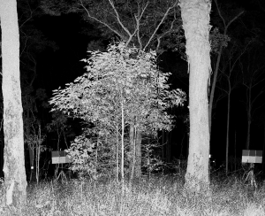
SALCA forest image

Forest laser scan from the Salford Advanced Laser Canopy Analyser


Viva success – Daniel Caparros-Midwood

Last week, on the 7th March, Daniel Caparros-Midwood successfully passed his viva with 1 months corrections. Dan has been in the department since 2008 when he started as an undergraduate on our GIS degree. After graduating he immediatly started a PhD on optimised spatial planning with us under the supervision of Stuart Barr and Richard Dawson, and then left around six months ago to begin his carrer in GIS at AMEC after submitting his PhD.

Well done Dan and good look in the future!

ITRC book published

Last week a book, ‘The Future of National Infrastructure: A Systems-of-Systems Approach’, by reasearchers from the ITRC (Infrastructure Transitions Research Consortium), was released and made available for purchase. The book provides insights into a range of the work undertaken in the ITRC project, from the economic and demographic projections to 2100 for the UK, to the analysis performed with developed national scale models for critical infrastructure systems and the developed underlying database and visualisation tools used. Synopsis:

“The future of national infrastructure: A system-of-systems approach provides practitioners, decision-makers, and academics with the concepts, models and tools needed to identify and test robust, sustainable, and resilient strategies for the provision of national-scale infrastructure. It takes a “system-of-systems” view on the interconnected infrastructure networks – including transport, telecommunications, energy, water, and waste-management – and derives an integrated vision on infrastructure provision required to ensure that nations have an infrastructure system that is fit for the future.”

Our own Stuart Barr, David Alderson and Craig Robson have all been involved in the research behind the book which has been carried out over the past five years, with a single chapter devoted to the work where their time has been focused, though they have also contributed to much of the other work. The chapter, ‘Database, simulation modelling and visualisation for national infrastructure assessment’, documents the tools developed here at Newcastle; the underlying database for the infrastructure models including developed schema’s as well as the visualisation and reporting tools for both the data used for the modelling and for the results from the simulation work and subsequent analysis. This research has involved the development of a national infrastructure database containing a suite of data for many of the critical infrastructures in the UK along with the associated data such as economic and demographic modelling outputs for demand modelling as well as hazard data for modelling the resilience of the infrastructure networks/systems. Along with this, a schema and associated functions for the simulation and modelling of national infrastructures has been developed as well as a PostgreSQL/postgis schema for networks and the wrappers for integration into the python package NetworkX. On top of these, a suite of web based visualisation tools have been developed with facilities to view and interrogate the results from the infrastructure modelling and simulation, tools to view the underlying demographic data, one of the main drivers for the modelling. More details of these outputs are available in the book, and further publications in the form of journal articles are in preparation.

Python II

In this week’s Understanding Code – Python seminar the use of classes were explored. Whilst this felt quite a step up from last week’s topics on variables, for, if and while loops, we were reassured that Phil Jeffes, the seminar presenter, had been studying his undergraduate for two years before classes were introduced.

The examples started with basic implementation of classes; how they are defined and can then have functions called upon them. Towards the end of the seminar, a more complex example was given. Participants were given some code which, when completed, would allow them to move between different rooms of a house depending on the user’s input. To complete the code an if statement was required to determine the user’s input and to catch if the number of inputs exceeded the number of variables in the list.

The Understanding Code series comes to an end next Monday (07th March) where everything taught up to date will be used to link python code to a web browser.

Field work in Iraq

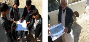
As part of Mustafa Hameed’s PhD research, he spent some time doing fieldwork in communities in his native Iraq. The research is assessing the role of VGI (volunteered geographic information) input in re-building the Iraqi cadastral system after years of chaos. The work done in the town of Al-Hilla (south of Baghdad) during December 2015 and January 2016 concentrated on several aspects: firstly, interviews with land administration professionals yielded an assessment of the current land administration system and opinions regarding the role of VGI; secondly, sample attribute data pertaining to land parcels was collected from professionals, gatekeepers of selected communities, and some owners of parcels in those communities; finally, geometrical data was collected by the owner of parcels who identified their parcel boundaries using three different techniques (GPS app on a smartphone, iPad tablet, and paper-printed satellite image). It was pleasing to see such a large number of local people willing to volunteer their knowledge, time and services to this project.

Fieldwork pictures:

Using printed satellite image to identify parcel boundaries

Above: Using printed satellite image to identify parcel boundaries

Using an iPad with uploaded and georeferenced cadastral maps to identify and edit parcels

Above: Using an iPad with uploaded and georeferenced cadastral maps to identify and edit parcels

Using smartphones to find GPS coordinates on parcel corners

Above: Using smartphones to find GPS coordinates on parcel corners