Lufton 2015 – updates and the like

After much plotting and planning we’re pleased to announce that we will be digging again this Easter!

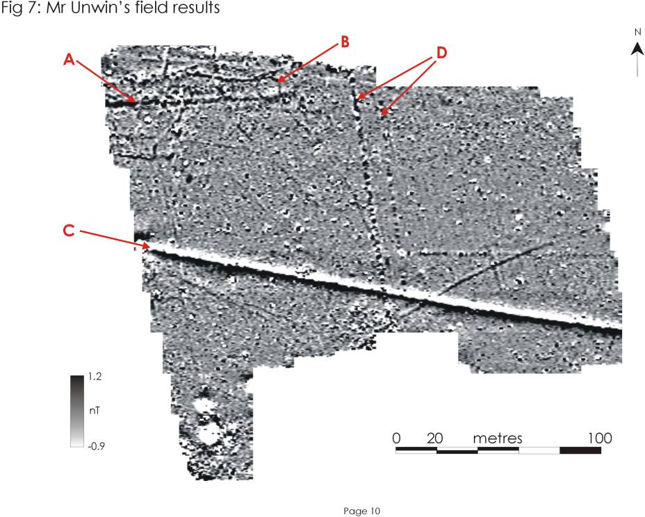
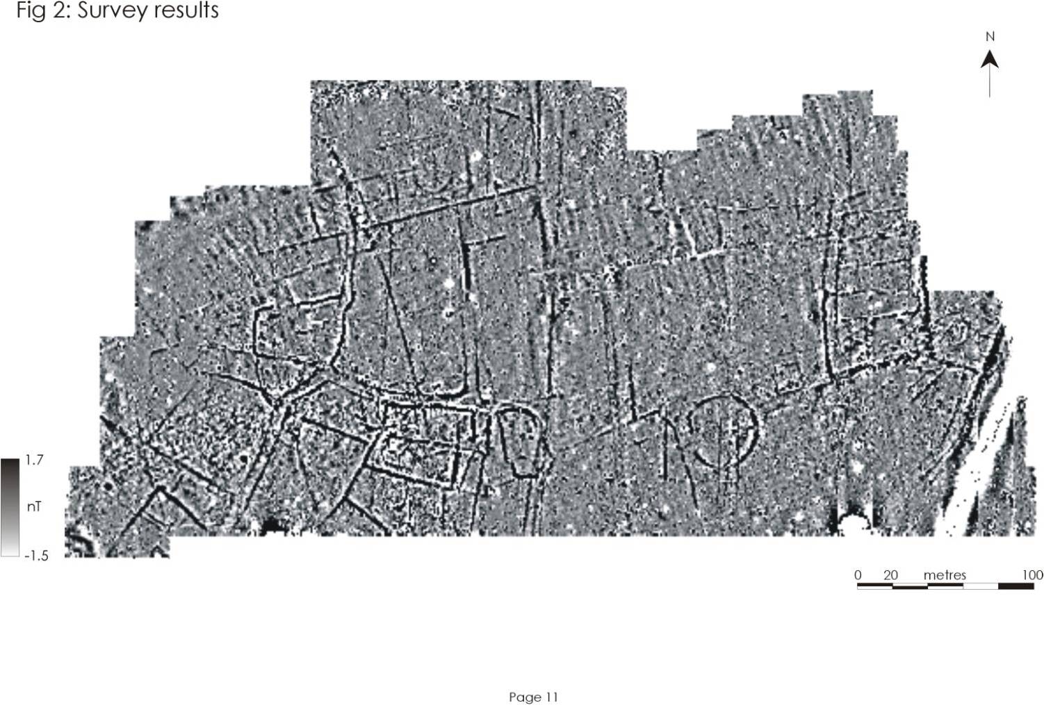
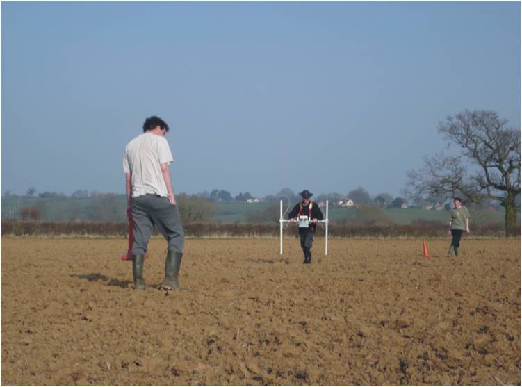
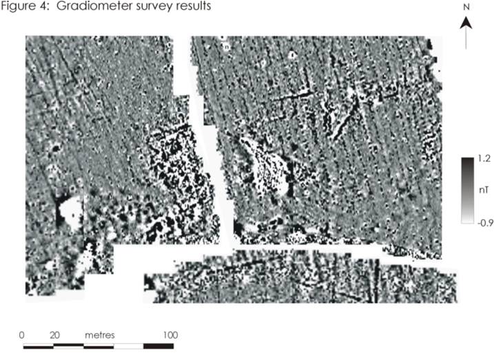
Even as we write Nigel, Liz and the gang in Somerset are working to re-survey our target excavation area.

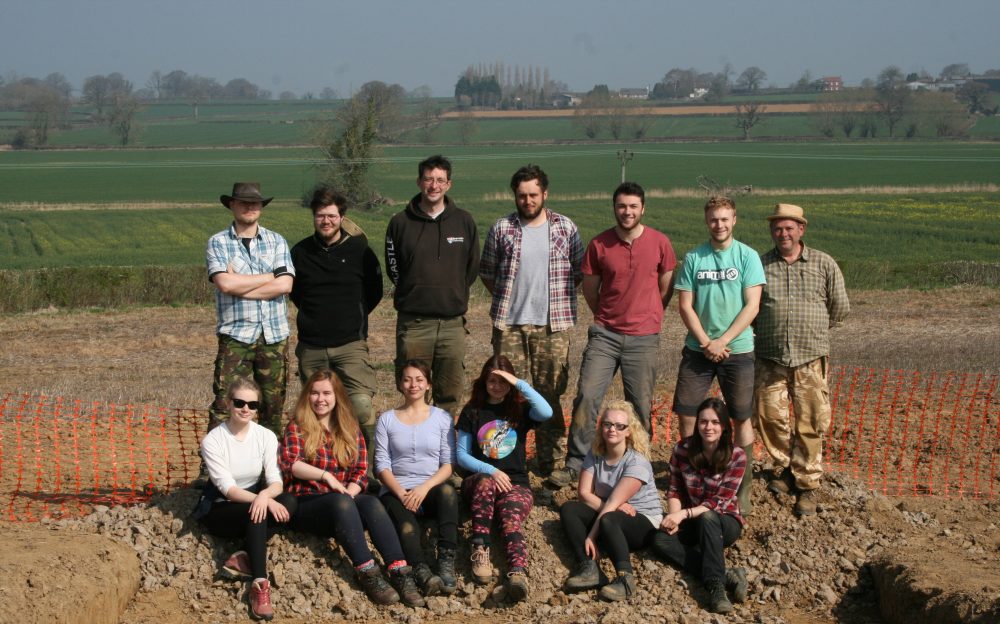
The new team will be James G (Director); Andrew Agate (Co-Director); James H (Assistant Supervisor); Hayley and Chris (experienced excavators) along with Douglas; Elliott; Zara; Mara; Tilly; Josh and Holly-Ann. What a team!

In the meantime James G is on research leave and hopes that be before we return to Somerset the 2013 post-excavation assessment will be completed. Work is also progressing on the 2014 post-excavation assessment and just this morning Don O’Meara was finalising the report on the iron working slag. Apparently we have evidence from Barrow for medieval smithing (the working of iron, but not its production from iron ores).

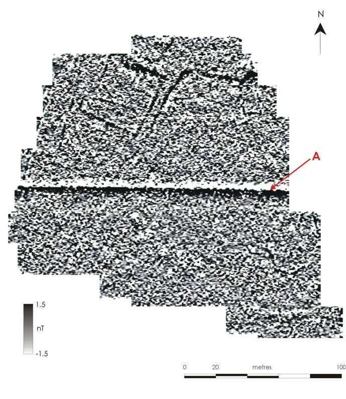
In other news the paper James, Liz and Ali wrote on greenwaste and archaeological geophysics has been accepted for publication by the top geophysics journal Archaeological Prospection. Once it’s published we’ll add a link to the article.

Geophysics Danscombe and Ten Acres

The geophysics team have completed two further fields called Danscombe and Ten Acres. Both of these fields contain geophysical anomalies that are likely to be archaeological. One of the most interesting discoveries is a sinuous anomaly that is probably an ancient stream channel that would have fed into Balls Water (or Welham’s Brook).

TENACRES

Geophysics of Ten Acres. The features in this field may well be Romano-British © Geoflo and The Lufton Project

LAMBCHOP

Geophysics of Danscmobe. The sinuous anomaly is likely to be an ancient stream channel © Geoflo and The Lufton Project

Rolling & Geophysics

Geoflo and SSARG are busy extending the geophysical survey. The ‘Any Other Duties’ clause is in full effect here as Nigel rolls a hay bale out of the way before surveying.

Geoflo geophysics

Nigel rolling haybales before surveying © GeoFlo

Meanwhile James is writing funding applications for next year’s excavations…

A new season of geophysics

We’re pleased to say that Nigel, Neil, Doug and some other SSARG members have just started to extend our geophysical survey. This is a piece of work we’ve been meaning to do since 2012 and will give us a much greater coverage of the landscape to the south west of the villa.

Updates to follow – so keep an eye on the blog!

The work is partially funded by the Aston Fund of the Somerset Archaeological and Natural History Society.

The devil’s in the detail

The Newcastle part of the excavation team met today for a briefing about the dig. We had a good think about where we’re going to put this year’s trenches (and why!).

We’ve also also just taken delivery of a Bartington MS3 magnetic susceptibility meter, which we hope to use on site. ‘Mag sus’ meters are used to detect burning and other human activities that change the magnetic properties of a deposit.

James and Andy also did a bit of refresher training on Newcastle’s Geoscan RM15 resistivity meter. We hope to do some resistivity survey that will complement our magnetometer surveys in the field.

There’s a lot going on behind the scenes in the North East. The devil’s in the detail!

Danscombe and Mr Unwin’s Field

We completed the survey of Hungerford and realised that the settlement continued further to the south. So we carried on surveying and in 2010 and 2011 covered two smaller fields known as Danscombe and Mr Unwin’s Field.

Geophysics of Danscombe © GeoFlo and The Lufton Project

Danscombe was particularly interesting because just before the magnetometer survey was carried out the landowner manured the field with ‘green waste‘. This is the composted hedge clippings and other stuff collected from householders by the council. Theoretically it shouldn’t have an impact on the survey but at Danscombe we discovered that the ‘green waste’ had a lot of many metal contaminants. These had a negative impact on the survey (compare image above with the one below) and this problem is currently being studied by Alissa, an MA student at Newcastle.

For all of the problems caused by the ‘green waste’ we could see that the ancient settlement continued into this field. The big line running across the image is a modern pipeline (A).

The Mr Unwin’s Field (to the east: below) was also surveyed and contained further anomalies associated with the settlement (A). We also identified a round anomaly (B) that we thought might be the remains of a roundhouse or barrow. This is where we decided to dig in 2012.

Geophysics of Mr Unwin's Field © GeoFlo and The Lufton Project


Hungerford

Following the geophysical survey of the area around the villa we took a decision to survey the big field to the south. This piece of land is known as ‘Hungerford’, a fieldname that usually denotes poor land. In the nineteenth century this big field was a number of smaller fields some of which were named ‘Little’ and ‘Lower Danscombe’.

The geophysical survey was undertaken between 2009 and 2011 and revealed an astonishing archaeological landscape. It is of many phases but includes a large and almost circular enclosure and a settlement with trackways and enclosures. This ancient settlement was a new discovery. We had no idea it was there and it came as quite a surprise.

The settlement probably dates to the Iron Age and Roman periods. Some of the geophysical anomalies are likely to be contemporary with the villa – it may be where the agricultural workers and tenants lived.

Geophysics of Hungerford © GeoFlo and the Lufton Project


Lifting the corner: Magnetometry 2009

At the same time that we carried out the resistivity survey of the villa we also carried out a much larger survey using a Bartington gradiometer. This type of instrument senses very slight changes in the earth’s magnetic field caused by burning, silting or the dumping of refuse.

Geophysics near the villa in 2009 © The Lufton Villa Project

The survey was designed to identify the extent of the Roman villa (visible in the SE corner of the western field) and to see if there were any associated buildings or features like roads, trackways and field boundaries. The results showed that these heavy clay fields had a lot of modern field drains in them (these are visible as parallel lines running NNW to SSE on the graphic below). There were also hints that an archaeological landscape was preserved in these fields.

A greyscale plot of the results of the gradiometer survey (Caldwell 2009, Fig 4)

As we were to discover, this survey was a little bit like lifting the corner of a rug. When we carried out a more extensive survey to the south incredible things were revealed…

The Origins of the Landscape Project 2009: Resistivity Survey of the Villa

The current project began when James was a post-doctoral resesearcher at Cambridge University. He was (and remains) interested in the end of the Roman Empire and the late Roman villa on the outskirts of his home town seemed an exciting site to study.

Since Leonard Hayward’s excavations no archaeological work had been carried out on the villa. For a long time the villa was being regularly ploughed and we were unsure what impact this was having on the buried remains. It was also unclear whether Leonard Hayward had uncovered the whole of the building, or just one wing of a grander structure (like the villa excavated not far away at Dinnington by Winchester University).

In 2009 James received permission from English Heritage and the landowners to geophysically survey the villa site. This survey was carried out in March with the assistance of Liz Caldwell and Nigel Harvey of GeoFlo and volunteers from the South Somerset Archaeological Research Group and the Yeovil Archaeological and Local History Society.


Resistivity survey of the Roman villa at Lufton (Caldwell 2009, Figs 6 & 7) © GeoFlo and the Lufton Project
The resistivity survey (which is good at detecting differences between dry features such as stone walls and damp features like ditches) showed that the villa building did survive. It also demonstrated that the range of rooms excavated by Hayward was not part of a grander structure.
Further Reading:
Caldwell, E. 2009 Lufton Villa, Yeovil, Somerset: Geophysical Survey, March 2009. Taunton, Unpublished SSARG Report GS1003