Sad News

Prof Mick Aston of Time Team fame sadly passed away yesterday. Mick had a long-standing interest in the Lufton area from his time working in Somerset. He was extremely supportive of the current project and some of the geophysical survey has been funded by the Aston Fund of the Somerset Archaeological and Natural History Society.

The project sends its condolences and best wishes to Mick’s family, friends and colleagues. He will be missed.

Plan of the 2012 Excavations

James and Andy are busy finishing the report on the 2012 excavations. When completed this report will be submitted to the Historic Environment Record.

Andy has spent some time turning the site drawings into a plan of the excavation. The Bronze Age ring ditch is [010] and [030] and is cut by Iron Age ditch [005]/[036].

Further information about the Bronze Age and Iron Age in Somerset can be found in the South Western Archaeological Research Framework.

2012Plan

Plan of the 2012 trench showing prehistoric features © Andrew Agate and The Lufton Project.


Public Lectures

James Gerrard will be giving two public lectures during the course of the excavations.

The first will be held on the 27th July 2013 at the Abbey Manor Community Centre. The talk starts at 7.30pm and will be on the current excavations.

The second lecture will be on ‘Somerset and the End of Roman Britain’ and will take place in Seavington Memorial Hall on Thursday 18th July at 7.30pm. Tickets for this event are £6 in advance or £7.50 on the door. Please phone 01460 249730 for further details.

The devil’s in the detail

The Newcastle part of the excavation team met today for a briefing about the dig. We had a good think about where we’re going to put this year’s trenches (and why!).

We’ve also also just taken delivery of a Bartington MS3 magnetic susceptibility meter, which we hope to use on site. ‘Mag sus’ meters are used to detect burning and other human activities that change the magnetic properties of a deposit.

James and Andy also did a bit of refresher training on Newcastle’s Geoscan RM15 resistivity meter. We hope to do some resistivity survey that will complement our magnetometer surveys in the field.

There’s a lot going on behind the scenes in the North East. The devil’s in the detail!

Seven Weeks to go

It’s seven weeks until this year’s excavation team lands in Somerset.

In Newcastle all sorts of behind the scenes preparations are happening. The minibus is booked, lists of equipment are being drawn up and we’re all thinking hard about exactly where we should dig this year and why.

Our grant from Brympton Parish council has also arrived (a big thank you to everyone in Brympton for their support).

In week or so the students (Adam, Eleanor, Dave, Georgia, Johanna, Kevin, Lucy and Danni) will have their final briefing and be issued with kit lists. Some of them are currently thinking about exams so I expect the dig seems a long way off.


Englands Field Names

Every field in the land has a name and many of these names are recorded on Victorian Tithe Maps. Copies of these documents for Somerset are held by the Somerset Records Office. As part of the project we’ve been looking at the field names recorded on the Tithe Maps for Lufton and the surrounding parishes.

The names given to fields by people who worked them in the past often reflect something important about those pieces of land. They might tell us who owned the land (Ball’s Mead), they might describe the piece of land (Three Cornered Field), or they might tell us about the history of the piece of land. Chester would indicate a Roman site, Blacklands a site that might have been occupied intensely in the past. So far our work hasn’t turned up any of these names but there are an interesting group of fields over in Odcombe.

Just north of the village of Odcombe are a series of fields with ‘Englands’ names. This name is likely to derive from inland and this term is often associated with parts of early medieval estates that were under direct lordly control. Two recent pieces of archaeological fieldwork on fields with ‘Englands’ names in Charleton Horethorne and Sparkford have demonstrated that both of these sites were occupied in antiquity. The fields in Odcombe might also contain similar evidence.

Englands Field Names near Odcombe © The Lufton Project and Andrew Agate

A short article on this discovery will be published in the journal of the Medieval Settlement Research Group.


Danscombe and Mr Unwin’s Field

We completed the survey of Hungerford and realised that the settlement continued further to the south. So we carried on surveying and in 2010 and 2011 covered two smaller fields known as Danscombe and Mr Unwin’s Field.

Geophysics of Danscombe © GeoFlo and The Lufton Project

Danscombe was particularly interesting because just before the magnetometer survey was carried out the landowner manured the field with ‘green waste‘. This is the composted hedge clippings and other stuff collected from householders by the council. Theoretically it shouldn’t have an impact on the survey but at Danscombe we discovered that the ‘green waste’ had a lot of many metal contaminants. These had a negative impact on the survey (compare image above with the one below) and this problem is currently being studied by Alissa, an MA student at Newcastle.

For all of the problems caused by the ‘green waste’ we could see that the ancient settlement continued into this field. The big line running across the image is a modern pipeline (A).

The Mr Unwin’s Field (to the east: below) was also surveyed and contained further anomalies associated with the settlement (A). We also identified a round anomaly (B) that we thought might be the remains of a roundhouse or barrow. This is where we decided to dig in 2012.

Geophysics of Mr Unwin's Field © GeoFlo and The Lufton Project


Flints

Excavation is a small part of the archaeological process. We dig for a little while but spend much longer trying to figure out what our discoveries mean. Finds analysis is a big part of the post-excavation work. Our flint assemblage was looked at by Dr Rob Young and this post is based on his analysis.

Flints were used by prehistoric peoples for tools. They worked (or knapped) the flint to produce edges that were sharper than surgical steel. A wide variety of prehistoric stone tools are known but the object illustrated below is a heavy and thick end scraper of Neolithic or Bronze Age date. It is roughly contemporary with the ring-ditch we dug in 2012.

Flint scraper of Neolithic/Bronze Age date © Rob Young and the Lufton Project

Excavations 2012 Week 3

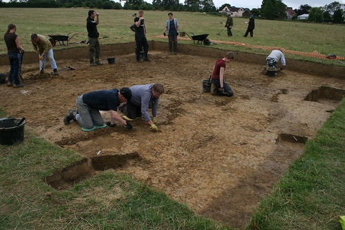
The third and final week saw the trench extended and a lot of work to investigate the ditches and sort some modern features (including a septic tank outfall pipe) from the ancient features.

Excavation 2012

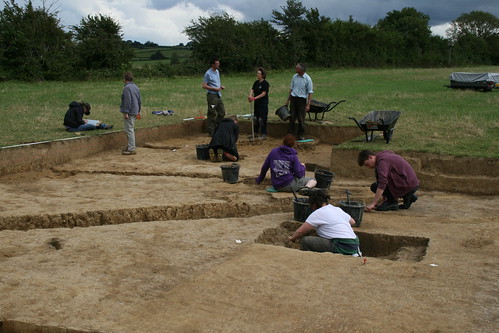
Excavating in Week 3 © The Lufton Project


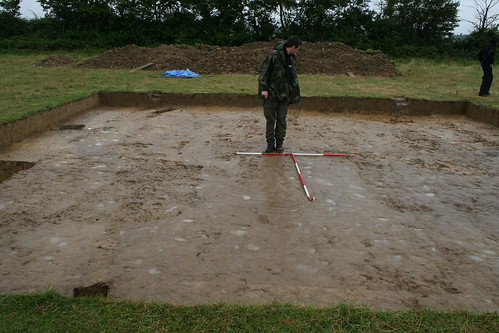
As archaeological excavation is destruction it was important that everything was properly recorded. A lot of drawings, photographs and paperwork were completed.

Danni Recording

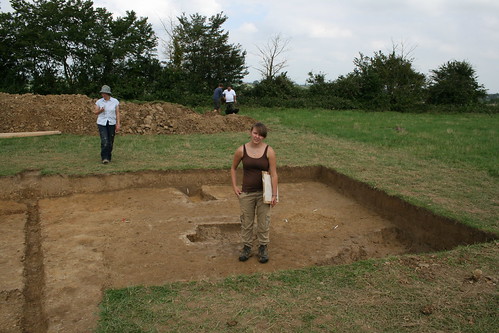
Danni Recording © The Lufton Project

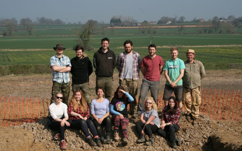
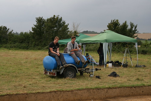
Towards the end of the excavation Mr Unwin (the landowner) came to look at our trench, He was a very genial and tolerant host and the project is very grateful to Mr Unwin and his family for the support they are giving to this work.

The Landowner and James

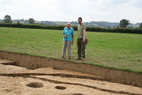
James shows Mr Norman Unwin the trench © The Lufton Project

At the end of the week we had some help from Jamie and Carole Pullen. They lent us a digger and driver to backfill our trench! Then we put the turf back and headed back to Newcastle.

Backfilling

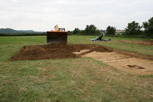
Backfilling the trench © The Lufton Project


Excavations 2012 Week 2

Over the weekend we talked to lots of visitors at the open day. Then on Sunday our prayers were answered. The heavens opened and it rained.

Wet Trench

James surveying a wet trench © The Lufton Project


Some water in the soil meant that we could see the archaeology and that the digging was a bit easier.

Excavating 2012

The ring-ditch is revealed as we begin to define and excavate features © The Lufton Project


We worked hard to define and begin to excavate the features. We were rewarded with some tiny pieces of Early to Middle Bronze Age pottery from the ring ditch and some Iron Age pottery from the big ditch.

Kristjan and Fraser

Kristjan and Fraser working hard © The Lufton Project

We made good progress in Week 2. The water bowser that seemed so important to have in the dryness of Week 1 was a bit redundant…

We went into Week 3 feeling pretty happy with what we’d discovered.