Digital Civics 2020 Blog Entry 4

The most important topic this week was to further define the goals that we want to achieve with our project with the help of a series of ‘How might we’ questions that were devised in this session. With those in mind, we were presented a few examples of existing applications to facilitate an understanding of their contexts of use, with which we will be designing our project aim.

With our main aim being to help the residents in Bensham express their needs and aspirations for their community, these are the questions and points that came to mind:

  • How might we develop a process of co-production between the residents and the ‘Best of Bensham’ group or between the ‘Best of Bensham’ group and the city council?
  • Help creating a community-led group that works to solve issues of their neighbourhood and holds close contact with members of the community
  • How can we help create a self-organised group among Bensham residents that is able to voice their views and establish a better connection with the council?
  • How might a community group be able to relieve some pressure that the council is overburdened with?

For our search for relevant existing applications, we first established a list of core criteria based on the questions above and a few examples that were presented during the seminar, which included both analogue devices and fully digital website-based means, to make our search for further examples more accurate and goal-oriented:

  • Enable residents to voice their concerns to the community
  • Provide a way where the residents and the council can communicate more directly with each other
  • Provide a means where residents would be able to connect with each other and co-produce solutions with the council

Following these criteria for our search, we have identified multiple applications and platforms which employ means that are uncomplicated to handle and make use of state-of-the-art technology, thus having the potential to gain a wide reach among members of a community.

  • Commonplace: An online platform which seeks to bring citizens and planning authorities as well as councils together to shape the living environment. It comes with the functionality of submitting online feedback, which can be seen and reviewed by the respective council and authorities and reduces the effort that needs to be put into organising in-person interviews.
  • FixMyStreet: This mobile application allows residents to document issues they come across and report them to the local council. The main page provides easy-to-follow instructions for its users, as well as an overview of new and updated reports. Residents are also saved from the trouble of searching for contact persons in the council to report an issue to, as the application does it automatically with its submissions, and provides the space for the respective council to write responses and updates.
  • Block by Block: This collaboration makes use of a popular 3-D sandbox video game called ‘Minecraft’ to involve people from all over the world to partake in public projects where they are otherwise excluded. The virtual world in the game provides an easy way of three-dimensional modelling to tackle a respective issue, and it is not limited by materials. It allows people of a community to come together and express their ideas and suggestions in form of easy-to-make visualisations that are visible to everyone.

While each of these applications focus on a different aspect of engaging people through the employment of state-of-the-art technology, the common point here is to bring people together to reach a common goal and cut down the efforts of establishing communication with local governments. This is an important step to encourage more active participation from citizens in local matters, which will be the main aim of our project.

Sources

Commonplace. (n.d.) Conversations to create better places. Available from: https://www.commonplace.is [Accessed 9th March 2020]

FixMyStreet. (n.d.) Report, view or discuss local problems. Available from: https://www.fixmystreet.com/ [Accessed 9th March 2020]

Mojang, Microsoft, UN-Habitat. (n.d.) Block by Block. Available from: https://www.blockbyblock.org/about [Accessed 7th March 2020]

Falco, E., & Kleinhans, R. (2018). Digital Participatory Platforms for Co-Production in Urban Development. International Journal of E-Planning Research7(3), 1-27. doi: 10.4018/ijepr.2018070105

Digital Civics 2020 Blog Entry 5

This week we worked on the first steps on designing a prototype for our project through sketching. Before drawing our ideas, we review all the work that has been done so far and addressed the objectives so every individual knew what our design would lean towards to. We divided our work into 2 parts. On the first part each individual generated and shared a broad range of ideas through sketching in a certain amount of time. The sketches were influence by the research and interviews that has been conducted in the past. Those ideas once shared were discussed with the group. Each member of the group was given 3 red stickers in order to vote for the ideas that were the most relevant for them. As a result, ideas that had the most stickers were the most relevant as we can see on photo 1 and 2 below. This had an impact on the final decisions we made about the prototype we want to design.

PHOTO 1

PHOTO 2

On PHOTO 1 the prototype presented is a digital based application that permit to report issues to the local authority but also share it with the other residents. Through a voting system and enabling people to leave comments it has the purpose to make the voices of the residents to be heard. This prototype has also the purpose of enhancing interaction between residents by creating profiles where they can share their interest skills and knowledge. This prototype has the purpose to enhance connectivity between the local authority and the residents but also between the residents.

On PHOTO 2 the prototype presented is a box with a device that enable to record and listen what other people have been saying notably concerns and suggestions. In the box you have chairs where you could interact directly with other residents. It aims to encourage communication and interaction between residents.

For the second part we took one or several ideas (but no more than 2,3) that were discussed and presented during the first part and sketch 8 variations of it within a short amount of time. When sketching we considered improvement or alternative that could be done with those ideas. After the time passed, we shared and discussed about the variations of our ideas.

PHOTO 3

On PHOTO 3 two variations of an idea is presented. The idea is a digital application that shows event and issues happening in an area. The left variation is a visual prototype that enables to look on projects/issues/events that has happened, going to happen and happening on a map where you just need to click on the coloured dots in order to have more information. The right variation is a descriptive prototype that enables to look on project/issues/events in a chronological way, personal interest and popularity way. In order to have more information you just need to click on the article.

During this session the main challenges we have encountered was to express our ideas through sketching in a short amount of time and to choose ideas that would become the basis for our future prototype. After this session influenced by the discussion we made on the ideas presented, we decided to work towards a digital application prototype that would promote/strengthen connection between the residents and the local authority and between residents. Further research with the prototype design, notably learning from existing application as examples will permit us to create a viable digital based service.

Digital Civics Entry Blog 3

User Research Methods

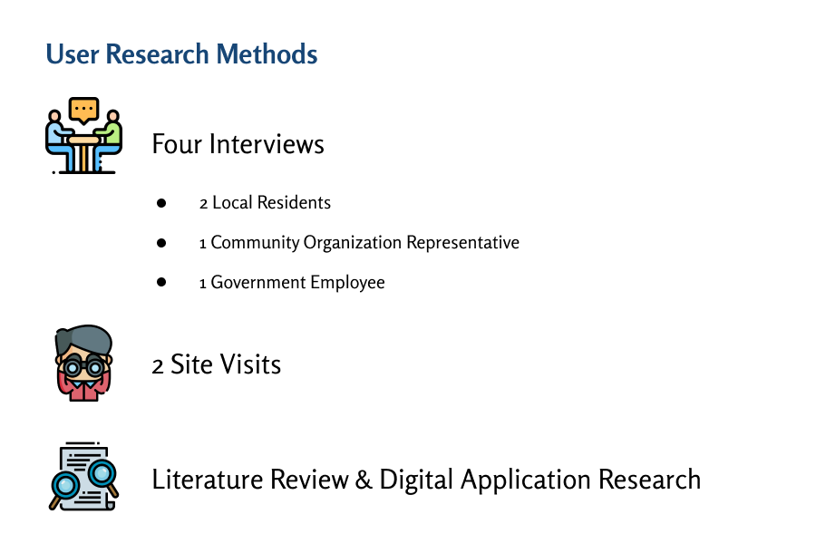
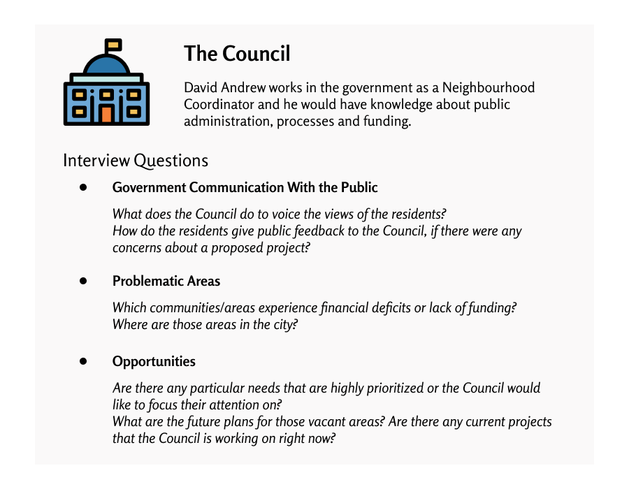
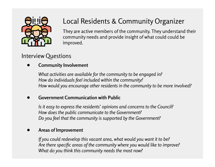
The team decided to conduct interviews and site visits for user research. We will be interviewing people who are representatives of the government, local residents and community organizer. These people are highly knowledgeable about their community needs, as they either live in the city or work directly with the community. Additionally, the team will conduct site visits in understanding the spatial connections and relationships with the residents. During the site visit, the interviewers will ask the residents to identify meeting points and vacant properties. This will help us figure out where the residents gathers and which areas could have the potential to be redeveloped for community needs.

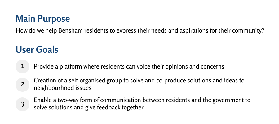
Aside from the interviews and observations, we are doing literature reviews on digital platforms that could create co-production in the community. Falco and Kleinhans (2018) displays the different types of digital participatory platforms (DPP). DDP functions as a two-way form of communication, bridging the gap between the residents and government. In this article, it provides successful DPP that are exercised in other cities and countries. We will be conducting research on DPPs that foster collaboration and co-production of ideas within the community. Ultimately, we hope to find DPPs that would align with the three User Goals.

These examples include CitySpidey, Commonplace, Block By Block, Fix My Street, Co-Urbanize, and Bang the Table. These digital application examples research serve as references to how we could potentially develop a product for the community.

After these interviews and observations, personas and customer journey mapping would be explored. Grudin and Pruitt (2002) show that persona is an excellent technique to focus on the main audience and enhance awareness on the user experience. The personas could be created after these interviews and site visits. Marquez, Downey, & Clement (2015) demonstrate that customer journey mapping is essential for understanding the overall experience and paths taken by the users. This method is important in establishing a connection between the designers and users, so the designers could determine which pathways would fit best for the users. These two techniques will be further explored in our research, prior to developing a digital application for the community.

Interview Questions & Observations

References

Falco, E., & Kleinhans, R. (2018). Digital Participatory Platforms for Co-Production in Urban Development. International Journal of E-Planning Research7(3), 52–79. doi: 10.4018/ijepr.2018070105
Grudin , J., & Pruitt, J. (2002). Personas, Participatory Design and Product Development: An Infrastructure for Engagement. Retrieved from https://pdfs.semanticscholar.org/9b03/ca765977dc9cf2dbcc25377e71aefa986164.pdf

Marquez, J. J., Downey, A., & Clement, R. (2015). Walking a Mile in the Users Shoes: Customer Journey Mapping as a Method to Understanding the User Experience. Internet Reference Services Quarterly, 20(3-4), 135–150. doi: 10.1080/10875301.2015.1107000

Lois

SIA Week 4 Log

Week 4 Log

This is the week 4 log for SIA. This week we carried out part of our user research, meeting with various project partners and also began searching for examples of products/services/devices that serve as state of the art in our project.

User Research:

As part of our user research we went to the Greening Wingrove Annual Meeting on the 16th February. We felt as though this meeting would give us a huge opportunity to meet some of our project partners and potentially even meet some local residents in the area. The event was also useful as it took place at 250 Philip Street, Arthur’s Hill (the building that part of our project is based on) and so we got a much better idea of the actual building we were working with.

At the meeting, we spoke with David Webb, who is a local resident and the Secretary of Greening Wingrove CIC as well as one of our key stakeholders in the project. Below are the most important and valuable points we obtained from the interview with David:

  • Currently local residents communicate through WhatsApp groups and Facebook pages. The WhatsApp groups are used to contribute ideas and thoughts, but are rarely used, with David mentioning that ‘messages are transferred maybe once every two weeks’. The Facebook groups are slightly more active. However, the problem is that there are many different pages and so trying to organise larger events or communicate on a large scale is difficult.
  • The main issue David said we would have with our project is that not everyone will use one form of social network, which on one of the reasons multiple platforms are currently used.
  • David’s vision for the building involved using it for multiple purposes. Ideas included a post office, renting out the top rooms for storage, use of the already in place music studio and events for the youth including youth clubs and weekly activities.

We also managed to speak with other members of Greening Wingrove with the main points from them being:

  • Not enough is available for younger generations to do, with many just roaming and playing on the streets.
  • There is a difficulty in getting all the locals involved in the area. This is primarily due to language barriers and people not knowing what events are out there.

We aim to continue with our user research in the following weeks with our door to door surveys. We are also hoping to organise an interview with Katrina Jordison, the Greening Wingrove CIC Community Organiser, as we were not able to speak to her for too long at the annual meeting.

Week 5 – Chase Park – workshop design & example search

This week during the seminar session we met Jen, our mentor, and had the opportunity to explain in detail the research, progress and initial ideas we had for our project. We explained to Jen how our project had developed from the initial brief, as that is the only information she had of our project until that point. We discussed with Jen our user research and told her our plans to run a workshop for the year 5 children of Front Street Primary School. Jen helped us to develop a clear, structured plan for the workshop. We also decided on our main aim for our project, to encourage pride and stewardship of young people in Chase Park. Jen also helped us to prepare questions ready for our interview planned for week 6 with Holly, the youth worker, from ‘Kick the Dust’. Aspects we plan to interview Holly on include, the context she works in, whether the people she works with are connected to Chase Park and what ideas she thinks are most likely to encourage engagement from younger people.

Week 5 was when the majority of our research into other projects in digital civics took place. One project we researched was Jen’s, ‘Participatory Media: Creating Spaces for Storytelling in Neighbourhood Planning’. This was useful as the project also used a park, Kingston Park. The project was to develop an app where citizens would have a platform to share their own stories. This project involved running workshops as a research method which we are also using as our own research. Another app we researched was an app created for breastfeeding mothers called ‘Feed Finder’. This app is location based, it provides. platform where breastfeeding mothers can rate and review places they have found to breastfeed for the information of other breastfeeding mothers. This app is loosely related to our project as it brings together experience of citizens themselves to create a reliable information service on an issue of importance to that community. Chase Park is an issue of importance to their local community, to have a location based app for Chase Park where users can share experiences, photos, videos, events etc in the park we believe would encourage others to visit.

Our next steps include: running the workshop at Front street Primary School, interviewing Holly from ‘Kick the Dust’ and drawing together all of our previous research to have a clear journey for our project development, ready for the midterm presentation at the end of week 6.

Week 5 Log – NUTC

LOG WEEK 5 

This week we met with one of the academic partners that mentors us, Tom Maskell (PhD student in Open Lab) who happens to have a background in walking and cycling connections for the community.  He introduced us to the newcastle walking cycling routes website in which he participated in the creation of. This website was able to show us the main concerns by the general public and where these were located on a map.  This is mainly coming from walking and cycling advocates – most comments are green so they believe it is very important, the red and yellow are less important. ( which suggests there are not many drivers as there aren’t many red and yellow.)

https://newcastlewalkingcyclingroutes.commonplace.is/comments/5beefcc45a173b000e05ac22

Our group discussion with our mentor led us to review our project aims as we currently didn’t have a main focus. Tom helped us to understand the best way to use our projects user research and the examples that inspired us to get to the point we are at. He also made us realise that we should do something interactive along Heaton Road that could be seen either by cyclists and pedestrians or drivers. 

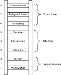
The Ladder of Participation 

Tom reminded us of The Ladder of Participation which we had heard of before but had forgotten about. He explained to us it’s very important to think about our approach to the project and to use this ladder to determine if we wanted more of a manipulative method of making the public more accustomed to the cycle route or if we wanted to be more informing and consult the public more on what they wanted.

Our Best Approach

After an intense group discussion we figured that our best approach should be a more persuasive one, closer to the middle/bottom of the scale, in which we could try to persuade the people sat on the fence or were fully opposed to the cycle route. We came to the conclusion the project is at its final stages of being given the go ahead, with one big final consultation happening in early May and then just the legal processes to be completed, so collecting people’s opinions wouldn’t be as relevant to just trying to change those of the opposed, as the project is shortlisted and one of the councils favourites to happen.

Process

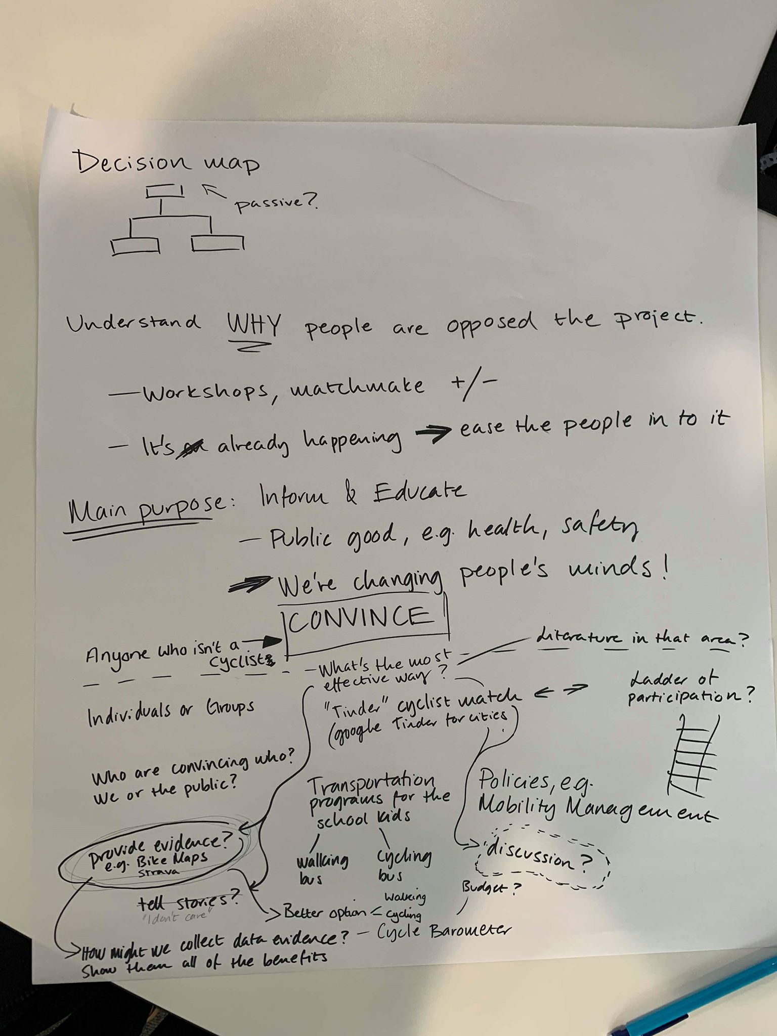
After deciding our main purpose we came up with many different questions of how to actually get across our aim to the public. These questions can be seen in the picture below in which some of our main questions were :

  • who’s trying to convince who? Us or the public?
  • Will we try to target individuals or groups?
  • Would we want to use data/prove, discussions or tell stories to convince people?

In the end we decided our main target would be finding the correct data to answer the question ‘how can people benefit?’ as this would motivate them to change their opinions. We think people would be led by the reduction in costs, health benefits, the advancement in helping the planet (Carbon Footprint reduction), making Heaton a safer environment and if they knew other transport methods were available and easier to use they may be swayed by that. 

Conclusion

We have been trying to come up with as many ideas as possible ready for next week in which we are to begin sketching our final project ideas. We still like the idea of a form of an interactive decision map or signs along Heaton Road with phases that show people the benefits of cycling, and we also like the sound of the Cycle Barometers in which Tom introduced us to.

Although the last one may be too much of an expensive method and more focused on the cyclists and not the people who are opposed who’s minds we are trying to change. We are hoping to have made our mind up on this ready for our next lecture.


Week 4 – Chase Park

This week we progressed further on our workshop we are doing with the children at Front Street Primary School Whickham. We have drawn up an outline plan of the activities we will complete with the children at the school. The current plan needs some tweaking and we discussed how an additional activity of how they would show other people about the park which we have added to the original plan. Hopefully we will get some creative ideas on how they would use video/technology to help them to this.

So far our plan is:

(0 min) Introduce ourselves and why we are there.

(5 min): Starter:

Get the teachers to organise children into groups of around 4-6, depending on class size.

Each group of children are to draw the outline of chase park, giving them A3 sheets with colouring pens and pencils.

* Use photographs as visual stimuli

* Ask them – what can you remember about the park? What is there? Where do you like going in the park? What do you like to do there?

* Remind them – Doesn’t have to be a work of art or very accurate etc

(20 min) Activity 2: Groups to decide between themselves what places in the park are the best to them, giving them stickers such as golden stars to stick on their drawings.

* Use star stickers, emoji stickers (Sean can bring these)

* Can also layer the map with post it notes, pens and stickers (Sean can bring these)

(30 min) (Class discussion)

Going around each group and getting them to say one of the places they highlighted and why.

(35 min) Activity 3: Giving them another set of colours, get them to draw on where and what they would want in their park. What would make them use it more.

* Describe how you would make the park better for people to come and visit

* Bring your ideas to life!

Write down possible ideas for activities that could be done in the park too.

(1hr 0 min) (Class discussion)

What were the best ideas of each group when they thought about improving or adding something new to the park.

* Write on flipchart paper

(1 hr 05 min) Activity 4:

How would they show / tell other people about the park? How would you get the message out about the great things that are in the park? Work in groups to come up with some ideas.

* Posters?

* Technology?

* Videos?

* News reports?

(1 hr 25 min) Class discussion and feedback.

(1 hr 30 min) Finish.

It still requires a bit more attention to detail before we deliver the workshop at the school but the general activities and timings are in place. Unlike a normal school activity, we want the workshop to provide us with information from the children rather than the other way around. We hope that the children will really enjoy having the opportunity to share their ideas to us, however creative or crazy they might be.

We are also currently organising a convenient time to meet Holly from ‘Kick the Dust’ and preparing some questions for her. Jen suggested we look to ask similar questions to what we will ask the children but phrase them in a more suitable way.

We have done some example searches, one of which was BlockBuilders (https://blockbuilders.co.uk). BlockBuilders use Minecraft to engage with younger children in planning and designing places. One positive would be that whilst children are engaging in planning and design of their communities they feel as though they are just playing, and it is made to be fun. If it is fun they are more like to enjoy it and be engaged with the product for longer. This was a good example as it specifically focuses on young people. A criticism for BlockBuilders is that it is only accessible via a Workshop from Brighton with limited spaces, and therefore it is currently inaccessible for most young children.

We recognise we have not completed enough useful example searches and are still doing research on example searches to help us develop our own concept.

Week 4 Log – NUTC – Example search

Log week 4

This week we followed up on our idea of taking a site visit to Heaton Road here we managed to talk to a few of the locals and gather some ideas of how they felt about the project. Most of them seemed to be happy with the idea of a cycle lane although these people claimed to be cyclists themselves so it coincides with the data we found on the website ‘streets for people’ (51% wanted segregated cycle lanes). A couple of the people we spoke to said they were drivers of cars and would struggle with the addition of a cycle lane, due to the lack of parking spaces that would become a reality once the lane was installed.

Our Inspirations 

This research was inspired by a project we found in the Netherlands about How to turn a Car city into a Cycling city*. As most of the cities (both in this project and in general) were planned and designed for the car, the first thing that had to be done was “appeasing the motorists instead of encouraging cyclists”. As we have written before, Heaton Road is very “car-occupied”, which makes this reference project very relevant to our own project. It has  inspired us to do more further research into their ideas and how ours could relate seen as they were successful.

We also found this article** useful which was suggested to us by Sean. After reading through it we understood more about the concept of a “smart city” and how GPS, as well as other GIS tools, could be used to track the main cycle routes within an area. We were then also able to recognise the divide between the East and West were the West had hardly any cycle routes in comparison potentially down to the development of transportation and wealth of the area.

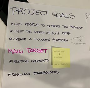
We spoke during the lecture about how negative comments would impact us and the project, and we have decided that negative comments would be our main target and we would focus on understanding them more and persuading the people to change their opinion. This is now one of our main project goals, alongside meeting the needs of the briefing given by Ali and creating a interactive/inclusive platform.

Our Concept 


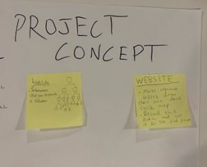
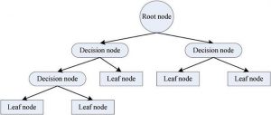
We also began to come up with a concept for our project although we feel that we will be able to adapt this more after talking to the other project partners (Mark and Julie). One of the concepts was the idea of getting cyclists to map their ideal route and recording this information, then putting it into a map of sorts to show how useful the cycle route would be by connecting Heaton Road to other/ smaller cycle paths. The other concept was a interactive Decision Tree, we would make several questions which would have multiple answers provided already to choose from, leading to more questions, eventually ending up with one final answer, which would be an end goal of the cycle route being the best option for all users. This would be an online concept but we would also be able to make it as an interactive poster for people without access to the internet.  

This is an example of the format of a Decision Tree, although we believe ours would be larger. The “leaf nodes” would be one final answer for the participants.

Next week we are planning to visit Heaton Road again and to interview some of the stakeholders to get a wider range of views on the project and hopefully to begin to build upon our concept idea. We are also meeting the project mentor so hopefully we will gain some insight into their thoughts on the project and some much needed experience in the area. We also have our meeting with Mark and Julie arranged although due to unforeseen circumstances  this has been set back slightly.

References

*Link to reference project: https://nextcity.org/features/view/how-to-turn-a-car-town-into-a-cycling-city?fbclid=IwAR1ckGS1GZ-tyq5lrf_wh3yy4qd2owdLhLYOgG5topXSbMKYfzJ3AWH0ZMY [Online: Accessed 19-02-2019]

**Link to article:

https://ledantec.net/wp-content/uploads/2014/09/Le-Dantec-Planning-with-Crowdsourced-Data-CSCW15.pdf?fbclid=IwAR3FHHvqkw5f5ue3geihm0nwpHWlHdQmQyg-B_AhsobTz_BtbLac7kzeLQg  [Online: Accessed 19-02-2019]

5) TRECC- sketching concept ideas

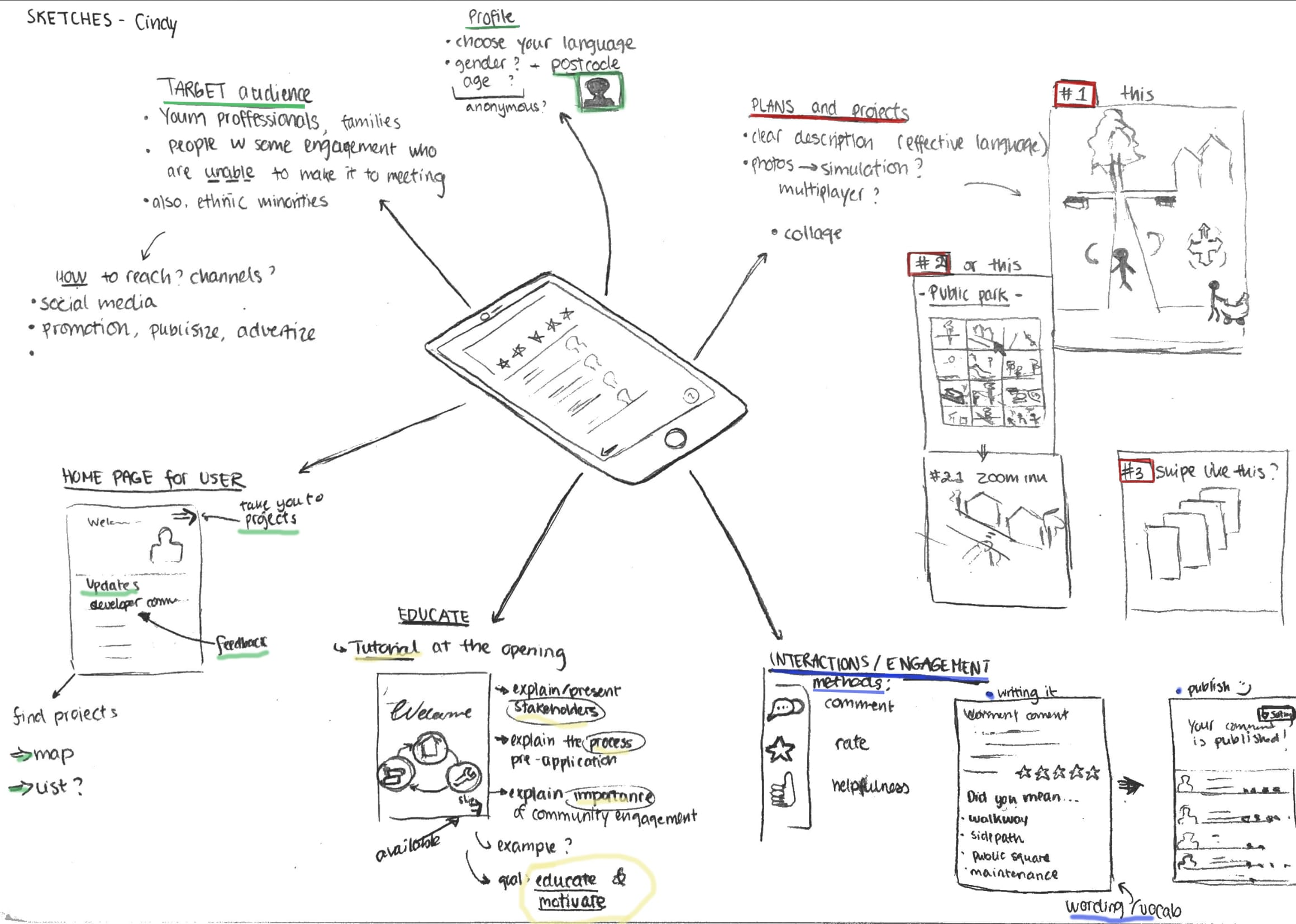
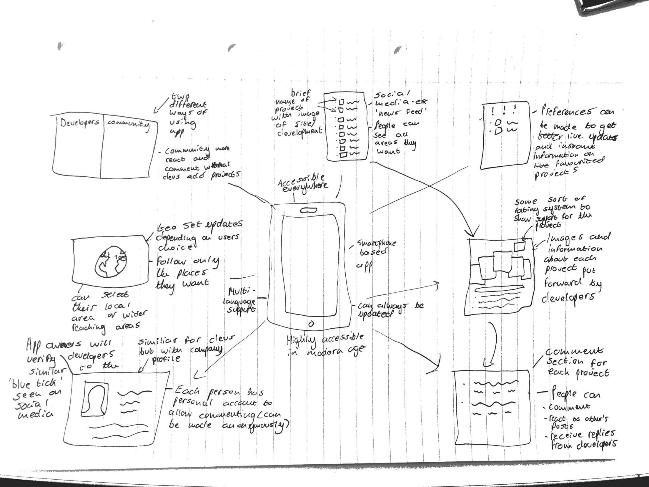
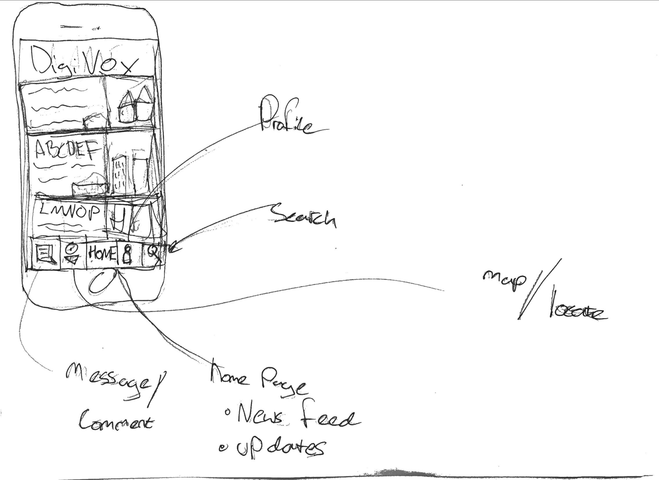
Hi, this week our group moved on from the ‘mapping’ section and began the ‘sketch’ section of our design sprint. We considered all the example research we had done, and thoroughly examined the summary notes each individual had made on their example readings as shown in blog 4. For us, it was also very important to consider the feedback we had received from client and mentor meetings (Nigel and John, Peter, Shelia, and David) which has been summarised in previous blog posts. The clients represented all the users we will be attempting to reach with the creation of the app, so, because different members of our group met with different clients, we then each acted as a facilitator for the opinions and interests of that user group. We had, firstly, come up with individual sketches based on the examples we had personally found and the feedback we had personally received from whichever client we met with. Here are some of the examples of our individual sketches:

 All of the sketches show we are designing a mobile based application, for easy accessibility and to modernise the process of community involvement, for which a profile home page will be needed. The most vital part of the app will need to be the uploaded content, that the developer provides, for the community to assess and comment on- an action that all of the individual sketches included. The developer can then see these comments, respond to them, and include them in their ‘statement of community involvement’ that they provide to the council. This way, the community can read any documents or images that would have normally only been available at the meetings and feel they are engaging directly with the developer- without having to attend the meeting, which is the main focus of people we are aiming this app at. One of the sketches includes a element of education within the app; to explain the process of community engagement, why is it important and what the pre-application stage involves. This could be important for including ‘harder to reach’ members of the community who may not understand the logistics or need for planning application consultancy.
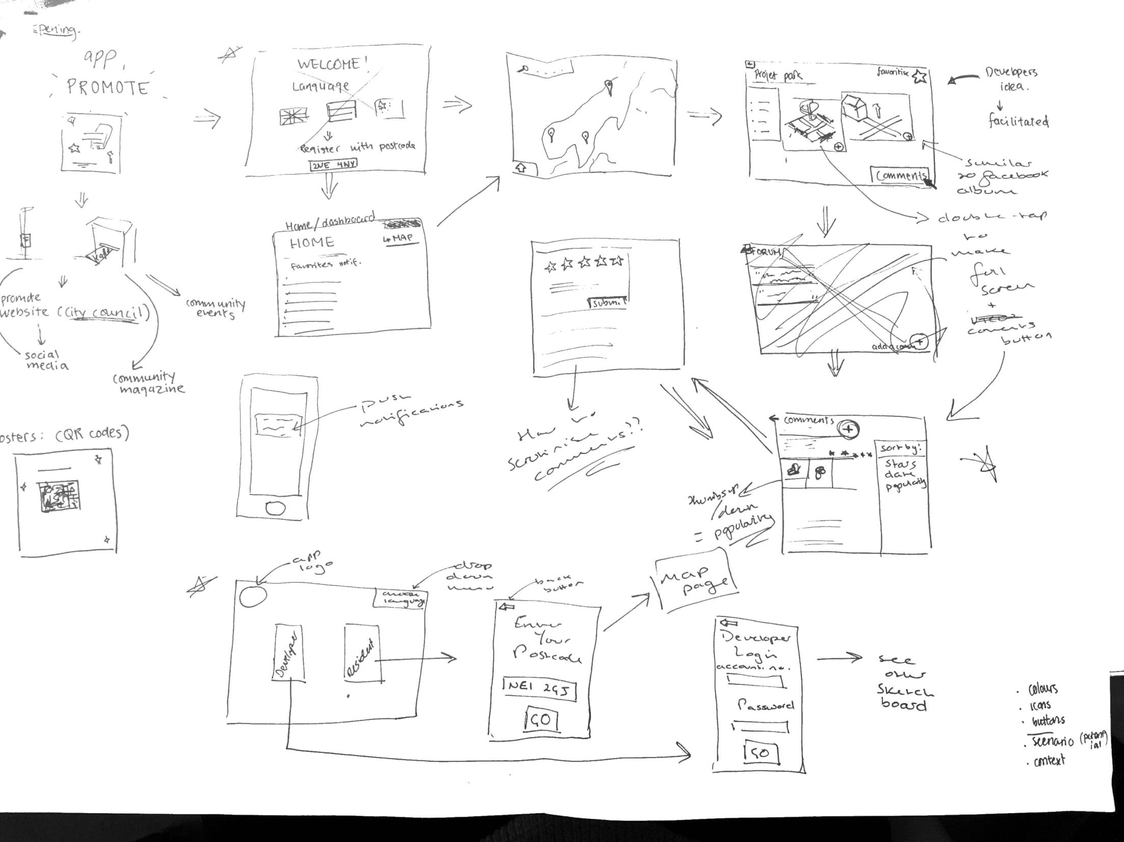
In the seminar on 8th November, we then collaborated to come up with an ‘overall’ sketch, which will act as our draft concept for the process of the app- we can fine tune and amend this over the coming weeks as well as we receive more feedback and think of more ideas in order to create a neater, final version for the presentation.

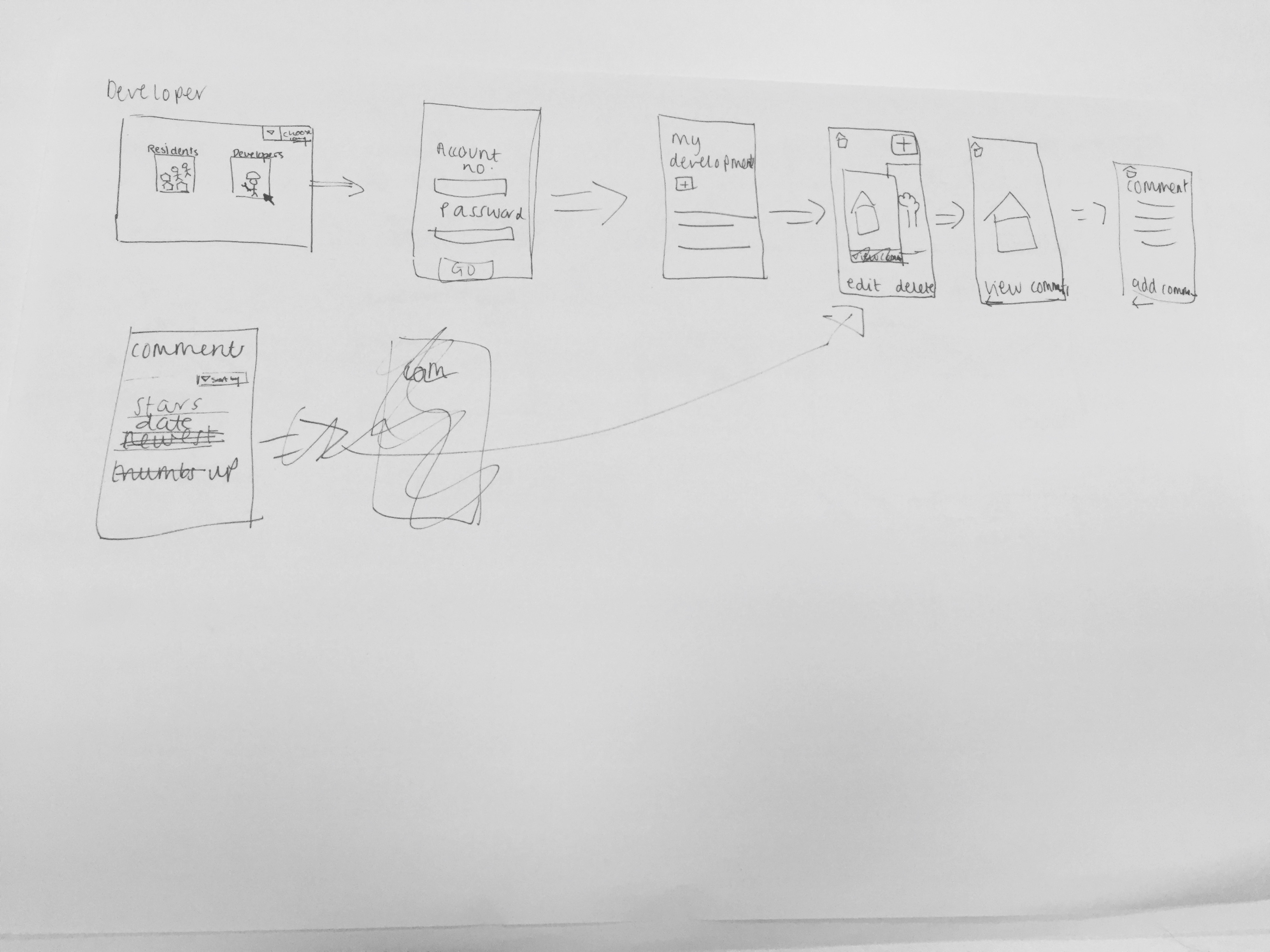
We decided the app would have to be accessible for both the developer and community residents, so would need two different overall sketches, depending on who was using it. Therefore, the opening page of the app would be a selection page where you can choose to access the developer part of the app or the residents part of the app; selecting the developer button will move you to login page where they can enter credentials provided by the council (so only legitimate developers can use it) or, selecting the resident button will move you to a page to enter your postcode, which will then automatically (only upon first login) take you straight to a map page, showing all the developments in the local area surrounding the postcode provided. We also all felt strongly about having a drop down language selection button on the home page, in order to include minority groups living in the area who may fall under the ‘harder to reach’ category.
The top image shows the sketch for the developer’s side of the app, so once they login they are taken to a ‘my development’ page, which will contain an overall description of the development and the ability to add, edit and delete documents or images relating to the development. This development page will then be accessible to residents from their side of the app by using the map to select which development page they want to view.

Key features of design:
-Commenting is also going to be available to both developers and residents, in order for them to engage directly with each other. Each document or image will include a 5-star rating system and a comments forum, and the developer can view comments on their ‘my development’ page, with the ability to sort the comments, for example, by number of stars. A thumbs up/thumbs down system will also be added for residents show agreement/disagreement with another resident’s comment, instead of writing their own comment saying the same thing- this will then make it easier for the developer when sorting through the comments as they can gauge which opinions are most/least popular.
Residents can also ‘favourite’ certain developments so updates regarding that development appear on their home page when they log into the app in the future and, if they choose to enable them, will receive push notifications telling them if, for example, the developer has uploaded a new photo into the developments’ document and image album- similar to a Facebook notification when someone you follow uploads a new image.

– The material published about the projects are facilitated by a third party (the app developers)- to reduce bias and increase communication by making the language understandable, clear and neutral.

-Update button is important to ensure that their opinions do not get lost in the process (as complained about earlier), and to ensure that all parties are updated with the most recent opinions and amendments.

Additional features
-There will be language options in the beginning of the app, so that minorities and “harder to reach”  groups have an opportunity to get engaged.

-The graphic and visual design need to be simple to increase readability for the user.

To progress the overall sketch we now need to answer some questions that arose during the seminar- how do we scrutinise resident/developer comments? how do we encourage the developer to upload documents/images to maintain transparency? how to we simplify terminology to make it more accessible to residents? do we include the ‘education’ part of the app?

Over the coming weeks we will constantly refine the overall sketch as new ideas arise and issues become visible during the prototyping stage of the sprint.

5) We love bikes week 5 mid term presentation

After the midterm presentation it was made clear that we needed to rethink our design and function of the project. One key point that was brought to our attention was the fact we needed to find some way to improve the accountability of the council to the forum. After research we found a webpage called “Fix my street” that involves an interactive map where people can point out different places in the city that they find problematic, upload images of the issues they find on the spot and also leave a comment where they can describe the issue and also make suggestions for improvements. The council then address these problems and change the status of the issue to fixed so people can see that the council is accountable to these problems.

Another issue that needed to be addressed was that the notes and minutes don’t always get sent out to the forums email list and that the minutes on the internet were not easy to access and not organised clearly. During our research to remedy this  we found an organisational website called Trello that clearly organises information and shows which are the most important issues that need to be dealt with first, software like this would be ideal for the forum so that can rob can see which issues of cycling in newcastle need to be tackled first.

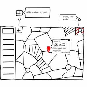
We started to think about how we could make a website that would address these issues raised above. We settled on a webpage due to our user research findings that showed this to be the most accessible format for the communication of information. The main feature of the website would be an interactive map of newcastle that would show all the areas that have been raised as an issue for cycling. Clicking on each individual point would show comments made by the forum and profile users on the site and also show a progress bar that fills when the comments have been addressed by the council and if these issues have been fixed to improve the accountability of the council to the forum which might encourage groups such as the newcastle cycling campaign to engage with the forum. There will also be a way for people to vote on which issue needs to be addressed. We’re choosing this as a feature so that the organization of the issues raised can be improved and rob and other council members can see which areas of newcastle’s cycling infrastructure needs to be improved first. When each issue is selected on the map it will redirect you to a page where there is more information on the issue and an area where you can view comments on the issue and write them yourself. A side note to the website will be a page that clearly and chronologically organises the minutes from the meetings so that people can access these whenever they want in a clear format. We decided to do this as this was one of they key problems that the stakeholders brought to our attention with the minutes from the forum.Users have the ability to create their own profiles on the webpage this will allow them to receive notifications and emails about the progress of projects this is in order to keep people interested in the projects taking place. Users involvement in the website is also rewarded for raising issues and voting on projects users will gain points which will gamify the website encouraging more user interaction. Once users have received enough points the can be redeemed for financial rewards.