Northern Ireland Ordinance Survey data via Digimap is free on trial until 31st July 2019. Adding to our existing EDINA collection, the collection provides a range of raster and vector data at scales ranging from 1:2500 to 1:1 million. Aerial photographs are also included.
Since this is a trial service, you will be required to delete any licensed data you hold on 31st July unless your institution chooses to take a subscription from 1st August 2019 onwards. Please bear this in mind when planning your work.
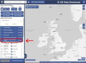
You can access Digimap via Library Search or our Maps library guide, log in with your university account and click on the Ordinance Survey tab to access the data. Use the data download option to get access. You will need to accept the license agreement the first time you use it.
Please explore and email us your feedback, or post it as a comment on this blog.