After a recent trial to the archive from Royal Geographical Society (RGS) we are delighted we’ve have managed to add this permanently to our collections.
The Archive of the RGS covers the history of geography exploration, colonisation and decolonisation, anthropology, international relations, climate science, gender studies, cartography and environmental history throughout the British Empire from 1482 to 2010.
As you’d expect the resources vary from manuscripts, correspondance, reports, proceedings, maps, charts, photographs, atlases to name just a few. Many of these primary source materials have never been digitised before and are available through Wiley for the first time.
These are available as digital images which can be analysed and downloaded.
The archive contains specific collections including the Everest Collection; the David Livingstone Collection; the Sir Ernest Shackleton Collection; the Stanley Collection; the Younghusband Collection; the Speke Collection; and the Gertrude Bell Collection.
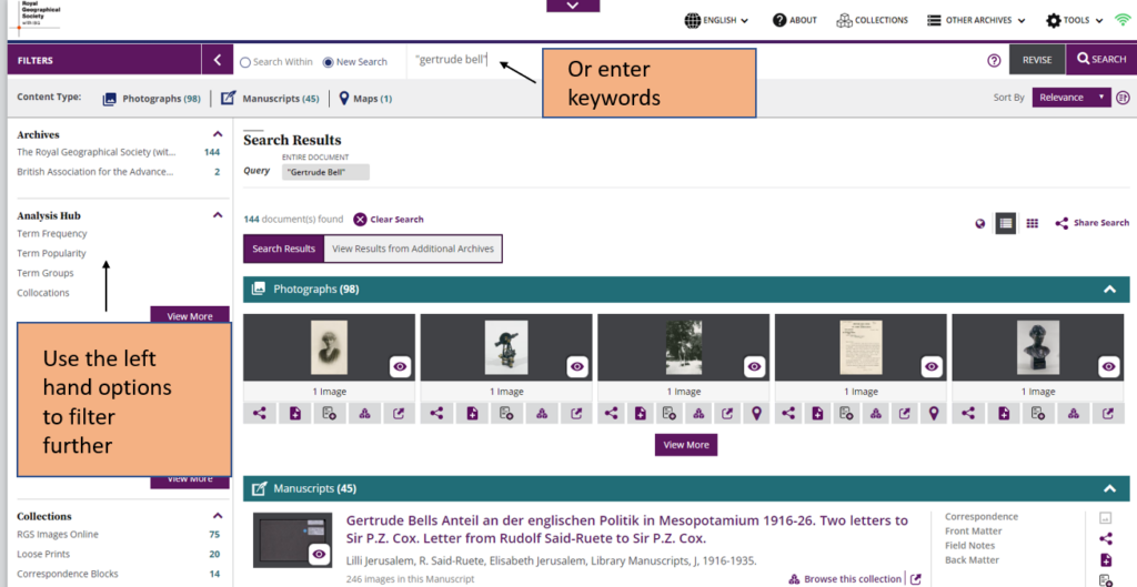
There are different ways you can search and browse the collections including choosing your content type first e.g. photographs

Then you can use some of the search functionality to locate what you’re interested in.

Other ways to search
On the homepage you’ll see these links :

The analysis hub lets you search for a keyword or term and see a timeline of when it was most used, which collections look important and related keywords.
The explorer let’s you look for photos and maps across all of the sub collections.
The place of publication browser let’s you use an interactive map of the world to navigate to the area you’re interested and highlights all relevant materials.
In terms of use, permissions and Copyright I’d recommend checking our their webpages for these.
We think this resource will be useful for both teaching and research purposes for those interested in all aspects of geography. We hope you love checking out the digital tools and functionality on the Wiley site.
