Tag Archives: mapping science

Measuring the Lake District

Every year our first year Surveying and Mapping  Sciences and GIS students take part in an eight day field trip to the Seathwaite Valley in the heart of the Lake District. In this blog post Tim Hajda tells us about his experience of it last Easter.

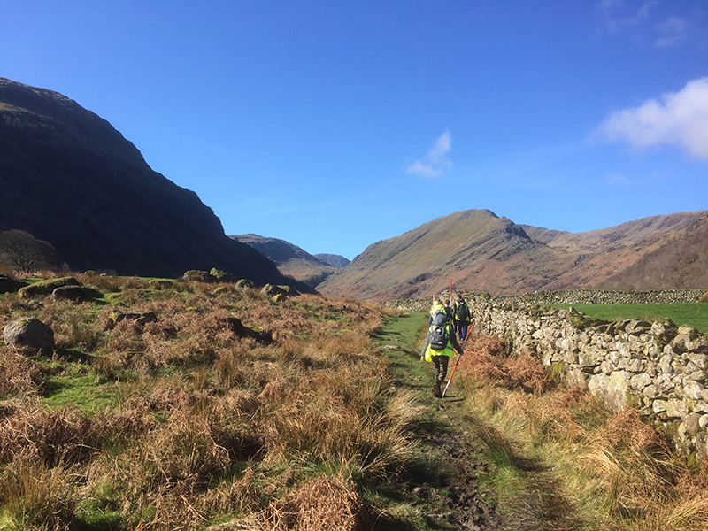
We arrived at Glaramara House, our hotel which served as a base for the fieldcourse, on Thursday morning after a scenic two-and-a-half hour coach ride from Newcastle.  The setting was stunning: a pastoral valley of green fields, dry stone walls and streams, surrounded by craggy fells, waterfalls and oak forests.  Our mission was to create a detailed map of the valley, so our first task was to lay the foundations by creating a network of known reference points.

Newcastle University surveying students setting up targets
Practicing setting up targets in front of the Glaramara House, our base for the fieldcourse

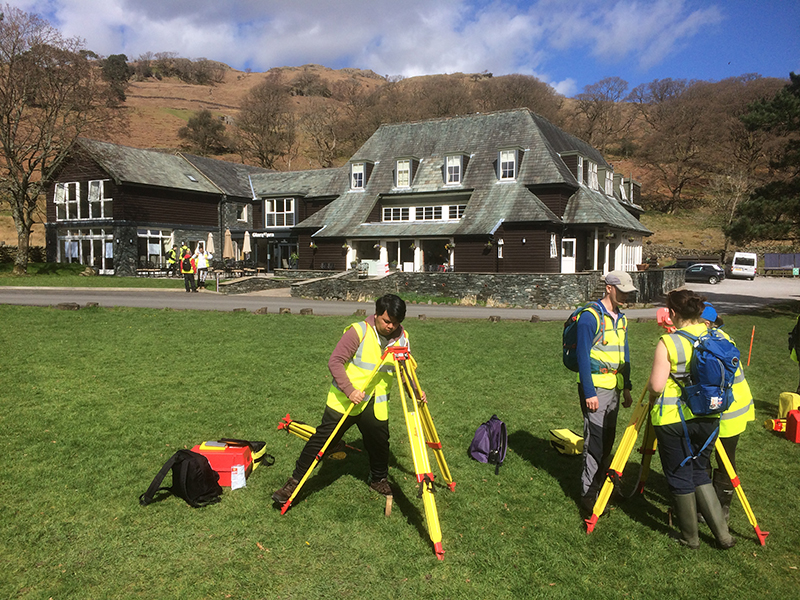
Shortly after arriving we donned our high-vis and waterproofs to brush up on the surveying skills we’d be using over the next eight days.  The valley is famous for being the wettest inhabited place in England, and it definitely lived up to its reputation.  After a soggy afternoon of measuring angles and levelling, we dried off and enjoyed what would be the first of many delicious dinners.

On Friday morning we enjoyed a full English breakfast before beginning our next task: establishing the primary control stations (reference points) throughout the valley.  We were divided into teams and taken by minibus to our assigned locations.  We spent the rest of the day measuring the angles and distances between points.  We would be using this data later to compute the coordinates of the stations.  The blustery weather was a challenge but we persevered.

Saturday’s assignment was to determine the height of points around the valley using spirit levelling.  Simple enough…or so we thought.  My team quickly realized that those lovely green fields were essentially giant mud pits and the stone walls an endless maze to navigate through, but it was a great feeling when we arrived at our last benchmark.  Another job finished and I’ve never been more grateful for a hot shower!

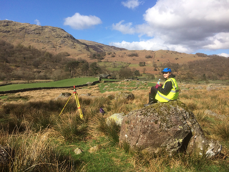
On Sunday the GIS students joined us, along with the sunshine – and we went out in teams to create secondary control networks around the valley.

Geomatic students walking in the Seathwaite Valley
Heading out into the field to design a control network.

One of my favourite aspects of the fieldcourse was working with my course mates.  It provided a great opportunity to get to know each other better.  Certain team members had particular strengths and we all worked together to complete our assigned tasks.  At the end of the exercise it was a great feeling to look at our finished maps together and be able to say, “we made this!”

I learned a lot of valuable lessons – good communication was vital, not only among team members but also with other teams to make sure everyone got the measurements they needed.  I also learned the importance of checking instrument settings before going out into the field and how important it is to book accurately and clearly with good sketches.  There are few things as frustrating as trying to decipher muddled notes after a long day in the field!

Newcastle University geomatics student surveying the Seathwaite Valley
Enjoying a sunny day of surveying in the beautiful Seathwaite Valley.

Another part of what made the fieldcourse enjoyable was the support of the staff and the surveying industry.  Throughout the trip, the staff were always ready to patiently answer questions, transport us to and from the field and give us helpful tips.  One evening, representatives from Leica Geosystems visited to present information about their company and entering the surveying industry.  It was a great opportunity to learn more about the jobs we’ll be doing after graduation.

All in all, it was a fantastic week at Glaramara and it shows what makes Newcastle University’s geomatics courses different from other universities’.  The hands-on learning approach using top-of-the-line equipment, in a beautiful setting, all with the constant support of a knowledgeable and patient staff, made it a truly fun and rewarding experience.

Find out more about our geomatics courses: https://www.ncl.ac.uk/engineering/undergraduate/geomatics/

#TryThisTuesday: Virtual Treasure Hunt

To celebrate International Talk Like a Pirate Day we have put together a virtual treasure hunt that you can do from a phone or computer.

For this treasure hunt you will need to solve clues to find co-ordinates to the next stop . The first three people to make it to the end of the hunt will win the treasure of a Street Science Busking Kit which is filled with equipment to make amazing science demonstrations at home!

Using Co-ordinates

Geographic co-ordinates allow every place on Earth to be identified with a set of numbers. The system that we’re using for this treasure hunt gives every point a latitude number and a longitude number.

If you were to draw a line from your point on the globe into the centre of the Earth and another from the centre of the Earth to the Equator, the angle between these two lines gives you the Latitude.

Longitude is measured slightly differently.  There is an invisible line running from the North Pole to the South Pole through the Royal Observatory in Greenwich, London, known as the Prime Meridian.  All points along this line have the longitude 0. The longitude of other points are calculated as the angle east or west from the Prime Meridian.

So Newcastle Upon Tyne, where we’re starting our treasure hunt from, has the co-ordinates 54.97, -1.61 because it is 54.97 degrees from the Equator and 1.61 degrees to the west of the Prime Meridian. Going west of the Prime Meridian or south of the Equator gives the co-ordinate a negative value.


The Treasure Hunt

Try to solve the clues to find the co-ordinates for the next place. Once you’ve got co-ordinates type them into Google maps (just like this: 54.97, -1.61 with latitude first) and make a note of where you’ve got to.

This will test your research skills as well as your maths skills, feel free to use Wikipedia and a calculator.

Destination One

The latitude for the first place is 57.14 divided by the number of universities in Newcastle Upon Tyne.

The longitude is  equal to 10 – 90.65.

Where are you?


Destination Two

To find the latitude of our second destination, take the last two digits of the year the first man walked on the moon, half this number then add 3.32

The longitude can be found by taking the year Newcastle University became independent from Durham University away from the year that the oldest part of the university (the School of Medicine and Surgery) was established and adding 6.52.

What amazing feat of engineering are you near?


Destination Three

For the latitude of our next place, take away 3.1 from the distance that Destination Two stretches in miles.

The longitude can calculated by the number of different countries that students at Newcastle University have come from divided by -2.

Which wondrous forest have we arrived at?


Destination Four

The latitude of this place can be uncovered by multiplying the number of countries that share Destination Three by 5 then adding 1.234

The longitude is equal to the number of reptile species that have been discovered in our previous destination divided by 63 then add 0.053

What amazing discoveries were made here?


Destination Five

The above place is often known by an abbreviation of four letters. If you convert these letters to numbers (eg. a=1, b=2, c=3 etc.) and square the second number, then add 0.197 you will have the latitude of our next  destination.

To find the longitude, convert the first letter of the abbreviation to a number and take this away from 58.274.

Which incredible man made structure are you looking at now?


Destination Six

For the latitude of our final place – where the treasure is buried – you will need to divide the total height of the structure we just saw (in metres) by -46.1.

To find the longitude, simply take away 16 from the number of floors in this structure.

Where is our treasure buried?

If you think you’ve cracked it, either send us an email to stem@ncl.ac.uk or comment below with the six places the co-ordinates led you to!